- Middlefield, New York
-
Middlefield, New York — Town — Otsego County map with the Town of Middlefield in Red
Coordinates: 42°41′18″N 74°52′27″W / 42.68833°N 74.87417°W Country United States State New York County Otsego Area – Total 65.9 sq mi (170.8 km2) – Land 64.4 sq mi (166.8 km2) – Water 1.5 sq mi (4.0 km2) Elevation 1,709 ft (521 m) Population (2000) – Total 2,249 – Density 34.9/sq mi (13.5/km2) Time zone Eastern (EST) (UTC-5) – Summer (DST) EDT (UTC-4) FIPS code 36-46910 GNIS feature ID 0979214 Middlefield is a town in Otsego County, New York, United States. The population was 2,249 at the 2000 census.
The Town of Middlefield is in the northeast part of the county. It is the largest by area in the county.
Contents
History
A location north of Middlefield village, known as "Nis-ka-yu-na," was a meeting location for natives.
During the 18th Century, three patents spanned the town: Godfrey Miller Patent, John Bowers Patent, and the Long Patent. Irish and Scots settlers moved into this area around 1755. The first settlements were made near Middlefield village.
Middlefield was formed from the Town of Cherry Valley in 1797.
The Phoenix cotton mill was started in 1815, but became a wool mill in 1866. Brewery Ommegang, which specializes in Belgian-style ales, opened in the Town of Middlefield in 1997.
Geography
According to the United States Census Bureau, the town has a total area of 65.9 square miles (171 km2), of which, 64.4 square miles (167 km2) of it is land and 1.5 square miles (3.9 km2) of it (2.32%) is water.
New York State Route 166 follows the course of Cherry Valley Creek through the south part of the town. Cherry Valley Creek and Red Creek, which drain the town, are tributaries of the Susquehanna River.
The western part of Middlefield borders Otsego Lake.
Demographics
As of the census[1] of 2000, there were 2,249 people, 792 households, and 564 families residing in the town. The population density was 34.9 people per square mile (13.5/km²). There were 1,058 housing units at an average density of 16.4 per square mile (6.3/km²). The racial makeup of the town was 96.31% White, 1.11% African American, 0.22% Native American, 0.89% Asian, 0.31% from other races, and 1.16% from two or more races. Hispanic or Latino of any race were 1.24% of the population.
There were 792 households out of which 32.6% had children under the age of 18 living with them, 58.8% were married couples living together, 7.3% had a female householder with no husband present, and 28.7% were non-families. 24.1% of all households were made up of individuals and 10.9% had someone living alone who was 65 years of age or older. The average household size was 2.52 and the average family size was 2.98.
In the town the population was spread out with 22.5% under the age of 18, 6.0% from 18 to 24, 23.9% from 25 to 44, 25.2% from 45 to 64, and 22.4% who were 65 years of age or older. The median age was 43 years. For every 100 females there were 96.4 males. For every 100 females age 18 and over, there were 89.8 males.
The median income for a household in the town was $39,625, and the median income for a family was $43,750. Males had a median income of $34,583 versus $25,795 for females. The per capita income for the town was $21,076. About 5.0% of families and 7.0% of the population were below the poverty line, including 8.4% of those under age 18 and 6.8% of those age 65 or over.
Communities and locations in Middlefield
- Bowerstown – A hamlet southeast of Cooperstown on County Route 52.
- Cooperstown – The eastern part of the Village of Cooperstown.
- Cooperstown-Westville Airport (K23) – An airport in the south part of Middlefield.
- Glimmerglass State Park – A small part of the state park is at the north town line by County Highway 31.
- Hyde Bay – Part of the bay of Otsego Lake is in the northwest part of the town.
- Lentsville – A hamlet in the north part of the town, south of Middlefied Center on County Road 33.
- Middlefield – Formerly known as Clarksville, the hamlet of Middlefield lies on County Road 35 on the east edge of the town. The hamlet was placed on the National Register of Historic Places in 1985.
- Middlefield Center – A small cluster of houses located on County Route 33.
- Phoenix Mills – A hamlet in the south part of the town.
- Westville – the hamlet of Westville lies on County Route 35 south of the hamlet of Middlefield.
- Whig Corners – A hamlet northeast of Cooperstown on County Route 33.
References
- ^ "American FactFinder". United States Census Bureau. http://factfinder.census.gov. Retrieved 2008-01-31.
External links
Municipalities and communities of Otsego County, New York City 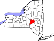
Towns Burlington | Butternuts | Cherry Valley | Decatur | Edmeston | Exeter | Hartwick | Laurens | Maryland | Middlefield | Milford | Morris | New Lisbon | Oneonta | Otego | Otsego | Pittsfield | Plainfield | Richfield | Roseboom | Springfield | Unadilla | Westford | Worcester
Villages Cherry Valley | Cooperstown | Gilbertsville | Laurens | Milford | Morris | Otego | Richfield Springs | Unadilla
CDP Other
hamletsBurlington Flats | Schenevus | Schuyler Lake | Silver Lake | South Edmeston | West Burlington | West Edmeston‡
Footnotes ‡This populated place also has portions in an adjacent county or counties
Categories:- Towns in New York
- Populated places in Otsego County, New York

Wikimedia Foundation. 2010.