- Cherry Valley (village), New York
-
Cherry Valley, New York — Village — Location within the state of New York
 Cherry Valley, New York
Coordinates: 42°48′1″N 74°45′0″W / 42.80028°N 74.75°WCoordinates: 42°48′1″N 74°45′0″W / 42.80028°N 74.75°W Country United States State New York County Otsego Area - Total 0.6 sq mi (1.5 km2) - Land 0.6 sq mi (1.5 km2) - Water 0.0 sq mi (0.0 km2) Elevation 1,345 ft (410 m) Population (2000) - Total 592 - Density 1,041.5/sq mi (402.1/km2) Time zone Eastern (EST) (UTC-5) - Summer (DST) EDT (UTC-4) ZIP codes 13320, 13450 Area code(s) 607 FIPS code 36-15242 GNIS feature ID 0946532 Cherry Valley is a village in Otsego County, New York, United States. The population was 592 at the 2000 census.
The Village of Cherry Valley is in the Town of Cherry Valley. Cherry Valley is located about 13 miles northeast of Cooperstown and 8 miles east of the northern end of Otsego Lake.
Contents
History
The village was established in 1740 by John Lindesay under the name Lindesay's Bush. In 1778, during the American Revolution, forty-seven village residents were killed by a British and Iroquois raiding party, an event to become known as the Cherry Valley Massacre.
The village was incorporated in 1812, setting itself apart from the town.
Geography
Cherry Valley is located at 42°48′1″N 74°45′0″W / 42.80028°N 74.75°W (42.800359, -74.750063)[1].
According to the United States Census Bureau, the village has a total area of 0.6 square miles (1.5 km²).None of the area is covered with water.
The village is located on New York State Route 166 at the junction of County Highways 50 and 54. It is in the northeast part of the county.
Cherry Valley Creek flows southward through the village.
Demographics
As of the census[2] of 2000, there were 592 people, 237 households, and 159 families residing in the village. The population density was 1,041.5 people per square mile (401.0/km²). There were 288 housing units at an average density of 506.7 per square mile (195.1/km²). The racial makeup of the village was 98.99% White, 0.51% Asian, and 0.51% from two or more races. Hispanic or Latino of any race were 0.17% of the population.
There were 237 households out of which 29.5% had children under the age of 18 living with them, 51.9% were married couples living together, 12.7% had a female householder with no husband present, and 32.5% were non-families. 28.3% of all households were made up of individuals and 12.7% had someone living alone who was 65 years of age or older. The average household size was 2.50 and the average family size was 3.08.
In the village the population was spread out with 25.0% under the age of 18, 7.1% from 18 to 24, 24.8% from 25 to 44, 26.4% from 45 to 64, and 16.7% who were 65 years of age or older. The median age was 41 years. For every 100 females there were 84.4 males. For every 100 females age 18 and over, there were 81.2 males.
The median income for a household in the village was $35,375, and the median income for a family was $41,375. Males had a median income of $27,083 versus $20,104 for females. The per capita income for the village was $15,808. About 9.8% of families and 13.3% of the population were below the poverty line, including 18.5% of those under age 18 and 4.9% of those age 65 or over.
Additional village facts
The village is somewhat off the beaten path (In spite of US Route 20 passing a few miles north), not much visited by tourists; Jack Kerouac and Allen Ginsberg used to visit to escape city life, especially in the autumn when the maple leaves change color. Many people around Cherry Valley are dairy farmers; tapping maple trees for sap, which is then refined into syrup, is a common spring practice. The area looks much like it did in the 19th century. Historic re-enactments are held to commemorate the importance of Cherry Valley during the American Revolution.
Area attractions include the Baseball Hall of Fame, the Bates Hop House, Judd Falls, Otsego Lake, and Glimmerglass State Park. There is an annual Memorial Day celebration which includes a Craft Fair, Flea Market, Chicken BBQ, and parade.
Cultural significance
Cherry Valley has a long history as an artist and writer's community. Willa Cather left New York City for the isolated village in 1911, writing O Pioneers! while there. Poet Allen Ginsberg bought a farm there in the 1960s, and the town became a haven and destination point for many of the major personalities of the Beat scene: William Burroughs, Gregory Corso, Peter Orlovsky, Herbert Huncke, Ray Bremser, Anne Waldman, Robert Creeley, Lawrence Ferlinghetti, Harry Smith, Mary Beach, Claude Pelieu and many others all spent time either living or visiting there. Poet Charles Plymell still lives in Cherry Valley—he and his wife Pam ran Cherry Valley Editions from their home, publishing small editions of major writers. Jazz pianist Paul Bley is also a resident of the small town, as is artist/writer Jack Walls, artists Richard Saba and Mark Mastroianni, film maker James Rasin, and National Book Award nominated novelist Dana Spiotta.
The transgender pioneer, actress and Andy Warhol Superstar Candy Darling is buried in the historic Cherry Valley Cemetery. A significant portion of the award winning feature length documentary film about her life, Beautiful Darling (2010), was shot in Cherry Valley. The photographer Ryan McGinley has staged several photo shoots in and around the village, and the artist Dash Snow shot one of his last 8mm pieces, "Sisyphus, Sissy Fuss, Silly Puss", there in late May 2009.
References
- ^ "US Gazetteer files: 2010, 2000, and 1990". United States Census Bureau. 2011-02-12. http://www.census.gov/geo/www/gazetteer/gazette.html. Retrieved 2011-04-23.
- ^ "American FactFinder". United States Census Bureau. http://factfinder.census.gov. Retrieved 2008-01-31.
External links
- Greater Cherry Valley Chamber of Commerce, Inc.
- Cherry Valley information
- Cherry Valley Museum
- Cherry Valley History
- Official Cherry Valley website
Municipalities and communities of Otsego County, New York County seat: Cooperstown City 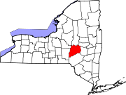
Towns Burlington | Butternuts | Cherry Valley | Decatur | Edmeston | Exeter | Hartwick | Laurens | Maryland | Middlefield | Milford | Morris | New Lisbon | Oneonta | Otego | Otsego | Pittsfield | Plainfield | Richfield | Roseboom | Springfield | Unadilla | Westford | Worcester
Villages Cherry Valley | Cooperstown | Gilbertsville | Laurens | Milford | Morris | Otego | Richfield Springs | Unadilla
CDP Other
hamletsBurlington Flats | Schenevus | Schuyler Lake | Silver Lake | South Edmeston | West Burlington | West Edmeston‡
Footnotes ‡This populated place also has portions in an adjacent county or counties
Categories:- Villages in New York
- Populated places in Otsego County, New York


Wikimedia Foundation. 2010.