- Roseboom, New York
Infobox Settlement
official_name = Roseboom, New York
settlement_type =Town
nickname =
motto =
imagesize =
image_caption =
image_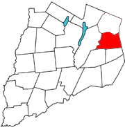
mapsize = 250x200px
map_caption = Roseboom,Otsego County, New York
mapsize1 =
map_caption1 =subdivision_type = Country
subdivision_name =United States
subdivision_type1 = State
subdivision_name1 =New York
subdivision_type2 = County
subdivision_name2 = Otsego
government_footnotes =
government_type =
leader_title =
leader_name =
leader_title1 =
leader_name1 =
established_title =
established_date =unit_pref = Imperial
area_footnotes =area_magnitude =
area_total_km2 = 85.6
area_land_km2 = 85.5
area_water_km2 = 0.1
area_total_sq_mi = 33.1
area_land_sq_mi = 33.0
area_water_sq_mi = 0.1population_as_of = 2000
population_footnotes =
population_total = 684
population_density_km2 = 8.0
population_density_sq_mi = 20.7timezone = Eastern (EST)
utc_offset = -5
timezone_DST = EDT
utc_offset_DST = -4
elevation_footnotes =
elevation_m = 443
elevation_ft = 1453
latd = 42 |latm = 42 |lats = 40 |latNS = N
longd = 74 |longm = 43 |longs = 36 |longEW = Wpostal_code_type =
ZIP code
postal_code = 13450
area_code = 607
blank_name = FIPS code
blank_info = 36-63638
blank1_name = GNIS feature ID
blank1_info = 0979434
website =
footnotes =Roseboom is a
town in Otsego County,New York ,United States . The population was 684 at the 2000 census. The town name is that of an early landowners and settlers Abram and John Roseboom.The Town of Roseboom is at the eastern county line.
History
The town was not settled until after the American Revolution.
The town was created from part of the Town of Cherry Valley in 1854.
Geography
According to the
United States Census Bureau , the town has a total area of 33.1square mile s (85.6km² ), of which, 33.0 square miles (85.5 km²) of it is land and 0.1 square miles (0.2 km²) of it (0.18%) is water.New York State Route 165 intersectsNew York State Route 166 near the west town line at Roseboom village.Cherry Valley Creek flows southward near the west town line, receiving the inflow of Pleasant Brook and Snyder Creek.Demographics
As of the
census GR|2 of 2000, there were 684 people, 267 households, and 191 families residing in the town. Thepopulation density was 20.7 people per square mile (8.0/km²). There were 416 housing units at an average density of 12.6/sq mi (4.9/km²). The racial makeup of the town was 98.39% White, 0.15% African American, 0.88% Asian, 0.15% from other races, and 0.44% from two or more races. Hispanic or Latino of any race were 0.73% of the population.There were 267 households out of which 33.3% had children under the age of 18 living with them, 55.1% were married couples living together, 9.4% had a female householder with no husband present, and 28.1% were non-families. 21.0% of all households were made up of individuals and 8.6% had someone living alone who was 65 years of age or older. The average household size was 2.56 and the average family size was 2.98.
In the town the population was spread out with 24.4% under the age of 18, 7.5% from 18 to 24, 27.8% from 25 to 44, 27.6% from 45 to 64, and 12.7% who were 65 years of age or older. The median age was 39 years. For every 100 females there were 106.6 males. For every 100 females age 18 and over, there were 106.8 males.
The median income for a household in the town was $37,841, and the median income for a family was $43,438. Males had a median income of $24,205 versus $19,940 for females. The
per capita income for the town was $19,977. About 7.4% of families and 10.6% of the population were below thepoverty line , including 19.4% of those under age 18 and 2.7% of those age 65 or over.Communities and locations in Roseboom
*Belvedere Lake -- A small lake east of Roseboom village.
*Butlers Corners -- A location southwest of South Valley hamlet at the junction of County Roads 34 and 39.
*Center Valley -- A hamlet on County Route 50 at the town line in the northeast corner of Roseboom.
*Honey Hill -- An elevation north of South Valley.
*Lowell's Corners -- A former location in the eastern part of Roseboom.
*Pleasant Brook -- (1) A hamlet in the eastern part of Roseboom on NY-165, (2) a stream flowing westward past the hamlet.
*Roseboom (earlier "Lodi") -- A hamlet near the west town line, located at the junction of routes NY-165 and NY-166 by Cherry Valley Creek.
*South Valley -- A hamlet located in the south half of Roseboon on NY-165.
*Weber Corners -- A location at the east town line on NY-165.
*Winnie Hollow -- A valley in the north part of the town.References
External links
Wikimedia Foundation. 2010.