- Burlington, New York
Infobox Settlement
official_name = Burlington, New York
settlement_type =Town
nickname =
motto =
imagesize =
image_caption =
image_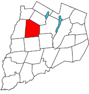
mapsize = 250x200px
map_caption = Burlington, Otsego County, New York
mapsize1 =
map_caption1 =subdivision_type = Country
subdivision_name =United States
subdivision_type1 = State
subdivision_name1 =New York
subdivision_type2 = County
subdivision_name2 = Otsego
government_footnotes =
government_type =
leader_title =
leader_name =
leader_title1 =
leader_name1 =
established_title =
established_date =unit_pref = Imperial
area_footnotes =area_magnitude =
area_total_km2 = 116.6
area_land_km2 = 116.5
area_water_km2 = 0.2
area_total_sq_mi = 45.0
area_land_sq_mi = 45.0
area_water_sq_mi = 0.1population_as_of = 2000
population_footnotes =
population_total = 1085
population_density_km2 = 9.3
population_density_sq_mi = 24.1timezone = Eastern (EST)
utc_offset = -5
timezone_DST = EDT
utc_offset_DST = -4
elevation_footnotes =
elevation_m = 597
elevation_ft = 1959
latd = 42 |latm = 43 |lats = 42 |latNS = N
longd = 75 |longm = 8 |longs = 29 |longEW = Wpostal_code_type =
ZIP code
postal_code = 13315
area_code = 607
blank_name = FIPS code
blank_info = 36-11209
blank1_name = GNIS feature ID
blank1_info = 0978766
website =
footnotes =Burlington is a
town in Otsego County,New York , USA. The population was 1,085 at the 2000 census.The Town of Burlington is in the northwest part of the county and is north of Oneonta.
Geography
According to the
United States Census Bureau , the town has a total area of 45.0square mile s (116.6km² ), of which, 45.0 square miles (116.5 km²) of it is land and 0.1 square miles (0.2 km²) of it (0.13%) is water.North-south highway
New York State Route 51 and east-west highwayNew York State Route 80 intersect at Barett Corners.Butternut Creek and
Wharton Creek are important waterways in the town.History
Early settlers came from
New England .Burlington was formed from the Town of Otsego,
April 10 ,1792 . It retained its original dimensions until 1797, when Pittsfield (and what would come to be New Lisbon) was set off. It was further diminished in area by the erection of Edmeston, in 1808.Notable residents
*Benjmain Franklin Angel, (1815-1894), born in Burlington, former ambassador of the United States cite book | title = Who Was Who in America, Historical Volume, 1607-1896 | publisher = Marquis Who's Who | location = Chicago | date = 1963]
Demographics
As of the
census GR|2 of 2000, there were 1,085 people, 392 households, and 301 families residing in the town. Thepopulation density was 24.1 people per square mile (9.3/km²). There were 500 housing units at an average density of 11.1/sq mi (4.3/km²). The racial makeup of the town was 97.14% White, 0.18% African American, 0.18% Native American, 0.28% Asian, 0.37% from other races, and 1.84% from two or more races. Hispanic or Latino of any race were 1.66% of the population.There were 392 households out of which 36.2% had children under the age of 18 living with them, 65.1% were married couples living together, 7.9% had a female householder with no husband present, and 23.2% were non-families. 18.6% of all households were made up of individuals and 8.2% had someone living alone who was 65 years of age or older. The average household size was 2.76 and the average family size was 3.08.
In the town the population was spread out with 26.5% under the age of 18, 7.7% from 18 to 24, 29.3% from 25 to 44, 22.6% from 45 to 64, and 13.9% who were 65 years of age or older. The median age was 38 years. For every 100 females there were 103.6 males. For every 100 females age 18 and over, there were 94.6 males.
The median income for a household in the town was $36,823, and the median income for a family was $42,500. Males had a median income of $28,000 versus $20,667 for females. The
per capita income for the town was $15,184. About 7.4% of families and 11.8% of the population were below thepoverty line , including 11.5% of those under age 18 and 17.1% of those age 65 or over.Communities and locations in the Town of Burlington
*Barett Corners -- A hamlet south of Burlington Flats on NY-51 at its intersection with NY-80.
*Beverly Inn Corners -- A hamlet north of Burlington Flats on NY-51.
*Burlington Flats -- A hamlet in the western part of the town located on route NY-51.
*Burlington -- The hamlet of Burlington is located on NY-80.
*Chapinville -- A hamlet south of Burlington Flats on NY-51.
*Methodist Hollow -- A location near the south town line.
*Patent -- A hamlet neat the east town line.
*Pecktown -- A hamlet near the north town line.
*Round Top -- A hill north of NY-80.
*West Burlington -- A hamlet near the west town line on conjoined routes NY-51 and NY-80.
*Wharton -- An historic location in the northwest part of the town.
*Wharton Creek -- A stream flowing through the west part of the town.References
"History of Otsego County, New York 1740-1878, Chapter XXX Town of Burlington",Published by Everts and Fariss 1878.
External links
* [http://www.rootsweb.com/~nyotsego/bur.htm Early map and short history of Burlington]
Wikimedia Foundation. 2010.