- Olean (town), New York
-
Olean, New York — Town — Location within the state of New York
 Olean, New York
Coordinates: 42°4′8″N 78°24′54″W / 42.06889°N 78.415°WCoordinates: 42°4′8″N 78°24′54″W / 42.06889°N 78.415°W Country United States State New York County Cattaraugus Government – Type Town Council – Town Supervisor Ted E. Hewitt (R) – Town Council Members' ListArea – Total 29.7 sq mi (77.0 km2) – Land 29.6 sq mi (76.8 km2) – Water 0.1 sq mi (0.2 km2) Elevation 1,837 ft (560 m) Population (2000) – Total 2,029 – Density 68.5/sq mi (26.4/km2) Time zone Eastern (EST) (UTC-5) – Summer (DST) EDT (UTC-4) ZIP code 14760 Area code(s) 716, 585 FIPS code 36-54727 GNIS feature ID 0979306 Olean is a town in Cattaraugus County, New York, United States. The population was 2,029 at the 2000 census. The name is derived from the Latin word "oleum" due to the discovery of crude oil in nearby Ischua.
The Town of Olean is in the southeast corner of the county. The City of Olean, originally the Village of Olean, is adjacent to the town.
Contents
History
Olean was first settled around 1805. The Town of Olean was established in 1808 as the only town in the county. The "Town of Ischua," (now Franklinville) was established in 1812, part of Perrysburg was removed in 1814, Great Valley was formed in 1818, Hinsdale in 1820, and Portville, in 1837.
The Village of Olean, was originally named "Hamilton," after Alexander Hamilton, but was called Olean Point until simplified to Olean in 1823.
The name "Olean" was suggested for the area due to the oil found in the vicinity. The famed Seneca Oil Spring, discovered by the Franciscan Missionary Joseph De La Roche D'Allion in 1627 was located about 14 miles upstream of Olean Point. The original town hall burned in 1884, prompting a law that forbade wooden structures in parts of the town.
Geography
According to the United States Census Bureau, the town has a total area of 29.7 square miles (77.0 km²), of which, 29.6 square miles (76.8 km²) of it is land and 0.1 square miles (0.2 km²) of it (0.27%) is water.
The Allegheny River flows through the town. The south town line is the border of Pennsylvania. The Southern Tier Expressway (Interstate 86 and New York State Route 17, New York State Route 16, and New York State Route 417 pass through the town.
Adjacent towns and areas
Demographics
As of the census[1] of 2000, there were 2,029 people, 827 households, and 564 families residing in the town. The population density was 68.5 people per square mile (26.4/km²). There were 891 housing units at an average density of 30.1 per square mile (11.6/km²). The racial makeup of the town was 97.88% White, 0.34% Black or African American, 0.15% Native American, 0.79% Asian, and 0.84% from two or more races. Hispanic or Latino of any race were 0.34% of the population.
There were 827 households out of which 29.6% had children under the age of 18 living with them, 56.5% were married couples living together, 8.3% had a female householder with no husband present, and 31.7% were non-families. 25.9% of all households were made up of individuals and 11.5% had someone living alone who was 65 years of age or older. The average household size was 2.45 and the average family size was 2.95.
In the town the population was spread out with 24.2% under the age of 18, 6.4% from 18 to 24, 27.1% from 25 to 44, 26.9% from 45 to 64, and 15.3% who were 65 years of age or older. The median age was 40 years. For every 100 females there were 99.5 males. For every 100 females age 18 and over, there were 98.8 males.
The median income for a household in the town was $36,288, and the median income for a family was $47,232. Males had a median income of $35,947 versus $23,641 for females. The per capita income for the town was $19,265. About 7.1% of families and 10.2% of the population were below the poverty line, including 13.6% of those under age 18 and 6.1% of those age 65 or over.
Communities and locations in the Town of Olean
- Baldwin Heights – A district in northern Olean.
- Barnum – A hamlet by the south town line on County Road 29.
- Boardmanville – A district of the City of Olean on the northeast side of Olean Creek.
- Camel Back – A steep hill southwest of the City of Olean, south of the river.
- East Olean – A district of the City of Olean on the east and southeast of the Olean Creek.
- Four Mile – A community at the west town line, located on NY-16.
- Giermek Executive Airport (8G3) – A general aviation grass strip airport on the south side of the Allegheny River and southeast of the City of Olean.
- Haydenville – A hamlet on the eastern town line on County Road 92.
- Homer Hill – An area in the northwest of the City of Olean mostly removed by the construction of NY 17/I-86.
- North Olean – A district in northern Olean, west of Olean Creek.
- Mount Herman – A steep hill on the south side of the river.
- Olean Creek – A stream, flowing south through the town. It separates North Olean from Boardmanville. It flows into the Allegheny River and forms the western boundary of East Olean
- Seneca Heights – A section of the City of Olean, south and east of the Allegheny River.
- South Olean – The section of Olean south of State Street and east of Fourth street.
- Cherry Hill-- A neighborhood in the City of Olean.
References
- ^ "American FactFinder". United States Census Bureau. http://factfinder.census.gov. Retrieved 2008-01-31.
External links
Municipalities and communities of Cattaraugus County, New York Cities 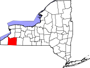
Towns Allegany | Ashford | Carrollton | Coldspring | Conewango | Dayton | East Otto | Ellicottville | Farmersville | Franklinville | Freedom | Great Valley | Hinsdale | Humphrey | Ischua | Leon | Little Valley | Lyndon | Machias | Mansfield | Napoli | New Albion | Olean | Otto | Perrysburg | Persia | Portville | Randolph | Red House | Salamanca | South Valley | Yorkshire
Villages Allegany | Cattaraugus | Delevan | East Randolph | Ellicottville | Franklinville | Gowanda‡ | Little Valley | Perrysburg | Portville | Randolph | South Dayton
CDPs Other
hamletsIndian
reservationsFootnotes ‡This populated place also has portions in an adjacent county or counties
Categories:- Towns in New York
- Populated places in Cattaraugus County, New York
- Populated places established in 1805


Wikimedia Foundation. 2010.