- Mansfield, New York
-
Mansfield, New York — Town — Location within the state of New York
 Mansfield, New York
Coordinates: 42°18′36″N 78°45′24″W / 42.31°N 78.75667°WCoordinates: 42°18′36″N 78°45′24″W / 42.31°N 78.75667°W Country United States State New York County Cattaraugus Government - Type Town Council - Town Supervisor Robert C. Keis, Sr. (R) - Town Council Members' ListArea - Total 39.6 sq mi (102.5 km2) - Land 39.6 sq mi (102.5 km2) - Water 0.0 sq mi (0.0 km2) Elevation 1,873 ft (571 m) Population (2000) - Total 800 - Density 20.2/sq mi (7.8/km2) Time zone Eastern (EST) (UTC-5) - Summer (DST) EDT (UTC-4) FIPS code 36-45161 GNIS feature ID 0979193 Mansfield is a town in Cattaraugus County, New York, United States. The population was 800 at the 2000 census. The name was thought to be that of a noble family in England.
The Town of Mansfield is centrally located in Cattaraugus County, north of Salamanca.
Contents
History
The area was first settled around 1817. The Town of Mansfield was formed in 1830 from part of the Town of Little Valley. The town was first called "Cecilius." The name "Mansfield" was adopted in 1831.
Geography
According to the United States Census Bureau, the town has a total area of 39.6 square miles (103 km2), of which, 39.6 square miles (103 km2) of it is land and 0.03% is water.
The town is primarily served by county roads; Cattaraugus County Route 14 (Toad Hollow Road) runs from south to north through the town, while Cattaraugus County Route 13 runs west to east in the northern part of the town. New York State Route 242 passes across the southeast corner of the town and New York State Route 353 through a small portion of the southwest corner.
Mansfield Creek flows across the north part of the town, and Little Valley Creek crosses the southwest corner.
Adjacent towns and areas
Demographics
As of the census[1] of 2000, there were 800 people, 305 households, and 234 families residing in the town. The population density was 20.2 people per square mile (7.8/km²). There were 540 housing units at an average density of 13.6 per square mile (5.3/km²). The racial makeup of the town was 98.88% White, 0.12% African American, 0.75% Native American, 0.12% Asian, and 0.12% from two or more races. Hispanic or Latino of any race were 0.25% of the population.
There were 305 households out of which 33.8% had children under the age of 18 living with them, 64.3% were married couples living together, 6.6% had a female householder with no husband present, and 23.0% were non-families. 19.3% of all households were made up of individuals and 6.9% had someone living alone who was 65 years of age or older. The average household size was 2.61 and the average family size was 3.00.
In the town the population was spread out with 27.9% under the age of 18, 6.3% from 18 to 24, 27.8% from 25 to 44, 27.4% from 45 to 64, and 10.8% who were 65 years of age or older. The median age was 38 years. For every 100 females there were 108.3 males. For every 100 females age 18 and over, there were 103.9 males.
The median income for a household in the town was $36,420, and the median income for a family was $37,500. Males had a median income of $27,614 versus $24,750 for females. The per capita income for the town was $21,700. About 6.3% of families and 8.0% of the population were below the poverty line, including 7.8% of those under age 18 and 2.4% of those age 65 or over.
Communities and locations in Mansfield
- Eddyville – a hamlet in the north part of the town on County Road 14.
- Eddyville Corners – A location north of Eddyville on County Roads 13 and 14.
- Five Points – A location southwest of Eddyville near the town center on County Road 14.
- Mansfield Creek – A stream flowing through the town.
- Maples – A location east of Eddyville on County Road 13.
- Orlando – A hamlet near the east town line on County Road 13.
References
- ^ "American FactFinder". United States Census Bureau. http://factfinder.census.gov. Retrieved 2008-01-31.
External links
Municipalities and communities of Cattaraugus County, New York County seat: Little Valley Cities 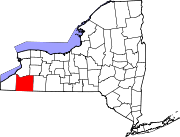
Towns Allegany | Ashford | Carrollton | Coldspring | Conewango | Dayton | East Otto | Ellicottville | Farmersville | Franklinville | Freedom | Great Valley | Hinsdale | Humphrey | Ischua | Leon | Little Valley | Lyndon | Machias | Mansfield | Napoli | New Albion | Olean | Otto | Perrysburg | Persia | Portville | Randolph | Red House | Salamanca | South Valley | Yorkshire
Villages Allegany | Cattaraugus | Delevan | East Randolph | Ellicottville | Franklinville | Gowanda‡ | Little Valley | Perrysburg | Portville | Randolph | South Dayton
CDPs Other
hamletsIndian
reservationsFootnotes ‡This populated place also has portions in an adjacent county or counties
Categories:- Towns in New York
- Populated places in Cattaraugus County, New York


Wikimedia Foundation. 2010.