- Delevan, New York
-
Delevan, New York — Village — Location within the state of New York
 Delevan, New York
Coordinates: 42°29′N 78°29′W / 42.483°N 78.483°WCoordinates: 42°29′N 78°29′W / 42.483°N 78.483°W Country United States State New York County Cattaraugus Area - Total 1.0 sq mi (2.5 km2) - Land 1.0 sq mi (2.5 km2) - Water 0.0 sq mi (0.0 km2) Elevation 1,424 ft (434 m) Population (2000) - Total 1,089 - Density 1,113.0/sq mi (429.7/km2) Time zone Eastern (EST) (UTC-5) - Summer (DST) EDT (UTC-4) ZIP code 14042 Area code(s) 716 FIPS code 36-20115 GNIS feature ID 0948273 Delevan is a village in Cattaraugus County, New York, United States. The population was 1,089 at the 2000 census.
The Village of Delevan lies inside the Town of Yorkshire
Contents
History
The first lot was cleared around 1821. The name of the area was changed from Yorkshire Center to Delevan in 1892. The Village of Delevan was incorporated in 1915.
Geography
Delevan is located at 42°29′N 78°29′W / 42.483°N 78.483°W (42.4896, -78.4798)[1].
According to the United States Census Bureau, the village has a total area of 1.0 square mile (2.6 km2), all of it land.
New York State Route 16 passes through the village. Cattaraugus County Routes 20, 21 and 73 terminate at the village limits.
Yorkshire is north of the community of Lime Lake and south of the community of Yorkshire. Elton Creek joins Lime Lake Outlet west of the village.
Demographics
As of the census[2] of 2000, there were 1,089 people, 436 households, and 279 families residing in the village. The population density was 1,113.0 people per square mile (429.0/km²). There were 470 housing units at an average density of 480.4 per square mile (185.2/km²). The racial makeup of the village was 98.26% White, 0.18% African American, 0.09% Native American, 0.55% Asian, 0.18% from other races, and 0.73% from two or more races. Hispanic or Latino of any race were 0.64% of the population.
There were 436 households out of which 32.6% had children under the age of 18 living with them, 50.5% were married couples living together, 10.1% had a female householder with no husband present, and 35.8% were non-families. 29.6% of all households were made up of individuals and 11.0% had someone living alone who was 65 years of age or older. The average household size was 2.50 and the average family size was 3.13.
In the village the population was spread out with 28.1% under the age of 18, 10.4% from 18 to 24, 25.6% from 25 to 44, 23.9% from 45 to 64, and 12.0% who were 65 years of age or older. The median age was 34 years. For every 100 females there were 104.3 males. For every 100 females age 18 and over, there were 93.8 males.
The median income for a household in the village was $33,654, and the median income for a family was $42,039. Males had a median income of $32,037 versus $22,500 for females. The per capita income for the village was $15,667. About 11.2% of families and 14.8% of the population were below the poverty line, including 26.3% of those under age 18 and 6.5% of those age 65 or over.
References
- ^ "US Gazetteer files: 2010, 2000, and 1990". United States Census Bureau. 2011-02-12. http://www.census.gov/geo/www/gazetteer/gazette.html. Retrieved 2011-04-23.
- ^ "American FactFinder". United States Census Bureau. http://factfinder.census.gov. Retrieved 2008-01-31.
External links
Municipalities and communities of Cattaraugus County, New York County seat: Little Valley Cities 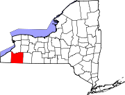
Towns Allegany | Ashford | Carrollton | Coldspring | Conewango | Dayton | East Otto | Ellicottville | Farmersville | Franklinville | Freedom | Great Valley | Hinsdale | Humphrey | Ischua | Leon | Little Valley | Lyndon | Machias | Mansfield | Napoli | New Albion | Olean | Otto | Perrysburg | Persia | Portville | Randolph | Red House | Salamanca | South Valley | Yorkshire
Villages Allegany | Cattaraugus | Delevan | East Randolph | Ellicottville | Franklinville | Gowanda‡ | Little Valley | Perrysburg | Portville | Randolph | South Dayton
CDPs Other
hamletsIndian
reservationsFootnotes ‡This populated place also has portions in an adjacent county or counties
Categories:- Villages in New York
- Populated places in Cattaraugus County, New York


Wikimedia Foundation. 2010.