- Moravia (town), New York
-
- For other places with this name, see Moravia (disambiguation).
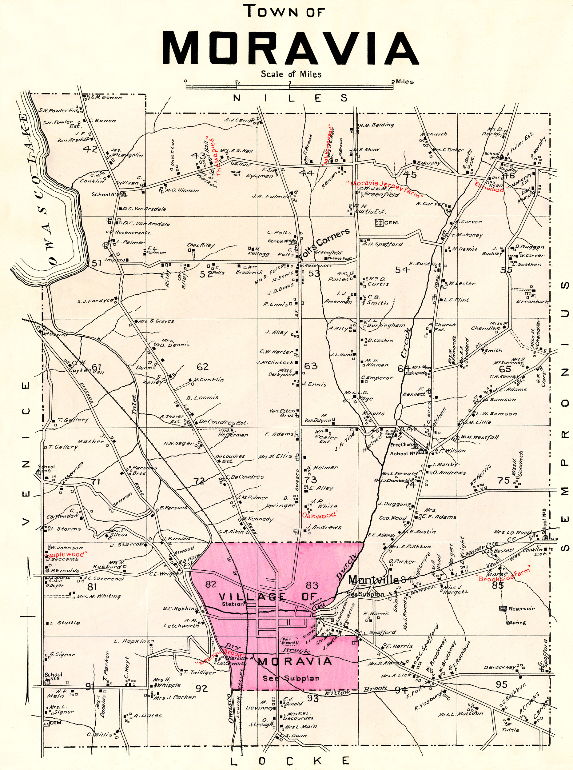
Moravia, New York — Town — Town of Moravia, NY, 1904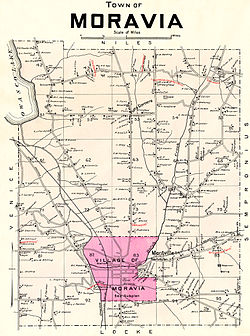
Country United States State New York County Cayuga Government – Type Town Council – Town Supervisor Gary W. Hatfield (R) – Town Council Members' ListPopulation (2000) – Total 3,626 – Density 125.5/sq mi (48.5/km2) Time zone Eastern (EST) Moravia is a town in Cayuga County, New York, United States. The population was 3,626 at the 2010 census.
The Town of Moravia contains a village called Moravia. Moravia is in the Finger Lakes region, south of Auburn, New York.
Contents
History
Moravia was part of the Central New York Military Tract. The first settlers arrived around 1789, while the natives still lived in the area. The town was formed in 1833 from the Town of Sempronius.
Past residents of note
- Millard Fillmore, US President was born east of Moravia village and married in the village.
- John D. Rockefeller, boyhood home of the American industrialist.
- John Wood, Illinois Governor and founder of Quincy, Illinois.
Geography
According to the United States Census Bureau, the town has a total area of 29.6 square miles (76.8 km²), of which, 29.0 square miles (75.1 km²) of it is land and 0.6 square miles (1.7 km²) of it (2.19%) is water.
Moravia is at the south end of Owasco Lake, and the Owasco Inlet flows northward through the town to the lake. Mill Creek flows into the Owasco Inlet at Moravia village.
New York State Route 38 joins New York State Route 38A at Moravia village.
Demographics
As of the census[1] of 2000, there were 4,040 people, 1,003 households, and 685 families residing in the town. The population density was 139.3 people per square mile (53.8/km²). There were 1,198 housing units at an average density of 41.3 per square mile (15.9/km²). The racial makeup of the town was 72.30% White, 21.39% Black or African American, 0.27% Native American, 0.27% Asian, 5.35% from other races, and 0.42% from two or more races. Hispanic or Latino of any race were 9.98% of the population.
There were 1,003 households out of which 32.5% had children under the age of 18 living with them, 55.3% were married couples living together, 8.5% had a female householder with no husband present, and 31.7% were non-families. 24.7% of all households were made up of individuals and 13.6% had someone living alone who was 65 years of age or older. The average household size was 2.53 and the average family size was 3.01.
In the town the population was spread out with 16.8% under the age of 18, 10.5% from 18 to 24, 42.9% from 25 to 44, 19.9% from 45 to 64, and 9.9% who were 65 years of age or older. The median age was 36 years. For every 100 females there were 202.6 males. For every 100 females age 18 and over, there were 237.0 males.
The median income for a household in the town was $38,081, and the median income for a family was $43,493. Males had a median income of $32,919 versus $23,264 for females. The per capita income for the town was $16,847. About 5.5% of families and 8.7% of the population were below the poverty line, including 11.2% of those under age 18 and 5.4% of those age 65 or over.
Communities and locations in the Town of Moravia
- Courtwright Corners – A location east of Southeast Owasco.
- Fillmore Glen State Park – A state park southeast of Moravia village.
- Four Town Corners – A location southeast of Owasco village at the east town line.
- Indian Grove – A location north of SOutheast Owasco.
- Montville – A hamlet east of Moravia village. It was once a rival for prominence over Moravia village.
- Moravia – The Village of Moravia is at the junction of NY-38 and NY-38A near the south town line.
- Owasco Hill – A hamlet northwest of Owasco village at the town line.
- Perkins Corners – A location at the west town line, south of Owasco Hill.
- Southeast Owasco – A hamlet at the south end of Owasco Lake.
- Toll Gate Corners – A hamlet at the south town line, south of Moravia village.
- Wilson Corners – A hamlet northeast of Moravia village on NY-38A
References
- ^ "American FactFinder". United States Census Bureau. http://factfinder.census.gov. Retrieved 2008-01-31.
External links
Municipalities and communities of Cayuga County, New York City 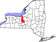
Towns Villages Aurora | Cato | Cayuga | Fair Haven | Meridian | Moravia | Port Byron | Union Springs | Weedsport
CDP Other
hamletCategories:- Towns in New York
- Populated places in Cayuga County, New York

Wikimedia Foundation. 2010.