- Meridian, New York
-
Meridian, New York — Village — Location within the state of New York
 Meridian, New York
Coordinates: 43°9′49″N 76°32′6″W / 43.16361°N 76.535°WCoordinates: 43°9′49″N 76°32′6″W / 43.16361°N 76.535°W Country United States State New York County Cayuga Area - Total 0.7 sq mi (1.8 km2) - Land 0.7 sq mi (1.8 km2) - Water 0.0 sq mi (0.0 km2) Elevation 453 ft (138 m) Population (2000) - Total 350 - Density 505.8/sq mi (195.3/km2) Time zone Eastern (EST) (UTC-5) - Summer (DST) EDT (UTC-4) ZIP code 13113 Area code(s) 315 FIPS code 36-46646 GNIS feature ID 0956983 Meridian is a village in Cayuga County, New York, United States. The population was 350 at the 2000 census.
The Village of Meridian is near the north town line of the Town of Cato and is west of Syracuse, New York.
Contents
History
The community was settled in 1804. It was once called "Cato Four Corners." Meridian was incorporated as a village in 1854.
The Meridian Baptist Church, at the eastern edge of the village, was founded in 1810. The church is celebrating the 200th anniversary of its founding for a full year, with the anniversary observance ending on October, 2010.
The William Smith Ingham House was listed on the National Register of Historic Places in 2005.[1]
Famous residents
Theodore Ruggles Timby, inventor of the revolving turret used on the U.S.S. Monitor during the American Civil War, lived for a time in Meridian, prior to the time the name was changed from Cato Four Corners to Meridian. His residence still stands on the west side of Bonta Bridge Road, south of the center of the village.
Geography
Meridian is located at 43°9′49″N 76°32′6″W / 43.16361°N 76.535°W (43.163531, -76.535045)[2].
According to the United States Census Bureau, the village has a total area of 0.7 square miles (1.8 km2), all of it land.
New York State Route 370 passes through the village.
Demographics
As of the census[3] of 2000, there were 350 people, 118 households, and 90 families residing in the village. The population density was 505.8 people per square mile (195.8/km²). There were 120 housing units at an average density of 173.4 per square mile (67.1/km²). The racial makeup of the village was 97.43% White, 0.57% Native American, and 2.00% from two or more races. Hispanic or Latino of any race were 1.14% of the population.
There were 118 households out of which 38.1% had children under the age of 18 living with them, 61.0% were married couples living together, 10.2% had a female householder with no husband present, and 22.9% were non-families. 17.8% of all households were made up of individuals and 6.8% had someone living alone who was 65 years of age or older. The average household size was 2.97 and the average family size was 3.34.
In the village the population was spread out with 31.4% under the age of 18, 8.0% from 18 to 24, 29.1% from 25 to 44, 19.1% from 45 to 64, and 12.3% who were 65 years of age or older. The median age was 34 years. For every 100 females there were 105.9 males. For every 100 females age 18 and over, there were 96.7 males.
The median income for a household in the village was $41,250, and the median income for a family was $48,250. Males had a median income of $35,313 versus $25,125 for females. The per capita income for the village was $15,567. About 5.5% of families and 9.4% of the population were below the poverty line, including 10.5% of those under age 18 and 5.7% of those age 65 or over.
References
- ^ "National Register Information System". National Register of Historic Places. National Park Service. 2009-03-13. http://nrhp.focus.nps.gov/natreg/docs/All_Data.html.
- ^ "US Gazetteer files: 2010, 2000, and 1990". United States Census Bureau. 2011-02-12. http://www.census.gov/geo/www/gazetteer/gazette.html. Retrieved 2011-04-23.
- ^ "American FactFinder". United States Census Bureau. http://factfinder.census.gov. Retrieved 2008-01-31.
Municipalities and communities of Cayuga County, New York County seat: Auburn City 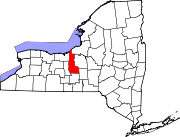
Towns Villages Aurora | Cato | Cayuga | Fair Haven | Meridian | Moravia | Port Byron | Union Springs | Weedsport
CDP Other
hamletCategories:- Villages in New York
- Populated places established in 1804
- Populated places in Cayuga County, New York


Wikimedia Foundation. 2010.