- Moravia (village), New York
-
Moravia, New York — Village — Location within the state of New York
 Moravia, New York
Coordinates: 42°42′40″N 76°25′23″W / 42.71111°N 76.42306°WCoordinates: 42°42′40″N 76°25′23″W / 42.71111°N 76.42306°W Country United States State New York County Cayuga Area – Total 1.7 sq mi (4.5 km2) – Land 1.7 sq mi (4.5 km2) – Water 0.0 sq mi (0.0 km2) Elevation 735 ft (224 m) Population (2000) – Total 1,363 – Density 793.0/sq mi (306.2/km2) Time zone Eastern (EST) (UTC-5) – Summer (DST) EDT (UTC-4) ZIP code 13118 Area code(s) 315 FIPS code 36-48296 GNIS feature ID 0957642 Moravia is a village in Cayuga County, New York, United States. The population was 1,363 at the 2000 census.
The Village of Moravia is in the south part of the Town of Moravia and is south of Auburn, New York.
Nearby Fillmore Glen State Park contains a replica of the cabin in which President Millard Fillmore was born.
Contents
History
The village was in the Central New York Military Tract and is on the site of a former native village.
Moravia village was founded in 1789 by John Stoyell, a veteran. It was then called "Owasco Flats." The Village of Moravia was incorporated in 1837 and re-incorporated in 1859 when enlarged.[1]
The Powers Library, erected in 1880, is the oldest continuously used library in New York.[2]
People of note from Moravia village
- Millard Fillmore was married in the village.
- John D. Rockefeller, boyhood home of the future industrialist.
- Andrew Dickson White, educator and president of Cornell University.
Geography
Moravia is located at 42°42′39″N 76°25′22″W / 42.71083°N 76.42278°W (42.711108, -76.42302)[3].
According to the United States Census Bureau, the village has a total area of 1.7 square miles (4.5 km²).None of the area is covered with water.
The village is south of Owasco Lake, and the Owasco Inlet flows through the village.
New York State Route 38 intersects New York State Route 38A in Moravia village.
Demographics
As of the census[4] of 2000, there were 1,363 people, 542 households, and 338 families residing in the village. The population density was 793.0 people per square mile (306.0/km²). There were 592 housing units at an average density of 344.4 per square mile (132.9/km²). The racial makeup of the village was 98.39% White, 0.29% Black or African American, 0.15% Native American, 0.29% Asian, and 0.88% from two or more races. Hispanic or Latino of any race were 0.37% of the population.
There were 542 households out of which 32.7% had children under the age of 18 living with them, 46.9% were married couples living together, 10.7% had a female householder with no husband present, and 37.5% were non-families. 30.3% of all households were made up of individuals and 18.3% had someone living alone who was 65 years of age or older. The average household size was 2.45 and the average family size was 3.05.
In the village the population was spread out with 27.4% under the age of 18, 6.5% from 18 to 24, 25.7% from 25 to 44, 22.4% from 45 to 64, and 18.0% who were 65 years of age or older. The median age was 38 years. For every 100 females there were 85.9 males. For every 100 females age 18 and over, there were 81.5 males.
The median income for a household in the village was $33,864, and the median income for a family was $41,513. Males had a median income of $30,625 versus $23,264 for females. The per capita income for the village was $16,447. About 4.8% of families and 9.2% of the population were below the poverty line, including 11.4% of those under age 18 and 6.6% of those age 65 or over.
References
- ^ Scarry, B. "History of the Village of Moravia, NY." Cayuga County NYGenWeb Project.
- ^ Joshi, L. B. "Moravia Continues Powers's Vision." The Citizen, 2006.
- ^ "US Gazetteer files: 2010, 2000, and 1990". United States Census Bureau. 2011-02-12. http://www.census.gov/geo/www/gazetteer/gazette.html. Retrieved 2011-04-23.
- ^ "American FactFinder". United States Census Bureau. http://factfinder.census.gov. Retrieved 2008-01-31.
External links
- Village of Moravia, NY
- History of Moravia village
- Powers Library
- Area photos, maps, history and genealogy
Municipalities and communities of Cayuga County, New York City 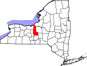
Towns Villages Aurora | Cato | Cayuga | Fair Haven | Meridian | Moravia | Port Byron | Union Springs | Weedsport
CDP Other
hamletCategories:- Villages in New York
- Populated places established in 1789
- Populated places in Cayuga County, New York


Wikimedia Foundation. 2010.