- Mina, New York
-
Mina — Town — Location within the state of New York
 Mina
MinaCoordinates: 42°7′56″N 79°42′19″W / 42.13222°N 79.70528°W Country United States State New York County Chautauqua Government – Type Town Council – Town Supervisor Rebecca N. Brumagin (D) – Town Council Members' ListArea – Total 36.3 sq mi (94.0 km2) – Land 35.9 sq mi (92.9 km2) – Water 0.4 sq mi (1.1 km2) Elevation 1,634 ft (498 m) Population (2000) – Total 1,176 – Density 32.8/sq mi (12.7/km2) Time zone Eastern (EST) (UTC-5) – Summer (DST) EDT (UTC-4) FIPS code 36-47592 GNIS feature ID 0979222 Mina is a town in Chautauqua County, New York, USA. The population was 1,176 at the 2000 census.
The Town of Mina is at the western county border. The town is best known as a summer resort area. During the summer months, the population swells to many times the year-round level.
Contents
History
The town was first settled around 1815 by Alexander Findley, who built the first mills. The Town of Mina was formed in 1824 from a partition of the Town of Clymer. In 1832, part of the town was used to form the Town of Sherman.
In 1915, the population of Mina was 1,021.
Geography
According to the United States Census Bureau, the town has a total area of 36.3 square miles (94 km2), of which, 35.9 square miles (93 km2) of it is land and 0.4 square miles (1.0 km2) of it (1.21%) is water.
Interstate 86 passes through the north part of the town. New York State Route 426 and New York State Route 430 intersect at Findley Lake village.
Adjacent towns and areas
Mina borders the townships of North East and Greenfield, Erie County, Pennsylvania at its western town line. The Town of Ripley is to the north, and the Town of French Creek is to the south. The Town of Sherman is to the east.
Demographics
As of the census[1] of 2000, there were 1,176 people, 456 households, and 336 families residing in the town. The population density was 32.8 people per square mile (12.7/km²). There were 750 housing units at an average density of 20.9 per square mile (8.1/km²). The racial makeup of the town was 98.13% White, 0.26% African American, 0.34% Native American, 0.17% Asian, 0.26% from other races, and 0.85% from two or more races. Hispanic or Latino of any race were 0.85% of the population.
There were 456 households out of which 28.3% had children under the age of 18 living with them, 64.7% were married couples living together, 3.5% had a female householder with no husband present, and 26.3% were non-families. 23.7% of all households were made up of individuals and 10.1% had someone living alone who was 65 years of age or older. The average household size was 2.58 and the average family size was 2.99.
In the town the population was spread out with 24.7% under the age of 18, 6.0% from 18 to 24, 28.1% from 25 to 44, 26.4% from 45 to 64, and 14.6% who were 65 years of age or older. The median age was 40 years. For every 100 females there were 100.7 males. For every 100 females age 18 and over, there were 103.0 males.
The median income for a household in the town was $40,139, and the median income for a family was $45,074. Males had a median income of $32,391 versus $22,404 for females. The per capita income for the town was $18,240. About 6.8% of families and 9.3% of the population were below the poverty line, including 15.4% of those under age 18 and 7.3% of those age 65 or over.
Communities and locations in Mina
- Findley Lake – A lake in the southwest part of the town. Water from the lake drains to the north into French Creek.
- Findley Lake – A hamlet named after the lake and the location of many summer homes. The village is at the north end of the lake by the junction of NY-426 and NY-430.
- Marks Corners – A location in the southeast corner of the town.
- Mina – The hamlet of Mina, located on NY Route 430 in the eastern part of the town.
References
- ^ "American FactFinder". United States Census Bureau. http://factfinder.census.gov. Retrieved 2008-01-31.
External links
Municipalities and communities of Chautauqua County, New York Cities 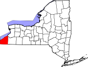
Towns Villages Bemus Point | Brocton | Cassadaga | Celoron | Cherry Creek | Falconer | Forestville | Fredonia | Lakewood | Mayville | Panama | Sherman | Silver Creek | Sinclairville | Westfield
CDPs Other
hamletsIndian
reservationCategories:- Towns in New York
- Populated places in Chautauqua County, New York


Wikimedia Foundation. 2010.