- Maple Springs, New York
-
Maple Springs is a hamlet located within the Town of Ellery in Chautauqua County, New York in the United States at an elevation of 1312 ft (400 m) above sea level[1]. It is situated along the east shore of Chautauqua Lake, between the villages of Mayville and Bemus Point. The postal code is 14756. New York State Route 430 runs through the hamlet.
Maple Springs is the setting for Midway State Park, the fifth-oldest remaining trolley park and fifteenth oldest amusement park in the nation. It was listed on the National Register of Historic Places in 2009.[2]
References
- ^ U.S. Geological Survey Geographic Names Information System: Maple Springs, New York
- ^ "National Register Information System". National Register of Historic Places. National Park Service. 2009-03-13. http://nrhp.focus.nps.gov/natreg/docs/All_Data.html.
Municipalities and communities of Chautauqua County, New York County seat: Mayville Cities 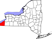
Towns Villages Bemus Point | Brocton | Cassadaga | Celoron | Cherry Creek | Falconer | Forestville | Fredonia | Lakewood | Mayville | Panama | Sherman | Silver Creek | Sinclairville | Westfield
CDPs Other
hamletsIndian
reservationCoordinates: 42°11′48″N 79°25′26″W / 42.19667°N 79.42389°W
Categories:- Hamlets in New York
- Populated places in Chautauqua County, New York
- New York geography stubs

Wikimedia Foundation. 2010.