- List of highways in Essex County, New York
-
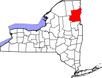 Essex County's location within New York State
The highways in Essex County, New York account for about 688 miles (1,107 km) of the highway system in New York, with 330.6 miles (532.0 km) of state roads and 357.4 miles (575.2 km) of county roads.[1] Several highways within the borders of the county serve as connections to ferry landings and bridges across Lake Champlain. There is one interstate highway in Essex County, Interstate 87, known locally as the Adirondack Northway. There is one U.S. highway in the county, the north–south U.S. Route 9. The next level of highway, designated state touring routes, has 11 designated highways that are spread throughout the county. The longest of these is New York State Route 9N, which runs for 67.69 miles (108.94 km) through the county. The shortest touring route in Essex County is New York State Route 373, which runs for 3.20 miles (5.15 km).[2]
The next level of highways in Essex County are the reference routes. The six reference routes in the county are short connectors; another reference route is no longer designated as such and is a former alignment of New York State Route 8, which stretches for 4.11 miles (6.61 km).[3] The last level of highways in the county is county roads. There are over 60 county roads in Essex County; most serve as collector roads.
Contents
Highways
Interstate highways and U.S. highways
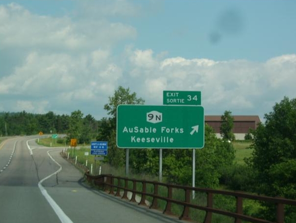
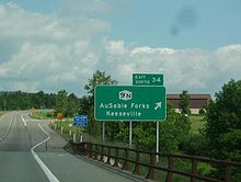 Exit 34 signage along the Northway (Interstate 87). Exit 34 is also Reference Route 915F
There is one interstate highway in Essex County, Interstate 87, stretching for 57.23 miles (92.10 km) from the Warren County line near Schroon Lake to the Clinton County line north of Keeseville.[2] The highway was assigned after being built in 1967 to connect Keeseville to the Clinton County line, paralleling the alignment of U.S. Route 9.[4][5]
There is one U.S. Route in Essex County, U.S. Route 9, which runs for 58.99 miles (94.94 km) in two segments. The first, spanning 57.83 miles (93.07 km), enters from Warren County near Schroon Lake before entering Clinton County temporarily. The second, spanning 1.16 miles (1.87 km), stretches from both lines of Clinton County.[2] Route 9 was assigned in the area in 1926 along a stagecoach route and has remained virtually unchanged since.[6]
State touring routes
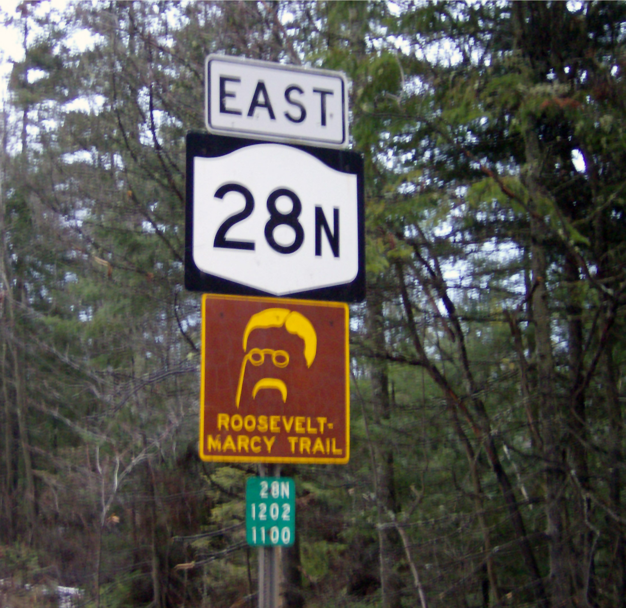
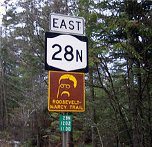 NY 28N sign along with Roosevelt-Marcy Trail Marker
There are 10 state touring routes in Essex county, the longest of which is NY 9N at 67.69 miles (108.94 km), which stretches from the Warren County line near Lake George to the Clinton County line north of Willsboro.[2] The shortest is Route 373, running for 3.20 miles (5.15 km).[2] Some state highways have been decommissioned, including New York State Route 192 (now part of New York State Route 86),[7] New York State Route 427 (now part of New York State Route 73), and New York State Route 86A (also part of NY 73).[7] New York State Route 8 was once concurrent with Routes 9N and 22, which continue into Essex County from Warren County, and ended in Crown Point at the Vermont border.[7] This has been replaced by NY 185 post-truncation, since Route 8 no longer exists in Essex County.[2]
State reference routes
There are six reference routes in Essex County;[8] there used to be seven, but on April 7, 2008, during reconstruction of the Champlain Bridge, the New York State Department of Transportation decided to promote New York State Route 910L to a touring route, now designated NY 185.[9] Around this time, there was an addition to the highway system, with the designation of New York State Route 915K, exit 33 on the Adirondack Northway. The longest reference route is New York State Route 910M at 0.81 miles (1.30 km), running from John Brown's Grave to NY 73.[2] The other three reference routes are NY 910K (part of the Blue Ridge Road), NY 912T (the shortest reference route, at 0.12 miles (0.19 km),[2] and a connector to NY 373), and NY 913Q, which serves Mount Van Hoevenberg in North Elba.[8]
County routes
There are over 60 county routes in Essex County, signed with the pentagonal county highway shields found in most of the state. The first in order is CR 2, also known as Corduroy Road and Creek Road in Ticonderoga; the last is CR 86E, known locally as Saint Huberts Road in Saint Huberts.[10] In Keene, there are five county routes along NY 73 that are former alignments of NY 86A, which previously ran along that alignment.[11]
Interstates, U.S. Routes, and State Routes
The chart below shows current interstate, U.S., and state highways by year of creation, length, and towns crossed. The towns are in order of how the road encounters them. Routes with (19xx) in them is when that particular route was removed from the highway system.
Route # Year created Length within Essex County[2] Locations  I-87
I-871967[5] 57.23 miles (92.10 km) Schroon, North Hudson, Elizabethtown, Westport, Lewis, Chesterfield  US 9
US 91926[6] 58.99 miles (94.94 km) South Schroon, Schroon Lake, Schroon, North Hudson, Underwood, New Russia, Elizabethtown, Lewis, Chesterfield, Keeseville, Ausable Chasm  NY 3
NY 31924[12] 6.90 miles (11.10 km) Saranac Lake, Bloomingdale, St. Armand  NY 8
NY 81930[13] (1960s) 26.03 miles (41.89 km) Ticonderoga, Crown Point  NY 9N
NY 9N1930[13] 67.69 miles (108.94 km) Ticonderoga, Crown Point, Port Henry, Moriah, Westport, Elizabethtown, Keene, Upper Jay, Jay, Au Sable Forks  NY 22
NY 221924[12] 61.02 miles (98.20 km) Ticonderoga, Crown Point, Port Henry, Moriah, Westport, Wadhams, Whallonsburg, Essex, Willsboro, Chesterfield, Keeseville  NY 28N
1930[13] 26.81 miles (43.15 km) Olmstedville, Minerva, Newcomb  NY 73
NY 731930[13] 27.60 miles (44.42 km) Lake Placid, North Elba, Keene, Keene Valley, Underwood  NY 74
NY 741930[13] 20.44 miles (32.89 km) Schroon, Severance, Paradox, Ticonderoga  NY 86
NY 861930[13] 26.65 miles (42.89 km) Jay, Wilmington, Lake Placid, Ray Brook, Saranac Lake, North Elba  NY 86A
1930[13] (1940s) 11.48 miles (18.48 km) Lake Placid, North Elba, Keene  NY 185
2008[9] 3.93 miles (6.32 km) Crown Point  NY 192
1930[13] (1988) 0.53 miles (0.85 km) Saint Armand  NY 195
1930[13] (mid-1930s) 8.38 miles (13.49 km) Elizabethtown, Westport  NY 347
1930[13] (mid-1930s) 4.11 miles (6.61 km) Crown Point NY 347mid-1930s[7] (1950s) 1.38 miles (2.22 km) Ticonderoga  NY 373
1930[13] 3.20 miles (5.15 km) Ausable Chasm, Port Kent  NY 427
1930[13] (1940s) 14.27 miles (22.97 km) Keene  NY 431
1935[14] 7.96 miles (12.81 km) Wilmington, North Pole, Whiteface Mountain  NY 910K
— 0.72 miles (1.16 km) North Hudson  NY 910M
— 0.81 miles (1.30 km) North Elba  NY 912T
— 0.12 miles (0.19 km) Chesterfield  NY 913Q
— 0.74 miles (1.19 km) North Elba  NY 915F
— 0.34 miles (0.55 km) Chesterfield  NY 915K
by 2009[8] 0.19 miles (0.31 km) Chesterfield County routes
The following is a list of county routes in Essex County. Essex county routes are signed with the standard pentagon shield. The towns are in order of how the road encounters them (either from the south to the north or from the west to the east).
Route #[10] Name Length Locations Notes  CR 2
CR 2Corduroy Road, Creek Road 9.85 miles (15.85 km)[15] Ticonderoga, Crown Point  CR 3
CR 3Black Point Road 2.44 miles (3.93 km)[16] Ticonderoga Dead ends on the shores of Lake George.  CR 4
CR 4Ensign Pond Road, Dugway Road, Tarbell Hill Road 15.85 miles (25.51 km)[17] North Hudson, Moriah  CR 5
CR 5Baldwin Road 2.85 miles (4.59 km)[18] Ticonderoga Dead end  CR 6
CR 6Tracy Road, Powerhouse Road 8.06 miles (12.97 km)[19] North Hudson, Moriah  CR 6A
CR 6ASilver Hill Road 2.88 miles (4.63 km)[20] Moriah  CR 7
CR 7Vineyard Road, Bradford Hill Road, White Church Road, Moriah Road, Center Road, Plank Road, Fisher Hill Road, Lincoln Pond Road 26.30 miles (42.33 km)[21] Crown Point, Moriah, Ticonderoga, Elizabethtown  CR 7B
CR 7BBartlett Pond Road 1.46 miles (2.35 km)[22] Moriah Dead end  CR 8
CR 8Elizabethtown – Wadhams Road 7.02 miles (11.30 km)[23] Elizabethtown, Westport  CR 10
CR 10Fox Run Road, Lewis-Wadhams Road 12.26 miles (19.73 km)[24] Westport, Lewis, Elizabethtown CR 10A Water Street 1.09 miles (1.75 km)[25] Elizabethtown  CR 11
CR 11Trout Brook Road 0.42 miles (0.68 km)[26] Ticonderoga  CR 12
CR 12Jersey Street, Stowersville Road, Wells Hill Road 11.46 miles (18.44 km)[27] Essex, Lewis Formerly had two discontinuous segments. The western segment was redesignated CR 83  CR 13
CR 13Hurricane Road 6.15 miles (9.90 km)[28] Keene  CR 14
CR 14Deerhead Road 9.26 miles (14.90 km)[29] Lewis, Willsboro  CR 15
CR 15Augur Lake Road 3.58 miles (5.76 km)[30] Chesterfield Dead-ends at Augur Lake  CR 16
CR 16Clinton Street, Port Douglas Road 3.61 miles (5.81 km)[31] Chesterfield  CR 17
CR 17Soper Road 2.55 miles (4.10 km)[32] Chesterfield  CR 18
CR 18River Road 5.88 miles (9.46 km)[33] Saint Armand  CR 19
CR 19Bonnie View Road 3.75 miles (6.04 km)[34] Wilmington Crosses the county line and becomes an unnumbered road in Clinton County  CR 20
CR 20Trudeau Road 0.97 miles (1.56 km)[35] Saint Armand  CR 21
CR 21River Road 4.01 miles (6.45 km)[36] North Elba Designated as the "10th Mountain Division Memorial Trail"  CR 23
CR 23Averyville Lane 3.66 miles (5.89 km)[37] North Elba Dead end  CR 24
CR 24Irishtown Road, Hoffman Road 12.82 miles (20.63 km)[38] Schroon, Minerva  CR 25
CR 25Tahawus Road, Upper Works Road 9.84 miles (15.84 km)[39] Newcomb Dead end  CR 26
CR 26Bear Cub Road 2.49 miles (4.01 km)[40] North Elba Dead-ends south of the town near Heaven Hill  CR 26A
Newman Road — North Elba  CR 27
CR 27Farrell Road, Point Road 5.54 miles (8.92 km)[41] Willsboro Terminates south of Willsboro Point  CR 28
CR 28Highlands Road 7.47 miles (12.02 km)[42] Chesterfield  CR 29
CR 29Olmstedville Road 4.00 miles (6.44 km)[43] Minerva  CR 29A
Donnelly Road 0.53 miles (0.85 km)[44] Minerva  CR 30
CR 30Morse Memorial Highway, Church Road 4.00 miles (6.44 km)[45] Minerva  CR 31
CR 31Whiteface Inn Lane 1.54 miles (2.48 km)[46] North Elba  CR 32
CR 32Raybrook Road 1.58 miles (2.54 km)[47] North Elba  CR 33
CR 33Southern extension of Pine Street in Saranac Lake 2.31 miles (3.72 km)[48] North Elba County maintenance ends at Payeville Road  CR 34
CR 34Trout Brook Road 6.62 miles (10.65 km)[49] Schroon, Minerva Also known as CR 24B  CR 35
CR 35Old Military Road 3.61 miles (5.81 km)[50] North Elba  CR 36
CR 36Wilson Road 0.54 miles (0.87 km)[51] Minerva  CR 37
CR 3714th Road, Town Shed Road, Longs Hill Road, Oneil Road 3.65 miles (5.87 km)[52] Minerva County maintenance ends at Bennett Road  CR 38
CR 38New Hague Road 1.05 miles (1.69 km)[53] Ticonderoga Continues southward as Warren County Route 21A  CR 39
CR 39Putts Pond Road 3.91 miles (6.29 km)[54] Ticonderoga Dead end  CR 40
CR 40Alstead Hill Lane 1.08 miles (1.74 km)[55] Keene County maintenance ends at Bartlett Road  CR 41
CR 41Lower Road 0.70 miles (1.13 km)[56] Ticonderoga Continues south as Washington CR 2.  CR 42
CR 42West Moriah Road, Tarbell Hill Road 2.44 miles (3.93 km)[57] Moriah  CR 43
CR 43Shore-Airport Road 4.18 miles (6.73 km)[58] Ticonderoga  CR 44
CR 44Stevenson Road 5.85 miles (9.41 km)[59] Westport  CR 45
CR 45Sugar Hill Road 1.37 miles (2.20 km)[60] Crown Point  CR 46
CR 46Factoryville Road 2.05 miles (3.30 km)[61] Crown Point  CR 47
CR 47Amy Hill Road, Pearl Street 4.06 miles (6.53 km)[62] Crown Point  CR 48 (South)
Old Chilson Road 3.40 miles (5.47 km)[63] Ticonderoga CR 48 (North)Lake Road 3.42 miles (5.50 km)[64] Crown Point  CR 49
CR 49Delano Road 2.86 miles (4.60 km)[65] Ticonderoga  CR 50
CR 50Russell Street 2.84 miles (4.57 km)[66] Crown Point  CR 51
CR 51Gilmore Hill Road 1.00 mile (1.61 km)[67] Keene  CR 52
CR 52Styles Brook Road 2.92 miles (4.70 km)[68] Keene County maintenance ends at Upland Meadows Road  CR 53
CR 53Cutting Road 1.23 miles (1.98 km)[69] Lewis  CR 54
CR 54Pilfershire Road 3.19 miles (5.13 km)[70] Moriah  CR 55
CR 55Walker Road, Whallons Bay Road 6.84 miles (11.01 km)[71] Essex Also known as CR 22K
Discontinuous at the Boquet River CR 56
CR 56Middle Chilson Road 2.20 miles (3.54 km)[72] Ticonderoga  CR 57
CR 57Reber Road 1.37 miles (2.20 km)[73] Willsboro, Essex Partial town road  CR 58
CR 58Valley Road 2.79 miles (4.49 km)[74] Jay  CR 59
CR 59Youngs Road 2.57 miles (4.14 km)[75] Westport  CR 60
CR 60Sam Spear Road 1.90 miles (3.06 km)[76] Westport  CR 61
CR 61Maple Street 0.26 miles (0.42 km)[77] Willsboro  CR 62
CR 62Farrell Road 1.89 miles (3.04 km)[78] Willsboro Also known as CR 27B  CR 63
CR 63Fox Farm Road 0.87 miles (1.40 km)[79] Wilmington  CR 64
CR 64Randys Lane, Stickney Bridge Road 5.86 miles (9.43 km)[80] Jay  CR 65
CR 65Sheldrake Road 2.54 miles (4.09 km)[81] Jay  CR 66
CR 66Middle Road 6.11 miles (9.83 km)[82] Essex, Willsboro Also known as CR 22M  CR 67
CR 67Old Schroon Road 1.64 miles (2.64 km)[83] Schroon  CR 68
CR 68Sunset Drive 5.07 miles (8.16 km)[84] Willsboro  CR 69
CR 69Hulls Falls Road 2.46 miles (3.96 km)[85] Keene  CR 70
CR 70Witherbee Road, Dalton Hill Road 3.78 miles (6.08 km)[86] Moriah  CR 71
CR 71Mace Chasm Road 5.54 miles (8.92 km)[87] Chesterfield  CR 72
CR 72Whiteface Mountain Road, Gillsepie Drive 4.26 miles (6.86 km)[88] Wilmington, Saint Armand Crosses the county line and continues as Franklin County Route 48. Also known as CR 18A.  CR 75
CR 75Eaton Lane 0.36 miles (0.58 km)[89] Newcomb  CR 76
CR 76Tahawus Road 0.80 miles (1.29 km)[90] Newcomb  CR 77
CR 77Alexandria Avenue 1.54 miles (2.48 km)[91] Ticonderoga County Route from intersection with Lake George Avenue and West  CR 78
CR 78Johnson Pond Road 2.96 miles (4.76 km)[92] North Hudson Continues as CR 2 near Johnson Pond  CR 79
CR 79Raymond Wright Way 0.98 miles (1.58 km)[93] Moriah  CR 80
CR 80Lake Shore Road 10.18 miles (16.38 km)[94] Essex, Westport Also known as CR 22J  CR 81
CR 81Saint Regis Street 0.53 miles (0.85 km)[95] Saint Armand Continues into Franklin County as CR 55;Formerly a segment of New York State Route 192  CR 82
CR 82Glen Road 3.83 miles (6.16 km)[96] Jay  CR 83
CR 83Jay Mountain Road, Trumbulls Road, Springfield Road, Haselton Road 5.55 miles (8.93 km)[97] Jay, Wilmington Crosses the county line and becomes an unnumbered road in Clinton County  CR 84
CR 84Blue Ridge Road 18.83 miles (30.30 km)[98] Newcomb, Minerva, North Hudson Also known as CR 2B[3]  CR 86A
Ausable Road 1.19 miles (1.92 km)[99] Saint Huberts Old alignment of former NY 86A. Not signed.[11]  CR 86B
Adirondack Street, Market Street 0.67 miles (1.08 km)[100] Keene Valley Old alignment of former NY 86A. Not signed.[11]  CR 86C
Cemetery Lane 0.33 miles (0.53 km)[101] Keene Valley Old alignment of former NY 86A. Not signed.[11]  CR 86D
Airport Lane 0.81 miles (1.30 km)[102] Keene Valley Old alignment of former NY 86A. Not signed.[11]  CR 86E
Saint Huberts Road 0.33 miles (0.53 km)[103] Saint Huberts Old alignment of former NY 86A. Not signed.[11] Bibliography
- Yahoo Maps (2009). Overviews of County Routes (Map). Cartography by NAVTEQ.
References
- ^ "Overview of mileage in Essex County, New York" (PDF). New York State Department of Transportation. 2006. https://www.nysdot.gov/divisions/engineering/technical-services/hds-respository/essex.pdf. Retrieved June 30, 2008.
- ^ a b c d e f g h i "2006 Traffic Data Report for New York State" (PDF). New York State Department of Transportation. July 16, 2007. https://www.nysdot.gov/divisions/engineering/technical-services/hds-respository/NYSDOT_Traffic_Data_Report_2006.pdf. Retrieved June 30, 2008.
- ^ a b "2003 Essex County traffic counts" (PDF). New York State Department of Transportation. https://www.nysdot.gov/divisions/engineering/technical-services/hds-respository/onondagatvbk.pdf. Retrieved June 30, 2008.
- ^ Lamy, Margaret (May 18, 1966). "Big Gaps Are Being Closed in the Link Between the Thruway and Canada". The New York Times. http://select.nytimes.com/gst/abstract.html?res=FA0716FC3C5F137A93CAA9178ED85F428685F9. Retrieved June 30, 2008.
- ^ a b "Schroon Lake 1804–2004". Adirondack Gold Pages. 2008. http://www.adirondackgoldpages.com/regional/schroonlake.htm. Retrieved June 30, 2008.
- ^ a b United States Department of Agriculture (November 11, 1926). United States System of Highways (Map).
- ^ a b c d Sun Oil Company (1935). Road Map & Historical Guide - New York (Map). Cartography by Rand McNally and Company.
- ^ a b c (PDF) Official Description of Highway Touring Routes, Bicycling Touring Routes, Scenic Byways, & Commemorative/Memorial Designations in New York State. New York State Department of Transportation. January 2009. https://www.nysdot.gov/divisions/operating/oom/transportation-systems/repository/2009%20tour-bk.pdf. Retrieved June 14, 2009.
- ^ a b "Construction and Other Restrictions Report – Sorted by Route" (PDF). New York State Department of Transportation. May 11, 2009. https://www.nysdot.gov/transportation-partners/nys-transportation-federation/permits/ny-permits/repository/WeeklyRestrictionReportByRoute.PDF. Retrieved May 12, 2009.
- ^ a b Jimapco Incorporated (2005). New York State Road Atlas (Map). Cartography by Jimapco Incorporated (1st ed.).
- ^ a b c d e f New York State Department of Transportation (1968). Keene Valley Digital Raster Quadrangle (Map). 1:24,000. http://www.nysgis.state.ny.us/gisdata/quads/drg24/dotpreview/index.cfm?code=g48. Retrieved January 25, 2010.
- ^ a b "New York's Main Highways Designated by Numbers". The New York Times: p. XX9. December 21, 1924.
- ^ a b c d e f g h i j k l Dickinson, Leon A. (January 12, 1930). "New Signs for State Highways". The New York Times: p. 136.
- ^ "New Scenic State Road". The New York Times: p. 11. February 23, 1935.
- ^ Yahoo! Inc. Yahoo! Maps – County Route 2 (Map). Cartography by NAVTEQ. http://maps.yahoo.com/#mvt=m&lat=43.954528&lon=-73.433774&zoom=16&q1=43.878278%2C-73.538831&q2=43.930781%2C-73.510549&q3=43.945553%2C-73.489564&q4=43.952134%2C-73.4533&q5=43.951361%2C-73.432186. Retrieved April 1, 2010.
- ^ Yahoo! Inc. Yahoo! Maps – County Route 3 (Map). Cartography by NAVTEQ. http://maps.yahoo.com/#mvt=m&lat=43.836371&lon=-73.424286&zoom=16&q1=43.804138%2C-73.433341&q2=43.836309%2C-73.426989. Retrieved April 1, 2010.
- ^ Yahoo! Inc. Yahoo! Maps – County Route 4 (Map). Cartography by NAVTEQ. http://maps.yahoo.com/#mvt=h&lat=43.989636&lon=-73.719074&zoom=16&q1=44.048688%2C-73.459608&q2=44.057571%2C-73.495528&q3=44.052697%2C-73.545524&q4=44.036533%2C-73.588011&q5=43.98573%2C-73.716671. Retrieved April 1, 2010.
- ^ Yahoo! Inc. Yahoo! Maps – County Route 5 (Map). Cartography by NAVTEQ. http://maps.yahoo.com/#mvt=m&lat=43.80581&lon=-73.451237&zoom=16&q1=43.836155%2C-73.431109&q2=43.807018%2C-73.458532. Retrieved April 1, 2010.
- ^ Yahoo! Inc. Yahoo! Maps – County Route 6 (Map). Cartography by NAVTEQ. http://maps.yahoo.com/#mvt=h&lat=44.08855&lon=-73.536917&zoom=16&q1=Tracy%20Road%2C%20North%20Hudson%20NY&q2=44.089521%2C-73.530952. Retrieved April 1, 2010.
- ^ Yahoo! Inc. Yahoo! Maps – County Route 6A (Map). Cartography by NAVTEQ. http://maps.yahoo.com/#mvt=m&lat=44.075973&lon=-73.532619&zoom=17&q1=44.08805%2C-73.53588&q2=44.082147%2C-73.555171&q3=44.077399%2C-73.527769. Retrieved April 1, 2010.
- ^ Yahoo! Inc. Yahoo! Maps – County Route 7 (Map). Cartography by NAVTEQ. http://maps.yahoo.com/#mvt=h&lat=44.213505&lon=-73.584031&zoom=17&q1=43.885679%2C-73.448033&q2=43.937047%2C-73.468117&q3=43.949577%2C-73.474962&q4=43.971587%2C-73.488266&q5=44.04437%2C-73.504831&q6=44.066561%2C-73.508586&q7=44.095833%2C-73.521568&q8=44.11386%2C-73.559183&q9=44.131713%2C-73.570878&q10=44.170034%2C-73.586563. Retrieved April 1, 2010.
- ^ Yahoo! Inc. Yahoo! Maps – County Route 7B (Map). Cartography by NAVTEQ. http://maps.yahoo.com/#mvt=h&lat=44.111993&lon=-73.494446&zoom=16&q1=44.093148%2C-73.518608&q2=44.10865%2C-73.502429. Retrieved April 1, 2010.
- ^ Yahoo! Inc. Yahoo! Maps – County Route 8 (Map). Cartography by NAVTEQ. http://maps.yahoo.com/#mvt=h&lat=44.231097&lon=-73.458225&zoom=17&q1=44.218126%2C-73.587615&q2=44.229459%2C-73.49951&q3=44.229859%2C-73.461293. Retrieved April 1, 2010.
- ^ Yahoo! Inc. Yahoo! Maps – County Route 10 (Map). Cartography by NAVTEQ. http://maps.yahoo.com/#mvt=h&lat=44.233886&lon=-73.452141&zoom=16&q1=44.220309%2C-73.598825&q2=44.25871%2C-73.583934&q3=44.274045%2C-73.562562&q4=44.253577%2C-73.51175&q5=44.253546%2C-73.488147&q6=44.230273%2C-73.459308. Retrieved April 1, 2010.
- ^ Yahoo! Inc. Yahoo! Maps – County Route 10A (Map). Cartography by NAVTEQ. http://maps.yahoo.com/#mvt=m&lat=44.218349&lon=-73.599266&zoom=16&q1=44.216396%2C-73.590597&w0=44.22008704472697%2C-73.59754961770629&q2=44.221071%2C-73.609909. Retrieved April 1, 2010.
- ^ Yahoo! Inc. Yahoo! Maps – County Route 11 (Map). Cartography by NAVTEQ. http://maps.yahoo.com/#mvt=m&lat=43.801157&lon=-73.488062&zoom=16&q1=43.799221%2C-73.49334&q2=43.803371%2C-73.488062. Retrieved April 1, 2010.
- ^ Yahoo! Inc. Yahoo! Maps – County Route 12 (Map). Cartography by NAVTEQ. http://maps.yahoo.com/#mvt=h&lat=44.290507&lon=-73.604199&zoom=16&q1=44.304068%2C-73.402411&q2=44.306985%2C-73.447987&q3=44.301058%2C-73.498283&q4=44.291536%2C-73.599478. Retrieved April 1, 2010.
- ^ Yahoo! Inc. Yahoo! Maps – County Route 13 (Map). Cartography by NAVTEQ. http://maps.yahoo.com/#mvt=m&lat=44.240675&lon=-73.760671&zoom=16&q1=44.221133%2C-73.749384&q2=44.257782%2C-73.752088&q3=44.254677%2C-73.790025. Retrieved April 1, 2010.
- ^ Yahoo! Inc. Yahoo! Maps – County Route 14 (Map). Cartography by NAVTEQ. http://maps.yahoo.com/#mvt=m&lat=44.45611&lon=-73.518231&zoom=17&q1=44.489712%2C-73.485144&q2=44.455061%2C-73.515313. Retrieved April 1, 2010.
- ^ Yahoo! Inc. Yahoo! Maps – County Route 15 (Map). Cartography by NAVTEQ. http://maps.yahoo.com/#mvt=m&lat=44.45611&lon=-73.518231&zoom=17&q1=44.489712%2C-73.485144&q2=44.455061%2C-73.515313. Retrieved April 1, 2010.
- ^ Yahoo! Inc. Yahoo! Maps – County Route 16 (Map). Cartography by NAVTEQ. http://maps.yahoo.com/#mvt=m&lat=44.497985&lon=-73.468407&zoom=16&q1=44.503204%2C-73.480637&q2=44.482448%2C-73.418281. Retrieved April 1, 2010.
- ^ Yahoo! Inc. Yahoo! Maps – County Route 17 (Map). Cartography by NAVTEQ. http://maps.yahoo.com/#mvt=m&lat=44.51849&lon=-73.437765&zoom=17&q1=44.505033%2C-73.479994&q2=44.519355%2C-73.435877. Retrieved April 1, 2010.
- ^ Yahoo! Inc. Yahoo! Maps – County Route 18 (Map). Cartography by NAVTEQ. http://maps.yahoo.com/#mvt=h&lat=44.42684&lon=-73.986391&zoom=16&q1=44.408495%2C-74.083508&q2=44.423178%2C-73.989052. Retrieved April 1, 2010.
- ^ Yahoo! Inc. Yahoo! Maps – County Route 19 (Map). Cartography by NAVTEQ. http://maps.yahoo.com/#mvt=m&lat=44.439628&lon=-73.793866&zoom=17&q1=44.389914%2C-73.822233&q2=44.439237%2C-73.793544. Retrieved April 1, 2010.
- ^ Yahoo! Inc. Yahoo! Maps – County Route 20 (Map). Cartography by NAVTEQ. http://maps.yahoo.com/#mvt=h&lat=44.351896&lon=-74.132133&zoom=16&q1=44.34562%2C-74.117756&q2=Trudeau%20Road%2C%20Saint%20Armand%20NY. Retrieved April 1, 2010.
- ^ Yahoo! Inc. Yahoo! Maps – County Route 21 (Map). Cartography by NAVTEQ. http://maps.yahoo.com/#mvt=m&lat=44.300705&lon=-73.925573&zoom=17&q1=44.256176%2C-73.961837&q2=44.299975%2C-73.928813. Retrieved April 1, 2010.
- ^ Yahoo! Inc. Yahoo! Maps – County Route 23 (Map). Cartography by NAVTEQ. http://maps.yahoo.com/#mvt=m&lat=44.244671&lon=-74.04756&zoom=17&q1=44.272433%2C-73.995933&q2=44.243757%2C-74.052023. Retrieved April 1, 2010.
- ^ Yahoo! Inc. Yahoo! Maps – County Route 24 (Map). Cartography by NAVTEQ. http://maps.yahoo.com/#mvt=m&lat=43.792514&lon=-73.9379&zoom=16&q1=43.775427%2C-73.93524&q2=43.825977%2C-73.90404&q3=43.845727%2C-73.813875&q4=43.832726%2C-73.767612. Retrieved April 1, 2010.
- ^ Yahoo! Inc. Yahoo! Maps – County Route 25 (Map). Cartography by NAVTEQ. http://maps.yahoo.com/#mvt=m&lat=44.100471&lon=-74.054566&zoom=15&q1=43.958204%2C-74.053171&q2=44.088482%2C-74.056197. Retrieved April 1, 2010.
- ^ Yahoo! Inc. Yahoo! Maps – County Route 26 (Map). Cartography by NAVTEQ. http://maps.yahoo.com/#mvt=m&lat=44.239844&lon=-73.994946&zoom=17&q1=44.265335%2C-73.981384&q2=44.240867%2C-74.001769. Retrieved April 1, 2010.
- ^ Yahoo! Inc. Yahoo! Maps – County Route 27 (Map). Cartography by NAVTEQ. http://maps.yahoo.com/#mvt=m&lat=44.442063&lon=-73.369615&zoom=16&q1=44.370276%2C-73.395966&q2=44.444132%2C-73.376911. Retrieved April 1, 2010.
- ^ Yahoo! Inc. Yahoo! Maps – County Route 28 (Map). Cartography by NAVTEQ. http://maps.yahoo.com/#mvt=m&lat=43.759575&lon=-73.956955&zoom=15&q1=43.758738%2C-73.908718&q2=43.761962%2C-73.950603. Retrieved April 1, 2010.
- ^ Yahoo! Inc. Yahoo! Maps – County Route 29 (Map). Cartography by NAVTEQ. http://maps.yahoo.com/#mvt=m&lat=43.759575&lon=-73.956955&zoom=15&q1=43.758738%2C-73.908718&q2=43.761962%2C-73.950603. Retrieved April 1, 2010.
- ^ Yahoo! Inc. Yahoo! Maps – County Route 29A (Map). Cartography by NAVTEQ. http://maps.yahoo.com/#mvt=m&lat=43.777488&lon=-73.925283&zoom=16&q1=43.771925%2C-73.92288&q2=43.77363%2C-73.92494&q3=43.77332%2C-73.931764. Retrieved April 1, 2010.
- ^ Yahoo! Inc. Yahoo! Maps – County Route 30 (Map). Cartography by NAVTEQ. http://maps.yahoo.com/#mvt=m&lat=43.775814&lon=-73.954294&zoom=15&q1=43.757622%2C-73.925884&w0=&q2=43.785265%2C-73.971546&w1=43.78633874292509%2C-73.97558212280273&q3=43.787186%2C-73.980816. Retrieved April 1, 2010.
- ^ Yahoo! Inc. Yahoo! Maps – County Route 31 (Map). Cartography by NAVTEQ. http://maps.yahoo.com/#mvt=m&lat=44.298416&lon=-74.010824&zoom=17&q1=44.296382%2C-74.008764&q2=44.312782%2C-74.003357. Retrieved April 1, 2010.
- ^ Yahoo! Inc. Yahoo! Maps – County Route 32 (Map). Cartography by NAVTEQ. http://maps.yahoo.com/#mvt=m&lat=44.293917&lon=-74.098672&zoom=17&q1=44.299438%2C-74.103007&q2=44.29397%2C-74.095196&q3=44.299837%2C-74.081721. Retrieved April 1, 2010.
- ^ Yahoo! Inc. Yahoo! Maps – County Route 33 (Map). Cartography by NAVTEQ. http://maps.yahoo.com/#mvt=m&lat=44.315814&lon=-74.106633&zoom=17&q1=44.300113%2C-74.085669&q2=44.322024%2C-74.115774. Retrieved April 1, 2010.
- ^ Yahoo! Inc. Yahoo! Maps – County Route 34 (Map). Cartography by NAVTEQ. http://maps.yahoo.com/#mvt=m&lat=43.835528&lon=-73.854044&zoom=16&q1=43.771925%2C-73.922708&q2=43.783421%2C-73.888591&q3=43.796774%2C-73.878119&q4=43.822912%2C-73.866232&q5=43.839846%2C-73.855374. Retrieved April 1, 2010.
- ^ Yahoo! Inc. Yahoo! Maps – County Route 35 (Map). Cartography by NAVTEQ. http://maps.yahoo.com/#mvt=m&lat=44.290123&lon=-74.024922&zoom=17&q1=44.260387%2C-73.967244&q2=44.288472%2C-74.024707. Retrieved April 1, 2010.
- ^ Yahoo! Inc. Yahoo! Maps – County Route 36 (Map). Cartography by NAVTEQ. http://maps.yahoo.com/#mvt=m&lat=43.776899&lon=-73.956612&zoom=16&q1=43.777844%2C-73.95511&q2=43.771801%2C-73.961161. Retrieved April 1, 2010.
- ^ Yahoo! Inc. Yahoo! Maps – County Route 37 (Map). Cartography by NAVTEQ. http://maps.yahoo.com/#mvt=m&lat=43.798431&lon=-73.948029&zoom=16&q1=43.771585%2C-73.996652&q2=43.799623%2C-73.940475. Retrieved April 1, 2010.
- ^ Yahoo! Inc. Yahoo! Maps – County Route 38 (Map). Cartography by NAVTEQ. http://maps.yahoo.com/#mvt=m&lat=43.798214&lon=-73.525012&zoom=16&q1=43.794574%2C-73.542307&q2=43.79634%2C-73.524583. Retrieved April 1, 2010.
- ^ Yahoo! Inc. Yahoo! Maps – County Route 39 (Map). Cartography by NAVTEQ. http://maps.yahoo.com/#mvt=h&lat=43.84116&lon=-73.566002&zoom=16&q1=43.838482%2C-73.571195&q2=43.877194%2C-73.528451. Retrieved April 1, 2010.
- ^ Yahoo! Inc. Yahoo! Maps – County Route 40 (Map). Cartography by NAVTEQ. http://maps.yahoo.com/#mvt=m&lat=44.269046&lon=-73.825816&zoom=16&q1=44.266572%2C-73.79981&q2=44.272318%2C-73.815002. Retrieved April 1, 2010.
- ^ Yahoo! Inc. Yahoo! Maps – County Route 41 (Map). Cartography by NAVTEQ. http://maps.yahoo.com/#mvt=m&lat=43.812469&lon=-73.408235&zoom=16&q1=43.807142%2C-73.395661&q2=43.815225%2C-73.402399. Retrieved April 1, 2010.
- ^ Yahoo! Inc. Yahoo! Maps – County Route 42 (Map). Cartography by NAVTEQ. http://maps.yahoo.com/#mvt=m&lat=44.045666&lon=-73.515824&zoom=16&q1=44.041347%2C-73.559083&q2=44.049059%2C-73.485054. Retrieved April 1, 2010.
- ^ Yahoo! Inc. Yahoo! Maps – County Route 43 (Map). Cartography by NAVTEQ. http://maps.yahoo.com/#mvt=m&lat=43.860728&lon=-73.416647&zoom=16&q1=43.901776%2C-73.427376&q2=43.856582%2C-73.417033. Retrieved April 1, 2010.
- ^ Yahoo! Inc. Yahoo! Maps – County Route 44 (Map). Cartography by NAVTEQ. http://maps.yahoo.com/#mvt=m&lat=44.183661&lon=-73.43799&zoom=17&q1=44.106265%2C-73.446316&q2=44.181945%2C-73.432862. Retrieved April 1, 2010.
- ^ Yahoo! Inc. Yahoo! Maps – County Route 45 (Map). Cartography by NAVTEQ. http://maps.yahoo.com/#mvt=m&lat=43.939767&lon=-73.427633&zoom=16&q1=43.95123%2C-73.431968&q2=43.942918%2C-73.431839&q3=43.936614%2C-73.41935. Retrieved April 1, 2010.
- ^ Yahoo! Inc. Yahoo! Maps – County Route 46 (Map). Cartography by NAVTEQ. http://maps.yahoo.com/#mvt=m&lat=43.972236&lon=-73.44304&zoom=16&q1=43.949963%2C-73.459605&q2=43.974243%2C-73.441881. Retrieved April 1, 2010.
- ^ Yahoo! Inc. Yahoo! Maps – County Route 47 (Map). Cartography by NAVTEQ. http://maps.yahoo.com/#mvt=m&lat=43.936398&lon=-73.509129&zoom=16&q1=43.930681%2C-73.510331&q2=43.951601%2C-73.441709. Retrieved April 1, 2010.
- ^ Yahoo! Inc. Yahoo! Maps – County Route 48S (Map). Cartography by NAVTEQ. http://maps.yahoo.com/#mvt=m&lat=43.871032&lon=-73.502134&zoom=16&q1=43.852714%2C-73.437504&q2=43.868928%2C-73.496469. Retrieved April 1, 2010.
- ^ Yahoo! Inc. Yahoo! Maps – County Route 48N (Map). Cartography by NAVTEQ. http://maps.yahoo.com/#mvt=m&lat=43.988263&lon=-73.42141&zoom=16&q1=43.958892%2C-73.430165&q2=44.001477%2C-73.419222. Retrieved April 1, 2010.
- ^ Yahoo! Inc. Yahoo! Maps – County Route 49 (Map). Cartography by NAVTEQ. http://maps.yahoo.com/#mvt=m&lat=43.904311&lon=-73.417934&zoom=16&q1=43.859584%2C-73.426045&q2=43.900168%2C-73.421496. Retrieved April 1, 2010.
- ^ Yahoo! Inc. Yahoo! Maps – County Route 50 (Map). Cartography by NAVTEQ. http://maps.yahoo.com/#mvt=m&lat=43.965163&lon=-73.445143&zoom=16&q1=43.9571%2C-73.486341&q2=43.965811%2C-73.432354. Retrieved April 1, 2010.
- ^ Yahoo! Inc. Yahoo! Maps – County Route 51 (Map). Cartography by NAVTEQ. http://maps.yahoo.com/#mvt=m&lat=44.268277&lon=-73.812555&zoom=16&q1=44.260394%2C-73.820581&w0=44.265987808203015%2C-73.81186884683227&q2=44.266602%2C-73.80453. Retrieved April 1, 2010.
- ^ Yahoo! Inc. Yahoo! Maps – County Route 52 (Map). Cartography by NAVTEQ. http://maps.yahoo.com/#mvt=m&lat=44.300559&lon=-73.759115&zoom=17&q1=44.298539%2C-73.786195&q2=44.302624%2C-73.731327. Retrieved April 1, 2010.
- ^ Yahoo! Inc. Yahoo! Maps – County Route 53 (Map). Cartography by NAVTEQ. http://maps.yahoo.com/#mvt=h&lat=44.244247&lon=-73.585007&zoom=16&q1=44.243679%2C-73.592603&q2=44.240789%2C-73.569128. Retrieved April 1, 2010.
- ^ Yahoo! Inc. Yahoo! Maps – County Route 54 (Map). Cartography by NAVTEQ. http://maps.yahoo.com/#mvt=m&lat=44.081106&lon=-73.505861&zoom=16&q1=44.089722%2C-73.454191&q2=44.077576%2C-73.511569. Retrieved April 1, 2010.
- ^ Yahoo! Inc. Yahoo! Maps – County Route 55 (Map). Cartography by NAVTEQ. http://maps.yahoo.com/#mvt=m&lat=44.272964&lon=-73.345883&zoom=16&q1=44.246854%2C-73.460038&q2=44.264128%2C-73.404634&q3=44.26797%2C-73.380688&q4=44.273593%2C-73.350389. Retrieved April 1, 2010.
- ^ Yahoo! Inc. Yahoo! Maps – County Route 56 (Map). Cartography by NAVTEQ. http://maps.yahoo.com/#mvt=m&lat=43.904311&lon=-73.417934&zoom=16&q1=43.859584%2C-73.426045&q2=43.900168%2C-73.421496. Retrieved April 1, 2010.
- ^ Yahoo! Inc. Yahoo! Maps – County Route 57 (Map). Cartography by NAVTEQ. http://maps.yahoo.com/#mvt=m&lat=44.303868&lon=-73.472655&zoom=17&q1=44.304505%2C-73.47508&q2=44.32405%2C-73.478899. Retrieved April 1, 2010.
- ^ Yahoo! Inc. Yahoo! Maps – County Route 58 (Map). Cartography by NAVTEQ. http://maps.yahoo.com/#mvt=m&lat=44.336099&lon=-73.758085&zoom=17&q1=44.335416%2C-73.760531&q2=44.364954%2C-73.723367. Retrieved April 1, 2010.
- ^ Yahoo! Inc. Yahoo! Maps – County Route 59 (Map). Cartography by NAVTEQ. http://maps.yahoo.com/#mvt=m&lat=44.224562&lon=-73.473396&zoom=16&q1=44.208806%2C-73.504252&q2=44.23037%2C-73.463203. Retrieved April 1, 2010.
- ^ Yahoo! Inc. Yahoo! Maps – County Route 60 (Map). Cartography by NAVTEQ. http://maps.yahoo.com/#mvt=m&lat=44.209491&lon=-73.461787&zoom=17&q1=44.193577%2C-73.466143&q2=44.216665%2C-73.455242. Retrieved April 1, 2010.
- ^ Yahoo! Inc. Yahoo! Maps – County Route 61 (Map). Cartography by NAVTEQ. http://maps.yahoo.com/#mvt=h&lat=44.363788&lon=-73.393734&zoom=17&q1=44.361954%2C-73.393283&q2=44.365606%2C-73.394313. Retrieved April 1, 2010.
- ^ Yahoo! Inc. Yahoo! Maps – County Route 62 (Map). Cartography by NAVTEQ. http://maps.yahoo.com/#mvt=m&lat=44.377654&lon=-73.397682&zoom=16&q1=44.372424%2C-73.39485&q2=44.397174%2C-73.384035. Retrieved April 1, 2010.
- ^ Yahoo! Inc. Yahoo! Maps – County Route 63 (Map). Cartography by NAVTEQ. http://maps.yahoo.com/#mvt=m&lat=44.364248&lon=-73.81998&zoom=17&q1=44.362967%2C-73.842918&q2=44.362906%2C-73.825473. Retrieved April 1, 2010.
- ^ Yahoo! Inc. Yahoo! Maps – County Route 64 (Map). Cartography by NAVTEQ. http://maps.yahoo.com/#mvt=m&lat=44.401291&lon=-73.677576&zoom=17&q1=44.372577%2C-73.725148&q2=44.409653%2C-73.656741&q3=44.413224%2C-73.681417. Retrieved April 1, 2010.
- ^ Yahoo! Inc. Yahoo! Maps – County Route 65 (Map). Cartography by NAVTEQ. http://maps.yahoo.com/#mvt=m&lat=44.431959&lon=-73.67425&zoom=17&q1=44.411048%2C-73.659745&q2=44.438295%2C-73.678542. Retrieved April 1, 2010.
- ^ Yahoo! Inc. Yahoo! Maps – County Route 66 (Map). Cartography by NAVTEQ. http://maps.yahoo.com/#mvt=m&lat=44.358019&lon=-73.383477&zoom=16&q1=44.271197%2C-73.375709&q2=44.357881%2C-73.391073. Retrieved April 1, 2010.
- ^ Yahoo! Inc. Yahoo! Maps – County Route 67 (Map). Cartography by NAVTEQ. http://maps.yahoo.com/#mvt=m&lat=43.795054&lon=-73.791173&zoom=16&q1=43.780292%2C-73.796537&q2=43.792746%2C-73.792718&q3=43.797951%2C-73.781817. Retrieved April 1, 2010.
- ^ Yahoo! Inc. Yahoo! Maps – County Route 68 (Map). Cartography by NAVTEQ. http://maps.yahoo.com/#mvt=m&lat=44.336322&lon=-73.412617&zoom=16&q1=44.324611%2C-73.459609&w0=44.331952767163685%2C-73.41133117675781&q2=44.35736%2C-73.391588. Retrieved April 1, 2010.
- ^ Yahoo! Inc. Yahoo! Maps – County Route 69 (Map). Cartography by NAVTEQ. http://maps.yahoo.com/#mvt=m&lat=44.241282&lon=-73.791087&zoom=17&q1=44.256368%2C-73.793083&w0=44.24099739283074%2C-73.79840415757751&q2=44.226192%2C-73.785186. Retrieved April 1, 2010.
- ^ Yahoo! Inc. Yahoo! Maps – County Route 70 (Map). Cartography by NAVTEQ. http://maps.yahoo.com/#mvt=m&lat=44.062838&lon=-73.511676&zoom=17&q1=44.061288%2C-73.509809&q2=44.105802%2C-73.549613. Retrieved April 1, 2010.
- ^ Yahoo! Inc. Yahoo! Maps – County Route 71 (Map). Cartography by NAVTEQ. http://maps.yahoo.com/#mvt=m&lat=44.460628&lon=-73.479264&zoom=16&q1=44.459571%2C-73.483255&q2=44.526124%2C-73.456905. Retrieved April 1, 2010.
- ^ Yahoo! Inc. Yahoo! Maps – County Route 72 (Map). Cartography by NAVTEQ. http://maps.yahoo.com/#mvt=m&lat=44.425745&lon=-73.938126&zoom=17&q1=44.402333%2C-73.873345&q2=44.426381%2C-73.94246. Retrieved April 1, 2010.
- ^ Yahoo! Inc. Yahoo! Maps – County Route 75 (Map). Cartography by NAVTEQ. http://maps.yahoo.com/#mvt=m&lat=43.951724&lon=-74.069264&zoom=17&q1=43.949276%2C-74.0748&q2=43.950713%2C-74.071582&q3=43.951809%2C-74.068706. Retrieved April 1, 2010.
- ^ Yahoo! Inc. Yahoo! Maps – County Route 76 (Map). Cartography by NAVTEQ. http://maps.yahoo.com/#mvt=m&lat=44.0378&lon=-74.054308&zoom=17&q1=44.043137%2C-74.058342&q2=44.043484%2C-74.050038. Retrieved April 1, 2010.
- ^ Yahoo! Inc. Yahoo! Maps – County Route 77 (Map). Cartography by NAVTEQ. http://maps.yahoo.com/#mvt=m&lat=43.839869&lon=-73.434414&zoom=16&q1=43.836278%2C-73.423556&q2=43.842562%2C-73.451408. Retrieved April 1, 2010.
- ^ Yahoo! Inc. Yahoo! Maps – County Route 78 (Map). Cartography by NAVTEQ. http://maps.yahoo.com/#mvt=m&lat=43.931901&lon=-73.678155&zoom=17&q1=43.955996%2C-73.725362&q2=43.933393%2C-73.684035. Retrieved April 1, 2010.
- ^ Yahoo! Inc. Yahoo! Maps – County Route 79 (Map). Cartography by NAVTEQ. http://maps.yahoo.com/#mvt=m&lat=44.088458&lon=-73.526053&zoom=17&q1=44.087618%2C-73.533262&q2=44.088374%2C-73.515753. Retrieved April 1, 2010.
- ^ Yahoo! Inc. Yahoo! Maps – County Route 80 (Map). Cartography by NAVTEQ. http://maps.yahoo.com/#mvt=m&lat=44.303162&lon=-73.347643&zoom=16&q1=44.190815%2C-73.435319&q2=44.309596%2C-73.351591. Retrieved April 1, 2010.
- ^ Yahoo! Inc. Yahoo! Maps – County Route 81 (Map). Cartography by NAVTEQ. http://maps.yahoo.com/#mvt=h&lat=44.409889&lon=-74.092692&zoom=16&q1=44.411744%2C-74.095567&q2=44.407912%2C-74.087371. Retrieved April 1, 2010.
- ^ Yahoo! Inc. Yahoo! Maps – County Route 82 (Map). Cartography by NAVTEQ. http://maps.yahoo.com/#mvt=m&lat=44.324588&lon=-73.729482&zoom=17&q1=44.372566%2C-73.725244&q2=44.323398%2C-73.72989. Retrieved April 1, 2010.
- ^ Yahoo! Inc. Yahoo! Maps – County Route 83 (Map). Cartography by NAVTEQ. http://maps.yahoo.com/#mvt=m&lat=44.441711&lon=-73.740651&zoom=17&q1=44.388688%2C-73.815302&q2=44.442791%2C-73.744921. Retrieved April 1, 2010.
- ^ Yahoo! Inc. Yahoo! Maps – County Route 84 (Map). Cartography by NAVTEQ. http://maps.yahoo.com/#mvt=m&lat=43.952404&lon=-74.063321&zoom=17&q1=43.951516%2C-73.735018&q2=43.948426%2C-74.068685. Retrieved April 1, 2010.
- ^ Yahoo! Inc. Yahoo! Maps – County Route 86A (Map). Cartography by NAVTEQ. http://maps.yahoo.com/#mvt=h&lat=44.151044&lon=-73.772819&zoom=17&q1=44.156948%2C-73.772755&q2=44.151098%2C-73.779213&q3=44.149651%2C-73.774943&q4=44.149389%2C-73.772261&q5=44.150174%2C-73.767712. Retrieved April 1, 2010.
- ^ Yahoo! Inc. Yahoo! Maps – County Route 86B (Map). Cartography by NAVTEQ. http://maps.yahoo.com/#mvt=h&lat=44.194725&lon=-73.779453&zoom=16&q1=44.189602%2C-73.786705&q2=44.190617%2C-73.79237&q3=44.191233%2C-73.786534. Retrieved April 1, 2010.
- ^ Yahoo! Inc. Yahoo! Maps – County Route 86C (Map). Cartography by NAVTEQ. http://maps.yahoo.com/#mvt=h&lat=44.236034&lon=-73.769325&zoom=16&q1=44.233436%2C-73.779667&q2=44.237833%2C-73.781255. Retrieved April 1, 2010.
- ^ Yahoo! Inc. Yahoo! Maps – County Route 86D (Map). Cartography by NAVTEQ. http://maps.yahoo.com/#mvt=h&lat=44.218579&lon=-73.785543&zoom=17&q1=44.208236%2C-73.78814&q2=44.217771%2C-73.789406&q3=44.217925%2C-73.787046. Retrieved April 1, 2010.
- ^ Yahoo! Inc. Yahoo! Maps – County Route 86E (Map). Cartography by NAVTEQ. http://maps.yahoo.com/#mvt=m&lat=43.952404&lon=-74.063321&zoom=17&q1=43.951516%2C-73.735018&q2=43.948426%2C-74.068685. Retrieved April 1, 2010.
 Highways in Essex County, New York
Interstate 87 • New York State Route 185 • New York State Route 192 • New York State Route 373 • New York State Route 431 • New York State Route 910K • New York State Route 910M • New York State Route 912T • New York State Route 913Q • New York State Route 915F • New York State Route 915K
Categories:- Lists of roads in the United States
- New York transport-related lists
- Transportation in Essex County, New York

Wikimedia Foundation. 2010.