- List of county routes in Franklin County, New York
-
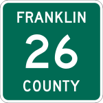 The standard marker for county routes in Franklin County.
The Franklin County, New York, Highway Department maintains 266 miles (428 km) of roads as county routes. All county routes in Franklin County are signed with a green square marker that is unique to the county. There is no apparent pattern to how routes are assigned; however, no active county route has the same number as any of the county's U.S. Highways or New York state touring routes, with the exception of County Route 3 (CR 3). The section of New York State Route 374 (NY 374) that lies north of U.S. Route 11 (US 11) is owned and maintained by Franklin County and is thus co-signed as a state touring route and as a Franklin County route. The longest route in the county is CR 26, which was once NY 99.
Contents
Routes 1–30
Route Length[1] From Via To Notes mi km CR 1 4.72 7.60 NY 95 / CR 4 in Bombay Bombay – Fort Covington Road NY 37 in Fort Covington CR 2 3.21 5.17 NY 95 Townsend Road in Bombay CR 1 CR 3 5.48 8.82 CR 8 in Bangor Cooks Corners Road CR 4 in Fort Covington CR 4 7.80 12.55 NY 95 / CR 1 in Bombay Coggin Bridge – Bombay Road NY 37 in Westville CR 5 10.97 17.65 NY 458 in Waverly Moira – St. Regis Falls Road US 11 / NY 95 in Moira Was part of NY 95 during the 1930s[2] CR 6 3.41 5.49 St. Lawrence County line (becomes CR 52) North Lawrence – Moira Road in Moira NY 95 CR 7 3.89 6.26 NY 11B in Dickinson Gale Road US 11 in Brushton CR 8 10.31 16.59 Brushton village line at Moira Fay–Brushton Road NY 37 in Malone CR 9 1.24 2.00 St. Lawrence County line (becomes CR 37) Helena Road in Bombay NY 95 CR 10 2.98 4.80 CR 12 in Brandon Crooks Road NY 11B in Bangor CR 11 Former number; see CR 22 CR 12 3.63 5.84 CR 15 Skerry Road in Brandon CR 13 CR 13 3.21 5.17 CR 12 in Brandon Bangor–Skelly Road NY 11B / CR 53 in Bangor CR 14 14.85 23.90 CR 5 in Waverly Red Tavern Road NY 30 / CR 26 in Duane CR 15 2.71 4.36 CR 12 in Brandon Eddy Road NY 11B in Bangor CR 16 2.90 4.67 NY 11B Bacon Road in Bangor US 11 CR 17 4.95 7.97 US 11 in Moira Sayles Road CR 32 in Bombay CR 18 8.16 13.13 NY 30 in Santa Clara Forest Home Road Ampersand Avenue in Harrietstown CR 19 5.03 8.10 CR 8 in Bangor Jewett Road NY 37 / NY 122 in Westville CR 20 5.93 9.54 NY 37 in Westville Trout River – Westville Road NY 30 in Constable CR 21 0.23 0.37 CR 19 Old State Highway in Westville NY 37 CR 22 2.30 3.70 US 11 / CR 53 Depot Road in Bangor CR 8 Formerly CR 11;[3] previously assigned to modern NY 122,[4] which was transferred to state in 1980[5] CR 23 8.88 14.29 US 11 in Malone Malone–Chateaugay Road US 11 in Chateaugay CR 24 11.39 18.33 US 11 in Malone Brainardsville Road NY 190 / NY 374 in Bellmont CR 25 7.46 12.01 CR 41 at Studley Hill Road Duane Road in Malone Malone village line CR 26 19.14 30.80 NY 30 in Duane Port Kent – Hopkinton Turnpike NY 3 in Franklin Designated as NY 99 from 1930 to 1994[6][7] CR 27 12.35 19.88 CR 26 in Duane Pond Road CR 25 in Malone CR 28 2.90 4.67 NY 30 in Constable Town Line Road US 11 in Malone CR 29 5.00 8.05 US 11 Jamison Line Road in Burke Canadian border CR 30 Former number; see CR 60 Routes 31 and up
Route Length[1] From Via To Notes mi km CR 31 3.14 5.05 NY 86 Jones Pond Road in Brighton CR 60 CR 32 5.74 9.24 NY 95 in Bombay South Bombay Road CR 3 in Bangor CR 33 5.74 9.24 CR 24 in Bellmont Willis Road CR 23 in Chateaugay CR 34 1.28 2.06 CR 23 / CR 36 in Burke village Mill Street and Burke Center Road US 11 in Burke CR 35 6.43 10.35 US 11 Chasm Road in Chateaugay NY 374 / CR 52 CR 36 4.03 6.49 CR 33 in Bellmont Flynn Road and Depot Street CR 23 / CR 34 in Burke village CR 37[8] NY 374 / CR 24 Brainardsville Road in Bellmont Clinton County line (became CR 4) Transferred to state in 1980;[5] now part of NY 190 CR 38 4.02 6.47 NY 30 in Constable Irish Street US 11 in Burke CR 39 3.65 5.87 US 11 Earlville Road in Chateaugay Farquher Road CR 40 4.79 7.71 CR 20 in Westville Sulphur Springs Road CR 20 / CR 56 in Constable CR 41 3.76 6.05 NY 30 Fayetteville Road in Malone CR 25 at Studley Hill Road CR 42 3.31 5.33 CR 4 Merrick Road and Salmon Street in Fort Covington NY 37 CR 43 4.71 7.58 NY 37 Drum Street Road in Fort Covington Little Salmon River bridge CR 44 1.50 2.41 NY 30 Stetson Road and Hosley Avenue in Tupper Lake NY 3 / NY 30 CR 45 2.40 3.86 NY 3 Wawbeek Road in Harrietstown NY 30 CR 46 0.97 1.56 NY 30 Back Bay and Saranac Inn Roads in Santa Clara NY 30 CR 47 1.10 1.77 Saranac Lake village line Old Colby Lake Road in Harrietstown NY 86 CR 48 3.66 5.89 Essex County line (becomes CR 18) Franklin Falls Road in Franklin Essex County line (becomes CR 72) CR 49 0.73 1.17 Tupper Lake village line McLaughlin Avenue in Tupper Lake Tupper Lake village line CR 50 3.63 5.84 CR 18 McMaster Road in Harrietstown NY 186 CR 51 1.74 2.80 US 11 Creighton Road in Malone NY 37 CR 52 4.65 7.48 US 11 / NY 374 in Chateaugay village River Street and River Road Canadian border at Chateaugay Entire length overlaps with NY 374; transferred to county in 1980[5] CR 53 2.06 3.32 NY 11B / CR 13 Bangor – North Bangor Road in Bangor US 11 / CR 22 Formerly part of NY 122;[9] transferred to county in 1980[5] CR 54 1.40 2.25 NY 374 Forge Road in Bellmont Clinton County line (becomes CR 5) Formerly part of NY 190;[10] transferred to county in 1980[5] CR 55 3.57 5.75 NY 86 in Brighton Bloomingdale Road Essex County line at Franklin (becomes CR 81) Formerly part of NY 192;[10] transferred to county in 1980[5] CR 56 1.47 2.37 NY 30 New Road in Constable CR 20 / CR 40 CR 60 11.69 18.81 NY 86 in Brighton Gabriels–Onchiota Road NY 3 in Franklin Formerly CR 30[11] See also
References
- ^ a b "Franklin County Inventory Listing" (CSV). New York State Department of Transportation. March 2, 2010. https://www.nysdot.gov/divisions/engineering/technical-services/hds-repository2/INV_2010-03-02_franklin.csv. Retrieved November 4, 2010.
- ^ Sun Oil Company (1935). Road Map & Historical Guide – New York (Map). Cartography by Rand McNally and Company.
- ^ New York State Department of Transportation (1969). Bangor Digital Raster Quadrangle (Map). 1:24,000. http://www.nysgis.state.ny.us/gisdata/quads/drg24/dotpreview/index.cfm?code=b43. Retrieved November 4, 2010.
- ^ New York State Department of Transportation (1969). Constable Digital Raster Quadrangle (Map). 1:24,000. http://www.nysgis.state.ny.us/gisdata/quads/drg24/dotpreview/index.cfm?code=a44. Retrieved November 4, 2010.
- ^ a b c d e f New York State Legislature. "New York State Highway Law § 341". http://public.leginfo.state.ny.us/LAWSSEAF.cgi?QUERYTYPE=LAWS+&QUERYDATA=$$HAY341$$@TXHAY0341+&LIST=LAW+&TARGET=VIEW. Retrieved November 4, 2010.
- ^ Automobile Legal Association (ALA) Automobile Green Book, 1930–31 and 1931–32 editions, (Scarborough Motor Guide Co., Boston, 1930 and 1931). The 1930–31 edition shows New York state routes prior to the 1930 renumbering
- ^ New York State Department of Transportation (January 2009) (PDF). Official Description of Highway Touring Routes, Bicycling Touring Routes, Scenic Byways, & Commemorative/Memorial Designations in New York State. https://www.nysdot.gov/divisions/operating/oom/transportation-systems/repository/2009%20tour-bk.pdf. Retrieved November 4, 2010.
- ^ New York State Department of Transportation (1969). Brainardsville Digital Raster Quadrangle (Map). 1:24,000. http://www.nysgis.state.ny.us/gisdata/quads/drg24/dotpreview/index.cfm?code=b46. Retrieved November 4, 2010.
- ^ Rand McNally and Company (1985). New York (Map). ISBN 0-528-91040-X.
- ^ a b Exxon (1979). New York (Map). Cartography by General Drafting.
- ^ New York State Department of Transportation (1969). Loon Lake Digital Raster Quadrangle (Map). 1:24,000. http://www.nysgis.state.ny.us/gisdata/quads/drg24/dotpreview/index.cfm?code=d46. Retrieved November 4, 2010.
External links
Categories:- County routes in Franklin County, New York

Wikimedia Foundation. 2010.