- Brighton, Franklin County, New York
-
- Brighton is also a different town in Monroe County, New York.
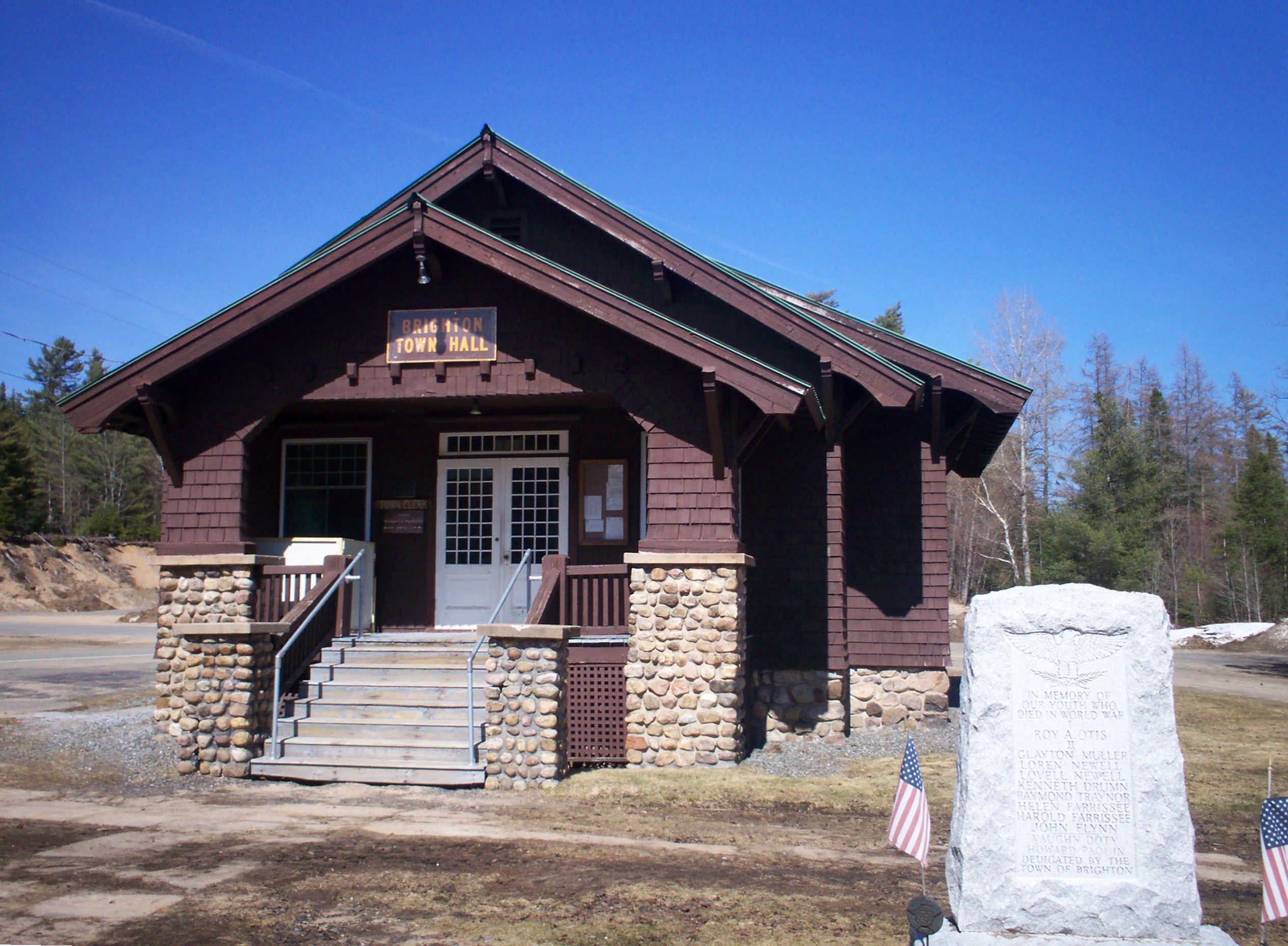
Brighton, New York — Town — Brighton Town Hall, Benjamin A. Muncil, 1914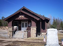 Location within the state of New York
 Brighton, New York
Coordinates: 44°26′27″N 74°13′56″W / 44.44083°N 74.23222°WCoordinates: 44°26′27″N 74°13′56″W / 44.44083°N 74.23222°W Country United States State New York County Franklin Government – Type Town Council – Town Supervisor John Quenell (D) – Town Council Members' ListArea – Total 83.0 sq mi (215.0 km2) – Land 78.0 sq mi (202.1 km2) – Water 5.0 sq mi (12.9 km2) Elevation 1,880 ft (573 m) Population (2000) – Total 1,682 – Density 21.6/sq mi (8.3/km2) Time zone Eastern (EST) (UTC-5) – Summer (DST) EDT (UTC-4) FIPS code 36-08213 GNIS feature ID 0978752 Brighton is a town in Franklin County, New York, United States. The population was 1,682 at the 2000 census. It was named after Brighton, England by early surveyors in the region.
The Town of Brighton is in the southwest part of the county and is inside the Adirondack Park.
Paul Smith's College is in the community of Paul Smiths, a hamlet of Brighton.
Contents
History
The first settlers in this area arrived around 1815.
The Town of Brighton was set aside from the Town of Duane Town of Duane in 1858. James M. Wardner was elected its first supervisor. Apollos "Paul" Smith arrived in 1859 and gradually built up a hotel in the community that bears his name. Having become an important Adirondack Hotel, Paul Smith's College was established by his family. The College now uses the land where the hotel once stood along Lower St. Regis Lake. Also around that time James Wardner had a small hotel on Rainbow Lake.
Among the "second round" of settlers in the Town of Brighton after its pioneers Follensby, S. Johnson, the Rice brothers, Amos and Levi; Oliver Keese and Thomas A. Tomlinson; James and Seth Wardner, were the Ricketsons, the Rands, the Dustins, Jute Q. King and his son, Philemon King. They were scattered along the highway from Keese Mill and McColloms to Paul Smiths to Easy Street to the Split Rock Road and to Rainbow Lake and Jones Pond.
The hamlet now-called Gabriels actually originated back when only the Rands, the Ricketsons, the Dustins, the Otis' were settled on farms nearer to the Split Rock Road and Ricketson Brook in the southern part of the town along the boundary with the Town of Harrietstown than where Gabriels is currently situated. It wasn't until the Adirondack & St. Lawrence Railway came in 1892 that Gabriels expanded northward with many settling near the railroad station. The railroad brought the Sister's of Mercy with their tuberculosis sanitorium, it brought Muncil's saw mill. Paul Smith's Hotel immediately started a stage line to the railroad station.
Also during the 19th Century, sanatoria for the treatment of tuberculosis were erected. The Gabriels Sanatorium. opened in 1897, is now Camp Gabriels, a New York prison.
The Brighton Town Hall was designed and built by Benjamin A. Muncil in 1914. Muncil was a talented local builder who also designed and built Marjorie Merriweather Post's Camp Topridge, and White Pine Camp, which was used as a summer White House of US President Calvin Coolidge.
Geography
 Saint Regis Presbyterian Church, Keese Mill
According to the United States Census Bureau, the town has a total area of 83.0 square miles (215 km2), of which, 78.0 square miles (202 km2) of it is land and 5.0 square miles (13 km2) of it (5.99%) is water.
New York State Route 30 is a north-south highway in the town and intersects New York State Route 86 at Paul Smiths.
The Town of Brighton is in the southern portion of Franklin County which is separated in a curious way (unique to the Adirondack region of the State of New York) from the main part of the county by many miles of NYS forest preserve lands (See also Adirondack Park, NYS Forest Preserve, the Blue Line, the Adirondack Park Agency). Consequently, there is a subtle disconnect between the main goings-on in the county from those in the northern versus the southern portion.
The majority of the Town of Brighton is woodlands, lakes, streams and ponds (both publicly and privately owned) with a few areas of developed hamlets and farmland (privately owned).
Demographics
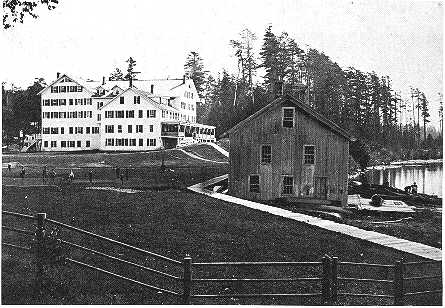
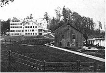 Paul Smith's Hotel, circa 1892
As of the census[1] of 2000, there were 1,682 people, 319 households, and 203 families residing in the town. The population density was 21.6 people per square mile (8.3/km²). There were 591 housing units at an average density of 7.6 per square mile (2.9/km²). The racial makeup of the town was 79.37% White, 18.55% African American, 0.65% Native American, 1.19% Asian, and 0.24% from two or more races. Hispanic or Latino of any race were 0.48% of the population.
There were 319 households out of which 34.5% had children under the age of 18 living with them, 53.9% were married couples living together, 5.0% had a female householder with no husband present, and 36.1% were non-families. 29.2% of all households were made up of individuals and 9.1% had someone living alone who was 65 years of age or older. The average household size was 2.46 and the average family size was 3.04.
In the town the population was spread out with 11.7% under the age of 18, 37.5% from 18 to 24, 29.8% from 25 to 44, 15.5% from 45 to 64, and 5.4% who were 65 years of age or older. The median age was 26 years. For every 100 females there were 215.0 males. For every 100 females age 18 and over, there were 246.2 males.
The median income for a household in the town was $42,679, and the median income for a family was $48,250. Males had a median income of $35,952 versus $26,250 for females. The per capita income for the town was $11,995. About 3.0% of families and 6.2% of the population were below the poverty line, including 5.3% of those under age 18 and 8.7% of those age 65 or over.
Communities and locations in Brighton

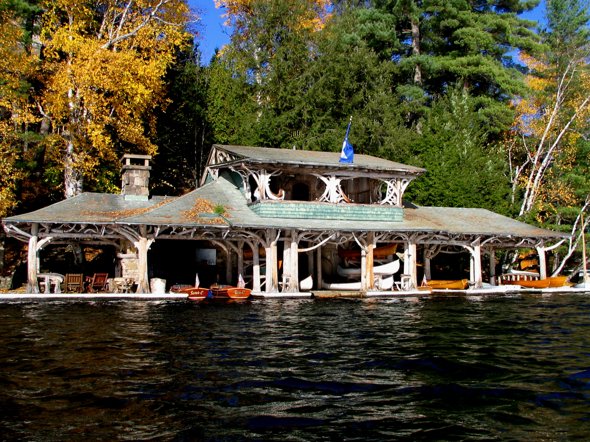
 Topridge, Upper St Regis Lake.
- Easy Street – A hamlet east of Paul Smiths on NY-86. It is also known as "Paul Smiths Easy Street."
- Gabriels – A hamlet in the southeast part of the town, located on NY-86 at the junction of County Road 30, the site of Camp Gabriels, a former minimum security state prison..
- Jones Pond – A lake north of Gabriels.
- Keese Mill – A hamlet west of Paul Smiths.
- Lower St. Regis Lake – A lake south of Paul Smiths where Paul Smith's College is located.
- McCollums – A hamlet in the northwest part of the town on NY-30.
- Meacham Lake – A lake partly in the town at the north town line.
- Osgood Pond – A lake northeast of Paul Smiths.
- Osgood River – A stream flowing toward Macomber Lake past McCollums.
- Paul Smiths – A hamlet in the south part of the town on NY-30.
- Rainbow Lake – (1) A hamlet near the east town line, north of Gabriels on County Road 60, and (2) A lake at the east town line near the community of Rainbow Lake.
- Spitfire Lake – A lake south of Lower St. Regis Lake.
- Upper St. Regis Lake – A lake at the south town line.
References
- ^ "American FactFinder". United States Census Bureau. http://factfinder.census.gov. Retrieved 2008-01-31.
Further reading
Collins, Geraldine, 1977. The Brighton Story, North Country Books, Lakemont, NY, 202 pp., incl. bibliography.
Brighton Architectural Heritage Committee, 2002. Brighton 2000: Life in the Town of Brighton, Franklin County, New York in the year 2000, Brighton Architectural Heritage Committee, Paul Smiths, NY, 153 pp. (Available on CD).
Kudish, Dr. Michael, 1975. A Preliminary Vascular Flora of the Paul Smiths-Saranac Lake Area, The Adirondacks, New York, With Notes on the Climate, Geology, and Soils, Paul Smith’s College, Paul Smiths, NY.
Kudish, Dr. Michael, 1981. Paul Smiths Flora II: Additional Vascular Plants, Bryophytes (Mosses and Liverworts), Soils and Vegetation, Local Forest History, Paul Smith’s College, Paul Smiths, NY.
Kudish, Dr. Michael, 1992. Adirondack Upland Flora, The Chauncy Press, Saranac Lake, N.Yl, 316 pp. (In this work, Dr. Kudish, as a forest ecologist brings together all the factors leading to why it is certain plants, trees, bushes grow where they do in way understandable to the mere layman. While applicable to the whole Adirondack Park, Dr. Kudish made extensive use of the Town of Brighton and the surrounding area.)
Kudish, Dr. Michael, 2004. Historical Update: Paul Smith’s College Lands, Forests, and Buildings 1981 to 2004, Paul Smith’s College, Paul Smiths, NY, 76 pp., incl. index. (Contains much information about the Town of Brighton)
“Town of Brighton Smart Growth Plan,” 9 July 2009, prepared by F.X. Browne, Inc., Saranac Lake, NY., 36 pp. (incl. biblio), six appendices provide supporting information.
Wardner, Charles A., 2010. Footprints & Sunset on Adirondack Trails: The Memoirs of James Manchester Wardner 1831-1904, privately published by Joan Wardner Allen, printed by Graphics North, Jay, NY.
External links
- Town of Brighton, NY
- History of Brighton
- Early history of Brighton
- Historic Saranac Hotel
- Paul Smiths College
Municipalities and communities of Franklin County, New York Towns Bangor | Bellmont | Bombay | Brandon | Brighton | Burke | Chateaugay | Constable | Dickinson | Duane | Fort Covington | Franklin | Harrietstown | Malone | Moira | Santa Clara | Tupper Lake | Waverly | Westville
Villages Brushton | Burke | Chateaugay | Malone | Saranac Lake‡ | Tupper Lake
Hamlets Gabriels | Goldsmith | Hogansburg | Keese Mill | Lake Clear | Paul Smiths | Skerry | Upper St. Regis | Vermontville
Indian
reservationFootnotes ‡This populated place also has portions in an adjacent county or counties
Categories:- Adirondacks
- Towns in New York
- Populated places in Franklin County, New York


Wikimedia Foundation. 2010.