- Constable, New York
-
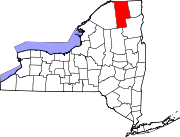
Constable, New York — Town — Location within the state of New York
 Constable, New York
Coordinates: 44°56′27″N 74°17′26″W / 44.94083°N 74.29056°W Country United States State New York County Franklin Government – Type Town Council – Town Supervisor Michael Shea (D) – Town Council Members' ListArea – Total 32.8 sq mi (85.0 km2) – Land 32.8 sq mi (85.0 km2) – Water 0.0 sq mi (0.0 km2) Elevation 305 ft (93 m) Population (2000) – Total 1,428 – Density 43.5/sq mi (16.8/km2) Time zone Eastern (EST) (UTC-5) – Summer (DST) EDT (UTC-4) ZIP code 12926 Area code(s) 518 FIPS code 36-17871 GNIS feature ID 0978863 Constable is a town in Franklin County, New York, United States. The population was 1,428 at the 2000 census. The town is named after William Constable, a member of the syndicate of original land owners.
The Town of Constable is on the northern border of the county and is north of the Village of Malone.
Contents
History
The Town of Constable was founded in 1807 from part of the Town of Malone. Its territory was reduced later to form other towns: Fort Covingtion (1817) and Westville (1829).
An early business opportunity involved "line stores," constructed so part of the shop was in Canada and the other end in the United States, allowing subtle shifting of merchandise across the border without the inconvenience of customs duties.
During the Civil War, draftable men slipped easily across the border to Canada to avoid military service.
Geography
According to the United States Census Bureau, the town has a total area of 32.8 square miles (85 km2), all of it land.
The north town line is the international border between the United States and Canada and is the border of Quebec.
New York State Route 122 is an east-west highway in the town. New York State Route 30 intersects NY-122 at Constable village.
Demographics
As of the census[1] of 2000, there were 1,428 people, 533 households, and 390 families residing in the town. The population density was 43.5 people per square mile (16.8/km²). There were 607 housing units at an average density of 18.5 per square mile (7.1/km²). The racial makeup of the town was 97.55% White, 0.07% African American, 1.47% Native American, 0.07% Asian, and 0.84% from two or more races. Hispanic or Latino of any race were 0.14% of the population.
There were 533 households out of which 38.1% had children under the age of 18 living with them, 58.2% were married couples living together, 9.4% had a female householder with no husband present, and 26.8% were non-families. 21.4% of all households were made up of individuals and 7.5% had someone living alone who was 65 years of age or older. The average household size was 2.67 and the average family size was 3.03.
In the town the population was spread out with 28.4% under the age of 18, 6.0% from 18 to 24, 32.7% from 25 to 44, 21.0% from 45 to 64, and 11.9% who were 65 years of age or older. The median age was 36 years. For every 100 females there were 104.3 males. For every 100 females age 18 and over, there were 103.4 males.
The median income for a household in the town was $31,029, and the median income for a family was $36,488. Males had a median income of $27,955 versus $21,354 for females. The per capita income for the town was $14,149. About 12.3% of families and 16.4% of the population were below the poverty line, including 22.5% of those under age 18 and 8.9% of those age 65 or over.
Communities and locations in Constable
- Constable – A hamlet near the center of the town on Route 30 at the junction with NY-122.
- Trout River – A stream flowing northward across the border into Canada, flowing past both Constable village and the community of Trout River.
- Trout River – A hamlet on the border of Canada at the junction of NY-30 and County Road 20. The community is a port of entry and has a similarly named community across the border in Quebec.
References
- ^ "American FactFinder". United States Census Bureau. http://factfinder.census.gov. Retrieved 2008-01-31.
External links
Coordinates: 44°55′45″N 74°17′50″W / 44.92917°N 74.29722°W
Municipalities and communities of Franklin County, New York Towns Bangor | Bellmont | Bombay | Brandon | Brighton | Burke | Chateaugay | Constable | Dickinson | Duane | Fort Covington | Franklin | Harrietstown | Malone | Moira | Santa Clara | Tupper Lake | Waverly | Westville
Villages Brushton | Burke | Chateaugay | Malone | Saranac Lake‡ | Tupper Lake
Hamlets Gabriels | Goldsmith | Hogansburg | Keese Mill | Lake Clear | Paul Smiths | Skerry | Upper St. Regis | Vermontville
Indian
reservationFootnotes ‡This populated place also has portions in an adjacent county or counties
Categories:- Towns in New York
- Populated places in Franklin County, New York


Wikimedia Foundation. 2010.