- New York State Route 343
-
NYS Route 343
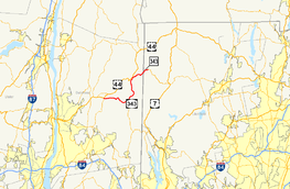
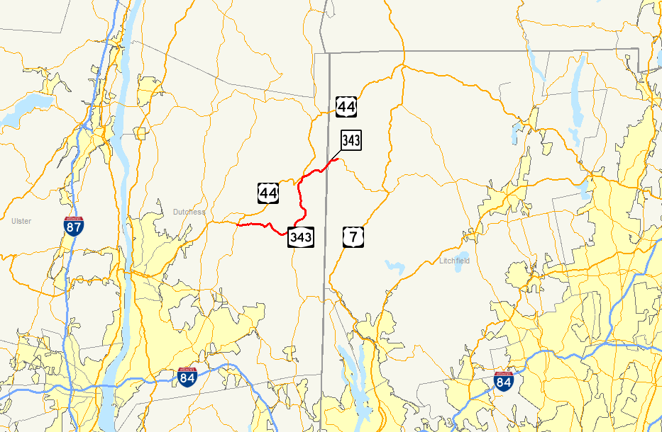
Map of Dutchess County, New York, and Litchfield County, Connecticut, with NY 343 and CT 343 highlighted in redRoute information Maintained by NYSDOT (NY 343) and ConnDOT (CT 343) Length: 19.95 mi (32.11 km)
NY 343: 18.45 mi;[1] CT 343: 1.50 mi[2]History: NY 343 assigned 1930[3]
CT 343 assigned 1932[3]Major junctions West end:  NY 82 in Millbrook
 US 44 / NY 22 in Amenia
East end: 
 Route 4 / Route 41 in Sharon, CT (as CT 343)
Location Counties: Dutchess, Litchfield (CT) Highway system Numbered highways in New York
Interstate • U.S. • N.Y. (former) • Reference • County←  NY 342
NY 344  →
→←  Route 341
Route 349  →
→New York State Route 343 (NY 343) is a state highway located entirely within central Dutchess County, in the Hudson Valley region of the U.S. state of New York. It runs east–west from the intersection of NY 82 in the village of Millbrook to the Connecticut state line in the town of Amenia, where it continues eastward briefly as Connecticut Route 343. Along the way, it has a 7.3-mile (11.7 km) concurrency with NY 22 from vicinity of the hamlet of Dover Plains to the hamlet of Amenia.
The entirety of modern Route 343 was originally the Dover branch of the Dutchess Turnpike. The turnpike, which was in operation from the early to the mid-19th century, was a major transportation route at the time, connecting several local communities to Litchfield County, Connecticut, and the city of Poughkeepsie. NY 343 was designated in 1930, connecting the hamlet of Amenia to the state line, but was relocated a few years later onto the portion of New York State Route 200 from South Millbrook to the hamlet of Dover Plains. The NY 200 designation was then transferred to NY 343's original alignment. NY 343 absorbed NY 200 in the early 1940s, creating an overlap with NY 22 between Dover Plains and Amenia. The Connecticut portion of the highway was originally designated as part of Route 4; however, it was renumbered to Route 343 in 1932.
Several landmarks along the way include the Silo Ridge Country Club in the hamlet of Wassaic, Beekman Park in the hamlet of Amenia, and the Troutbeck Conference Center in the hamlet of Leedsville.[4] When NY 343 crosses the state line, it becomes Connecticut's Route 343 and passes through more rural and residential areas. Route 343 stretches for 1.50 miles (2.41 km) into the town of Sharon, Connecticut, where it terminates at a junction with Route 4 and Route 41.
Contents
Route description
NY 343
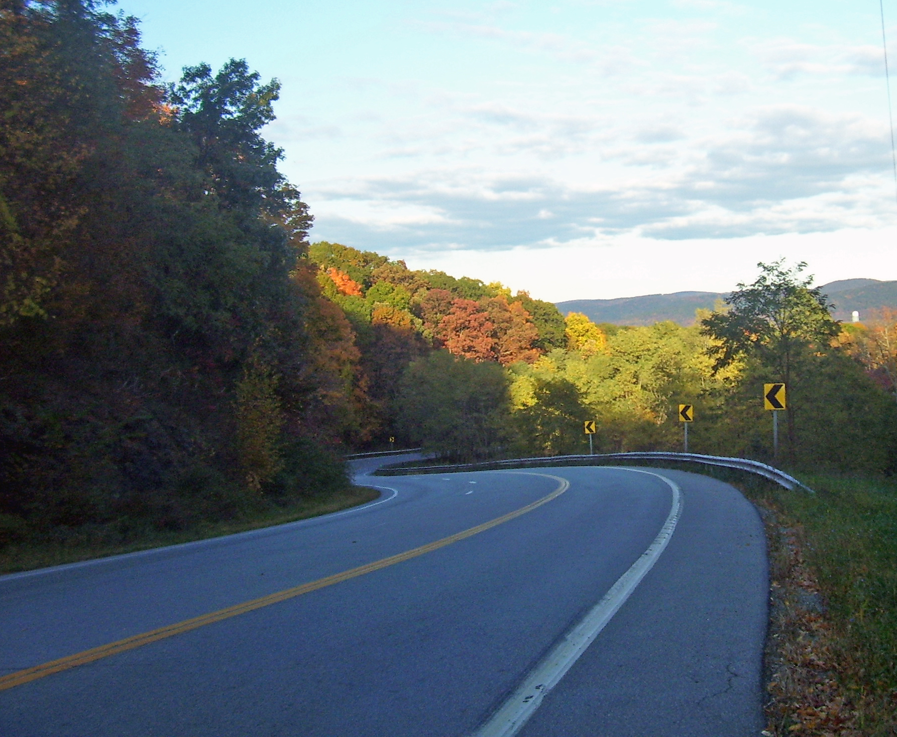
 A view east into the Harlem Valley between Millbrook and Dover Plains
NY 343 begins at an intersection with NY 82 (cosigned as U.S. Route 44 or US 44 until 2008[5][6]) in the hamlet of South Millbrook, located within the village of Millbrook. The road heads eastward into the town of Washington, intersecting an old alignment of Route 82 and passing to the south of Millbrook Golf and Tennis Club. Route 343 continues past fields, residential homes, and farms. The highway passes south of the creek, Mill Brook, entering the hamlet of Littlerest, then turns to the southeast at an intersection with County Route 99 (CR 99). At the intersection with CR 23, Route 343 again changes direction, this time to the northeast, and soon crosses Stone Church Brook in the hamlet of Mutton Hollow. Route 343 then changes directions a third time, traveling to the southeast once again towards the hamlet of Dover Plains.[7]
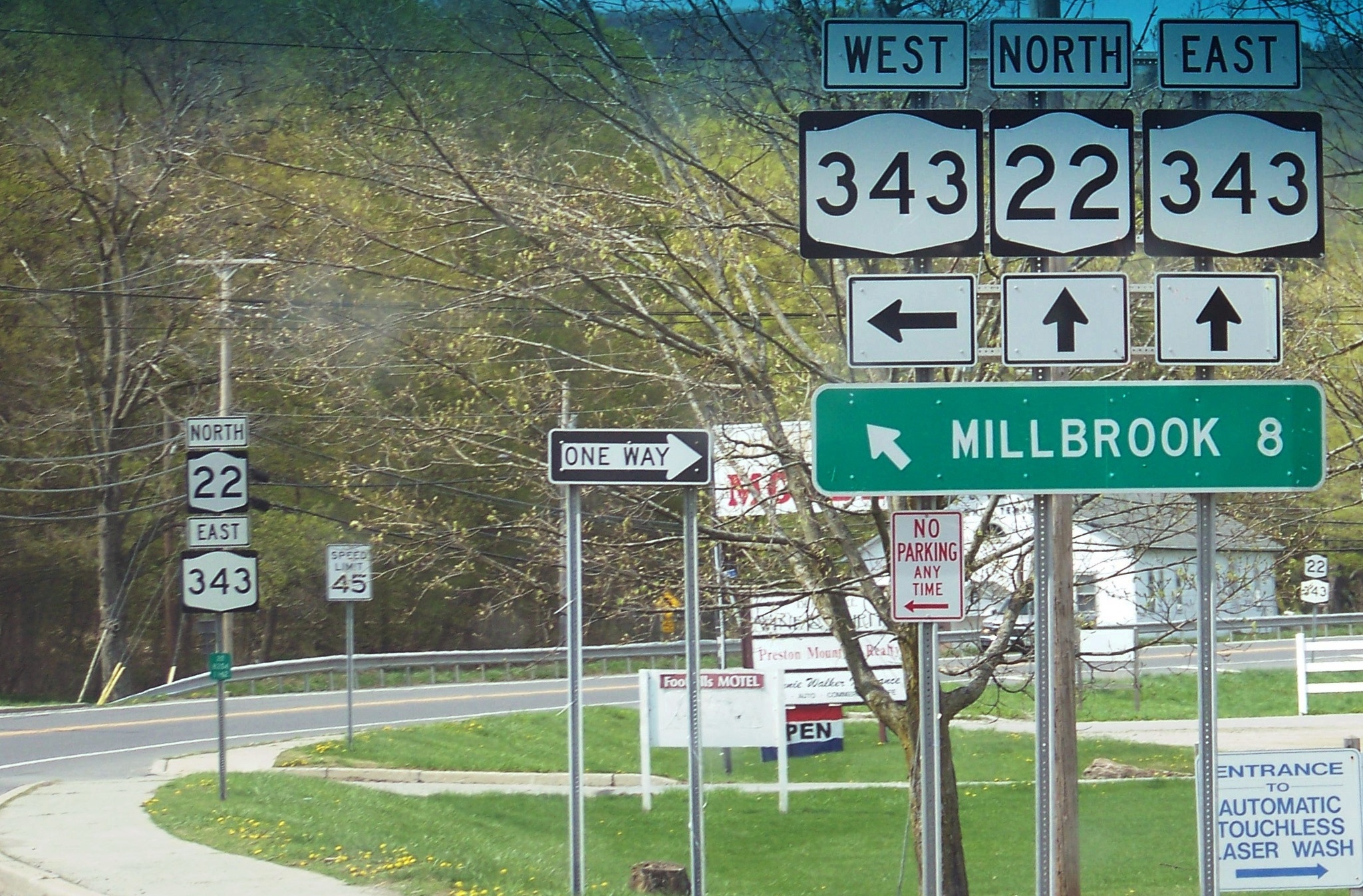
Northwest of Dover Plains, Route 343 turns to the northeast and passes into the town of Amenia. Just east of the town line, NY 343 intersects NY 22. NY 343 turns north onto NY 22, and the joined routes pass to the west of a series of moderately-sized mountains as they head through regions of rural farms, fields and homes. The roads parallel the Tenmile River and soon intersect with CR 81 (a former routing of NY 22) south of the hamlet of Wassaic. After passing through Wassaic, the roads cross Wassaic Creek and enter a small valley, soon passing the Wassaic Train Station and continuing northward towards the hamlet of Amenia.[7]
 Monument denoting places in Dutchess County along Route 343 in Dover Plains
CR 81 merges with NY 22 and NY 343 as the main roads pass by Beekman Park and Silo Ridge Country Club in the hamlet of Amenia. The roads pass a pond and split at the intersection with US 44. US 44 and NY 22 continue to the north, and NY 343 continues eastward towards the state line. The road passes south of the Amenia Cemetery, changing directions several times. Route 343 then intersects with CR 2 and turns to the northeast, passing over the Webatuck Creek. About 2 miles (3.2 km) later, NY 343 crosses the state line and enters Connecticut.[7]
NY 343 is classified as a rural major collector road between Millbrook and Dover Plains and carries average annual daily traffic (AADT) of about 3,100 vehicles per day (as of 2006), 5% of which is classified as truck traffic. The portion concurrent with Route 22 is a rural principal arterial road with average traffic of 5,600 per day (with 7% classified as truck traffic). East of Route 22, Route 343 is a rural minor arterial road carrying about 4,100 vehicles per day (with 6% classified as truck traffic).[8][9]
CT 343
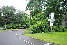 Intersection of CT 343 and CT 41 in Sharon
When Route 343 crosses the state line into the town of Sharon, it enters a moderately rural area where a large factory is located. Route 343, known as Amenia Road, heads northeast towards the town center, passing through patches of forests and intersecting with Sharon Valley Road, a connector to Route 361. After passing north of Sharon Country Club, the highway turns east as it enters the town center, where the surroundings of the highway begin to become populated. Route 343 ends 1.5 miles (2.4 km) from the state line at an intersection with Route 4 and Route 41 south of the town green.[10]
History
Old roads
The alignment used by modern Route 343 was a major transportation route that passed through the colonial settlements of Wassaic and Amenia. The highway helped General George Washington's troops during the American Revolutionary War and was also the main supply route to the hamlets of Payne's Corners (now Amenia), Washiac (now Wassaic) and Dover Plains. Stone statues that marked the way to different places including New York City, Fishkill and Boston were put up along the road during the Revolution, helping suppliers of salt from Boston.[11] This highway grew significantly over the years, with settlements growing along the highway during the early 19th century.[12] There were also a few factories along the route, including a Borden Food Corporation factory that produced condensed milk in the 1860s.[13]
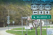 NY 343 and NY 22 concurrency near Dover, New York
Route 343 from the NY 22 / US 44 intersection in Amenia to the Connecticut state line was part of the main line of the Dutchess Turnpike, which ran from Poughkeepsie to the state line at Amenia, mostly along modern US 44. Prior to the building of the turnpike, the section of modern Route 343 east of Amenia to the state line was a swamp and did not connect Amenia to the state line.[11] The turnpike corporation was established by law in April 1802 and finished grading the highway in 1805.[14] In May 1803, the continuation of the Dutchess Turnpike into Connecticut, the Goshen and Sharon Turnpike, was also chartered. When the road was completed a few years later, it established a continuous, improved road between Poughkeepsie and Hartford.[15] In 1806, a branch route, splitting off from the mainline at South Millbrook, was established to connect the hamlet of Dover Plains to Poughkeepsie. The southern branch used modern Route 343 from its western end at US 44 in South Millbrook to NY 22 in Dover Plains.[16][17] The state took over maintenance of the turnpikes at the beginning of the 20th century.
Designation
In 1924, the main line of the Dutchess Turnpike was designated as NY 21, connecting the city of Poughkeepsie to the Connecticut state line as the original turnpike did. The road continued into Connecticut as Route 4, a highway that was part of the New England road marking system.[18] In the 1930 state highway renumbering, old NY 21 was broken up into several state routes. The portion between NY 82A west of the hamlet of Amenia and the Connecticut state line in the town of Sharon was renumbered as NY 343.[19][20] In 1932, the continuation of NY 343 in Connecticut was renumbered from Route 4 to Route 343 to match the New York route number.[3]
As part of the 1930 renumbering, the Dover branch of the Dutchess Turnpike between modern NY 82 in the village of Millbrook and NY 22 north of the hamlet of Dover Plains was designated as part of NY 200, which began in the city of Poughkeepsie and went via Millbrook to the vicinity of Dover Plains.[19] US 44 was assigned ca. 1935, resulting in the reconfiguration of several state routes in Dutchess County. Two of the routes affected were NY 200 and NY 343. The alignments of the two routes were swapped, with the former Route 343 between NY 22 in the hamlet of Amenia and the Connecticut state line becoming Route 200 and the portion of former Route 200 between the village of Millbrook and the hamlet of Dover Plains becoming Route 343. The remaining portions of both routes' old routings became part of the new US 44.[21][22]
The NY 200 designation was removed from the Amenia–Sharon road in the early 1940s and NY 343 was redesignated along that section. The two segments of Route 343 were connected via an overlap with NY 22, which remains to this day.[23][24]
Major intersections
County Location Mile[1][2] Destinations Notes Dutchess Millbrook 0.00 NY 82 (Franklin Avenue)Town of Amenia 7.53 NY 22 southSouthern terminus of NY 22 / NY 343 overlap 10.46  CR 81 (South Amenia Road)
Hamlet of Wassaic 14.92 US 44 / NY 22 northHamlet of Amenia; northern terminus of NY 22 / NY 343 overlap 18.45
0.00New York – Connecticut state line
Roadway becomes NY 343 westbound and CT 343 eastboundLitchfield Sharon 1.50 Route 4 / Route 411.000 mi = 1.609 km; 1.000 km = 0.621 mi References
- ^ a b "2008 Traffic Data Report for New York State" (PDF). New York State Department of Transportation. June 16, 2009. p. 296. https://www.nysdot.gov/divisions/engineering/technical-services/hds-respository/NYSDOT_Traffic_Data_Report_2008.pdf. Retrieved October 13, 2009.
- ^ a b "State highway log Connecticut" (PDF). Connecticut Department of Transportation. 2007. http://www.ct.gov/dot/LIB/dot/Documents/dpolicy/hwylog/hwylog.pdf. Retrieved June 17, 2008.
- ^ a b c Automobile Legal Association (ALA) Automobile Green Book (1931–32 ed.). Boston: Scarborough Motor Guide Co. 1931. pp. 146–147.
- ^ New York State Department of Transportation (1989). Amenia Digital Raster Quadrangle (Map). 1:24,000. http://www.nysgis.state.ny.us/gisdata/quads/drg24/dotpreview/index.cfm?code=z50. Retrieved January 20, 2010.
- ^ American Automobile Association (1979). New York (Map). Cartography by AAA.
- ^ "Route 44/44A Roadway Sign Change, Town of Washington, Village of Millbrook, Dutchess County" (Press release). New York State Department of Transportation. April 7, 2008. https://www.nysdot.gov/news/traveler-advisories/2006/2008-04-071. Retrieved June 28, 2008.
- ^ a b c Google, Inc. Google Maps – overview map of NY 343 (Map). Cartography by Google, Inc. http://maps.google.com/maps?sourceid=navclient&ie=UTF-8&rls=IBMA,IBMA:2006-25,IBMA:en&q=from:+US-44+%4041.775920,+-73.701850+to:+RT-343+%4041.762025,+-73.617251+to:RT-22/RT-343+%4041.816908,+-73.563029+to:RT-343+%4041.868133,+-73.501423&um=1&sa=N&tab=wl. Retrieved March 24, 2008.
- ^ "Traffic Data Viewer". New York State Department of Transportation. https://www.nysdot.gov/tdv. Retrieved June 24, 2008.
- ^ Highway Data Services Bureau (August 6, 2008), "Highway Condition Survey of State Touring and Reference Routes (2006)", Pavement Management; Highway Data Management Systems (New York State Department of Transportation)
- ^ Google, Inc. Google Maps – overview map of CT 343 (Map). Cartography by Google, Inc. http://maps.google.com/maps?sourceid=navclient&ie=UTF-8&rlz=1T4ADBF_enUS232US232&q=from%3A%20Amenia%20Rd%2FCT-343%20%4041.868270%2C%20-73.501270%20to%3A%20Amenia%20Rd%2FCT-343%20%4041.876321%2C%20-73.477067&um=1&sa=N&tab=wl. Retrieved June 17, 2008.
- ^ a b Reed, Newton (1875). Early History of Amenia. De Lacey & Wiley, Printers. http://books.google.com/?id=9QUCAAAAYAAJ&printsec=frontcover&dq=Early+history+of+Amenia. Retrieved June 7, 2008.
- ^ Dutchess County Tourism Department. "Dutchess County Tours" (PDF). Dutchess County, New York. http://www.dutchesstourism.com/PDF/2005-Brochures/tour4.pdf. Retrieved June 7, 2008.
- ^ International Directory of Company Histories. 22. St. James Press. 1998. ISBN 1-55862-363-9.
- ^ Dutchess County Unit Federal Writers' Project (1937). American Guide Series: Dutchess County. William Penn Association of Philadelphia. ISBN 0-404-57944-2.
- ^ James Wood, Frederic (1919). The Turnpikes of New England and Evolution of the Same Through England, Virginia, and Maryland. Marshall Jones. pp. 371–372. OCLC 1600049. http://books.google.com/?id=1pzNa0Ucb1UC.
- ^ "Toll-Bridge and Turnpike Companies". The Revised Statutes of the State of New-York. 3. Printed by Packard and Van Benthuysen. 1829. pp. 587–624. http://books.google.com/?id=KJEDAAAAQAAJ&pg=PA587#v=onepage&q=. Retrieved February 4, 2010.
- ^ Henry S. Tanner (1825). New York (Map). http://www.davidrumsey.com/detail?id=1-1-26023-1100426&name=New+York.. Retrieved August 6, 2008. Accessed via the David Rumsey Map Collection.
- ^ "New York's Main Highways Designated by Numbers". The New York Times: p. XX9. December 21, 1924.
- ^ a b Dickinson, Leon A. (January 12, 1930). "New Signs for State Highways". The New York Times: p. 136.
- ^ Automobile Legal Association (ALA) Automobile Green Book, 1930/31 and 1931/32 editions, (Scarborough Motor Guide Co., Boston, 1930 and 1931). The 1930/31 edition shows New York state routes prior to the 1930 renumbering
- ^ Texas Oil Company (1934). Road Map of New York (Map). Cartography by Rand McNally and Company.
- ^ Sun Oil Company (1935). Road Map & Historical Guide – New York (Map). Cartography by Rand McNally and Company.
- ^ Esso (1940). New York (Map). Cartography by General Drafting.
- ^ Esso (1942). New York with Pictorial Guide (Map). Cartography by General Drafting.
External links
Categories:- State highways in New York
- Transportation in Dutchess County, New York
- Amenia, New York
- State highways in Connecticut


Wikimedia Foundation. 2010.