- Millbrook, New York
-
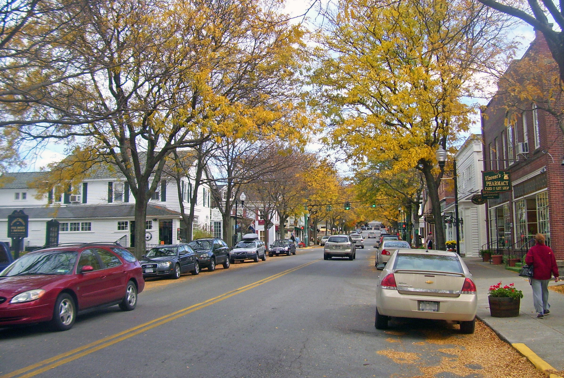
Millbrook Village  Franklin Ave
Name origin: From local estate Country USA State New York Region Hudson Valley County Dutchess Town Washington Center Village Green - elevation 480 ft (146 m) - coordinates 41°47′5″N 73°41′16″W / 41.78472°N 73.68778°W Highest point N of SE corner - elevation 870 ft (265 m) - coordinates 41°46′32″N 73°41′6″W / 41.77556°N 73.685°W Lowest point East Branch Wappinger Creek at W village line - elevation 450 ft (137 m) - coordinates 41°47′18″N 73°41′51″W / 41.78833°N 73.6975°W Area 1.9 sq mi (5 km2) Population 3,429 (2000) Density 764.3 / sq mi (295 / km2) Founded 1895 Government - location 35 Merritt Avenue Mayor Andrew Ciferri[1] Timezone Eastern (EST) (UTC-5) - summer (DST) EDT (UTC-4) ZIP Code 12545 Area code 845 Exchange 677 Code = 266
FIPS code 36-47273 GNIS feature ID 0957288 
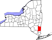
 Location of Millbrook within New York
Wikimedia Commons: Millbrook, New York Website: millbrook.village.ny.us Millbrook is a village in Dutchess County, New York, United States. It is often said to be a "low-key version of the Hamptons" and one of the wealthiest towns in New York State. Millbrook's estimated town population was 1,551 in 2008. Millbrook is located in the Hudson Valley, an hour and thirty minute drive upstate of New York City. On its main street, Franklin Avenue, many of the village's main eateries, stores, and landmarks including the public library, can be found.
The Village of Millbrook is near the center of the Town of Washington. Until April 2008, US Route 44 passed through the village, but it was rerouted through what was route 44A. The road through the town is now unsigned reference route 984P.
Millbrook is part of the Poughkeepsie–Newburgh–Middletown Metropolitan Statistical Area as well as the larger New York–Newark–Bridgeport Combined Statistical Area.
Contents
History
Millbrook was settled by Quakers in the middle eighteenth century. What now comprises the village originally had two areas of settlement, Hart's Village and the hamlet of Mechanic. The area known as Hart's Village was centered around the grist mill along the East Branch of the Wappinger Creek off of Hart's Village Road. The building still stands today, and has been converted to an apartment building. The Hamlet of Mechanic is now known as South Millbrook, and is located near the junction of NY route 343 and Old Route 82 (Dutchess County route 111), where the turn monument is.
The village is from the Great Nine Partners Patent, and a street and burial ground at the south east edge of town now bear the name. Prior to the Revolutionary War, what is now known as the Town of Washington was called the Charlotte Precinct.
The Village of Millbrook, as it is known today, was developed around the Dutchess and Columbia railroad train station which was located on the village green. The train station was built in 1870 on the lands of Issac Merritt, who laid out the streets soon thereafter.
Geography
Millbrook is located at 41°47′14″N 73°41′32″W / 41.78722°N 73.69222°W (41.787125, -73.692246)[2].
According to the United States Census Bureau, the village has a total area of 1.9 square miles (4.9 km2), of which 1.9 square miles (4.9 km2) is land and 0.1 square miles (0.26 km2) (2.60%) is water.
Demographics
As of the census[3] of 2000, there were 1,429 people, 678 households, and 360 families residing in the village. The population density was 764.3 people per square mile (295.0/km²). There were 744 housing units at an average density of 397.9 per square mile (153.6/km²). The racial makeup of the village was 95.87% White, 2.66% African American, 0.21% Asian, 0.28% from other races, and 0.98% from two or more races. Hispanic or Latino of any race were 3.01% of the population.
There were 878 households out of which 23.7% had children under the age of 18 living with them, 42.6% were married couples living together, 8.3% had a female householder with no husband present, and 46.8% were non-families. 40.9% of all households were made up of individuals and 19.0% had someone living alone who was 65 years of age or older. The average household size was 2.10 and the average family size was 2.88.
In the village the population was spread out with 21.0% under the age of 18, 5.9% from 18 to 24, 25.3% from 25 to 44, 26.7% from 45 to 64, and 21.1% who were 65 years of age or older. The median age was 44 years. For every 100 females there were 85.1 males. For every 100 females age 18 and over, there were 82.4 males.
The median income for a household in the village was $68,552, and the median income for a family was $92,417. Males had a median income of $67,917 versus $37,917 for females. The per capita income for the village was $49,114. About .95% of families and 5.7% of the population were below the poverty line, including 4.4% of those under age 18 and 1.9% of those age 65 or over.
Schools and colleges
 Bennett Junior College Halcyon Hall, c. 1910)
- Dutchess Day School (website)
- Millbrook Central School District (website)
- Millbrook High School, New York (website)
- Millbrook School (website) (Physically located in the Town of Stanford, but commonly associated with Millbrook due to its name.)
- Colleges in the general area:
- Bard College (Annandale-on-Hudson) (website)
- Culinary Institute of America (Hyde Park) (website)
- Dutchess Community College (Poughkeepsie) (website)
- Marist College (Poughkeepsie) (website)
- Ridley-Lowell Business & Technical Institute (Poughkeepsie)
- State University of New York at New Paltz (New Paltz) (website)
- Vassar College (Poughkeepsie) (website)
Millbrook was also the location of the campus of the former Bennett College, which closed in 1978.
Points of interest
- Mary Flagler Cary Arboretum
- Innisfree Garden
- Nine Partners Meeting House
- Millbrook Vineyards & Winery
Notable residents
- Frank Carillo, rock musician
- Katie Couric, TV News Anchor
- Gordon Elliott, TV host
- Frederic Fekkai, hairdresser
- Louann Fernald, attorney and Playboy Playmate (1979)
- F. William Free, advertising executive
- Daryl Hall, singer-songwriter
- Faith Hill, singer
- Timothy Leary, counter-cultural icon
- Richard Migliore, retired jockey
- Roswell Miller, husband of Margaret Carnegie Miller, heiress
- Matthew Modine, actor
- Mary Tyler Moore, actress
- Idris Muhammad, jazz drummer
- Ryan Murphy, poet
- Liam Neeson, actor and his late wife, the actress Natasha Richardson
- Ric Ocasek, singer and producer
- Paulina Porizkova, model
- Ines Rivero, model
- William Sadler, actor
- Oakleigh Thorne, heir
- Rufus Wainwright, singer-songwriter
- Sigourney Weaver, actress
References
- Notes
- ^ http://www.millbrooknyonline.com
- ^ "US Gazetteer files: 2010, 2000, and 1990". United States Census Bureau. 2011-02-12. http://www.census.gov/geo/www/gazetteer/gazette.html. Retrieved 2011-04-23.
- ^ "American FactFinder". United States Census Bureau. http://factfinder.census.gov. Retrieved 2008-01-31.
External links
- Millbrook information
- city-data.com entry
- Millbrook Free Library
- Millbrook Fire Department
- Dutchess NEEP
- Millbrook Vineyards & Winery
Municipalities and communities of Dutchess County, New York Cities Beacon | Poughkeepsie
Towns Amenia | Beekman | Clinton | Dover | East Fishkill | Fishkill | Hyde Park | LaGrange | Milan | North East | Pawling | Pine Plains | Pleasant Valley | Poughkeepsie | Red Hook | Rhinebeck | Stanford | Union Vale | Wappinger | Washington
Villages CDPs Other
hamletsAnnandale-on-Hudson | Barrytown | Boston Corner‡ | Chelsea | Linden Acres | Mabbettsville | New Hamburg | Pleasant Plains | Quaker Hill | Rhinecliff | Salt Point | Shekomeko | Sylvan Lake | Van Keurens | Verbank | Wassaic
Footnotes ‡This populated place also has portions in an adjacent county or counties
Categories:- Villages in New York
- Poughkeepsie–Newburgh–Middletown metropolitan area
- Populated places in Dutchess County, New York


Wikimedia Foundation. 2010.