- Portal:U.S. Roads
-
Portals → Technology → Transport → Roads → U.S. Roads The U.S. Roads Portal
The highway system of the United States is a network of interconnected state, U.S., and Interstate highways. Each of the fifty states, the District of Columbia, Puerto Rico, Guam, and the U.S. Virgin Islands own and maintain a part of this vast system, including U.S. and Interstate highways, which are not owned or maintained at the federal level.


Interstate Highways have the highest speed limits and the highest traffic. Interstates are numbered in a grid: even-numbered routes for east–west routes (with the lowest numbers along Mexico and the Gulf of Mexico), and odd-numbered routes are north–south routes (with the lowest numbers along the Pacific Ocean). Three-digit interstates are, generally, either beltways or spurs of their parent interstates (for example, Interstate 510 is a spur into the city of New Orleans, Louisiana, and is connected to Interstate 10).


U.S. Numbered Highways are the original interstate highways, dating back to 1926. U.S. Highways are also numbered in a grid: even numbered for east–west routes (with the lowest numbers along Canada) and odd numbered for north–south routes (with the lowest numbers along the Atlantic Ocean). Three-digit highways, also known as "child routes," are branches off their main one- or two-digit "parents" (for example, U.S. Route 202 is a branch of U.S. Route 2). However, US 101, rather than a "child" of US 1, is considered a "mainline" U.S. Route.


State highways are the next level in the hierarchy. Each state and territory has its own system for numbering highways, some more systematic than others. Each state also has its own design for its highway markers; the number in a circle is the default sign, but many choose a different design connected to the state, such as an outline of the state with the number inside. Many states also operate a system of county highways.
Selected article
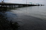
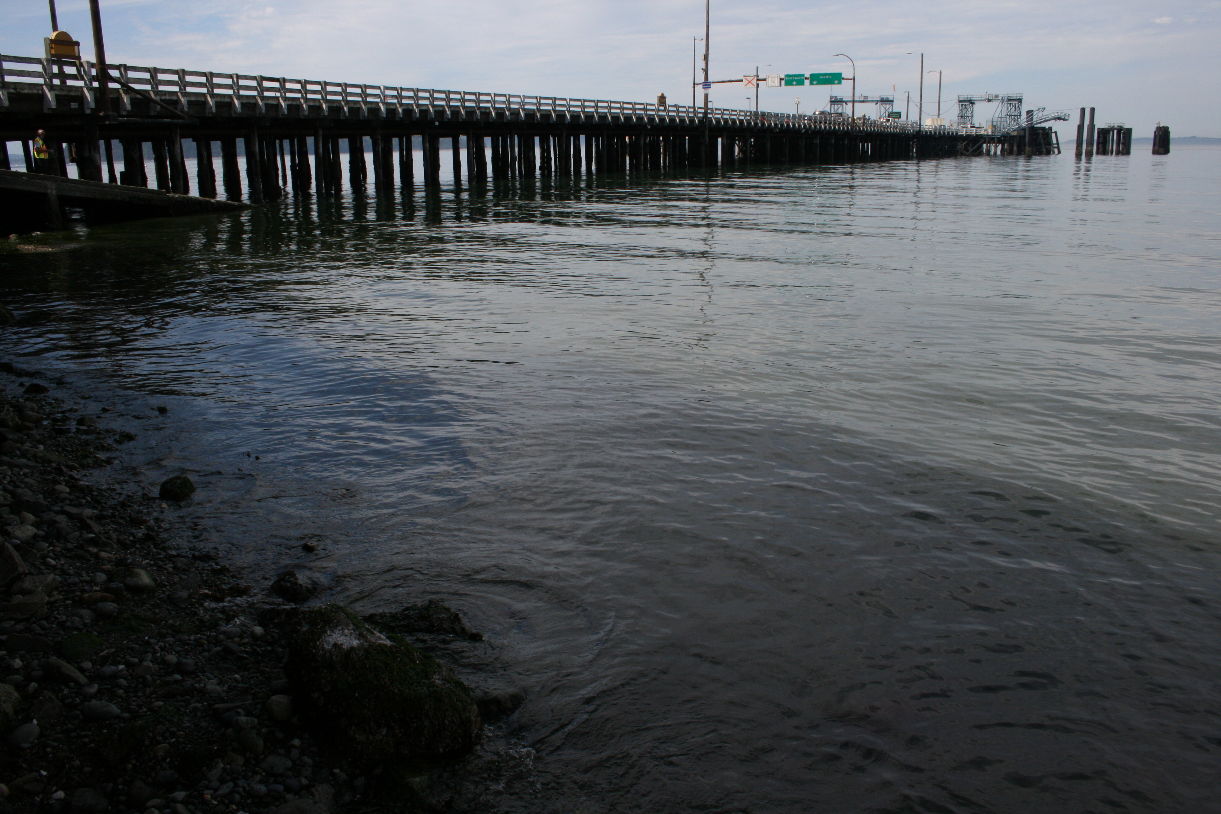
State Route 339 (SR 339) is a 8.5-nautical-mile-long (9.8 mi; 15.7 km)[1] ferry route designated as a state highway in the U.S. state of Washington. It connects Vashon Island's Vashon Heights ferry terminal to downtown Seattle's Pier 50, via a passenger-only ferry, the MV Skagit. The ferry is financed by the King County Ferry District (KCFD) and tolls collected at Pier 50. Despite being part of the KCFD, the ferry is operated by Washington State Ferries (WSF).[2] SR 339 is one of only four ferry routes providing access to and from Vashon Island, and has the lowest annual average ridership of the four routes. The state of Washington took over the operation of the ferry route in 1951, and designated it SR 339 in 1994.
Recently selected: Prairie Avenue • Interstate 80 Business (West Wendover, Nevada – Wendover, Utah) • Capitol Loop
Selected picture

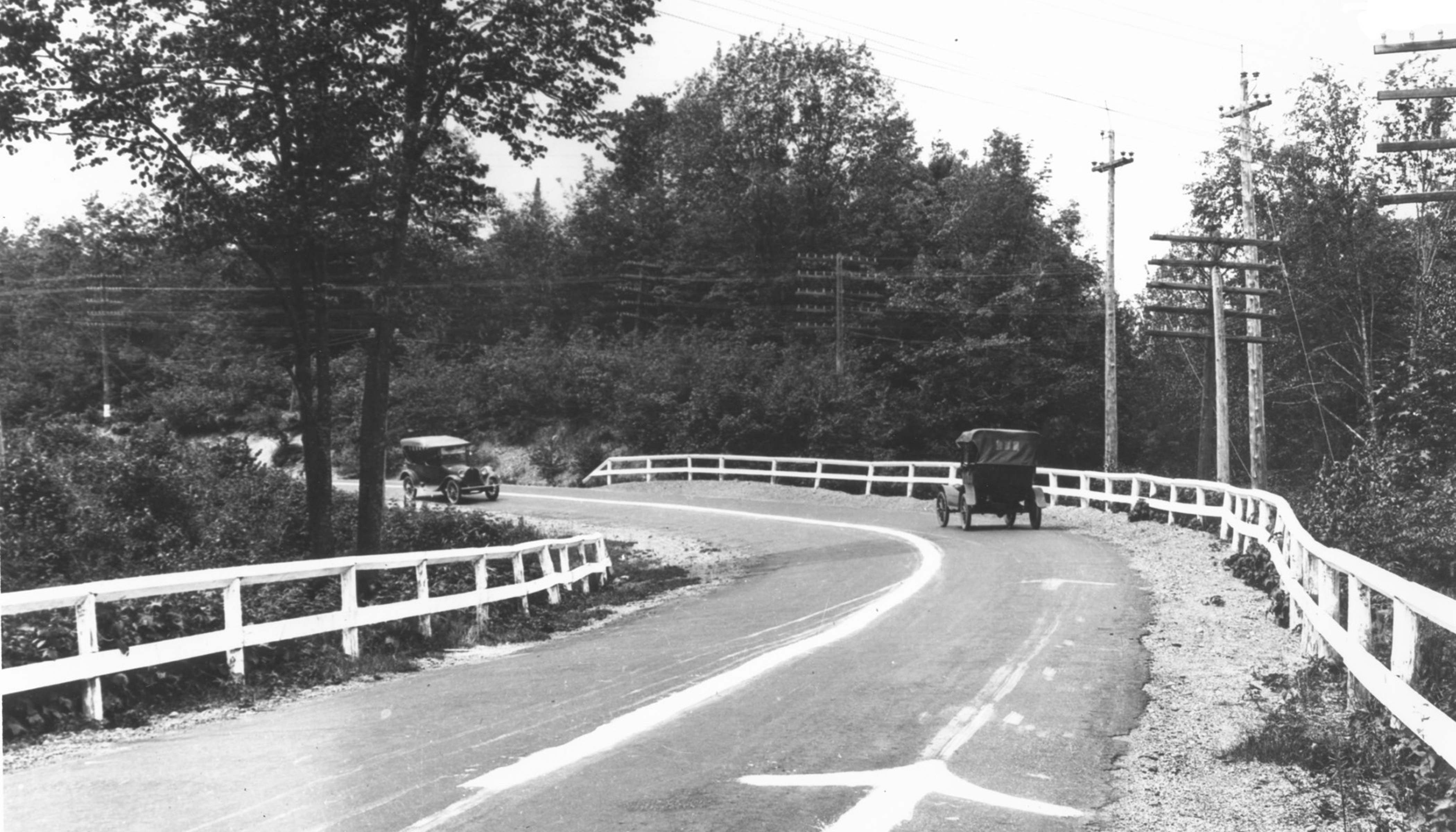
The original M-15 (now County Road 492) between Marquette and Negaunee, Michigan in 1917 showing the first centerline on a state highway. Recently selected: Blue Ridge Parkway • Interstate 70 in Maryland • U.S. Route 550
Did you know...

- ... that a portion of Virginia State Route 110 is used for the course of the Marine Corps Marathon (pictured)?
- ... that a landmark along Interstate 84 is the Thousand Mile Tree, which marks the western progress of exactly 1000 miles along the original alignment of the First Transcontinental Railroad?
- ... that the Michigan Department of Transportation has erroneously marked Forest Highway 16 as "County Road H-16" on their maps since 1992?
- ... that the section of Maryland Route 307 between the Dorchester–Caroline county line and Federalsburg became the first section of state road placed under contract for construction by the Maryland State Roads Commission in June 1909?
- ...that, despite being added to California's state highway system in 1933, the portion of State Route 190 over the Sierra Nevada remains unconstructed?
Categories
Things you can do
Nominations and votes for selected articles and selected pictures are always needed. Anyone can nominate an article, and anyone can vote for an article. You can also recommend items for Did you know?. If you have news related to U.S. roads, you can add it to the news section above.
See also Wikipedia:WikiProject U.S. Roads/to do, Category:U.S. road articles needing attention and individual state highway project to-do lists.
U.S. Roads news
- November 22: The second portion of Maryland Route 200 (Intercounty Connector) opens between Maryland Route 97 and I-95, with tolls to be waived until December 4.[3]
- November 7: The new Lake Champlain Bridge between New York and Vermont, replacing the Champlain Bridge demolished in 2009, opens to traffic.[4]
- November 2: A 3-mile-long (4.8 km) section of I-680 between the Missouri River and I-29 reopened after floods this summer destroyed the old roadway. Construction was fast-tracked and completed in 34 working days.[5]
- October 10: A temporary bridge for North Carolina Highway 12 in the Outer Banks opens over a 200-foot (61 m) inlet carved by Hurricane Irene on August 27, 2011, providing access to Hatteras Island. The bridge, which is 662 feet (202 m) long, could be in place for more than 10 years while other solutions are thought out.[6]
- August 19: The Minnesota Department of Transportation opened an extension of State Highway 610 to traffic in Maple Grove and Brooklyn Park.[7]
- July 31: The Nevada Department of Transportation has announced that the Galena Creek Bridge is complete enough to stand without the aid of falsework, which will be removed shortly. This is one of the last remaining obstacles to the completion of Interstate 580, which has been planned since the 1960s and has been delayed multiple times. The freeway is currently scheduled to open in 2012.[8]
- July 15: A portion of Interstate 405 in Los Angeles, California through Sepulveda Pass that carries 500,000 motorists a weekend is closed for construction until Monday, July 18 to allow for the demolition of a bridge as part of a widening project. The closure is expected to cause major traffic headaches throughout Los Angeles and has been referred to as "Carmageddon".[9]
- July 11: The remaining portion of the Mon-Fayette Expressway (West Virginia Route 43) in Monongalia County opens to traffic, providing a connection between Morgantown, West Virginia and Uniontown, Pennsylvania.[10]
U.S. Transportation WikiNews
Wikinews U.S. Roads portal
- September 25: Nepal plane crash kills 19
- March 26: Part of California highway near Big Sur falls into the sea
- March 13: New York tour bus crash kills 14
- January 27: U.S. Army revives next-generation Ground Combat Vehicle program
- January 21: Tanker crash kills two in Brevard County, Florida
- January 15: US Marine killed after vehicle capsizes, sinks in Oceanside Harbor, California
WikiProjects
WikiProject U.S. Roads
- By state:
- Alabama Highways Taskforce
- WikiProject California State Highways
- Connecticut Routes Taskforce
- WikiProject Florida State Roads
- WikiProject Georgia State Routes
- Illinois State Routes Taskforce
- Indiana State Roads Taskforce
- Iowa State Highways Taskforce
- Kansas State Highways Taskforce
- Kentucky State Highways Taskforce
- Louisiana Highways Taskforce
- WikiProject Roads in Maryland
- WikiProject Massachusetts state highways
- WikiProject Michigan State Highways
- WikiProject Minnesota State Highways
- Missouri State Highways Taskforce
- Nebraska Highways Taskforce
- Nevada Roads Taskforce
- New Hampshire State Highways Taskforce
- WikiProject New Jersey State and County Routes
- WikiProject New York State routes
- North Carolina State Highways Taskforce
- Ohio State Highways Taskforce
- WikiProject Oklahoma State Highways
- WikiProject Oregon State Highways
- WikiProject Pennsylvania State Highways
- WikiProject Rhode Island Routes
- South Carolina Highways Taskforce
- Tennessee State Routes Taskforce
- WikiProject Texas State Highways
- WikiProject Utah State Highways
- Vermont Routes Taskforce
- Virginia Highways Taskforce
- WikiProject Washington State Highways
- West Virginia Routes Taskforce
- Wisconsin Highways Taskforce
Related portals


Cars Roads Canada Roads 


Michigan Highways New York Roads Washington Roads Numbered highways in the United States
National systemsAlabama · Alaska · Arizona · Arkansas · California · Colorado · Connecticut · Delaware · Florida · Georgia · Hawaii · Idaho · Illinois · Indiana · Iowa · Kansas · Kentucky · Louisiana · Maine · Maryland · Massachusetts · Michigan · Minnesota · Mississippi · Missouri · Montana · Nebraska · Nevada · New Hampshire · New Jersey · New Mexico · New York · North Carolina · North Dakota · Ohio · Oklahoma · Oregon · Pennsylvania · Rhode Island · South Carolina · South Dakota · Tennessee · Texas · Utah · Vermont · Virginia · Washington · West Virginia · Wisconsin · Wyoming
Other areasReferences and notes
- ^ "Seattle-Vashon Passenger-Only Including Seattle-Southworth Travel" (PDF). WSF 2003 South Sound Travel Survey Analysis and Results Report. Washington State Department of Transportation. http://www.wsdot.wa.gov/ferries/travel_survey/2003/8.Seattle-Vashon+Transfers.pdf. Retrieved September 6, 2008.
- ^ "Seattle / Vashon PO". Summer 2008 Schedule. Washington State Ferries. http://www.wsdot.wa.gov/ferries/schedules/current/index.cfm?route=sea-vapo. Retrieved September 6, 2008.
- ^ Schwind, Dan (November 22, 2011). "ICC opens second segment, connecting Laurel to Gaithersburg". The Baltimore Sun. http://www.baltimoresun.com/explore/howard/news/community/ph-ll-newsbriefs-icc-20111122,0,5885612.story. Retrieved November 24, 2011.
- ^ Waldman, Scott (November 6, 2011). "Lake Champlain Bridge set to open". The Albany Times-Union (Albany, New York). http://www.timesunion.com/local/article/Lake-Champlain-Bridge-set-to-open-2251370.php. Retrieved November 7, 2011.
- ^ "Interstate 680 to reopen on Nov. 2; grand reopening ceremony planned" (Press release). Iowa Department of Transportation. http://www.news.iowadot.gov/newsandinfo/2011/10/interstate-680-to-reopen-on-nov-2-grand-reopening-ceremony-planned-moriver.html. Retrieved November 3, 2011.
- ^ Fernandes, Deirdre (October 10, 2011). "N.C. 12 has opened, restoring traffic to Hatteras Island". The Virginian-Pilot (Norfolk, VA). http://hamptonroads.com/2011/10/nc-12-reopen-restoring-traffic-hatteras. Retrieved October 11, 2011.
- ^ Baca, Maria Elena (August 16, 2011). "High-fives all around for another leg of Hwy. 610". Star Tribune (Minneapolis). Archived from the original on August 19, 2011. http://www.webcitation.org/613tW2CdH. Retrieved August 19, 2011.
- ^ Dornan, Geoff (July 31, 2011). "Reno-Carson Freeway Nearing Completion". Nevada Appeal (Carson City, NV). http://www.nevadaappeal.com/article/20110731/NEWS/110739963/1001&parentprofile=1058.
- ^ Nagourney, Adam; Lovett, Ian (July 15, 2011). "Los Angeles Puts It in Park As Freeway Project Starts". The New York Times. http://www.nytimes.com/2011/07/16/us/16freeway.html. Retrieved July 16, 2011.
- ^ Moniot, Stacy (July 11, 2011). "Mon Fayette Expressway Opens in Monongalia County". The State Journal (Charleston, WV). http://www.statejournal.com/story.cfm?func=viewstory&storyid=103061. Retrieved July 12, 2011.
Purge server cache Categories:- United States portals
- Transport portals


Wikimedia Foundation. 2010.