- Geology of Mars
-
Mars 
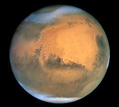 Mars as seen by the Hubble Space TelescopeDesignations
Adjective Martian Epoch J2000 Aphelion 249,209,300 km
1.665861 AUPerihelion 206,669,000 km
1.381497 AUSemi-major axis 227,939,100 km
1.523679 AUEccentricity 0.093315 Orbital period 686.971 day
1.8808 Julian years
668.5991 solsSynodic period 779.96 day
2.135 Julian yearsAverage orbital speed 24.077 km/s Inclination 1.850°
5.65° to Sun's EquatorLongitude of ascending node 49.562° Argument of perihelion 286.537° Satellites 2 Physical characteristicsEquatorial radius 3,396.2 ± 0.1 km[a][2]
0.533 EarthsPolar radius 3,376.2 ± 0.1 km[a][2]
0.531 EarthsFlattening 0.00589 ± 0.00015 Surface area 144,798,500 km²
0.284 EarthsVolume 1.6318×10¹¹ km³
0.151 EarthsMass 6.4185×10²³ kg
0.107 EarthsMean density 3.934 g/cm³ Equatorial surface gravity 3.69 m/s²
0.376 gEscape velocity 5.027 km/s Sidereal rotation
period1.025957 day
24.62296 h[3]Equatorial rotation velocity 868.22 km/h Axial tilt 25.19° North pole right ascension 21 h 10 min 44 s
317.68143°North pole declination 52.88650° Albedo 0.15[4] Surface temp.
Kelvin
Celsiusmin mean max 186 K 227 K 268 K[3] −87 °C −46 °C −5 °C Apparent magnitude +1.8 to −2.91[4] Angular diameter 3.5" — 25.1"[4] AtmosphereSurface pressure 0.7–0.9 kPa Composition 95.72% Carbon dioxide
2.7% Nitrogen
10 ppb Methane
1.6% Argon
0.2% Oxygen
0.07% Carbon monoxide
0.03% Water vapor
0.01% Nitric oxide
2.5 ppm Neon
300 ppb Krypton
130 ppb Formaldehyde
80 ppb Xenon
30 ppb OzoneThe geology of Mars is the scientific study of the surface, crust, and interior of the planet Mars. It emphasizes the composition, structure, history, and physical processes that shape the planet. It is fully analogous to the field of terrestrial geology. In planetary science, the term geology is used in its broadest sense to mean the study of the solid parts of planets and moons. The term incorporates aspects of geophysics, geochemistry, geodesy, and cartography.[5] The neologism, areology, from the Greek word Arēs (Mars), as a synonym for Mars' geology sometimes appears in the popular media and works of science fiction (e.g., Kim Stanley Robinson’s Mars trilogy),[6] but the term is rarely, if ever, used by professional geologists and planetary scientists.[7]
Elemental composition
Mars is a terrestrial planet, which means that its bulk composition, like Earth's, consists of silicates (minerals containing silicon and oxygen), metals, and other elements that typically make up rock. Also like Earth, Mars is a differentiated planet, meaning that it has a central core made up of metallic iron and nickel surrounded by a less dense, silicate mantle and crust.[8] The planet's distinctive red coloration is due to the oxidation of iron on its surface.
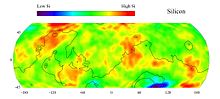 Elemental abundances can be determined remotely by orbiting spacecraft. This map shows the surface concentration (by weight percent) of the element silicon based on data from the Gamma Ray Spectrometer (GRS) Suite on the Mars Odyssey spacecraft. Similar maps exist for a number of other elements.
Much of what we know about the elemental composition of Mars comes from orbiting spacecraft and landers. (See Exploration of Mars for list.) Most of these spacecraft carry spectrometers and other instruments to measure the surface composition of Mars by either remote sensing from orbit or in situ analyses on the surface. We also have many actual samples of Mars in the form of meteorites that have made their way to Earth. Martian meteorites (often called SNC’s, for Shergottites, Nakhlites, and Chassignites[9]—the groups of meteorites first shown to have a martian origin) provide data on the chemical composition of Mars’ crust and interior that would not otherwise be available except through a sample return mission.
Based on these data sources, scientists think that the most abundant chemical elements in the martian crust, besides silicon and oxygen, are iron, magnesium, aluminum, calcium, and potassium. These elements are major components of the minerals comprising igneous rocks.[10] The elements titanium, chromium, manganese, sulfur, phosphorus, sodium, and chlorine are less abundant[11][12] but are still important components of many accessory minerals[13] in rocks and of secondary minerals (weathering products) in the dust and soils (the regolith). Hydrogen is present as water (H2O) ice and in hydrated minerals. Carbon occurs as carbon dioxide (CO2) in the atmosphere and sometimes as dry ice at the poles. An unknown amount of carbon is also stored in carbonates. Molecular nitrogen (N2) makes up 2.7 percent of the atmosphere. As far as we know, organic compounds are absent[14] except for a trace of methane detected in the atmosphere.[15][16]
The elemental composition of Mars is different from Earth′s in several significant ways. First, Martian meteorite analysis suggests that the planet’s mantle is about twice as rich in iron as the Earth’s mantle.[17][18] Second, its core is more rich in sulfur.[19] Third, the Martian mantle is richer in potassium and phosphorus than Earth’s, and fourth, the Martian crust contains a higher percentage of volatile elements such as sulfur and chlorine than the Earth's crust does. Many of these conclusions are supported by in situ analyses of rocks and soils on the Martian surface.[20]
Global physiography
Most of our current knowledge about the geology of Mars comes from studying landforms and relief features (terrain) seen in images taken by orbiting spacecraft. Mars has a number of distinct, large-scale surface features that indicate the types of geological processes that have operated on the planet over time. This section introduces several of the larger physiographic regions of Mars. Together, these regions illustrate how geologic processes involving volcanism, tectonism, water, ice, and impacts have shaped the planet on a global scale.
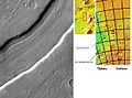
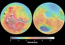 Mars Orbital Laser Altimeter (MOLA) colorized shaded-relief maps showing elevations in the western and eastern hemispheres of Mars. (Left): The western hemisphere is dominated by the Tharsis region (red and brown). Tall volcanoes appear white. Valles Marineris (blue) is the long gash-like feature to the right. (Right): Eastern hemisphere shows the cratered highlands (yellow to red) with the Hellas basin (deep blue/purple) at lower left. The Elysium province is at the upper right edge. Areas north of the dichotomy boundary appear as shades of blue on both maps.
Hemispheric dichotomy
The northern and southern hemispheres of Mars are strikingly different from each other in topography and physiography. This dichotomy is a fundamental global geologic feature of the planet. Simply stated, the northern part of the planet is an enormous topographic depression. About one-third of the planet’s surface (mostly in the northern hemisphere) lies 3–6 km lower in elevation than the southern two-thirds. This is a first-order relief feature on par with the elevation difference between Earth’s continents and ocean basins.[21] The dichotomy is also expressed in two other ways: as a difference in impact crater density and crustal thickness between the two hemispheres.[22] The hemisphere south of the dichotomy boundary (often called the southern highlands or uplands) is very heavily cratered and ancient, characterized by rugged surfaces that date back to the period of heavy bombardment. In contrast, the lowlands north of the dichotomy boundary have few large craters, are very smooth and flat, and have other features indicating that extensive resurfacing has occurred since the southern highlands formed. The third distinction between the two hemispheres is in crustal thickness. Topographic and geophysical gravity data indicate that the crust in the southern highlands has a maximum thickness of about 58 km, while crust in the northern lowlands “peaks” at around 32 km in thickness.[23][24] The location of the dichotomy boundary varies in latitude across Mars and depends on which of the three physical expressions of the dichotomy is being considered.
The origin and age of the hemispheric dichotomy are still debated. Hypotheses of origin generally fall into two categories: one, the dichotomy was produced by a mega-impact event or several large impacts early in the planet’s history (exogenic theories)[25][26][27] or two, the dichotomy was produced by crustal thinning in the northern hemisphere by mantle convection, overturning, or other chemical and thermal processes in the planet’s interior (endogenic theories).[28][29] One endogenic model proposes an early episode of plate tectonics producing a thinner crust in the north, similar to what is occurring at spreading plate boundaries on Earth.[30] Whatever its origin, the Martian dichotomy appears to be extremely old. Laser altimeter and radar sounding data from orbiting spacecraft have identified a large number of basin-sized structures previously hidden in visual images. Called quasi-circular depressions (QCDs), these features likely represent derelict impact craters from the period of heavy bombardment that are now covered by a veneer of younger deposits. Crater counting studies of QCDs suggest that the underlying surface in the northern hemisphere is at least as old as the oldest exposed crust in the southern highlands.[31] The ancient age of the dichotomy places a significant constraint on theories of its origin.[32]
Tharsis and Elysium volcanic provinces
Straddling the dichotomy boundary in Mars’ western hemisphere is a massive volcano-tectonic province known as the Tharsis region or the Tharsis bulge. This immense, elevated structure is thousands of kilometers in diameter and covers up to 25% of the planet’s surface.[33] Averaging 7–10 km above datum (Martian “sea” level), Tharsis contains the highest elevations on the planet and the largest known volcanoes in the Solar System. Three enormous volcanoes, Ascraeus Mons, Pavonis Mons, and Arsia Mons (collectively known as the Tharsis Montes), sit aligned NE-SW along the crest of the buldge. The vast Alba Mons (formerly Alba Patera) occupies the northern part of the region. The huge shield volcano Olympus Mons lies off the main buldge, at the western edge of the province. The extreme massiveness of Tharsis has placed tremendous stresses on the planet’s lithosphere. As a result, immense extensional fractures (grabens and rift valleys) radiate outward from Tharsis, extending halfway around the planet.[34]
A smaller volcanic center lies several thousand kilometers west of Tharsis in Elysium. The Elysium volcanic complex is about 2,000 kilometers in diameter and consists of three main volcanoes, Elysium Mons, Hecates Tholus, and Albor Tholus. The Elysium group of volcanoes is thought to be somewhat different than the Tharsis Montes, in that development of the former involved both lavas and pyroclastics.[35]
Large impact basins
Several enormous, circular impact basins are present on Mars. The largest is the Hellas basin located in the southern hemisphere, centered at about 64°E longitude and 40°S latitude. The central part of the basin (Hellas Planitia) is 1,800 km in diameter[36] and surrounded by a broad, heavily eroded annular rim structure characterized by closely spaced rugged irregular mountains (massifs), which probably represent uplifted, jostled blocks of old pre-basin crust.[37] (See Anseris Mons, for example.) Ancient, low-relief volcanic constructs (highland paterae) are located on the northeastern and southwestern portions of the rim. The basin floor contains thick, structurally complex sedimentary deposits that have a long geologic history of deposition, erosion, and internal deformation. The lowest elevations on the planet are located within the Hellas basin, with some areas of the basin floor lying over 8 km below datum.[38]
The two other large impact structures on the planet are the Argyre and Isidis basins. Like Hellas, Argyre (800 km in diameter) is located in the southern highlands and is surrounded by a broad ring of mountains. The mountains in the southern portion of the rim, Charitum Montes, may have been eroded by valley glaciers and ice sheets at some point in Mars’ history.[39] The Isidis basin (roughly 1,000 km in diameter) lies on the dichotomy boundary at about 87°E longitude. The northeastern portion of the basin rim has been eroded and is now buried by northern plains deposits, giving the basin a semicircular outline. The northwestern rim of the basin is characterized by arcuate grabens (Nili Fossae) that are circumferential to the basin. One additional large basin, Utopia, is completely buried by northern plains deposits. Its outline is clearly discernable only from altimetry data. All of the large basins on Mars are extremely old, dating back to the late heavy bombardment. They are thought to be comparable in age to the Imbrium and Orientale basins on the Moon.
Equatorial canyon system
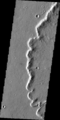
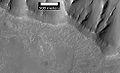
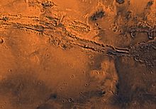 Viking Orbiter 1 view image of Valles Marineris.
Near the equator in the western hemisphere lies an immense system of deep, interconnected canyons and troughs collectively known as the Valles Marineris. The canyon system extends eastward from Tharsis for a length of over 4,000 km, nearly a quarter of the planet’s circumference. If placed on Earth, Valles Marineris would span the width of North America.[40] In places, the canyons are up to 300 km wide and 10 km deep. Often compared to Earth’s Grand Canyon, the Valles Marineris has a very different origin than its tinier, so-called counterpart on Earth. The Grand Canyon is largely a product of water erosion. The Martian equatorial canyons were formed mostly by faulting and thus are more similar to the East African Rift valleys.[41] The canyons represent the surface expression of powerful extensional strain in the Martian crust, probably due to loading from the Tharsis bulge.[42]
Chaotic terrain and outflow channels
The terrain at the eastern end of the Valles Marineris grades into dense jumbles of low rounded hills that seem to have formed by the collapse of upland surfaces to form broad, rubble-filled hollows.[43] Called chaotic terrain, these areas mark the heads of huge outflow channels that emerge full size from the chaotic terrain and empty (debouch) northward into Chryse Planitia. The presence of streamlined islands and other geomorphic features indicate that the channels were most likely formed by catastrophic releases of water from aquifers or the melting of subsurface ice. The channels, which include Ares, Shalbatana, Simud, and Tiu Valles, are enormous by terrestrial standards, and the flows that formed them correspondingly immense. For example, the peak discharge required to carve the 28-km-wide Ares Vallis is estimated to have been 500 million cubic feet per second, over ten thousand times the average discharge of the Mississippi River.[44]
 Mars Orbital Laser Altimeter (MOLA) derived image of Planum Boreum. Vertical exaggeration is extreme. Note that residual ice cap is only the thin veneer (shown in white) on top of the plateau.
Ice caps
The polar ice caps are well-known telescopic features of Mars, first identified by Christiaan Huygens in 1672.[45] Since the 1960s, we have known that the seasonal caps (those seen in the telescope to grow and wane seasonally) are composed of carbon dioxide (CO2) ice that condenses out of the atmosphere as temperatures fall to 148 K, the frost point of CO2, during the polar wintertime.[46] In the north, the CO2 ice completely dissipates (sublimes) in summer, leaving behind a residual cap of water (H2O) ice. At the south pole, a small residual cap of CO2 ice remains in summer.
Both residual ice caps overlie thick layered deposits of interbedded ice and dust. In the north, the layered deposits form a 3 km-high, 1,000 km-diameter plateau called Planum Boreum. A similar kilometers-thick plateau, Planum Australe, lies in the south. Both plana (the Latin plural of planum) are sometimes treated to be synonymous with the “polar ice caps”, but the permanent ice (seen as the high albedo, white surfaces in images) forms only a relatively thin mantle on top of the layered deposits. The layered deposits probably represent alternating cycles of dust and ice deposition caused by climate changes related to variations in the planet's orbital parameters over time. (See Milankovitch cycles.) The polar layered deposits are some of the youngest geologic units on Mars.
Geologic history
Much of a planet’s history can be deciphered by looking at its surface and asking what came first and what came next. For example, a lava flow that spreads out and fills a large impact crater is clearly younger than the crater, and a small crater on top of the same lava flow is younger than both the lava and the larger crater. This principle, called the law of superposition, and other principles of stratigraphy, first formulated by Nicholas Steno in the 17th century, allowed geologists of the 19th century to divide the history of the Earth into the familiar eras of Paleozoic, Mesozoic, and Cenozoic. The same methodology was later applied to the Moon[47] and then to Mars.[48]
 HiRISE image illustrating Steno's law of superposition. The dark-toned lava flow overlies (is younger than) the light-toned terrain at right. The ejecta of the crater at center overlies both units, indicating that the crater is younger than both units.
Another stratigraphic principle used on planets where impact craters are well preserved is that of crater number density. The number of craters greater than a given size per unit surface area (usually million km2) provides a relative age for that surface. Heavily cratered surfaces are old, and sparsely cratered surfaces are young. Old surfaces have a lot of big craters, and young surfaces have mostly small craters or none at all.
These stratigraphic concepts form the basis for the Martian geologic timescale.
Relative vs. absolute ages
By using stratigraphic principles, we can usually delineate rock units only in terms of their relative age to each other. For example, knowing that Mesozoic rock strata making up the Cretaceous System lie on top of (and are therefore younger than) rocks of the Jurassic System tells us nothing about how long ago the Cretaceous or Jurassic Periods were. Other methods, such as radiometric dating, are needed to determine absolute ages in geologic time. On Earth, we have this information and know that the Cretaceous Period began around 146 million years ago (Mya) and ended 65 Mya with the extinction of the dinosaurs. Absolute ages are also known for selected rock units of the Moon based on samples returned to Earth.
Assigning absolute ages to rock units on Mars is much more problematic. Numerous attempts[49][50][51] have been made over the years to determine an absolute Martian chronology (timeline) by comparing estimated impact cratering rates for Mars to those on the Moon. If we know with precision the rate of impact crater formation on Mars by crater size per unit area over geologic time (the production rate or flux), then crater densities also provide a way to determine absolute ages.[52] Unfortunately, practical difficulties in crater counting[53] and uncertainties in estimating the flux still create huge uncertainties in the ages derived from these methods. Martian meteorites have provided datable samples that are consistent with ages calculated thus far,[54] but the locations on Mars from where the meteorites came (provenance) are unknown, limiting their value as chronostratigraphic tools. Absolute ages determined by crater density should therefore be taken with some skepticism.[55]
Crater density timescale
Studies of impact crater densities on the Martian surface[56] have delineated three broad periods in the planet's geologic history.[57] The periods were named after places on Mars that have large-scale surface features, such as large craters or widespead lava flows, that date back to these time periods. The absolute ages given here are only approximate. From oldest to youngest, the time periods are:
- Pre-Noachian Represents the interval from the accretion and differentiation of the planet about 4.5 billion years ago (Gya) to the formation of the Hellas impact basin, between 4.1 and 3.8 Gya.[58] Most of the geologic record of this interval has been erased by subsequent erosion and high impact rates. The crustal dichotomy is thought to have formed during this time, along with the Argyre and Isidis basins.
- Noachian Period (named after Noachis Terra): Formation of the oldest extant surfaces of Mars between 4.1 and about 3.7 billion years ago (Gya). Noachian-aged surfaces are scarred by many large impact craters. The Tharsis bulge is thought to have formed during the Noachian, along with extensive erosion by liquid water producing river valley networks. Large lakes or oceans may have been present.
- Hesperian Period (named after Hesperia Planum): 3.7 to approximately 3.0 Gya. The Hesperian Period is marked by the formation of extensive lava plains. The formation of Olympus Mons likely began during this period.[59] Catastrophic releases of water carved extensive outflow channels around Chryse Planitia and elswhere. Ephemeral lakes or seas formed in the northern lowlands.
- Amazonian Period (named after Amazonis Planitia): 3.0 Gya to present. Amazonian regions have few meteorite impact craters but are otherwise quite varied. Lava flows, glacial/periglacial activity, and minor releases of liquid water continued during this period.

The date of the Hesperian/Amazonian boundary is particularly uncertain and could range anywhere from 3.0 to 1.5 Gya.[60] Basically, the Hesperian is thought of as a transitional period between the end of heavy bombardment and the cold, dry Mars seen today.
Mineral alteration timescale
In 2006, researchers using data from the OMEGA Visible and Infrared Mineralogical Mapping Spectrometer on board the Mars Express orbiter proposed an alternative Martian timescale based on the predominant type of mineral alteration that occurred on Mars due to different styles of chemical weathering in the planet’s past. They proposed dividing the history of the Mars into three eras: the Phyllocian, Theiikian and Siderikan.[61][62]
- Phyllocian (named after phyllosilicate or clay minerals that characterize the era) lasted from the formation of the planet until around the Early Noachian (about 4.0 Gya). OMEGA identified outcropping of phyllosilicates at numerous locations on Mars, all in rocks that were exclusively Pre-Noachian or Noachian in age (most notably in rock exposures in Nili Fossae and Mawrth Vallis). Phyllosillicates require a water-rich, alkaline environment to form. The Phyllocian era correlates with the age of valley network formation on Mars, suggesting an early climate that was conducive to the presence of abundant surface water. It is thought that deposits from this era are the best candidates in which to search for evidence of past life on the planet.
- Theiikian (named after sulfurous in Greek, for the sulfate minerals that were formed) lasted until about 3.5 Gya. It was an era of extensive volcanism, which released large amounts of sulfur dioxide (SO2) into the atmosphere. The SO2 combined with water to create a sulfuric acid-rich environment that allowed the formation of hydrated sulfates (notably kieserite and gypsum).
- Siderikan (named for iron in Greek, for the iron oxides that formed) lasted from 3.5 GYa until the present. With the decline of volcanism and available water, the most notable surface weathering process has been the slow oxidation of the iron-rich rocks by atmospheric peroxides producing the red iron oxides that give the planet its familiar color.

Albedo features
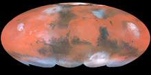 Mollweide projection of albedo features on Mars from Hubble Space Telescope. Bright ochre areas in left, center, and right are Tharsis, Arabia, and Elysium, respectively. The dark region at top center left is Acidalium Planitia. Syrtis Major is the dark area projecting upward in the center right. Note orographic clouds over Olympus and Elysium Montes (left and right, respectively).Main article: The Martian SurfaceFurther information: Classical albedo features on Mars
No topography is visible on Mars from Earth. The bright areas and dark markings seen through a telescope are albedo features. The bright, red-ochre areas are locations where fine dust covers the surface. Bright areas (excluding the polar caps and clouds) include Hellas, Tharsis, and Arabia Terra. The dark gray markings represent areas that the wind has swept clean of dust, leaving behind the lower layer of dark, rocky material. Dark markings are most distinct in a broad belt from 0° to 40° S latitude. However, the most prominent dark marking, Syrtis Major Planum, is in the northern hemisphere.[63] The classical albedo feature, Mare Acidalium (Acidalia Planitia), is another prominent dark area in the northern hemisphere. A third type of area, intermediate in color and albedo, is also present and thought to represent regions containing a mixture of the material from the bright and dark areas.[64]
Mineralogy and petrology
Mars is fundamentally an igneous planet. Rocks on the surface and in the crust consist predominantly of minerals that crystallize from magma. Most of our current knowledge about the mineral composition of Mars comes from spectroscopic data from orbiting spacecraft, in situ analyses of rocks and soils from six landing sites, and study of the Martian meteorites.[65] Spectrometers currently in orbit include THEMIS (Mars Odyssey), OMEGA (Mars Express), and CRISM (Mars Reconnaissance Orbiter). The two Mars exploration rovers each carry an Alpha Particle X-ray Spectrometer (APXS), a thermal emission spectrometer (Mini-TES), and Mössbauer spectrometer to identify minerals on the surface.
Primary rocks and minerals
The dark areas of Mars are characterized by the mafic rock-forming minerals olivine, pyroxene, and plagioclase feldspar. These minerals are the primary constituents of basalt, a dark volcanic rock that also makes up the Earth’s oceanic crust and the lunar maria.
 Mars Odyssey THEMIS false-color image of olivine basalts in the Valles Marineris. Layers rich in olivine appear purple.
The mineral olivine occurs all over the planet, but some of the largest concentrations are in Nili Fossae, an area containing Noachian-aged rocks. Another large olivine-rich outcrop is in Ganges Chasma, an eastern side chasm of Valles Marineris (pictured).[66] Olivine weathers rapidly into clay minerals in the presence of liquid water. Therefore, areas with large outcroppings of olivine-bearing rock indicate that liquid water has not been abundant since the rocks formed.[9]
Pyroxene minerals are also widespread across the surface. Both low-calcium (ortho-) and high-calcium (clino-) pyroxenes are present, with the high-calcium varieties associated with younger volcanic shields and the low-calcium forms (enstatite) more common in the old highland terrain. Because enstatite melts at a higher temperature than its high-calcium cousin, some researchers have argued that its presence in the highlands indicates that older magmas on Mars had higher temperatures than younger ones.[67]
Between 1997 and 2006, the Thermal Emission Spectrometer (TES) on the Mars Global Surveyor (MGS) spacecraft mapped the global mineral composition of the planet.[68] TES identified two global-scale volcanic units on Mars. Surface Type 1 (ST1) characterizes the Noachian-aged highlands and consists of unaltered plagioclase- and clinopyroxene-rich basalts. Surface Type 2 (ST2) is common in the younger plains north of the dichotomy boundary and is more silica rich than ST1. The lavas of ST2 have been interpreted as andesites or basaltic andesites, indicating the lavas in the northern plains originated from more chemically evolved, volatile-rich magmas.[69] (See Igneous differentiation and Fractional crystallization.) However, other researchers have suggested that ST2 represents weathered basalts with thin coatings of silica glass or other secondary minerals that formed through interaction with water- or ice-bearing materials.[70]
True intermediate and felsic rocks are present on Mars, but exposures are uncommon. Both TES and the Thermal Emission Imaging System (THEMIS) on the Mars Odyssey spacecraft have identified high silica rocks in Syrtis Major and near the southwestern rim of the crater Antoniadi. The rocks have spectra resembling quartz-rich dacites and granitoids, suggesting that at least some parts of the Martian crust may have a diversity of igneous rocks similar to Earth's.[71] Some geophysical evidence suggests that the bulk of the Martian crust may actually consist of basaltic andesite or andesite. The andesitic crust is hidden by overlying basaltic lavas that dominate the surface composition but are volumetrically minor.[8]
Dust and soils
Main article: Martian soilMuch of the Martian surface is deeply covered by dust as fine as talcum powder. The global predominance of dust obscures the underlying bedrock, making spectroscopic identification of primary minerals impossible from orbit over many areas of the planet. The red/orange appearance of the dust is caused by iron(III) oxide (nanophase Fe2O3) and the iron(III) oxide-hydroxide mineral goethite.[72]
The global dust cover and the presence of other wind-blown sediments has made soil compositions remarkably uniform across the Martian surface. Analysis of soil samples from the Viking landers in 1976, Pathfinder, and the Mars Exploration rovers show nearly identical mineral compositions from widely separated locations around the planet.[73] The soils consist of finely broken up basaltic rock fragments and are highly enriched in sulfur and chlorine, probably derived from volcanic gas emissions.[74]
Secondary (alteration) minerals
Minerals produced through hydrothermal alteration and weathering of primary basaltic minerals are also present on Mars. Secondary minerals include hematite, phyllosilicates (clay minerals), goethite, jarosite, iron sulfate minerals, opaline silica, and gypsum. Many of these secondary minerals require liquid water to form (aqueous minerals).
Opaline silica and iron sulfate minerals form in acidic (low pH) solutions. Sulfates have been found in a variety of locations, including near Juventae Chasma, Ius Chasma, Melas Chasma, Candor Chasma, and Ganges Chasma. These sites all contain fluvial landforms indicating that abundant water was once present.[75][76]
Some of the mineral classes detected may have formed in environments suitable (i.e., enough water and the proper pH) for life. The mineral smectite (a phyllosilicate) forms in near-neutral waters. Phyllosicates and carbonates are good for preserving organic matter, so they may contain evidence of past life.[77][78] Sulfate deposits preserve chemical and morphological fossils, and fossils of microorganisms form in iron oxides like hematite.[79] The presence of opaline silica points toward a hydrothermal environment that could support life. Silica is also excellent for preserving evidence of microbes.[80]
Sedimentary rocks
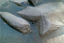 Cross-bedded sandstones inside Victoria Crater.
Layered sedimentary deposits are widespread on Mars. These deposits probably consist of both sedimentary rock and poorly indurated or unconsolidated sediments. Thick sedimentary deposits occur in the interior of several canyons in Valles Marineris, within large craters in Arabia and Meridiani Planum (see Henry Crater for example), and probably comprise much of the deposits in the northern lowlands (e.g., Vastitas Borealis Formation). The Mars Exploration Rover Opportunity landed in an area containing cross-bedded (mainly eolian) sandstones (Burns formation[81]). Fluvial-deltaic deposits are present in Eberswalde Crater and elsewhere, and photogeologic evidence suggests that many craters and low lying intercrater areas in the southern highlands contain Noachian-aged lake sediments.
While the possibility of carbonates on Mars has been of great interest to exobiologists and geochemists alike, there was little evidence for significant quantities of carbonate deposits on the surface. In the summer of 2008, the TEGA and WCL experiments on the 2007 Phoenix Mars lander found between 3–5wt% (percent by weight) calcite (CaCO3) and an alkaline soil.[82] In 2010, analyses by the Mars Exploration Rover Spirit identified outcrops rich in magnesium-iron carbonate (16–34 wt%) in the Columbia Hills of Gusev crater. The magnesium-iron carbonate most likely precipitated from carbonate-bearing solutions under hydrothermal conditions at near-neutral pH in association with volcanic activity during the Noachian Period.[83]
Impact craters
Impact craters were first identified on Mars by the Mariner 4 spacecraft in 1965.[84] Early observations showed that Martian craters were generally shallower and smoother than lunar craters, indicating that Mars has a more active history of erosion and deposition than the Moon.[85]
In other aspects, Martian craters resemble lunar craters. Both are products of hypervelocity impacts and show a progression of morphology types with increasing size. Martian craters below about 7 km in diameter are called simple craters; they are bowl-shaped with sharp raised rims and have depth/diameter ratios of about 1/5.[86] Martian craters change from simple to more complex types at diameters of roughly 5 to 8 km. Complex craters have central peaks (or peak complexes), relatively flat floors, and terracing or slumping along the inner walls. Complex craters are shallower than simple craters in proportion to their widths, with depth/diameter ratios ranging from 1/5 at the simple-to-complex transition diameter (~7 km) to about 1/30 for a 100-km diameter crater. Another transition occurs at crater diameters of around 130 km as central peaks turn into concentric rings of hills to form multi-ring basins.[87]
Mars has the greatest diversity of impact crater types than any other planet in the Solar System.[88] This is partly because the presence of both rocky and volatile-rich layers in the subsurface produces a range of morphologies even among craters within the same size classes. Mars also has an atmosphere that plays a role in ejecta emplacement and subsequent erosion. Moreover, Mars has a rate of volcanic and tectonic activity low enough that ancient, eroded craters are still preserved, yet high enough to have resurfaced large areas of the planet, producing a diverse range of crater populations of widely differing ages. Over 42,000 impact craters greater than 5 km in diameter have been catalogued on Mars,[89] and the number of smaller craters is probably innumerable. The density of craters on Mars is highest in the southern hemisphere, south of the dichotomy boundary. This is where most of the large craters and basins are located.
Crater morphology provides information about the physical structure and composition of the surface and subsurface at the time of impact. For example, the size of central peaks in Martian craters is larger than comparable craters on Mercury or the Moon.[90] In addition, the central peaks of many large craters on Mars have pit craters at their summits. Central pit craters are rare on the Moon but are very common on Mars and the icy satellites of the outer Solar System. Large central peaks and the abundance of pit craters probably indicate the presence of near-surface ice at the time of impact.[91]
The most notable difference between Martian craters and other craters in the Solar System is the presence of lobate (fludized) ejecta blankets. Many craters at equatorial and mid-latitudes on Mars have this form of ejecta morphology, which is thought to arise when the impacting object melts ice in the subsurface. Liquid water in the ejected material forms a muddy slurry that flows along the surface, producing the characteristic lobe shapes.[92][93] The crater Yuty is a good example of a rampart crater, which is so called because of the rampart-like edge to its ejecta blanket.[94]
-
HiRISE image of simple rayed crater on southeastern flank of Elysium Mons.
-

THEMIS image of complex crater with fluidized ejecta. Note central peak with pit crater.
-
Viking orbiter image of Yuty crater showing lobate ejecta.
-
THEMIS close-up view of ejecta from 17-km diameter crater at 21°S, 285°E. Note prominent rampart.
Martian craters are commonly classified by their ejecta. Craters with one ejecta layer are called single-layer ejecta (SLE) craters. Craters with two superposed ejecta blankets are called double-layer ejecta (DLE) craters, and craters with more than two ejecta layers are called multiple-layered ejecta (MLE) craters. These morphological differences are thought to reflect compositional differences (i.e., interlayered ice, rock, or water) in the subsurface at the time of impact.[95][96]
 Pedestal crater in Amazonis quadrangle as seen by HiRISE.
Martian craters show a large diversity of preservational states, from extremely fresh to old and eroded. Degraded and infilled impact craters record variations in volcanic, fluvial, and eolian activity over geologic time.[97] Pedestal craters are craters with their ejecta sitting above the surrounding terrain to form raised platforms. They occur because the crater's ejecta forms a resistant layer so that the area nearest the crater erodes more slowly than the rest of the region. Some pedestals are hundreds of meters above the surrounding area, meaning that hundreds of meters of material were eroded away. Pedestal craters were first observed during the Mariner 9 mission in 1972.[98][99][100]
Further information: Impact craterFurther information: List of craters on MarsFurther information: Rampart craterVolcanism
Main article: Volcanism on Mars Mariner 9 image of Olympus Mons. This is one of the first images to show that Mars has large volcanoes.
 THEMIS image of lava flows. Note the lobate shape of the edges.
Volcanic structures and landforms cover large portions of the Martian surface. Beginning with Mariner 9 in 1972, orbiting spacecraft have revealed a variety of volcanic features, including large shield volcanoes, extensive lava flows, and vast ridged plains formed by flood basalts. Based on crater counts, these volcanic features range from Noachian to late Amazonian in age, indicating that the planet has been volcanically active throughout its history and may still be so today.
The most conspicuous volcanoes on Mars occur in Tharsis and Elysium, where countless generations of basaltic lava flows have built up immense volcanic mountains. These volcanoes are strikingly similar to shield volcanoes on Earth. Both have shallow-sloping flanks and summit calderas. The main difference between Martian shield volcanoes and those on Earth is in size: Martian shield volcanoes are truly colossal. For example, Olympus Mons is 550 km across and 21 km high. It is nearly 100 times greater in volume than Mauna Loa in Hawaii, the largest shield volcano on Earth. Geologists think one of the reasons that volcanoes on Mars are able to grow so large is because Mars lacks plate tectonics. The Martian lithosphere does not slide over the upper mantle as on Earth, so lava from a stationary hot spot is able to accumulate at one location on the surface for many hundreds of millions of years.
In addition to the large shields, Mars has a range of other volcanic features. These include large volcanic domes (tholi), highland paterae (see below), volcanic plains, dikes, spatter ridges, and small domes.[101] However, the stratovolcano, the most common type of volcano on Earth, is much less evident on Mars.[102]
 MOLA shaded-relief maps showing location of Alba Mons.
Alba Mons, located in the northern Tharsis region, is a unique volcanic structure, with no counterpart on Earth or elsewhere on Mars. The flanks of the volcano have extremely low slopes characterized by extensive lava flows and channels. The average flank slope on Alba Mons is only about 0.5°, over five times lower than the slopes on the other Tharsis volcanoes. The volcano has a central edifice 350 km wide and 1.5 km high with a double caldera complex at the summit. Surrounding the central edifice is an incomplete ring of fractures (Alba Fossae and Tantalus Fossae). Flows related to the volcano can be traced as far north as 61°N and as far south as 26°N. If one counts these widespread flow fields, the volcano stretches an immense 2000 km north-south and 3000 km east-west, making it one of the most areally extensive volcanic features in the Solar System.[103][104][105] Most geological models suggest that Alba Mons is composed of highly fluid basaltic lava flows, but some researchers have identified possible pyroclastic deposits on the volcano's flanks.[106][107] Because Alba Mons lies antipodal to the Hellas impact basin, some researchers have conjectured that the volcano’s formation may have been related to crustal weakening from the Hellas impact, which produced strong seismic waves that focused on the opposite side of the planet.[108]
Most of the large shield volcanoes on Mars are located in the Tharsis and Elysium regions. One exception is Syrtis Major, which is a vast Hesperian-aged shield volcano located within the albedo feature bearing the same name. The volcano is 1200 km in diameter but only 2 km high.[109] It has two calderas, Meroe Patera and Nili Patera. Studies involving the regional gravity field suggest a solidified magma chamber at least 5 km thick lies under the surface.[110] Syrtis Major is of interest to geologists because dacite and granite have been detected there from orbiting spacecraft. Dacites and granites are silica-rich rocks that crystallize from a magma that is more chemically evolved and differentiated than basalt. They may form at the top of a magma chamber after the heavy minerals, such as olivine and pyroxene (those containing iron and magnesium), have settled to the bottom.[111] Dacites and granites are very common on Earth but rare on Mars.
 Viking orbiter view of Peneus Patera (left) and Amphitrites Patera (right). Both are ancient volcanic edifices southwest of Hellas.
In the southern hemisphere, particularly around the Hellas impact basin, are several flat-lying volcanic stuctures called highland paterae. These volcanoes are some of the oldest identifiable volcanic edifices on Mars.[112] They are characterized by having extremely low profiles with highly eroded ridges and channels that radiate outward from a degraded, central caldera complex. They include Hadriaca Patera, Amphritrites Patera, Tyrrhena Patera, Peneus Patera, and Pityusa Patera. Geomorphologic evidence suggests that the highland patera were produced through a combination of lava flows and pyroclastics from the interaction of magma with water. Some researchers speculate that the location of the highland paterae around Hellas is due to deep-seated fractures caused by the impact that provided conduits for magma to rise to the surface.[113][114][115] Although they are not very high, some paterae cover large areas—Amphritrites Patera, for example, covers a larger area than Olympus Mons.
Volcanic plains
Volcanic plains are widespead on Mars. Two types of plains are commonly recognized: those where lava flow features are common, and those where flow features are generally absent but a volcanic origin is inferred by other characteristics. Plains with abundant lava flow features occur in and around the large volcanic provinces of Tharsis and Elysium.[116] Flow features include both sheet flow and tube- and channel-fed flow morphologies. Sheet flows show complex, overlapping flow lobes and may extend for many hundreds of kilometers from their source areas.[117] Lava flows can form a lava tube when the exposed upper layers of lava cool and solidify to form a roof while the lava underneath continues flowing. Often, when all the remaining lava leaves the tube, the roof collapses to make a channel.[118] An unusual type of flow feature occurs in the Cerberus plains south of Elysium and in Amazonis. These flows have a broken platey texture, consisting of dark, kilometer-scale slabs embedded in a light-toned matrix. They have been attributed to rafted slabs of solidified lava floating on a more fluid subsurface. Others have claimed the broken slabs represent pack ice that froze over a sea that pooled in the area after massive releases of groundwater from the Cerberus Fossae area.
The second type of volcanic plains (ridged plains) are characterized by abundant wrinkle ridges. Volcanic flow features are rare or absent. The ridged plains are believed to be regions of extensive flood basalts, by analogy with the lunar maria. Ridged plains make up about 30% of the Martian surface[119] and are most prominent in Lunae, Hesperia, and Malea Plana, as well as throughout much of the northern lowlands. Ridged plains are all Hesperian in age and represent a style of volcanism globally predominant during that time period. The Hesperian Period is named after the ridged plains in Hesperia Planum.
Volcanoes and ice
 THEMIS image of Hrad Valles. This valley may have formed when eruptions in the Elysium Mons volcanic complex melted ground or surface ice.
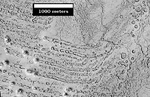 HiRISE image of possible rootless cones east of Elysium region. The chains of rings are interpreted to be caused by steam explosions when lava moved over ground that was rich in water ice.
Large amounts of water ice are believed to be present in the Martian subsurface. The interaction of ice with molten rock can produce distinct landforms. When hot volcanic material comes into contact with surface ice, large amounts of liquid water and mud may form that flow catastrophically down slope as massive debris flows (lahars). Some channels in volcanic areas, such as Hrad Valles near Elysium Mons, may have been carved or modified by lahars.[120] Lava flowing over water-saturated ground can cause the water to erupt violently in an explosion of steam (see phreatic eruption), producing small volcano-like landforms called pseudocraters, or rootless cones. Features that resemble terrestrial rootless cones occur in Elysium, Amazonis, and Isidis and Chryse Planitiae.[121] Finally, when a volcano erupts under an ice sheet, it can form a distinct, mesa-like landform called a tuya or table mountain. Some researchers[122] cite geomorphic evidence that many of the layered interior deposits in Valles Marineris may be the Martian equivalent of tuyas.
Possible plate tectonics
Plate tectonics on Mars has been a controversial idea. For many years, most scientists rejected the idea. However, some observations have caused researchers to revisit the notion.[citation needed] Pavonis Mons is the middle of three volcanoes (collectively known as Tharsis Montes) on the Tharsis bulge near the equator of the planet Mars. The other Tharsis volcanoes are Ascraeus Mons and Arsia Mons. The three Tharsis Montes, together with some smaller volcanoes to the north, form a straight line. This arrangement suggests that they were formed by a crustal plate moving over a hot spot. Such an arrangement exists in the Earth's Pacific Ocean as the Hawaiian Islands. The Hawaiian Islands are in a straight line, with the youngest in the south and the oldest in the north. So geologists believe the plate is moving while a stationary plume of hot magma rises and punches through the crust to produce volcanic mountains. However, the largest volcano on the planet, Olympus Mons, is thought to have formed when the plates were not moving. Olympus Mons may have formed just after the plate motion stopped. The mare-like plains on Mars are roughly 3 to 3.5 billion years old.[123] The giant shield volcanoes are younger, formed between 1 and 2 billion years ago. The youngest lava flows on Olympus Mons are only 20 to 200 million years old.[124]
Norman H. Sleep, professor of geophysics at Stanford University, spoke December 8, 2009 at the American Geophysical Union meeting in San Francisco. Sleep described how the three volcanoes that form a line along the Tharsis Ridge may be extinct island arc volcanoes like the Japanese Island chain.[125]
Besides the line of volcanoes, there is other evidence of plate tectonics on Mars. The Mars Global Surveyor (MGS) discovered magnetic stripes in the crust of Mars, especially in the Phaethontis and Eridania quadrangles. The magnetometer on MGS discovered 100 km wide stripes of magnetized crust running roughly parallel for up to 2000 km. These stripes alternate in polarity with the north magnetic pole of one pointing up from the surface and the north magnetic pole of the next pointing down. When similar stripes were discovered on Earth in the 1960s, they were taken as evidence of plate tectonics. However, there are some differences, between the magnetic stripes on Earth and those on Mars. The Martian stripes are wider, much more strongly magnetized, and do not appear to spread out from a middle crustal spreading zone. Because the area with the magnetic stripes is about 4 billion years old, it is believed that the global magnetic field probably lasted for only the first few hundred million years of Mars' life. At that time the temperature of the molten iron in the planet's core might have been high enough to mix it into a magnetic dynamo. Younger rock does not show any stripes. When molten rock containing magnetic material, such as hematite (Fe2O3), cools and solidifies in the presence of a magnetic field, it becomes magnetized and takes on the polarity of the background field. This magnetism is lost only if the rock is subsequently heated above the Curie temperature, which is 770 degrees C for pure iron, but lower for oxides such as hematite (ca. 650) or magnetite (ca. 580).[126] The magnetism left in rocks is a record of the magnetic field when the rock solidified.[127]
Valleys and channels
Main article: Water on MarsFurther information: Atmosphere of Mars
The Viking Orbiters caused a revolution in our ideas about water on Mars. Huge river valleys were found in many areas. They showed that floods of water broke through dams, carved deep valleys, eroded grooves into bedrock, and traveled thousands of kilometers. Areas of branched streams, in the southern hemisphere, suggested that rain once fell.[9][128][129]
The images below, some of the best from the Viking Orbiters, are mosaics of many small, high resolution images. Click on the images for more detail. Some of the pictures are labeled with place names.
-
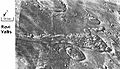
Streamlined Islands seen by Viking showed that large floods occurred on Mars. Image is located in Lunae Palus quadrangle.
-
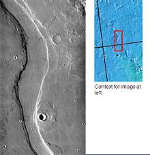
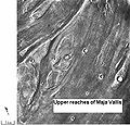
Tear-drop shaped islands caused by flood waters from Maja Vallis, as seen by Viking Orbiter. Image is located in Oxia Palus quadrangle. The islands are formed in the ejecta of Lod Crater, Bok Crater, and Gold Crater.
-

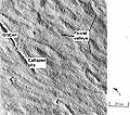
Scour Patterns, located in Lunae Palus quadrangle, were produced by flowing water from Maja Vallis, which lies just to the left of this mosaic. Detail of flow around Dromore Crater is shown on the next image.
-

Great amounts of water were required to carry out the erosion shown in this Viking image. Image is located in Lunae Palus quadrangle. The erosion shaped the ejecta around Dromore Crater.
-
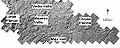
Waters from Vedra Vallis, Maumee Vallis, and Maja Valles went from Lunae Planum on the left, to Chryse Planitia on the right. Image is located in Lunae Palus quadrangle and was taken by Viking Orbiter.
-

Area around Northern Kasei Valles, showing relationships among Kasei Valles, Bahram Vallis, Vedra Vallis, Maumee Vallis, and Maja Valles. Map location is in Lunae Palus quadrangle and includes parts of Lunae Planum and Chryse Planitia.
-
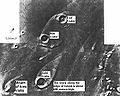
The ejecta from Arandas Crater acts like mud. It moves around small craters (indicated by arrows), instead of just falling down on them. Craters like this suggest that large amounts of frozen water were melted when the impact crater was produced. Image is located in Mare Acidalium quadrangle and was taken by Viking Orbiter.
-
This view of the flank of Alba Patera shows several chnnels/troughs. Some channels are associated with lava flows; others are probably caused by running water. A large trough or graben turns into a line of collapse pits. Image is located in Arcadia quadrangle and was taken by Viking Orbiter.
-

Branched channels in Thaumasia quadrangle, as seen by Viking Orbiter. Networks of channels like this are strong evidence for rain on Mars in the past.
-
The branched channels seen by Viking from orbit strongly suggested that it rained on Mars in the past. Image is located in Margaritifer Sinus quadrangle.
-
Ravi Vallis, as seen by Viking Orbiter. Ravi Vallis was probably formed when catastrophic floods came out of the ground to the right (chaotic terrain). Image located in Margaritifer Sinus quadrangle.
-
Channels near Warrego Valles. These branched channels are strong evidence for flowing water on Mars, perhaps during a much warmer period.
-
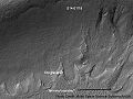
Semeykin Crater Drainage. Click on image to see details of drainage system. Location is Ismenius Lacus quadrangle.
-

Channels in Candor plateau, as seen by HiRISE. Location is Coprates quadrangle. Click on image to see many small, branched channels which are strong evidence for sustained precipitation.
-
Channels near the rim of Ius Chasma, as seen by HiRISE. The pattern and high density of these channels support precipitation as the source of the water. Location is Coprates quadrangle.
The high resolution Mars Orbiter Camera on the Mars Global Surveyor has taken pictures which give much more detail about the history of liquid water on the surface of Mars. Despite the many gigantic flood channels and associated tree-like network of tributaries found on Mars, there are no smaller scale structures that would indicate the origin of the flood waters. It has been suggested that weathering processes have denuded these, indicating the river valleys are old features. Another theory about the formation of the ancient river valleys is that rather than floods, they were created by the slow seeping out of groundwater. This observation is supported by the sudden ending of the river networks in theatre shaped heads, rather than tapering ones. Additionally, valleys are often discontinuous, small sections of uneroded land separating the parts of the river.[130]
On the other hand, evidence in favor of heavy or even catastrophic flooding is found in the giant ripples in the Athabasca Vallis.[131]
Research, published in the Journal of Geophysical Research in June 2010, reported the detection of 40,000 river valleys on Mars, about four times the number of river valleys that have previously been identified by scientists.[132]
Many Mars researchers now agree that the Martian water worn features can be divided into two distinct classes: 1. dendritic (branched), terrestrial-scale, widely distributed, Noachian-age "valley networks" and 2. exceptionally large, long, single-thread, isolated, uncommon, Hesperian-age "outflow channels". Consensus seems to be emerging that the latter formed in single, catastrophic ruptures of subsurface water reservoirs, possibly sealed by ice, discharging colossal quantities of water across an otherwise ultra-arid Mars surface.[133] The former, however, probably indicate prolonged "wet" (though still arid by terrestrial standards) conditions on Noachian-era Mars, with an active ongoing hydrological cycle.[134]
Higher resolution observations from spacecraft like Mars Global Surveyor also revealed at least a few hundred features along crater and canyon walls that appear similar to terrestrial seepage gullies.[135] The gullies tended to be Equator facing and in the highlands of the southern hemisphere, and all greater than 30° north or south latitude.[136] The researchers found no partially degraded (i.e. weathered) gullies and no superimposed impact craters, indicating that these are very young features.
-

Group of gullies on north wall of crater that lies west of the crater Newton (41.3047 degrees south latitude, 192.89 east longitide). Image taken with Mars Global Surveyor under the public target program.
-

Crater wall inside Mariner Crater showing a large group of gullies, as seen by HiRISE.
-
Gullies with branches.
-

Group of deep gullies, as seen by HiRISE.
Liquid water

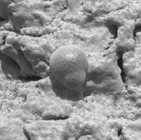 Mosaic shows some spherules partly embedded.Photo of Microscopic rock forms indicating past signs of water, taken by Opportunity
Liquid water cannot exist on the surface of Mars with its present low atmospheric pressure, except at the lowest elevations for short periods.[137][138] Recently, the discovery of gully deposits that were not seen ten years ago provided evidence to support the popular belief that liquid water flowed on the surface in the recent past.[139][140] There is some disagreement in the scientific community as to whether or not the new gully deposits were formed from liquid water. A paper, published in the January 2010 issue of Icarus, concluded that the observed deposits were probably dry flows that were started by a rockfall in steep regions.[141][142]
Among the findings from the Opportunity rover is the presence of hematite on Mars in the form of small spheres on the Meridiani Planum. The spheres are only a few millimetres in diameter and are believed to have formed as rock deposits under watery conditions billions of years ago. Other minerals have also been found containing forms of sulfur, iron, or bromine such as jarosite. This and other evidence led a group of 50 scientists to conclude in the December 9, 2004 edition of the journal Science that "Liquid water was once intermittently present at the Martian surface at Meridiani, and at times it saturated the subsurface. Because liquid water is a key prerequisite for life, we infer conditions at Meridiani may have been habitable for some period of time in Martian history." Later studies suggested that this liquid water was actually acid because of the types of minerals found at the location.[143][144] On the opposite side of the planet, the mineral goethite, which (unlike hematite) forms only in the presence of water, along with other evidence of water, has also been found by the Spirit rover in the "Columbia Hills".
On July 31, 2008, NASA announced that the Phoenix lander confirmed the presence of water ice on Mars,[145] as predicted on 2002 by the Mars Odyssey orbiter.
Studies have shown that various salts present in the Martian soil could act as a kind of antifreeze—keeping water liquid at temperatures far below its normal freezing point.[146][147] Some calculations suggest that tiny amounts of liquid water may be present for short periods of time (hours) in some locations.[148] Some researchers have calculated that when taking into consideration insolation and pressure factors that liquid water could exist in some areas for about 10% of the Martian year;[149] others estimate that water could be a liquid for only 2% of the year.[150] Either way, that may be enough liquid water to support some forms of hardy organisms. It may not take much liquid water for life—organisms have been found on Earth living on extremely thin layers of unfrozen water in below-freezing locations.[151] Research in December 2009 showed that liquid water could form in the daytime inside of snow on Mars. As light heats ice, it may be warming up dust grains located inside. These grains would then store heat and form water by melting some of the ice. This process has already been observed in Antarctica. Enough water may be produced for physical, chemical, and biological processes.[152][153]
Polar ice caps
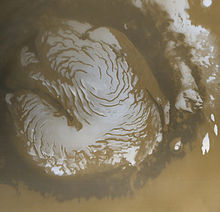 The Mars Global Surveyor acquired this image of the Martian north polar ice cap in early northern summer.
 North polar layered deposits can be seen on the trough wall imaged here by HiRISE.
Both the northern polar cap (Planum Boreum) and the southern polar cap (Planum Australe) are believed to grow in thickness during the winter and partially sublime during the summer. Data obtained by the Mars Express satellite, made it possible in 2004 to confirm that the southern polar cap has an average of 3 kilometres (1.9 mi) thick slab of CO2 ice[154] with varying contents of frozen water. Depending on its latitude, the polar cap can be a mixture of 85% CO2 ice and 15% water ice.[155] The second part comprises steep slopes known as scarps, made almost entirely of water ice, that fall away from the polar cap to the surrounding plains.[155] The third part encompasses the vast permafrost fields that stretch for tens of kilometres away from the scarps.[155][156] NASA scientists calculate that the volume of water ice in the south polar ice cap, if melted, would be sufficient to cover the entire planetary surface to a depth of 11 metres.[157]
Research, published in January 2010 using HiRISE images, says that understanding the layers is more complicated than was formerly believed. The brightness of the layers does not just depend on the amount of dust. The angle of the sun together with the angle of the spacecraft greatly affect the brightness seen by the camera. This angle depends on factors such as the shape of the trough wall and its orientation. Furthermore, the roughness of the surface can greatly change the albedo (amount of reflected light). In addition, many times what one is seeing is not a real layer, but a fresh covering of frost. All of these factors are influenced by the wind which can erode surfaces. The HiRISE camera did not reveal layers that were thinner than those seen by the Mars Global Surveyor. However, it did see more detail within layers.[158]
Ice patches
On July 28, 2005, the European Space Agency announced the existence of a crater partially filled with frozen water,[159] which some then interpreted as an "ice lake".[160] Images of the crater, taken by the High Resolution Stereo Camera on board the European Space Agency's Mars Express spacecraft, clearly show a broad sheet of ice in the bottom of an unnamed crater located on Vastitas Borealis, a broad plain that covers much of Mars' far northern latitudes, at approximately 70.5° North and 103° East. The crater is 35 km wide and about 2 km deep.
The height difference between the crater floor and the surface of the water ice is about 200 metres. ESA scientists have attributed most of this height difference to sand dunes beneath the water ice, which are partially visible. While scientists do not refer to the patch as a "lake", the water ice patch is remarkable for its size and for being present throughout the year. Deposits of water ice and layers of frost have been found in many different locations on the planet.
Equatorial frozen sea
Surface features consistent with pack ice have been discovered in the southern Elysium Planitia. What appear to be plates of broken ice, ranging in size from 30 m to 30 km, are found in channels leading to a flooded area of approximately the same depth and width as the North Sea. The plates show signs of break up and rotation that clearly distinguish them from lava plates elsewhere on the surface of Mars. The source for the flood is thought to be the nearby geological fault, Cerberus Fossae, which spewed water as well as lava some 2 to 10 million years ago.[161]
Ancient coastline
A striking feature of the topography of Mars is the flat plains of the northern hemisphere. With the increasing amounts of data returning from the current set of orbiting probes, what seems to be an ancient shoreline several thousands of kilometres long has been discovered. Actually, two different shorelines have been proposed. One, the Arabia shoreline, can be traced all around Mars except through the Tharsis volcanic region. The second, the Deuteronilus, follows the Vastitas Borealis Formation. Some researchers do not agree that these formations are real shorelines.[162][163] One major problem with the conjectured 2 Ga old shoreline is that it is not flat — i.e. does not follow a line of constant gravitational potential. However, a 2007 Nature article points out that this could be due to a change in distribution in Mars' mass, perhaps due to volcanic eruption or meteor impact—the Elysium volcanic province or the massive Utopia basin that is buried beneath the northern plains have been put forward as the most likely causes.[164] The Mars Ocean Hypothesis conjectures that the Vastitas Borealis basin was the site of a primordial ocean of liquid water 3.8 billion years ago.[165]
Geysers
Main article: Martian geyser Artist concept showing sand-laden jets erupt from geysers on Mars. (published by NASA); artist: Ron Miller.
The seasonal frosting of the south polar region results in the formation of a surface slab of 1 meter thick transparent or translucent seasonal dry ice. Early in the defrosting process, sunlight passing through the slab warms the darker substrate beneath it, causing some of the CO2 at the bottom of the slab to sublime, leading to a build-up of gas pressure in the space between the ground and the slab. Once the pressure reaches a sufficient level, the ice slab ruptures, releasing the pressure and generating geyser-like eruptions of gas with entrained dark basaltic sand or dust. The pressurized gas rushing towards the orifice carves spider-like radial channels in the ground below the slab.[166][167][168][169] This process is rapid, observed happening in the space of a few days, weeks, or months, a growth rate rather unusual in geology—especially for Mars.
Several articles published in the January 2010 issue of Icarus,[142] tell of what has been learned about these gas driven jets using HiRISE on the Mars Reconnaissance Orbiter. Evidence supports the model put forth earlier by H. Kieffer.[170] Measurements suggest the dark matter that is released is in the form of silt-sized particles. The total amount of dust in all the spiders is huge. It has been calculated that the total amount of dust moved around each year is equal to 100 times the mass of dust in a global dust storm. Stereo images show that some channels grow larger as they go uphill—meaning gas is the eroding agent instead of a liquid.[171] In some areas, the jets appear to hug the ground, rather than shoot up straight like a geyser. Observations suggest that a single jet may erupt with at least 30 grams of material per second. However, it is possible that this amount may increase by several orders of magnitude.[172]
Glaciers and ice ages
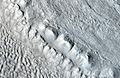
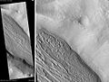
 Perspective view of a 5-km-wide, glacial-like lobe deposit sloping up into a box canyon along the crustal dichotomy boundary on Mars. The surface has moraines, deposits of rocks that show how the glacier advanced.
Many large areas of Mars have been shaped by glaciers. Much of the area in high latitudes, especially the Ismenius Lacus quadrangle, are believed to still contain enormous amounts of water ice.[9][173] Recent evidence has led many planetary scientists to believe that water ice still exists as glaciers with thin coverings of insulating rock.[174][175][176][177][178] In March 2010, scientists released the results of a radar study of an area called Deuteronilus Mensae that found widespread evidence of ice lying beneath a few meters of rock debris.[179] Glaciers are believed to be associated with Fretted terrain, many volcanoes, and even some craters. Researchers have described glacial deposits on Hecates Tholus,[180] Arsia Mons,[181] Pavonis Mons,[182] and Olympus Mons.[183]
Ridges of debris on the surface of the glaciers indicate the direction of ice movement. The surface of some glaciers have rough textures due to sublimation of buried ice. The ice goes directly into a gas (this process is called sublimation) and leaves behind an empty space. Overlying material then collapses into the void.[184] Glaciers are not pure ice; they contain dirt and rocks. At times, they dump their loads of material into ridges. Such ridges are called moraines. Some places on Mars have groups of ridges that are twisted around; this may have been due to more movement after the ridges were put into place. Sometimes chunks of ice fall from the glacier and get buried in the land surface. When they melt, a more or less round hole remains.[185] On Earth we call these features kettles or kettle holes. Mendon Ponds Park in upstate NY has preserved several of these kettles. The picture from HiRISE below shows possible kettles in Moreux Crater.
Pictures below show various features that appear to be connected with the existence of glaciers.
-
Moreux Crater moraines and kettle holes, as seen by HIRISE. Location is Ismenius Lacus quadrangle.
-
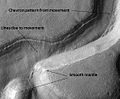
Niger Vallis with features typical of this latitude. Chevron pattern results from movement of ice-rich material. Click on image to see chevron pattern and mantle. Location is Hellas quadrangle.
-

Mesa in Ismenius Lacus quadrangle, as seen by CTX. Mesa has several glaciers eroding it. One of the glaciers is seen in greater detail in the next two images from HiRISE.
-
Glacier as seen by HiRISE under the HiWish program. Area in rectangle is enlarged in the next photo. Zone of accumulation of snow at the top. Glacier is moving down valley, then spreading out on plain. Evidence for flow comes from the many lines on surface. Location is in Protonilus Mensae in Ismenius Lacus quadrangle.
-
Enlargement of area in rectangle of the previous image. On Earth the ridge would be called the terminal moraine of an alpine glacier. Picture taken with HiRISE under the HiWish program.
Many mid-latitude craters contain straight and/or curved ridges of material that resemble glacial moraines on the Earth. Moving ice carries rock material, then drops it as the ice disappears. On Mars, with its extremely thin atmosphere, ice does not usually melt but instead sublimates. As a result, the rock debris is just dropped, and melt water is not produced so the remains of these glaciers do not appear the same as on the Earth. Various names have been applied to these ridged features. Depending on the author, they may be called arcuate ridges,[186] viscous flow features,[187] Martian flow features, or moraine-like ridges. Many, but not all, seem to be associated with gullies on the walls of craters and mantling material.[188]
-
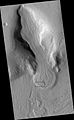
Gullies and possible remains of old glaciers in a crater in Eridania quadrangle, north of the large crater Kepler. One suspected glacier, to the right, has the shape of a tongue. Image taken with Mars Global Surveyor, under the Public Target program.
-

Tongue-Shaped Glacier, as seen by Mars Global Surveyor. Location is Hellas quadrangle.
-
Tongue-shaped glacier, as seen by HiRISE under the HiWish program. Ice may exist in the glacier, even today, beneath an insulating layer of dirt. Location is Hellas quadrangle.
-

Close-up of tongue-shaped glacier, as seen by HiRISE under the HiWish program. Resolution is about 1 meter, so one can see objects a few meters across in this image. Ice may exist in the glacier, even today, beneath an insulating layer of dirt. Location is Hellas quadrangle.
Lineated deposits are probably rock-covered glaciers which are found on the floors of some channels. Their surfaces have ridged and grooved materials that deflect around obstacles, similar to some glaciers on the Earth. Lineated floor deposits may be related to Lobate Debris Aprons, which have been proven to contain large amounts of ice by orbiting radar.[177][178][189]
For many years, researchers believed that on Mars features called Lobate Debris Aprons looked like glacial flows. It was thought that ice existed under a layer of insulating rocks.[174][175][176] With new instrument readings, it has been confirmed that Lobate Debris Aprons contain almost pure ice that is covered with a layer of rocks.[177][178]
-
Reull Vallis with lineated floor deposits. Click on image to see relationship to other features. Floor deposits are believed to be formed from ice movement. Location is Hellas quadrangle.
-
Coloe Fossae Lineated Valley Fill, as seen by HiRISE. Scale bar is 500 meters long. Location is Ismenius Lacus quadrangle.
Ice ages on Mars are far different than the ones that our Earth experiences. Ice ages on Mars, that is when ice accumulates, occur during warmer periods.[190] During a Martian ice age, the poles get warmer. Water ice leaves the ice caps and is deposited in mid latitudes. The moisture from the ice caps travels to lower latitudes in the form of deposits of frost or snow mixed generously with dust. The atmosphere of Mars contains a great deal of fine dust particles. Water vapor condenses on these particles, which then fall down to the ground due to the additional weight of the water coating. When ice at the top of the mantling layer returns to the atmosphere, it leaves behind dust which serves to insulate the remaining ice.[191] The total volume of water removed is about a few percent of the ice caps, or enough to cover the entire surface of the planet under one meter of water. Much of this moisture from the ice caps results in a thick smooth mantle that is thought to be a mixture of ice and dust.[192][193][194] This ice-rich mantle, a few yards thick, smoothes the land. But in places it displays a bumpy texture, resembling the surface of a basketball. Because there are few craters on this mantle, the mantle is relatively young. It is believed that this mantle was put in place during a relatively recent ice age. The mantle covers areas to the equivalent latitude of Saudi Arabia and the southern United States.
The images below, all taken with HiRISE show a variety of views of this smooth mantle.
-

Ptolemaeus Crater Rim. Click on image to see excellent view of mantle deposit. Location is Phaethontis quadrangle.
-

Atlantis Chaos. Click on image to see mantle covering and possible gullies. The two images are different parts of the original image. They have different scales. Location is Phaethontis quadrangle.
-
Dissected mantle with layers. Location is Noachis quadrangle.
Ice ages are driven by changes in Mars's orbit and tilt. Orbital calculations show that Mars wobbles on its axis far more than Earth. Earth is stabilized by its proportionally large moon, so it only wobbles a few degrees. Mars, in contrast, may change its tilt by tens of degrees.[195] Its poles get much more direct sunlight at times, which causes the ice caps to warm and become smaller as ice sublimes. Adding to the variability of the climate, the eccentricity of the orbit of Mars changes twice as much as Earth's eccentricity. Computer simulations have shown that a 45° tilt of the Martian axis would result in ice accumulation in areas that display glacial landforms.[196] A 2008 study provided evidence for multiple glacial phases during Late Amazonian glaciation at the dichotomy boundary on Mars.[197]
Glaciers on volcanoes
Using new MGS and Odyssey data, combined with recent developments in the study of cold-based glaciers, scientists believe glaciers once existed and still exist on some volcanoes. The evidence for this are concentric ridges (these are moraines dropped by the glacier), a knobby area (caused by ice sublimating), and a smooth section that flows over other deposits (debris-covered glacial ice). The ice could have been deposited when the tilt of Mars changed the climate, thereby causing more moisture to be present in the atmosphere. Studies suggest the glaciation happened in the Late Amazonian period, the latest period in Mars history. Multiple stages of glaciations probably occurred.[198] The ice present today represents one more resource for the possible future colonization of the planet. Researchers have described glacial deposits on Hecates Tholus,[180] Arisia Mons,[181] Pavonis Mons,[182] and Olympus Mons.[183]
Common surface features
Slope streaks
 When occurring near the top of a dune, dark sand may cascade down the dune leaving dark surface streaks -- streaks that might appear at first to be trees standing in front of the lighter regions.
A new phenomenon known as slope streaks has been uncovered by the HiRISE camera on the Mars Reconnaissance Orbiter. These features appear on crater walls and other slopes, and they are thin and many hundreds of metres long. The streaks have been observed to grow slowly over the course of a year or so, always beginning at a point source. Newly formed streaks are dark in colour but fade as they age until white. The cause is unknown, but theories range from dry dust avalanches (the favoured theory) to brine seepage.[199]
Examples of dark slope streaks from various parts of Mars are shown below. Click on image to get a better view.-
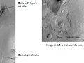
Tikonravev Crater floor in Arabia quadrangle, as seen by Mars Global Surveyor. Click on image to see dark slope streaks and layers.
-
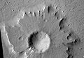
Pedestal crater in Amazonis quadrangle with dark streaks, as seen by HiRISE.
-

Nicholson crater mound with dark streaks, as seen by HiRISE.
-
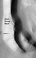
Tharsis Tholus block in the Tharsis quadrangle, as seen by HiRISE. Block probably tumbled down Tharsis Tholus which is just off to the right.
-

Ceraunius Fossae in Tharsis quadrangle, as seen by HiRISE.
-

Dark streaks in Diacria quadrangle, as seen by Mars Global Surveyor.
Dust devil tracks
Many areas on Mars experience the passage of giant dust devils. A thin coating of fine bright dust covers most of the Martian surface. When a dust devil travels by, it blows away the coating and exposes the underlying dark surface. These dust devils have been seen both from the ground and from orbit. They have even blown the dust off the solar panels of the two Rovers on Mars, thereby greatly extending their lives.[200] The twin Rovers were designed to last for 3 months; instead, they have lasted six years and are still going. The pattern of the tracks have been shown to change every few months.[201]
-
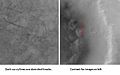
Kepler (Martian crater) showing dust devil tracks, as seen by Mars Global Surveyor.
-
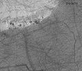
Pattern of large and small tracks made by giant dust devils.
-
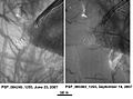
Russell Crater Dust Devil Changes in Noachis quadrangle, as seen by HiRISE. Click on image to see changes in dust devil tracks in just 3 months.
Sand dunes
Many locations on Mars have sand dunes. An erg (or sand sea), made up of aeolian dune fields referred to as the Circumpolar Dune Field[202] surrounds most of the north polar cap.[203] The dunes are covered by a seasonal carbon dioxide frost that forms in early autumn and remains until late spring.[203] Many martian dunes strongly resemble terrestrial dunes but images acquired by the High-Resolution Imaging Science Experiment on the Mars Reconnaissance Orbiter have shown that martian dunes in the north polar region are subject to modification via grainflow triggered by seasonal CO2 sublimation, a process not seen on Earth.[204] Many dunes are black because they are derived from the dark volcanic rock basalt. Extraterrestrial sand seas such as those found on Mars are referred to as "undae" from the Latin for waves.
-

Dark dunes (probably basalt) which form a dark spot in Noachis. Picture from Mars Global Surveyor.
-
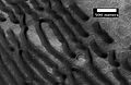
Wide view of dunes in Noachis, as seen by HiRISE.
-
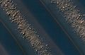
Close-up View of dunes in previous image, as seen by HiRISE. Note how sand barely covers some boulders.
-
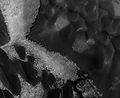
Rabe Crater Floor, as seen by HiRISE. Click on image to see layers. Dark sand that made the dunes was probably blown in from elsewhere.
-
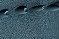
Barchan sand dunes in the Hellespontus region, as seen by HiRISE. The horns point in the downwind direction.
-

Proctor Crater Ripples and Dunes, as seen by HiRISE.
Medusae Fossae Formation
The Medusae Fossae Formation is a soft, easily eroded deposit that extends for nearly 1,000 km along the equator of Mars. Sometimes the formation appears as a smooth and gently undulating surface; however, in places it is wind-sculpted into ridges and grooves.[205] Radar imaging has suggested that the region may contain either extremely porous rock (for example volcanic ash) or deep layers of glacier-like ice deposits amounting to about the same quantity as is stored in Mars' south polar cap.[206][207]
The lower portion (member) of Medusae Fossae Formation contains many patterns and shapes that are thought to be the remains of streams. It is believed that streams formed valleys that were filled and became resistant to erosion by cementaion of minerals or by the gathering of a coarse covering layer. These inverted stream beds are sometimes called sinuous ridges or raised curvilinear features. They may be a kilometer or so in length. Their height ranges from a meter to greater than 10 meters, while the width of the narrow ones is less than 10 meters.[76][208]
The wind has eroded the surface of the formation into a series of linear ridges called yardangs. These ridges generally point in the direction of the prevailing winds that carved them and demonstrate the erosive power of martian winds. The easily eroded nature of the Medusae Fossae Formation suggests that it is composed of weakly cemented particles, and was most likely formed by the deposition of wind-blown dust or volcanic ash. Layers are seen in parts of the formation. A resistant caprock on the top of yardangs has been observed in Viking,[209] Mars Global Surveyor,[210] and HiRISE photos.[211] Very few impact craters are visible throughout the area so the surface is relatively young.[212]
-
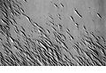
Medusae Fossae Formation as seen with Mars Odyssey's THEMIS. Notice elongated formations called yardangs.
-
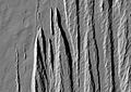
Medusae Fossae Formation as seen with HiRISE. Image is located in the Aeolis quadrangle.
-
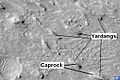
Yardangs in Medusae Fossae Formation with caprock labeled, as seen by HiRISE. Location is Aeolis quadrangle.
-
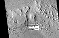
Layers in lower member of Medusae Fossae Formation, as seen by HiRISE. Location is Aeolis quadrangle.
Fretted terrain
Fretted terrain is a type of surface feature common to certain areas of Mars and discovered in Mariner 9 images. It lies between two different surfaces. The surface of Mars can be divided into two parts: low, young, uncratered plains that cover most of the northern hemisphere, and high-standing, old, heavily cratered areas that cover the southern hemisphere and a small part of the northern hemisphere. Between these two zones is the fretted terrain, containing a complicated mix of cliffs, mesas, buttes, and straight-walled and sinuous canyons. Fretted terrain contains smooth, flat lowlands along with steep cliffs. The scarps or cliffs are usually 1 to 2 km high. Channels in the area have wide, flat floors and steep walls.[9] Fretted terrain is most common in northern Arabia, between latitudes 30°N and 50°N and longitudes 270°W and 360°W.[213] Parts of the fretted terrain are called Deuteronilus Mensae and Protonilus Mensae.
In fretted terrain, the land seems to transition from narrow straight valleys to isolated mesas. Most of the mesas are surrounded by forms that have been called a variety of names (circum-mesa aprons, debris aprons, rock glaciers, and Lobate Debris Aprons).[214] At first they appeared to resemble rock glaciers on Earth, but scientists could not be sure. Eventually, proof of their true nature was discovered by radar studies with the Mars Reconnaissance Orbiter and showed that they contain pure water ice covered with a thin layer of rocks that insulated the ice.[174][177][178][189][215][216]
Besides rock covered glaciers around mesas, the region has many steep-walled valleys with lineations—ridges and grooves—on their floors. The material comprising these valley floors is called lineated valley fill. In some of the best images taken by the Viking Orbiters, some of the valley fill appeared to resemble alpine glaciers on Earth. Given this similarity, some scientists assumed that the lineations on these valley floors might have formed by flow of ice in (and perhaps through) these canyons and valleys. Today, it is generally agreed that glacial flow caused the lineations.
-

Fretted terrain of Ismenius Lacus showing flat floored valleys and cliffs. Photo taken with Mars Orbiter Camera (MOC)on the Mars Global Surveyor.
-
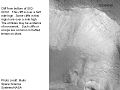
Enlargement of the photo on the left showing cliff. Photo taken with high resolution camera of Mars Global Surveyor (MGS).
-

Lobate Debris Apron in Phlegra Montes, as seen by HiRISE. The debris apron is probably mostly ice with a thin covering of rock debris, so it could be a source of water for future Martian colonists. Image from the Cebrenia quadrangle. Scale bar is 500 meters long.
-
Reull Vallis with lineated floor deposits, as seen by THEMIS. Image located in Hellas quadrangle. Click on image to see relationship to other features.
-
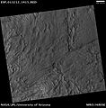
Fretted Terrain near Reull Vallis, as seen by HiRISE.
-
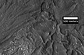
Close-up of Fretted Terrain near Reull Vallis, as seen by HiRISE. This area would be a challenge to walk across.
Chaos terrain
Chaos terrain is believed to be associated with the release of huge amounts of water. The chaotic features may have collapsed when water came out of the surface. Martian outflow channels commonly begin with a Chaos region. A chaotic region can be recognized by a tangle of mesas, buttes, and hills, all chopped through with valleys which in places look almost patterned. Some parts of this chaotic area have not collapsed completely—they are still formed into large mesas, so they may still contain water ice.[217] Chaotic terrain occurs in numerous locations on Mars, and always gives the strong impression that something abruptly disturbed the ground. Chaos regions formed long ago. By counting craters (more craters in any given area means an older surface) and by studying the valleys' relations with other geological features, scientists have concluded the channels formed 2.0 to 3.8 billion years ago.[218]
-

Huge canyons in Aureum Chaos, as seen by THEMIS. Gullies are rare at this latitude. Image from Margaritifer Sinus quadrangle.
-
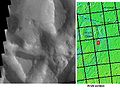
Iani Chaos, as seen by THEMIS. Sand from eroding mesas is covering brighter floor material. Click on image to see relationship of Iani Chaos to other local features. Image from Margaritifer Sinus quadrangle.
-

Erosion in Aram Chaos, as seen by THEMIS. Image in Oxia Palus quadrangle.
-
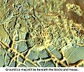
Blocks in Aram showing possible source of water, as seen by THEMIS. Image in Oxia Palus quadrangle.
-
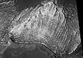
Light colored layers in Eos Chaos, as seen by HiRISE.
-

Gorgonum Chaos as seen by Mars Reconnaisance Orbiter HiRISE. Image is 4 km wide. Image in Phaethontis quadrangle.
-

Ister Chaos, as seen by HiRISE.
-

Close-up of Ister Chaos, as seen by HiRISE.
-
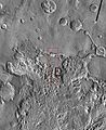
THEMIS image of wide view of following HiRISE images. Black box shows approximate location of HiRISE images. This image is just a part of the vast area known as Aureum Chaos. Click on image to see more details.
-
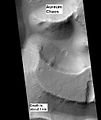
Aureum Chaos, as seen by HiRISE, under the HiWish program.
-

Close up view of previous image, as seen by HiRISE under HiWish program. Small round dots are boulders.
Scalloped topography
Scalloped topography is common in the mid-latitudes of Mars, between 45° and 60° north and south. It is particularly prominent in the region of Utopia Planitia[219][220] in the northern hemisphere and in the region of Peneus and Amphitrites Patera[221][222] in the southern hemisphere. Such topography consists of shallow, rimless depressions with scalloped edges, commonly referred to as "scalloped depressions" or simply "scallops". Scalloped depressions can be isolated or clustered and sometimes seem to coalesce. A typical scalloped depression displays a gentle equator-facing slope and a steeper pole-facing scarp. This topographic asymmetry is probably due to differences in insolation. Scalloped depressions are believed to form from the removal of subsurface material, possibly interstitial ice, by sublimation. This process may still be happening at present.[223]
-
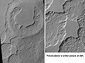
Scalloped Terrain at Peneus Patera, as seen by HiRISE. Scalloped terrain is quite common in some areas of Mars. Image is from the Noachis quadrangle.
-

Periglacial Forms in Utopia, as seen by HiRISE. Click on image to see patterned ground and Scalloped Topography. Image in Casius quadrangle.
-
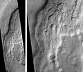
Mad Vallis, as seen by HiRISE. Picture on right is an enlargement of part of the other picture. Click on image to see scalloped terrain. Image in Hellas quadrangle.
-
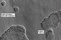
Stages in scallop formation, as seen by HiRISE. Location is Hellas quadrangle.
Interesting geological features
Avalanches
On February 19, 2008, a geologic event was captured by the HiRISE camera on the Mars Reconnaissance Orbiter. Images which captured a spectacular avalanche thought to be fine grained ice, dust, and large blocks are shown to have fallen from a 2,300-foot (700 m) high cliff. Evidence of the avalanche are shown by the dust clouds rising from the cliff afterwards.[224] Such geological events are theorized to be the cause of geologic patterns known as slope streaks.
-
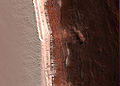
Image of the February 19, 2008 Mars avalanche captured by the Mars Reconnaissance Orbiter.
-
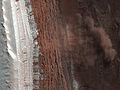
Closer shot of the avalanche.
-
Dust clouds rise above the 2,300-foot (700 m) deep cliff.
-
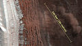
A photo with scale demonstrates the size of the avalanche.
Possible Caves
NASA scientists studying pictures from the Odyssey spacecraft have spotted what might be seven caves on the flanks of the Arsia Mons volcano on Mars. The pit entrances measure from 100 to 252 metres (330 to 827 ft) wide and they are believed to be at least 73 to 96 metres (240 to 315 ft) deep. See image below: the pits have been informally named (A) Dena, (B) Chloe, (C) Wendy, (D) Annie, (E) Abby (left) and Nikki, and (F) Jeanne. Because light did not reach the floor of most of the pits, it is likely that they extend much deeper than these lower estimates.[citation needed] Dena's floor was observed and found to be 130m deep.[225] Further investigation suggested that these were not necessarily lava tube "skylights".[226] Review of the images has resulted in yet more discoveries of deep pits.[227]
-

A cave on Mars ("Jeanne") as seen by the Mars Reconnaissance Orbiter.
-
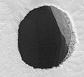
HiRISE closeup of Jeanne showing afternoon illumination of the east wall of the shaft.
-
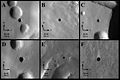
THEMIS image of cave entrances on Mars.
It has been suggested that human explorers on Mars could use lava tubes as shelters. The caves may be the only natural structures offering protection from the micrometeoroids, UV radiation, solar flares, and high energy particles that bombard the planet's surface.[228]
Inverted relief
Some areas of Mars show inverted relief, where features that were once depressions, like streams, are now above the surface. It is believed that materials like large rocks were deposited in low-lying areas. Later, wind erosion removed much of the surface layers, but left behind the more resistant deposits. Other ways of making inverted relief might be lava flowing down a stream bed or materials being cemented by minerals dissolved in water. On Earth, materials cemented by silica are highly resistant to all kinds of erosional forces. Examples of inverted channels on Earth are found in the Cedar Mountain Formation near Green River, Utah. Inverted relief in the shape of streams are further evidence of water flowing on the Martian surface in past times.[229] Inverted relief in the form of stream channels suggest that the climate was different—much wetter—when the inverted channels were formed.
In an article published in January 2010, a large group of scientists endorsed the idea of searching for life in Miyamoto Crater because of inverted stream channels and minerals that indicated the past presence of water.[76][76][230]
Images of other examples of inverted terrain are shown below from various parts of Mars.
-

Inverted Streams near Juventae Chasma, as seen by Mars Global Surveyor. These streams begin at the top of a ridge then run together.
-
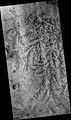
Inverted Channel with many branches in Syrtis Major quadrangle.
-
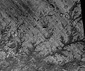
Inverted Stream Channels in Antoniadi Crater, as seen by HiRISE. Image in Syrtis Major quadrangle.
-

Inverted Channel in Miyamoto Crater, as seen by HiRISE. Image is located in Margaritifer Sinus quadrangle. The scale bar is 500 meters long.
See also
- Dark dune spots
- Seasonal flows on warm martian slopes
- Elysium Planitia
- Geography of Mars
- Hecates Tholus
- Glaciers on Mars
References
- ^ Yeomans, Donald K. (2006-07-13). "HORIZONS System". NASA JPL. http://ssd.jpl.nasa.gov/?horizons. Retrieved 2007-08-08. — At the site, go to the "web interface" then select "Ephemeris Type: ELEMENTS", "Target Body: Mars" and "Center: Sun".
- ^ a b Seidelmann, P. Kenneth; Archinal, B. A.; A’hearn, M. F.; et al. (2007). "Report of the IAU/IAGWorking Group on cartographic coordinates and rotational elements: 2006". Celestial Mechanics and Dynamical Astronomy 90 (3): 155–180. Bibcode 2007CeMDA..98..155S. doi:10.1007/s10569-007-9072-y. http://adsabs.harvard.edu/doi/10.1007/s10569-007-9072-y. Retrieved 2007-08-28.
- ^ a b "Mars: Facts & Figures". NASA. http://solarsystem.jpl.nasa.gov/planets/profile.cfm?Object=Mars&Display=Facts&System=Metric. Retrieved 2007-03-06.
- ^ a b c David R. Williams (September 1, 2004). "Mars Fact Sheet". National Space Science Data Center. NASA. http://nssdc.gsfc.nasa.gov/planetary/factsheet/marsfact.html. Retrieved 2006-06-24.
- ^ Greeley, Ronald (1993). Planetary landscapes (2nd ed.). New York: Chapman & Hall. p. 1. ISBN 0-412-05181-8.
- ^ Quinion, M. (1996). World Wide Words Website, http://www.worldwidewords.org/turnsofphrase/tp-are1.htm.
- ^ Carr, M.H., USGS, Personal Communication, September 13, 2010.
- ^ a b Nimmo, Francis; Tanaka, Ken (2005). "Early Crustal Evolution Of Mars". Annual Review of Earth and Planetary Sciences 33 (1): 133. Bibcode 2005AREPS..33..133N. doi:10.1146/annurev.earth.33.092203.122637. http://www2.ess.ucla.edu/~nimmo/website/version3.doc.
- ^ a b c d e Kieffer, H.H.; Jakosky, B.M.; Snyder, C.W. et al., eds (1992). Mars. Tucson: University of Arizona Press. p. [page needed]. ISBN 978-0-8165-1257-7.
- ^ Press, F.; Siever, R. (1978). Earth, 2nd ed.; W.H. Freeman: San Francisco, p. 343.
- ^ Clark, BC; Baird, AK; Rose Jr, HJ; Toulmin P, 3rd; Keil, K; Castro, AJ; Kelliher, WC; Rowe, CD et al. (1976). "Inorganic Analysis of Martian Samples at the Viking Landing Sites". Science 194 (4271): 1283–1288. Bibcode 1976Sci...194.1283C. doi:10.1126/science.194.4271.1283. PMID 17797084.
- ^ Foley, C.N. et al. (2008). Martian Surface Chemistry: APXS Results from the Pathfinder Landing Site, in The Martian Surface: Composition, Mineralogy, and Physical Properties, J.F. Bell III, Ed. Cambridge University Press: Cambridge, UK, pp. 42-43, Table 3.1.
- ^ See http://www.britannica.com/EBchecked/topic/2917/accessory-mineral for definition.
- ^ Klein, H.P. et al. (1992). "The Search for Extant Life on Mars". In Kieffer, H.H.; Jakosky, B.M.; Snyder, C.W. et al.. Mars. Tucson: University of Arizona Press. p. 1227. ISBN 978-0-8165-1257-7.
- ^ Krasnopolsky, V; Maillard, J; Owen, T (2004). "Detection of methane in the martian atmosphere: evidence for life?" (PDF). Icarus 172 (2): 537–547. Bibcode 2004Icar..172..537K. doi:10.1016/j.icarus.2004.07.004. http://www.stfc.ac.uk/resources/pdf/methaneonmars-krasnopolskyetal.pdf.
- ^ Formisano, V.; Atreya, S; Encrenaz, T; Ignatiev, N; Giuranna, M (2004). "Detection of Methane in the Atmosphere of Mars". Science 306 (5702): 1758–61. Bibcode 2004Sci...306.1758F. doi:10.1126/science.1101732. PMID 15514118.
- ^ Barlow, N.G. (2008). Mars: An Introduction to Its Interior, Surface, and Atmosphere. Cambridge, UK: Cambridge University Press. p. 42. ISBN 978-0-521-85226-5.
- ^ Halliday, A.N. et al. (2001). The Accretion, Composition and Early Differentiation of Mars. In Chronology and Evolution of Mars, Kallenbach, R. et al. Eds., Space Science Reviews, 96: pp. 197–230.
- ^ Treiman, A; Drake, M; Janssens, M; Wolf, R; Ebihara, M (1986). "Core Formation in the Earth and the Shergottite Parent Body". Geochimica et Cosmochimica Acta 50 (6): 1071–1091. Bibcode 1986GeCoA..50.1071T. doi:10.1016/0016-7037(86)90389-3.
- ^ See Bruckner, J. et al. (2008) Mars Exploration Rovers: Chemical Composition by the APX, in The Martian Surface: Composition, Mineralogy, and Physical Properties, J.F. Bell III, Ed.; Cambridge University Press: Cambridge, UK, p. 58 for example.
- ^ Watters, Thomas R.; McGovern, Patrick J.; Irwin Iii, Rossman P. (2007). "Hemispheres Apart: The Crustal Dichotomy on Mars" (PDF). Annu. Rev. Earth Planet. Sci. 35 (1): 621–652 [624, 626]. Bibcode 2007AREPS..35..621W. doi:10.1146/annurev.earth.35.031306.140220. http://epswww.unm.edu/iom/eps465/Reading/Dichotomy.pdf.
- ^ Carr 2006, pp. 78–79
- ^ Zuber, M. T.; Solomon, SC; Phillips, RJ; Smith, DE; Tyler, GL; Aharonson, O; Balmino, G; Banerdt, WB et al. (2000). "Internal Structure and Early Thermal Evolution of Mars from Mars Global Surveyor Topography and Gravity". Science 287 (5459): 1788–93. Bibcode 2000Sci...287.1788Z. doi:10.1126/science.287.5459.1788. PMID 10710301.
- ^ Neumann, G. A. (2004). "Crustal structure of Mars from gravity and topography". Journal of Geophysical Research 109 (E8). Bibcode 2004JGRE..10908002N. doi:10.1029/2004JE002262.
- ^ Wilhelms, D.E.; Squyres, S.W. (1984). "The Martian Hemispheric Dichotomy May Be Due to a Giant Impact". Nature 309 (5964): 138–140. Bibcode 1984Natur.309..138W. doi:10.1038/309138a0.
- ^ Frey, Herbert; Schultz, Richard A. (1988). "Large impact basins and the mega‐impact origin for the crustal dichotomy on Mars". Geophysical Research Letters 15 (3): 229–232. Bibcode 1988GeoRL..15..229F. doi:10.1029/GL015i003p00229.
- ^ Andrews-Hanna, J.C. et al. (2008). "The Borealis Basin and the Origin of the Martian Crustal Dichotomy". Nature 453 (7199): 1212. Bibcode 2008Natur.453.1212A. doi:10.1038/nature07011. PMID 18580944.
- ^ Wise, Donald U.; Golombek, Matthew P.; McGill, George E. (1979). "Tectonic Evolution of Mars". Journal of Geophysical Research 84 (B14): 7934–7939. Bibcode 1979JGR....84.7934W. doi:10.1029/JB084iB14p07934.
- ^ Elkins-Tanton, Linda T. (2005). "Possible formation of ancient crust on Mars through magma ocean processes" (PDF). Journal of Geophysical Research 110 (E12): E120S01. Bibcode 2005JGRE..11012S01E. doi:10.1029/2005JE002480. http://eaps.mit.edu/Elkins-Tanton/pdfs_of_papers/Mars%20early%20crust%20E-T%20et%20al%20JGR%202005.pdf.
- ^ Sleep, Norman H. (1994). "Martian plate tectonics". Journal of Geophysical Research 99 (E3): 5639–5655. Bibcode 1994JGR....99.5639S. doi:10.1029/94JE00216.
- ^ Watters, T.R.; McGovern; Irwin, R.P. (2007). "Hemispheres Apart: The Crustal Dichotomy on Mars". Annu. Rev. Earth Planet. Sci. 35: 630–635.
- ^ Solomon, S. C.; Aharonson, O; Aurnou, JM; Banerdt, WB; Carr, MH; Dombard, AJ; Frey, HV; Golombek, MP et al. (2005). "New Perspectives on Ancient Mars". Science 307 (5713): 1214–20. Bibcode 2005Sci...307.1214S. doi:10.1126/science.1101812. PMID 15731435.
- ^ Solomon, Sean C.; Head, James W. (1982). "Evolution of the Tharsis Province of Mars: The Importance of Heterogeneous Lithospheric Thickness and Volcanic Construction". J. Geophys. Res. 87 (B12): 9755–9774. Bibcode 1982JGR....87.9755S. doi:10.1029/JB087iB12p09755.
- ^ Carr, M.H (2007). Mars: Surface and Interior in Encyclopedia of the Solar System, 2nd ed., McFadden, L.-A. et al. Eds. Elsevier: San Diego, CA, p.319
- ^ Cattermole, Peter John (2001). Mars: the mystery unfolds. Oxford: Oxford University Press. p. 71. ISBN 0-19-521726-8.
- ^ Boyce, J.M. (2008) The Smithsonian Book of Mars; Konecky&Konecky: Old Saybrook, CT, p. 13.
- ^ Carr, M.H.; Saunders, R.S.; Strom R.G. (1984). Geology of the Terrestrial Planets; NASA Scientific and Technical Information Branch: Washington DC, 1984, p. 223. http://www.lpi.usra.edu/publications/books/geologyTerraPlanets/
- ^ Hartmann 2003, pp. 70–73
- ^ Kargel, J.S.; Strom, R.G. (1992). "Ancient Glaciation on Mars". Geology 20 (1): 3–7. Bibcode 1992Geo....20....3K. doi:10.1130/0091-7613(1992)020<0003:AGOM>2.3.CO;2.
- ^ Kargel, J.S. (2004) Mars: A Warmer Wetter Planet; Springer-Praxis: London, p. 52.
- ^ Carr 2006, p. 95
- ^ Hartmann 2003, p. 316
- ^ Carr 2006, p. 114
- ^ Baker, Victor R. (2001). "Water and the Martian Landscape" (PDF). Nature 412 (6843): 231. doi:10.1038/35084172. http://epswww.unm.edu/iom/eps465/Reading/WaterLandscape.pdf.
- ^ Sheehan, W. (1996). The Planet Mars: A History of Observation & Discovery; University of Arizona Press: Tucson, p. 25. http://www.uapress.arizona.edu/onlinebks/mars/contents.htm.
- ^ Leighton, R.B.; Murray, B.C. (1966). "Behavior of Carbon Dioxide and Other Volatiles on Mars". Science 153 (3732): 136–144. Bibcode 1966Sci...153..136L. doi:10.1126/science.153.3732.136. PMID 17831495.
- ^ See Mutch, T.A. (1970). Geology of the Moon: A Stratigraphic View; Princeton University Press: Princeton, NJ, 324 pp. and Wilhelms, D.E. (1987). The Geologic History of the Moon, USGS Professional Paper 1348; http://ser.sese.asu.edu/GHM/ for reviews of this topic.
- ^ Scott, D. H.; Carr, M.H. (1978) Geologic Map of Mars, Misc. Invest. Set. Map 1-1083; USGS: Reston, Va.
- ^ Neukum, G.; Wise, D.U. (1976). "Mars: A Standard Crater Curve and Possible New Time Scale". Science 194 (4272): 1381–1387. Bibcode 1976Sci...194.1381N. doi:10.1126/science.194.4272.1381. PMID 17819264.
- ^ Neukum, G.; Hiller, K. (1981). "Martian ages". J. Geophys. Res. 86 (B4): 3097–3121. Bibcode 1981JGR....86.3097N. doi:10.1029/JB086iB04p03097.
- ^ Hartmann, W.K.; Neukum, G. (2001). Cratering Chronology and Evolution of Mars. In Chronology and Evolution of Mars, Kallenbach, R. et al. Eds., Space Science Reviews, 96: pp. 105–164.
- ^ Hartmann, W.K. (2005). "Martian Cratering 8: Isochron Refinement and the Chronology of Mars". Icarus 174 (2): 294. Bibcode 2005Icar..174..294H. doi:10.1016/j.icarus.2004.11.023.
- ^ Hartmann, W.K. (2007). "Martian cratering 9: Toward Resolution of the Controversy about Small Craters". Icarus 189 (1): 274–278. Bibcode 2007Icar..189..274H. doi:10.1016/j.icarus.2007.02.011.
- ^ Hartmann 2003, p. 35
- ^ Carr 2006, p. 40
- ^ Tanaka, K.L. (1986). The Stratigraphy of Mars. J. Geophys. Res., Seventeenth Lunar and Planetary Science Conference Part 1, 91(B13), E139–E158.
- ^ Caplinger, Mike. "Determining the age of surfaces on Mars". Archived from the original on February 19, 2007. http://web.archive.org/web/20070219192450/http%3A//www.msss.com/http/ps/age2.html. Retrieved 2007-03-02.
- ^ Carr, M.H.; Head, J.W. (2010). "Geologic History of Mars". Earth Planet. Sci. Lett. 294: 185–203. Bibcode 2010E&PSL.294..185C. doi:10.1016/j.epsl.2009.06.042.
- ^ Fuller, Elizabeth R. (2002). "Amazonis Planitia: The role of geologically recent volcanism and sedimentation in the formation of the smoothest plains on Mars" (PDF). Journal of Geophysical Research 107 (E10). Bibcode 2002JGRE..107.5081F. doi:10.1029/2002JE001842. http://www.planetary.brown.edu/pdfs/2682.pdf.
- ^ Hartmann 2003, p. 34
- ^ Williams, Chris. "Probe reveals three ages of Mars". http://www.theregister.co.uk/2006/04/21/three_mars_eras/. Retrieved 2007-03-02.
- ^ Bibring, Jean-Pierre; Langevin, Y; Mustard, JF; Poulet, F; Arvidson, R; Gendrin, A; Gondet, B; Mangold, N et al. (2006). "Global Mineralogical and Aqueous Mars History Derived from OMEGA/Mars Express Data". Science 312 (5772): 400–404. Bibcode 2006Sci...312..400B. doi:10.1126/science.1122659. PMID 16627738.
- ^ Carr 2006, p. 1
- ^ Arvidson, Raymond E.; Guinness, Edward A.; Dale-Bannister, Mary A.; Adams, John; Smith, Milton; Christensen, Philip R.; Singer, Robert B. (1989). "Nature and Distribution of Surficial Deposits in Chryse Planitia and Vicinity, Mars". J. Geophys. Res. 94 (B2): 1573–1587. Bibcode 1989JGR....94.1573A. doi:10.1029/JB094iB02p01573.
- ^ McSween, Harry Y. (1985). "SNC Meteorites: Clues to Martian Petrologic Evolution?". Reviews of Geophysics 23 (4): 391–416. Bibcode 1985RvGeo..23..391M. doi:10.1029/RG023i004p00391.
- ^ Linda M.V. Martel. "Pretty Green Mineral -- Pretty Dry Mars?". psrd.hawaii.edu. http://www.psrd.hawaii.edu/Nov03/olivine.html. Retrieved 2007-02-23.
- ^ Soderblom, L.A.; Bell, J.F. (2008). Exploration of the Martian Surface: 1992–2007, in The Martian Surface: Composition, Mineralogy, and Physical Properties, J.F. Bell III, Ed. Cambridge University Press: Cambridge, UK, p. 11.
- ^ Christensen, P.R. et al. (2008) Global Mineralogy Mapped from the Mars Global Surveyor Thermal Emission Spectrometer, in The Martian Surface: Composition, Mineralogy, and Physical Properties, J. Bell, Ed.; Cambridge University Press: Cambridge, UK., p. 197.
- ^ Bandfield, J. L. (2000). "A Global View of Martian Surface Compositions from MGS-TES". Science 287 (5458): 1626. Bibcode 2000Sci...287.1626B. doi:10.1126/science.287.5458.1626.
- ^ Wyatt, M.B.; McSween Jr, H.Y. (2002). "Spectral Evidence for Weathered Basalt as an Alternative to Andesite in the Northern Lowlands of Mars". Nature 417 (6886): 263. doi:10.1038/417263a. PMID 12015596.
- ^ Bandfield, Joshua L. (2004). "Identification of quartzofeldspathic materials on Mars". Journal of Geophysical Research 109 (E10). Bibcode 2004JGRE..10910009B. doi:10.1029/2004JE002290.
- ^ Peplow, Mark (2004-05-06). "How Mars got its rust". Nature. doi:10.1038/news040503-6. http://www.nature.com/news/2004/040503/full/news040503-6.html. Retrieved 2006-04-18.
- ^ "NASA Mars Page". Volcanology of Mars. Archived from the original on September 29, 2006. http://web.archive.org/web/20060929042954/http%3A//erc.arc.nasa.gov/MarsVolc/basalt.htm. Retrieved June 13, 2006.
- ^ Carr 2006, p. 231
- ^ Weitz, C.M.; Milliken, R.E.; Grant, J.A.; McEwen, A.S.; Williams, R.M.E.; Bishop, J.L.; Thomson, B.J. (2010). "Mars Reconnaissance Orbiter observations of light-toned layered deposits and associated fluvial landforms on the plateus adjacent to Valles Marineris". Icarus 205 (1): 73–102. Bibcode 2010Icar..205...73W. doi:10.1016/j.icarus.2009.04.017.
- ^ a b c d www.sciencedirect.com/science/journal/00191035
- ^ Farmer, Jack D.; Des Marais, David J. (1999). "Exploring for a record of ancient Martian life" (PDF). Journal of Geophysical Letters 104 (E11): 26977–95. Bibcode 1999JGR...10426977F. doi:10.1029/1998JE000540. http://jfarmer.asu.edu/pubs/pdfs/martianlife.pdf.
- ^ Murchie, S.; Mustard, John F.; Ehlmann, Bethany L.; Milliken, Ralph E.; Bishop, Janice L.; McKeown, Nancy K.; Noe Dobrea, Eldar Z.; Seelos, Frank P. et al. (2009). "A synthesis of Martian aqueous mineralogy after 1 Mars year of observations from the Mars Reconnaissance Orbiter" (PDF). Journal of Geophysical Research 114: E00D06. Bibcode 2009JGRE..11400D06M. doi:10.1029/2009JE003342. http://www.planetary.brown.edu/pdfs/3964.pdf.
- ^ Squyres, S.; Grotzinger, JP; Arvidson, RE; Bell Jf, 3rd; Calvin, W; Christensen, PR; Clark, BC; Crisp, JA et al. (2004). "In Situ Evidence for an Ancient Aqueous Environment at Meridiani Planum, Mars". Science 306 (5702): 1709–1714. Bibcode 2004Sci...306.1709S. doi:10.1126/science.1104559. PMID 15576604.
- ^ Squyres, S. W.; Arvidson, R. E.; Ruff, S.; Gellert, R.; Morris, R. V.; Ming, D. W.; Crumpler, L.; Farmer, J. D. et al. (2008). "Detection of Silica-Rich Deposits on Mars". Science 320 (5879): 1063–1067. Bibcode 2008Sci...320.1063S. doi:10.1126/science.1155429. PMID 18497295.
- ^ Grotzinger, J.P.; Arvidson, R.E.; Bell Iii, J.F.; Calvin, W.; Clark, B.C.; Fike, D.A.; Golombek, M.; Greeley, R. et al. (2005). "Stratigraphy and Sedimentology of a Dry to Wet Eolian Depositional System, Burns formation, Meridiani Planum, Mars". Earth, Planet. Sci. Lett. 240 (1): 11–72. Bibcode 2005E&PSL.240...11G. doi:10.1016/j.epsl.2005.09.039.
- ^ Boynton, WV; Ming, DW; Kounaves, SP; Young, SM; Arvidson, RE; Hecht, MH; Hoffman, J; Niles, PB et al. (2009). "Evidence for Calcium Carbonate at the Mars Phoenix Landing Site". Science 325 (5936): 61–64. Bibcode 2009Sci...325...61B. doi:10.1126/science.1172768. PMID 19574384.
- ^ Morris, RV; Ruff, SW; Gellert, R; Ming, DW; Arvidson, RE; Clark, BC; Golden, DC; Siebach, K et al. (2010). "Identification of carbonate-rich outcrops on Mars by the Spirit rover" (PDF). Science 329 (5990): 421–4. Bibcode 2010Sci...329..421M. doi:10.1126/science.1189667. PMID 20522738. http://sciences.blogs.liberation.fr/files/carbonates-mars-spirit.pdf.
- ^ Leighton, R.B.; Murray, B.C.; Sharp, R.P.; Allen, J.D.; Sloan, R.K. (1965). "Mariner IV Photography of Mars: Initial Results". Science 149 (3684): 627–630. Bibcode 1965Sci...149..627L. doi:10.1126/science.149.3684.627. PMID 17747569.
- ^ Leighton, R.B.; Horowitz, NH; Murray, BC; Sharp, RP; Herriman, AH; Young, AT; Smith, BA; Davies, ME et al. (1969). "Mariner 6 and 7 Television Pictures: Preliminary Analysis". Science 166 (3901): 49–67. Bibcode 1969Sci...166...49L. doi:10.1126/science.166.3901.49. PMID 17769751.
- ^ Pike, R.J. (1980). "Formation of Complex Impact Craters: Evidence from Mars and Other Planets". Icarus 43 (1): 1–19 [5]. Bibcode 1980Icar...43....1P. doi:10.1016/0019-1035(80)90083-4.
- ^ Carr 2006, pp. 24–27
- ^ Strom, R.G.; Croft, S.K.; Barlow, N.G. (1992). "The Martian Impact Cratering Record". In Kieffer, H.H.; Jakosky, B.M.; Snyder, C.W. et al.. Mars. Tucson: University of Arizona Press. pp. 384–385. ISBN 978-0-8165-1257-7.
- ^ Barlow, N.G. (1988). "Crater Size-Frequency Distributions and a Revised Martian Relative Chronology". Icarus 75 (2): 285–305. Bibcode 1988Icar...75..285B. doi:10.1016/0019-1035(88)90006-1.
- ^ Hale, W.S.; Head, J.W. (1981). Lunar Planet. Sci. XII, pp. 386-388. (abstract 1135). http://www.lpi.usra.edu/meetings/lpsc1981/pdf/1135.pdf
- ^ Strom, R.G.; Croft, S.K.; Barlow, N.G. (1992). "The Martian Impact Cratering Record". In Kieffer, H.H.; Jakosky, B.M.; Snyder, C.W. et al.. Mars. Tucson: University of Arizona Press. pp. 386–390. ISBN 978-0-8165-1257-7.
- ^ Walter S. Kiefer (2004). "Maximum Impact - Impact Craters in the Solar System". NASA Solar System Exploration. http://sse.jpl.nasa.gov/scitech/display.cfm?ST_ID=25. Retrieved 2007-05-14.
- ^ Hartmann 2003, pp. 99–100
- ^ "Viking Orbiter Views Of Mars". NASA. http://history.nasa.gov/SP-441/ch7.htm. Retrieved 2007-03-16.
- ^ Boyce, J.M. The Smithsonian Book of Mars; Konecky&Konecky: Old Saybrook, CT, 2008, p. 203.
- ^ Barlow, N.G.; Boyce, Joseph M.; Costard, Francois M.; Craddock, Robert A.; Garvin, James B.; Sakimoto, Susan E. H.; Kuzmin, Ruslan O.; Roddy, David J. et al. (2000). "Standardizing the Nomenclature of Martian Impact Crater Ejecta Morphologies". J. Geophys. Res. 105 (E11): 26,733–8. Bibcode 2000JGR...10526733B. doi:10.1029/2000JE001258. http://hdl.handle.net/10088/3221.
- ^ Nadine Barlow. "Stones, Wind and Ice". Lunar and Planetary Institute. http://www.lpi.usra.edu/publications/slidesets/stones/. Retrieved 2007-03-15.
- ^ http://hirise.lpl.eduPSP_008508_1870
- ^ Bleacher, J. and S. Sakimoto. Pedestal Craters, A Tool For Interpreting Geological Histories and Estimating Erosion Rates. LPSC
- ^ http://themis.asu.edu/feature_utopiacraters
- ^ Cattermole, P.J. (2001) Mars: the Mystery Unfolds; Oxford University Press: New York, p. 72.
- ^ Carr 2006, p. 43
- ^ Boyce, J.M. (2008) The Smithsonian Book of Mars; Konecky&Konecky: Old Saybrook, CT, p. 104.
- ^ Carr 2006, p. 54
- ^ Cattermole, P.J. (2001) Mars: the Mystery Unfolds; Oxford University Press: New York, p. 84.
- ^ Barlow, N.G. (2008). Mars: An Introduction to Its Interior, Surface, and Atmosphere. Cambridge, UK: Cambridge University Press. p. 129. ISBN 978-0-521-85226-5.
- ^ Mouginis-Mark, P.J.; Wilson, L.; Zimbelman, J. R. (1988). "Polygenic Eruptions on Alba Patera, Mars: Evidence of Channel Erosion on Pyroclastic Flows". Bulletin of Volcanology 50 (6): 361–379. Bibcode 1988BVol...50..361M. doi:10.1007/BF01050636.
- ^ Williams, D.; R. Greeley (1994). "Assessment of antipodal-impact terrains on Mars". Icarus 110 (2): 196–202. Bibcode 1994Icar..110..196W. doi:10.1006/icar.1994.1116.
- ^ Hartmann 2003, p. 57
- ^ Kiefer, W. (2002). "Under the volcano: gravity evidence for an extinct magma chamber beneath Syrtis Major, Mars". American Geophysical Union, Fall Meeting 2002: abstract #P71B-0463. Bibcode 2002AGUFM.P71B0463K
- ^ Christensen, P. (July 2005). "The many faces of Mars". Scientific American. http://www.scientificamerican.com/article.cfm?id=the-many-faces-of-mars.
- ^ Head, J.W. (2007). The Geology of Mars: New Insights and Outstanding Questions in The Geology of Mars: Evidence from Earth-Based Analogs, Chapman, M., Ed; Cambridge University Press: Cambridge UK, p. 11.
- ^ Peterson, J. (1978). "Volcanism in the Noachis-Hellas region of Mars, 2". Lunar and Planetary Science IX: 3411–3432. Bibcode 1978LPSC....9.3411P.
- ^ Williams, D. et al. (2009). "The Circum-Hellas volcanic province, Mars: Overview". Planetary and Space Science 57 (8-9): 895–916. Bibcode 2009P&SS...57..895T. doi:10.1016/j.pss.2008.08.010.
- ^ Rodriguez, J.; K. Tanaka (2006). "Sisyphi Montes and southwest Hellas Paterae: possible impact, cryotectonic, volcanic, and mantle tectonic processes along Hellas Basin rings". Fourth Mars Polar Science Conference. p. 8066. http://adsabs.harvard.edu/abs/2006LPICo1323.8066R
- ^ Carr 2006, p. 70
- ^ Mouginis-Mark, P.J.; Wilson, L.; Zuber, M.T. (1992). The Physical Volcanology of Mars in Mars, H.H. Kieffer et al., Eds; University of Arizona Press: Tucson AZ, p 434.
- ^ [1][dead link]
- ^ Carr 2006, p. 71
- ^ "Hrad Valles". Thermal Emission Imaging System (THEMIS). Arizona State University. 15 July 2002. Archived from the original on 16 October 2004. http://web.archive.org/web/20041016205124/http://themis.asu.edu/zoom-20020715a.html. (via archive.org)
- ^ Fagents, F.A.; Thordarson, T. (2007). Rootless Volcanic Cones in Iceland and on Mars, in The Geology of Mars: Evidence from Earth-Based Analogs, Chapman, M., Ed; Cambridge University Press: Cambridge UK, pp. 151-177.
- ^ Chapman, M.G.; Smellie, J.L. (2007). Mars Interior Layered Deposits and Terrestrial Sub-Ice Volcanoes Compared: Observations and Interpretations of Similar Geomorphic Characteristics, in The Geology of Mars: Evidence from Earth-Based Analogs, Chapman, M., Ed; Cambridge University Press: Cambridge UK, pp. 178-207.
- ^ Volcanism on Mars
- ^ Geology of Mars - Volcanism
- ^ http://news.stanford.edu/pr/93/93/206Arc3014.html
- ^ Hargraves, Robert B.; Ade-Hall, James M. (1975). "Magnetic properties of separated mineral phases in unoxidized and oxidized Icelandic basalts". American Mineralogist 60: 29–34. http://www.minsocam.org/ammin/AM60/AM60_29.pdf.
- ^ "Martian Interior: Paleomagnetism". Mars Express. European Space Agency. 4 January 2007. http://sci.esa.int/science-e/www/object/index.cfm?fobjectid=31028&fbodylongid=645.
- ^ Raeburn, P. 1998. Uncovering the Secrets of the Red Planet Mars. National Geographic Society. Washington D.C.
- ^ Moore, P. et al. 1990. The Atlas of the Solar System. Mitchell Beazley Publishers NY, NY.
- ^ Jakosky, Bruce M. (1999). "Water, Climate, and Life". Science 283 (5402): 648–649. doi:10.1126/science.283.5402.648. PMID 9988657.
- ^ http://www.msss.com/mars_images/moc/2004/09/27/
- ^ http://www.sciencedaily.com/releases/2010/06/100613181245.htm
- ^ Carr, M.H. (1979). Formation of Martian flood features by relaease of water from confined aquifers. J. Geophys. Res., 84, 2995-3007.
- ^ Craddock, R.A. and Howard, A.D. (2002). The case for rainfall on a warm, wet early Mars. J. Geophys. Res., 107(E11), doi:10.1029/2001JE001505.
- ^ http://www.space.com/scienceastronomy/flashback-water-on-mars-announced-10-years-ago-100622.html
- ^ Malin, Michael C.; Edgett, Kenneth S. (2000). "Evidence for Recent Groundwater Seepage and Surface Runoff on Mars". Science 288 (5475): 2330–2335. Bibcode 2000Sci...288.2330M. doi:10.1126/science.288.5475.2330. PMID 10875910.
- ^ Heldmann et al., Jennifer L. (2005-05-07). "Formation of Martian gullies by the action of liquid water flowing under current Martian environmental conditions" (– Scholar search). Journal of Geophysical Research 110 (E5): Eo5004. Bibcode 2005JGRE..11005004H. doi:10.1029/2004JE002261. Archived from the original on December 1, 2007. http://web.archive.org/web/20071201012001/http%3A//daleandersen.seti.org/Dale%2520Andersen/Articles_files/Heldmann%2520et%2520al.2005.pdf. Retrieved 2007-08-12 'conditions such as now occur on Mars, outside of the temperature-pressure stability regime of liquid water' … 'Liquid water is typically stable at the lowest elevations and at low latitudes on the planet because the atmospheric pressure is greater than the vapor pressure of water and surface temperatures in equatorial regions can reach 273 K for parts of the day [Haberle et al., 2001]'
- ^ Kostama, V.-P.; Kreslavsky, M. A.; Head, J. W. (June 3, 2006). "Recent high-latitude icy mantle in the northern plains of Mars: Characteristics and ages of emplacement". Geophysical Research Letters 33 (11): L11201. Bibcode 2006GeoRL..3311201K. doi:10.1029/2006GL025946. http://www.agu.org/pubs/crossref/2006/2006GL025946.shtml. Retrieved 2007-08-12 'Martian high-latitude zones are covered with a smooth, layered ice-rich mantle'
- ^ JPL news release 2006-145
- ^ Malin, Michael C.; Kenneth S. Edgett, Liliya V. Posiolova, Shawn M. McColley, Eldar Z. Noe Dobrea (8 December 2006). "Present-Day Impact Cratering Rate and Contemporary Gully Activity on Mars". Science 314 (5805): 1573–1577. Bibcode 2006Sci...314.1573M. doi:10.1126/science.1135156. PMID 17158321. http://www.sciencemag.org/cgi/content/abstract/314/5805/1573. Retrieved 2009-09-03.
- ^ Kolb, Kelly Jean; Pelletier, Jon D.; McEwen, Alfred S. (2010). "Modeling the formation of bright slope deposits associated with gullies in Hale Crater, Mars: Implications for recent liquid water". Icarus 205 (1): 113–137. Bibcode 2010Icar..205..113K. doi:10.1016/j.icarus.2009.09.009.
- ^ a b http://www.sciencedirect.com/science/journal/00191035
- ^ Benison, KC; Laclair, DA (2003). "Modern and ancient extremely acid saline deposits: terrestrial analogs for martian environments?". Astrobiology 3 (3): 609–618. Bibcode 2003AsBio...3..609B. doi:10.1089/153110703322610690. PMID 14678669.
- ^ Benison, K; Bowen, B (2006). "Acid saline lake systems give clues about past environments and the search for life on Mars". Icarus 183 (1): 225–229. Bibcode 2006Icar..183..225B. doi:10.1016/j.icarus.2006.02.018.
- ^ Johnson, John (2008-08-01). "There's water on Mars, NASA confirms". Los Angeles Times. http://www.latimes.com/news/science/la-sci-phoenix1-2008aug01,0,3012423.story. Retrieved 2008-08-01.
- ^ http://www.spaceref.com/news/viewpr.html?pid=28377
- ^ Fair�n, Alberto G.; Davila, Alfonso F.; Gago-Duport, Luis; Amils, Ricardo; McKay, Christopher P. (May 2009). "Stability against freezing of aqueous solutions on early Mars". Nature 459 (7245): 401–4. Bibcode 2009Natur.459..401F. doi:10.1038/nature07978. PMID 19458717.
- ^ Kreslavsky, M; Head, J; Marchant, D (2008). "Periods of Active Permafrost Layer Formation During the Geological History of Mars: Implication for Circum-Polar and Mid-Latitude surface Processes" (PDF). Planetary and Space Science 56 (2): 289–302. Bibcode 2008P&SS...56..289K. doi:10.1016/j.pss.2006.02.010. http://www.planetary.brown.edu/pdfs/3229.pdf.
- ^ Lobitz, B.; Wood, BL; Averner, MM; McKay, CP (February 2001). "Use of spacecraft data to derive regions on Mars where liquid water would be stable". Proc. Natl. Acad. Sci. U.S.A. 98 (5): 2132–7. Bibcode 2001PNAS...98.2132L. doi:10.1073/pnas.031581098. PMC 30104. PMID 11226204. http://www.pubmedcentral.nih.gov/articlerender.fcgi?tool=pmcentrez&artid=30104.
- ^ Haberle, Robert M.; McKay, Christopher P.; Schaeffer, James; Cabrol, Nathalie A.; Grin, Edmon A.; Zent, Aaron P.; Quinn, Richard (2001). "On the possibility of liquid water on present-day Mars". Journal of Geophysical Research 106 (E10): 23317–23326. Bibcode 2001JGR...10623317H. doi:10.1029/2000JE001360.
- ^ http://www.universetoday.com/2008/09/04/phoenix-probe-says-both-yes-and-no-to-water-on-mars/
- ^ Shiga, David (7 December 2009). "Watery niche may foster life on Mars". New Scientist (2737). http://www.newscientist.com/article/mg20427373.700.
- ^ http://news.softpedia.com/news/Greenhouse-Effect-on Mars-May-Be-Allowing-for-Life-129065.shtml
- ^ "Mars' South Pole Ice Deep and Wide". Jet Propulsion Laboratory (NASA). March 15, 2007. http://jpl.nasa.gov/news/news.cfm?release=2007-030. Retrieved 2009-09-11.
- ^ a b c "Water at Martian south pole". European Space Agency (ESA). 17 March 2004. http://www.esa.int/SPECIALS/Mars_Express/SEMYKEX5WRD_0.html. Retrieved 2009-09-11.
- ^ Kostama, V.-P.; Kreslavsky, M. A.; Head, J. W. (June 3, 2006). "Recent high-latitude icy mantle in the northern plains of Mars: Characteristics and ages of emplacement". Geophysical Research Letters 33 (11): L11201. Bibcode 2006GeoRL..3311201K. doi:10.1029/2006GL025946. http://www.agu.org/pubs/crossref/2006/2006GL025946.shtml. Retrieved 2008-08-01
- ^ "Mars' South Pole Ice Deep and Wide". NASA. March 15, 2007. http://jpl.nasa.gov/news/news.cfm?release=2007-030. Retrieved 2009-09-13.
- ^ Fishbaugh, KE; Byrne, Shane; Herkenhoff, Kenneth E.; Kirk, Randolph L.; Fortezzo, Corey; Russell, Patrick S.; McEwen, Alfred (2010). "Evaluating the meaning of "layer" in the martian north polar layered depsoits and the impact on the climate connection" (PDF). Icarus 205 (1): 269–282. Bibcode 2010Icar..205..269F. doi:10.1016/j.icarus.2009.04.011. http://www.lpl.arizona.edu/~shane/publications/fishbaugh_etal_icarus_2010.pdf.
- ^ "Water ice in crater at Martian north pole" - July 27, 2005 ESA Press release. URL accessed March 17, 2006.
- ^ "Ice lake found on the Red Planet" - July 29, 2005 BBC story. URL accessed March 17, 2006.
- ^ Murray, John B.; et al. (2005). "Evidence from the Mars Express High Resolution Stereo Camera for a frozen sea close to Mars' equator". Nature 434 (7031): 352–356. Bibcode 2005Natur.434..352M. doi:10.1038/nature03379. PMID 15772653.
- ^ http://www.psrd.hawaii.edu/July03/MartianSea.html
- ^ Carr, Michael H. (2003). "Oceans on Mars: An assessment of the observational evidence and possible fate" (PDF). Journal of Geophysical Research 108 (E5): 5042. Bibcode 2003JGRE..108.5042C. doi:10.1029/2002JE001963. http://www.planetary.brown.edu/pdfs/2757.pdf.
- ^ Zuber, Maria T. (2007). "Mars at the tipping point". Nature 447 (7146): 785–786. Bibcode 2007Natur.447..785Z. doi:10.1038/447785a. PMID 17568733.
- ^ Baker, V. R.; Strom, R. G.; Gulick, V. C.; Kargel, J. S.; Komatsu, G.; Kale, V. S. (1991). "Ancient oceans, ice sheets and the hydrological cycle on Mars". Nature 352 (6348): 589–594. Bibcode 1991Natur.352..589B. doi:10.1038/352589a0.
- ^ "NASA Findings Suggest Jets Bursting From Martian Ice Cap". Jet Propulsion Laboratory (NASA). August 16, 2006. http://www.jpl.nasa.gov/news/news.cfm?release=2006-100. Retrieved 2009-08-11.
- ^ Kieffer, H. H. (2000). "ANNUAL PUNCTUATED CO2 SLAB-ICE AND JETS ON MARS." (PDF). Mars Polar Science 2000. http://www.lpi.usra.edu/meetings/polar2000/pdf/4095.pdf. Retrieved 2009-09-06
- ^ "SIMULATIONS OF GEYSER-TYPE ERUPTIONS IN CRYPTIC REGION OF MARTIAN SOUTH" (PDF). Fourth Mars Polar Science Conference. 2006. http://www.lpi.usra.edu/meetings/polar2006/pdf/8040.pdf. Retrieved 2009-08-11
- ^ Kieffer, Hugh H.; Philip R. Christensen and Timothy N. Titus (30 May 2006). "CO2 jets formed by sublimation beneath translucent slab ice in Mars' seasonal south polar ice cap". Nature 442 (7104): 793–796. Bibcode 2006Natur.442..793K. doi:10.1038/nature04945. PMID 16915284. http://www.nature.com/nature/journal/v442/n7104/abs/nature04945.html. Retrieved 2009-09-02.
- ^ Kieffer, H. 2000. Annual punctuated CO2 slab-ice and jets on Mars. LPI Contribution #1057.
- ^ Hansen, C.J.; N. Thomas, G. Portyankina, A. McEwen, T. Becker, S. Byrne, K. Herkenhoff, H. Kieffer, M. Mellon (2010). "HiRISE observations of gas sublimation-driven activity in Mars’ southern polar regions: I. Erosion of the surface". Icarus 205 (1): 283–295. Bibcode 2010Icar..205..283H. doi:10.1016/j.icarus.2009.07.021. http://www.lpl.arizona.edu/~shane/publications/hansen_etal_icarus_2010.pdf. Retrieved 2010-07-26.
- ^ Thomas, N.; Hansen, C.J.; Portyankina, G.; Russell, P.S. (2010). "HiRISE observations of gas sublimation-driven activity in Mars' southern polar regions: II. Surficial deposits and their origins". Icarus 205 (1): 296–310. Bibcode 2010Icar..205..296T. doi:10.1016/j.icarus.2009.05.030.
- ^ http://www.esa.int/SPECIALS/Mars_Express/SEMBS5V681F_0.html
- ^ a b c Head, J. et al. (2005). "Tropical to mid-latitude snow and ice accumulation, flow and glaciation on Mars". Nature 434 (7031): 346–50. Bibcode 2005Natur.434..346H. doi:10.1038/nature03359. PMID 15772652.
- ^ a b "Mars' climate in flux: Mid-latitude glaciers". Mars Today. http://www.marstoday.com/news/viewpr.html?pid=18050.
- ^ a b "Glaciers Reveal Martian Climate Has Been Recently Active" (Press release). Brown University. April 2008. http://news.brown.edu/pressreleases/2008/04/martian-glaciers.
- ^ a b c d Plaut, J. et al. (2008). "Radar Evidence for Ice in Lobate Debris Aprons in the Mid-Northern Latitudes of Mars". Lunar and Planetary Science XXXIX: 2290.
- ^ a b c d Holt, J. et al. (2008). "Radar Sounding Evidence for Ice within Lobate Debris Aprons near Hellas Basin, Mid-Southern Latitudes of Mars". Lunar and Planetary Science XXXIX: 2441.
- ^ Ohanlon, Larry (4 March 2010). "Mars' Ice Age Revealed in Map". Discovery News. http://news.discovery.com/space/mars-ice-sheet-map-climate.html.
- ^ a b Hauber, E. et al. (2005). "Discovery of a flank caldera and very young glacial activity at Hecates Tholus, Mars". Nature 434 (7031): 356–61. Bibcode 2005Natur.434..356H. doi:10.1038/nature03423. PMID 15772654.
- ^ a b Shean, David E.; Head, James W.; Fastook, James L.; Marchant, David R. (2007). "Recent glaciation at high elevations on Arsia Mons, Mars: Implications for the formation and evolution of large tropical mountain glaciers" (PDF). Journal of Geophysical Research 112 (E3): E03004. Bibcode 2007JGRE..11203004S. doi:10.1029/2006JE002761. http://www.planetary.brown.edu/pdfs/3281.pdf.
- ^ a b Shean, D. et al. (2005). "Origin and evolution of a cold-based mountain glacier on Mars: The Pavonis Mons fan-shaped deposit". Journal of Geophysical Research 110 (E5): E05001. Bibcode 2005JGRE..11005001S. doi:10.1029/2004JE002360.
- ^ a b Basilevsky, A. et al. (2006). "Geological recent tectonic, volcanic and fluvial activity on the eastern flank of the Olympus Mons volcano, Mars". Geophysical Research Letters 33: L13201. Bibcode 2006GeoRL..3313201B. doi:10.1029/2006GL026396.
- ^ Fretted Terrain Valley Traverse
- ^ Jumbled Flow Patterns
- ^ Berman, D. et al. (2005). "The role of arcuate ridges and gullies in the degradation of craters in the Newton Basin region of Mars". Icarus 178 (2): 465–86. Bibcode 2005Icar..178..465B. doi:10.1016/j.icarus.2005.05.011.
- ^ Milliken, R. et al. (2003). "Viscous flow features on the surface of Mars: Observations from high-resolution Mars Orbiter Camera (MOC) images". Journal of Geophysical Research 108: E6, 5057.
- ^ Arfstrom, J.; W. Hartmann (2005). "Martian flow features, moraine-like ridges, and gullies: Terrestrial analogs and interrelationships". Icarus 174 (2): 321–35. Bibcode 2005Icar..174..321A. doi:10.1016/j.icarus.2004.05.026.
- ^ a b Plaut Jeffrey J. et al. (28 January 2009). "Radar evidence for ice in lobate debris aprons in the mid-northern latitudes of Mars". Geophysical Research Letters 36 (2): L02203. Bibcode 2009GeoRL..3602203P. doi:10.1029/2008GL036379. http://www.planetary.brown.edu/pdfs/3733.pdf.
- ^ Baker, V (2003). "Icy martian mysteries". Nature 426 (6968): 779–80. doi:10.1038/426779a. PMID 14685217.
- ^ "Mars may be emerging from an ice age". ScienceDaily (MLA NASA/Jet Propulsion Laboratory). December 18, 2003. http://www.sciencedaily.com/releases/2003/12/031218075443.htm. Retrieved February 19, 2009.
- ^ Head, J. et al. (2003). "Recent ice ages on Mars". Nature 426 (6968): 797–802. doi:10.1038/nature02114. PMID 14685228.
- ^ Mustard, J. et al. (2001). "Evidence for recent climate change on Mars from the identification of youthful near-surface ground ice". Nature 412 (6845): 411–4. doi:10.1038/35086515. PMID 11473309.
- ^ Kreslavsky, M.; J. Head (2002). "Mars: Nature and evolution of young latitude-dependent water-ice-rich mantle" (PDF). Geophysical Research Letters 29 (15). Bibcode 2002GeoRL..29o..14K. doi:10.1029/2002GL015392. http://www.planetary.brown.edu/pdfs/2756.pdf.
- ^ http://hirise.lpl.arizona.edu/PSP_002917_2175
- ^ Forget, F. et al. (2006). "Formation of Glaciers on Mars by Atmospheric Precipitation at High Obliquity". Science 311 (5759): 368–71. Bibcode 2006Sci...311..368F. doi:10.1126/science.1120335. PMID 16424337.
- ^ Dickson, James L.; Head, James W.; Marchant, David R. (2008). "Late Amazonian glaciation at the dichotomy boundary on Mars: Evidence for glacial thickness maxima and multiple glacial phases". Geology 36 (5): 411–4. doi:10.1130/G24382A.1.
- ^ http://www.mars.asu.edu/christensen/advancedmarsclass/shean_glaciers_2005.pdf
- ^ "Newly-Formed Slope Streaks". NASA. http://hiroc.lpl.arizona.edu/images/PSP/diafotizo.php?ID=PSP_002396_1900. Retrieved 2007-03-16.
- ^ http://marsrovers.jpl.nasa.gov/gallery/press/spirit/20070412a.html
- ^ http://mars.jpl.nasa.gov/spotlight/KenEdgett.html
- ^ Massé, M.; Bourgeois, O., Le Mouélic, S., Verpoorter, C., Le Deit, L. (March). "Distribution and Origin of Polar Gypsum on Mars". 42nd Lunar and Planetary Science Conference. Lunar and Planetary Institute. http://www.lpi.usra.edu/meetings/lpsc2011/pdf/1737.pdf.
- ^ a b Schatz, Volker; H. Tsoar, K. S. Edgett, E. J. R. Parteli, H. J. Herrmann (2006). "Evidence for indurated sand dunes in the Martian north polar region". Journal of Geophysical Research 111 (E04006). doi:10.1029/2005JE002514. http://depts.washington.edu/marsweb/papers/PDFs/Tsoar-dunes.pdf.
- ^ Hansen, C. J.; M. Bourke, N. T. Bridges, S. Byrne, C. Colon, S. Diniega, C. Dundas, K. Herkenhoff, A. McEwen, M. Mellon, G. Portyankina, N. Thomas (4 February 2011). "Seasonal Erosion and Restoration of Mars’ Northern Polar Dunes". Science 331 (6017): 575–578. doi:10.1126/science.1197636. http://www.lpl.arizona.edu/~shane/publications/hansen_etal_science_2011.pdf.
- ^ http://www.universetoday.com/2005/03/29/medusa-fossae-region-on-mars/
- ^ Shiga, David (1 November 2007). "Vast amount of water ice may lie on Martian equator". New Scientist Space. http://space.newscientist.com/article/dn12866-vast-amount-of-water-ice-may-lie-on-martian-equator.html. Retrieved 20 January 2011.
- ^ Watters, T. R.; Campbell, B.; Carter, L.; Leuschen, C. J.; Plaut, J. J.; Picardi, G.; Orosei, R.; Safaeinili, A. et al. (2007). "Radar Sounding of the Medusae Fossae Formation Mars: Equatorial Ice or Dry, Low-Density Deposits?". Science 318 (5853): 1125–8. Bibcode 2007Sci...318.1125W. doi:10.1126/science.1148112. PMID 17975034.
- ^ Zimbelman, James R.; Griffin, Lora J. (2010). "HiRISE images of yardangs and sinuous ridges in the lower member of the Medusae Fossae Formation, Mars". Icarus 205 (1): 198–210. Bibcode 2010Icar..205..198Z. doi:10.1016/j.icarus.2009.04.003.
- ^ Scott, David H.; Tanaka, Kenneth L. (1982). "Ignimbrites of Amazonis Planitia Region of Mars". Journal of Geophysical Research 87 (B2): 1179–1190. Bibcode 1982JGR....87.1179S. doi:10.1029/JB087iB02p01179.
- ^ Malin, MC; Carr, MH; Danielson, GE; Davies, ME; Hartmann, WK; Ingersoll, AP; James, PB; Masursky, H et al. (March 1998). "Early views of the martian surface from the Mars Orbiter Camera of Mars Global Surveyor". Science 279 (5357): 1681–5. Bibcode 1998Sci...279.1681M. doi:10.1126/science.279.5357.1681. PMID 9497280.
- ^ Mandt, Kathleen E.; De Silva, Shanaka L.; Zimbelman, James R.; Crown, David A. (2008). "The origin of the Medusae Fossae Formation, Mars: Insights from a synoptic approach". Journal of Geophysical Research 113 (E12). Bibcode 2008JGRE..11312011M. doi:10.1029/2008JE003076. http://hdl.handle.net/10088/7052.
- ^ http://themis.la.asu.edu/zoom-20020416a.html
- ^ http://photojournal.jpl.nasa.gov/catalog/PIA01502
- ^ http://www.lpi.usra.edu/meetings/lpsc2000/pdf/1053.pdf
- ^ http://www.marstoday.com/news/viewpr.html?pid=18050
- ^ http://news.brown.edu/pressreleases/2008/04/martian-glaciers
- ^ http://themis.asu.edu/features/aramchaos
- ^ http://themis.asu.edu/features/hydraotes
- ^ Lefort, A.; Russell, P. S.; Thomas, N.; McEwen, A. S.; Dundas, C. M.; Kirk, R. L. (2009). "Observations of periglacial landforms in Utopia Planitia with the High Resolution Imaging Science Experiment (HiRISE)". Journal of Geophysical Research 114 (E4). Bibcode 2009JGRE..11404005L. doi:10.1029/2008JE003264.
- ^ Morgenstern, A; Hauber, E; Reiss, D; van Gasselt, S; Grosse, G; Schirrmeister, L (2007). "Deposition and degradation of a volatile-rich layer in Utopia Planitia, and implications for climate history on Mars" (PDF). Journal of Geophysical Research - Planets 112 (E6): E06010. Bibcode 2007JGRE..11206010M. doi:10.1029/2006JE002869. http://epic.awi.de/Publications/Mor2007e.pdf.
- ^ Lefort, A.; Russell, P.S.; Thomas, N. (2010). "Scalloped terrains in the Peneus and Amphitrites Paterae region of Mars as observed by HiRISE". Icarus 205 (1): 259. Bibcode 2010Icar..205..259L. doi:10.1016/j.icarus.2009.06.005.
- ^ Zanetti, M.; Hiesinger, H.; Reiss, D.; Hauber, E.; Neukum, G. (2009). "Scalloped Depression Development on Malea Planum and the Southern Wall of the Hellas Basin, Mars". Lunar and Planetary Science 40: abstract 2178. Bibcode 2009LPI....40.2178Z. http://www.lpi.usra.edu/meetings/lpsc2009/pdf/2178.pdf.
- ^ http://hiroc.lpl.arizona.edu/images/PSP?diafotizo.php?ID=PSP_002296_1215
- ^ DiscoveryChannel.ca - Mars avalanche caught on camera
- ^ Rincon, Paul (March 17, 2007). "'Cave entrances' spotted on Mars". BBC News. http://news.bbc.co.uk/2/hi/science/nature/6461201.stm.
- ^ Shiga, David (August 2007). "Strange Martian feature not a 'bottomless' cave after all". New Scientist. http://www.newscientist.com/article/dn12566-strange-martian-feature-not-a-bottomless-cave-after-all.html. Retrieved 2010-07-01.
- ^ "Teen project one-ups NASA, finds hole in Mars cave". AFP. 2010-06-23. http://www.google.com/hostednews/afp/article/ALeqM5jIFtIrGdFppmGQ1Kh-WLoF3qo8lg. Retrieved 2010-07-01.
- ^ Thompson, Andrea (2009-10-26). "Mars Caves Might Protect Microbes (or Astronauts)". Space.com. http://www.space.com/scienceastronomy/091026-mm-mars-caves.html. Retrieved 2010-07-01.
- ^ http://hirise.lpl.arizona.edu/PSP_006770_1760
- ^ Newsom, Horton E.; Lanza, Nina L.; Ollila, Ann M.; Wiseman, Sandra M.; Roush, Ted L.; Marzo, Giuseppe A.; Tornabene, Livio L.; Okubo, Chris H. et al. (2010). "Inverted channel deposits on the floor of Miyamoto crater, Mars". Icarus 205 (1): 64–72. Bibcode 2010Icar..205...64N. doi:10.1016/j.icarus.2009.03.030.
Bibliography
- Carr, Michael (2006). The surface of Mars. Cambridge, UK: Cambridge University Press. ISBN 0-521-87201-4.
- Hartmann, W. (2003). A Traveler's Guide to Mars: The Mysterious Landscapes of the Red Planet. New York: Workman Publishing. ISBN 978-0-7611-2606-5.
External links
- Geologic Map of Mars
- Oblique-impact complex on Mars including Syria Planum and Sinai Planum
- Accurate animations of flights over Mars in at 100 meter altitude
Mars Areography General- Observation history
- Albedo features (Solis Lacus)
- Atmosphere
- Canals (list)
- Climate
- Color
- Water
- Glaciers
- Life
- North Polar Basin
- Chaos terrain
- Noachian
- Soil
Regions- Alba Mons
- Albor Tholus
- Arsia Mons
- Ascraeus Mons
- Biblis Tholus
- Elysium Mons
- Hecates Tholus
- Olympus Mons
- Pavonis Mons
- Syrtis Major Planum
- Tharsis
- Tharsis Montes
- North Polar Basin
- Hellas Planitia
- Argyre Planitia
- Schiaparelli
- Gusev
- Eberswalde
- Bonneville
- Eagle
- Endeavour
- Endurance
- Erebus
- Victoria
- Gale
- Galle
- Ibragimov
- Santa Maria
- Valles
- Chasmata
- Outflow channel
- Valles Marineris
Areology
Moons Specific- Phobos
- (Features
- Stickney crater
- Monolith)
- Deimos
- (Features)
CommonExploration Past and
CurrentFutureAstronomy EclipsesAsteroidsMeteorites Other topics - Darian calendar
- Timekeeping on Mars
- Flag of Mars
- In Fiction
- Martian
- Mars Society
- (FMARS
- MDRS)
- Mars Institute
- (Haughton–Mars Project)
- Mythology
- Ocean Hypothesis
Categories:- Mars
- Planetary geology
- Graphical timelines
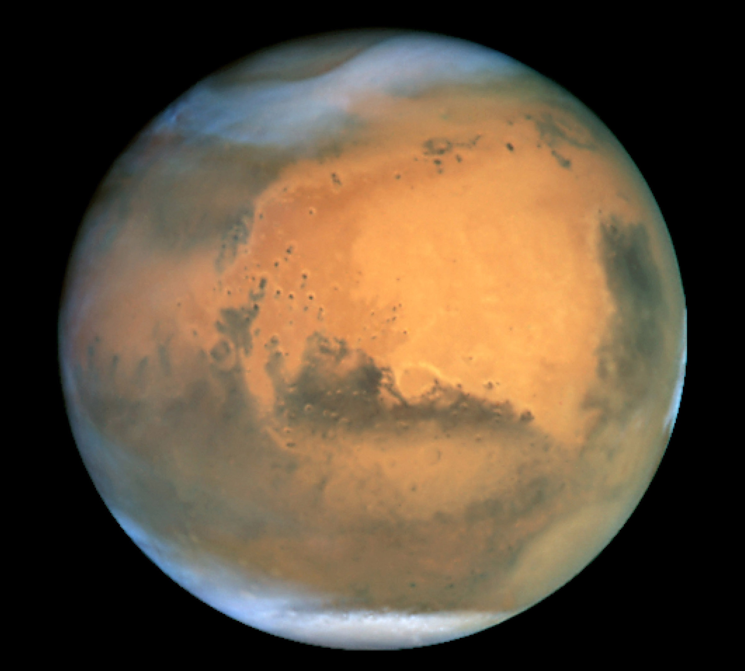
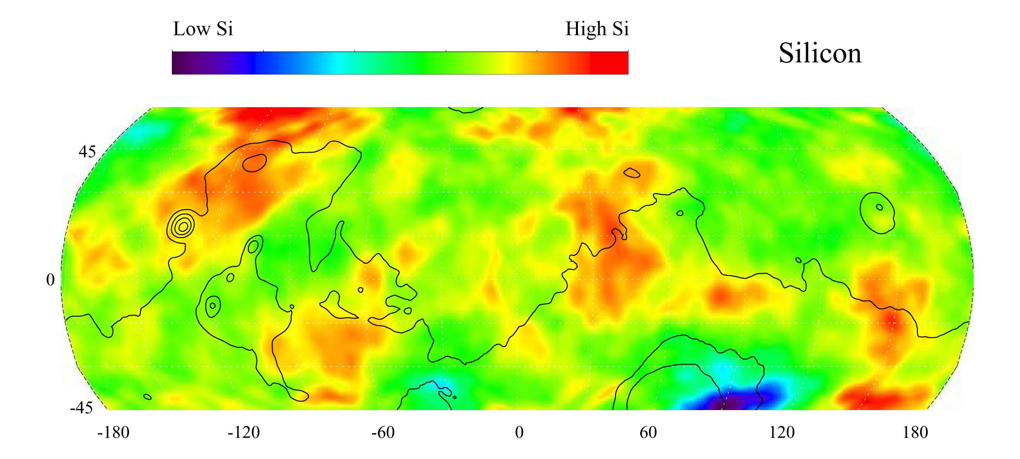
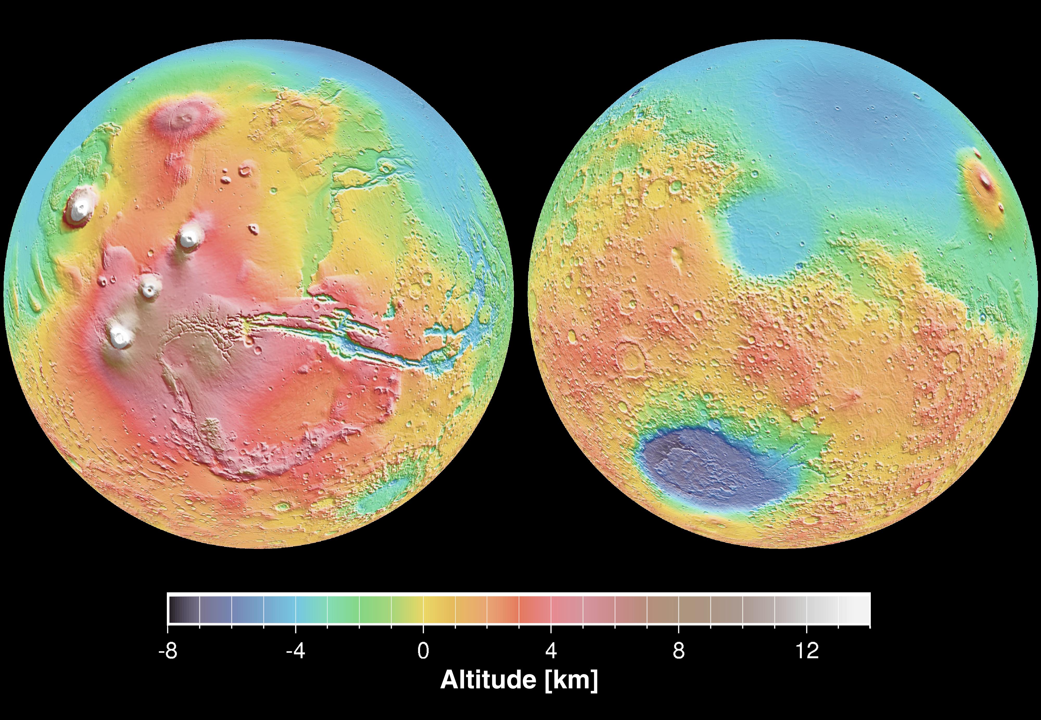


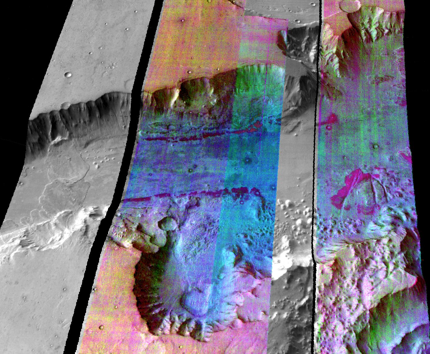


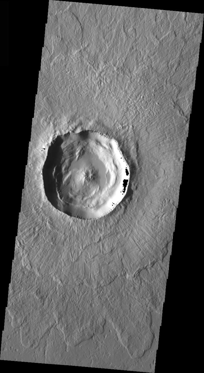
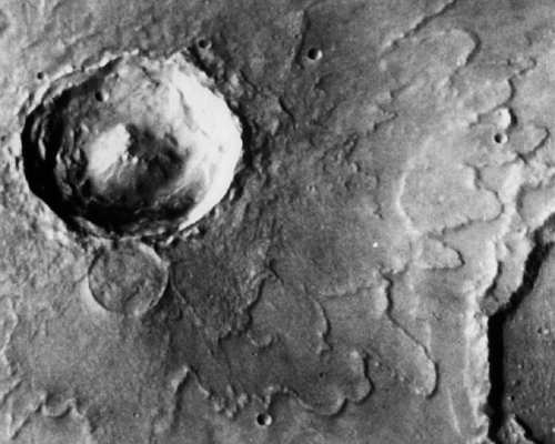


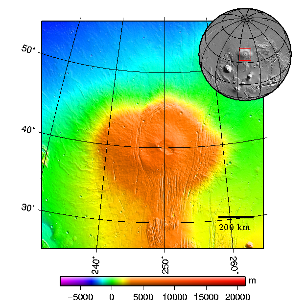
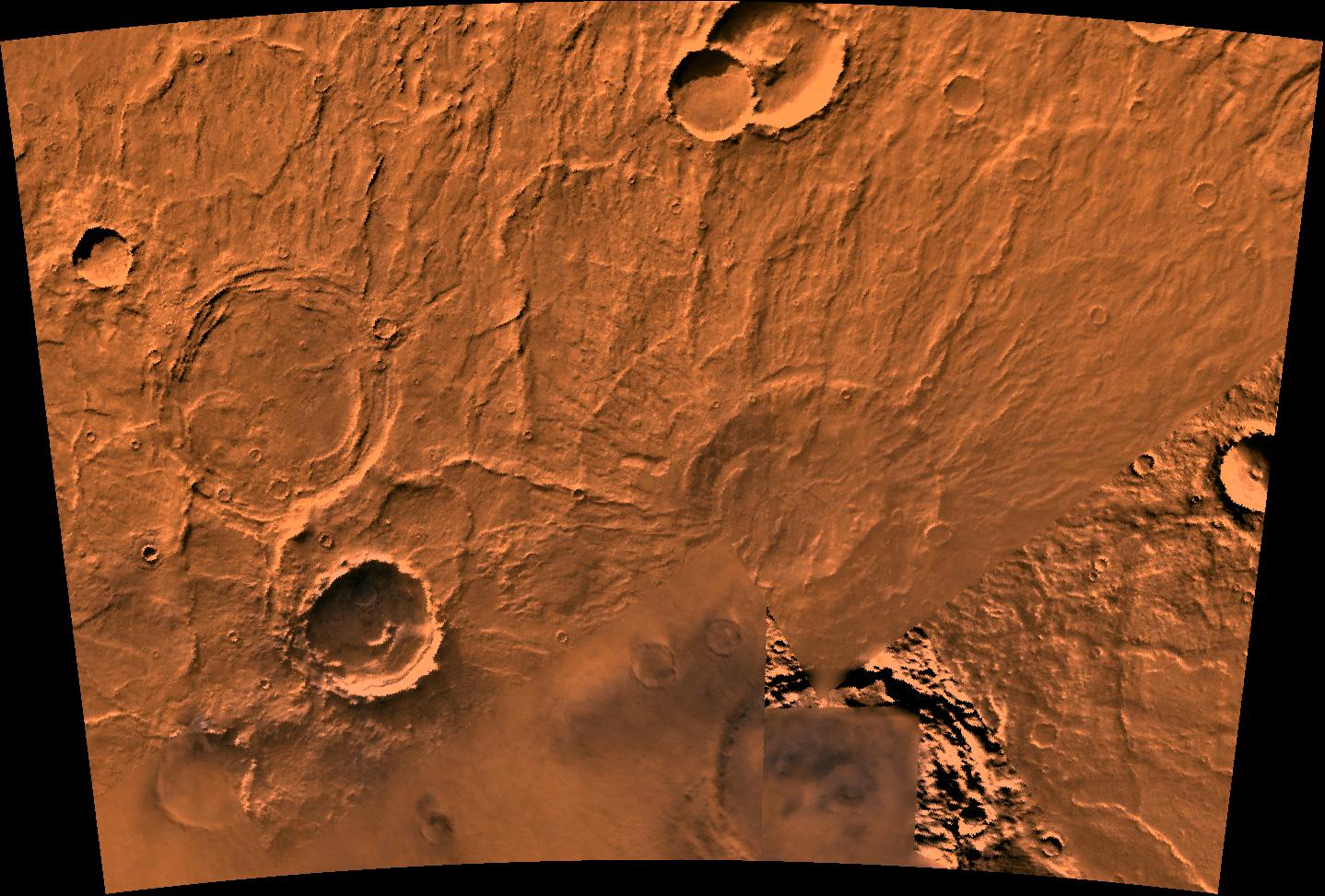

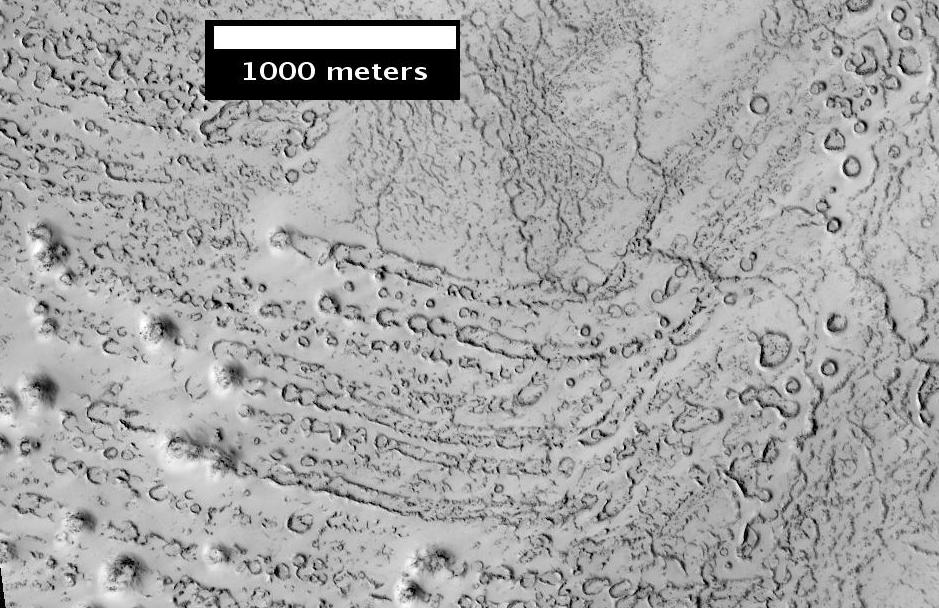
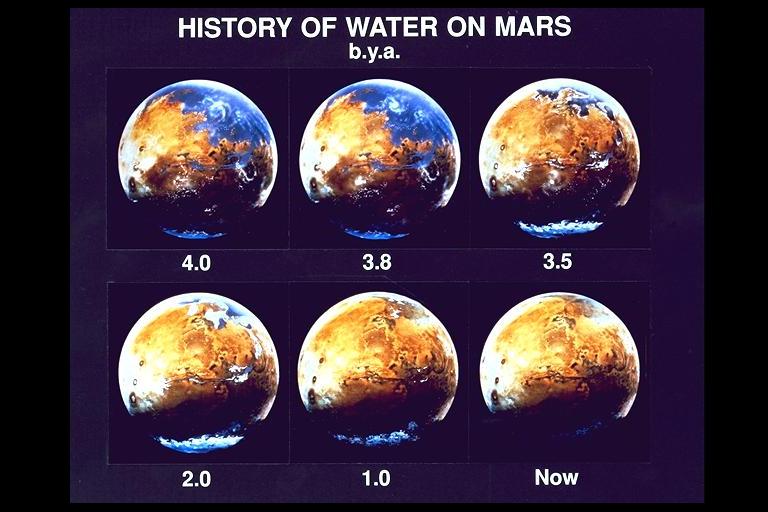
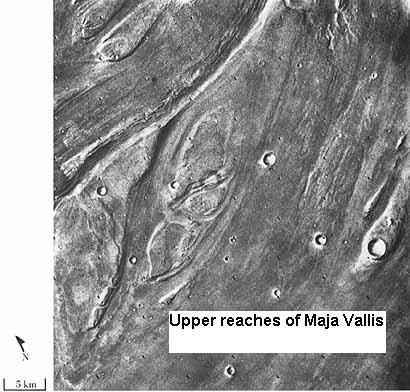
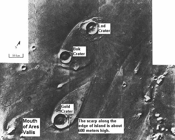
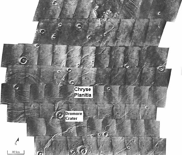
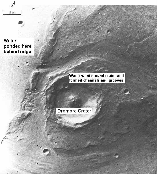
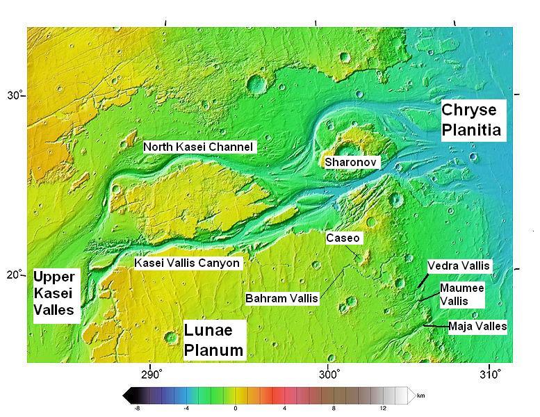
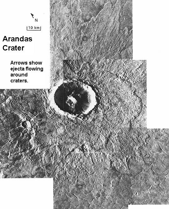
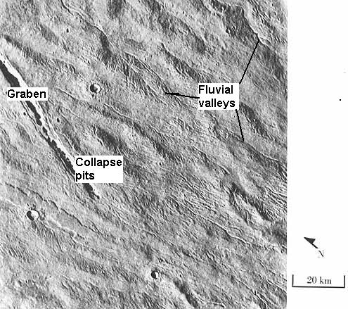
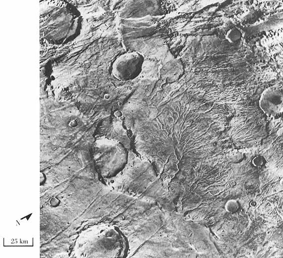
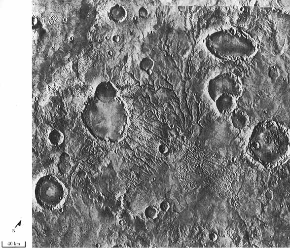
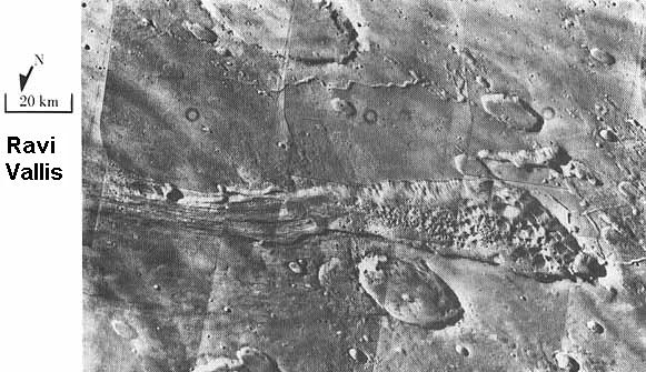
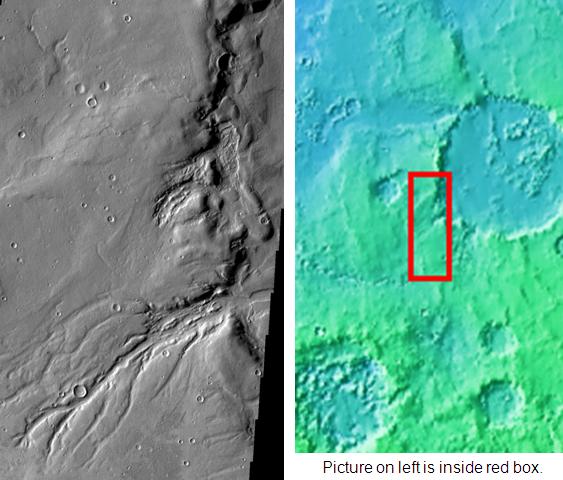
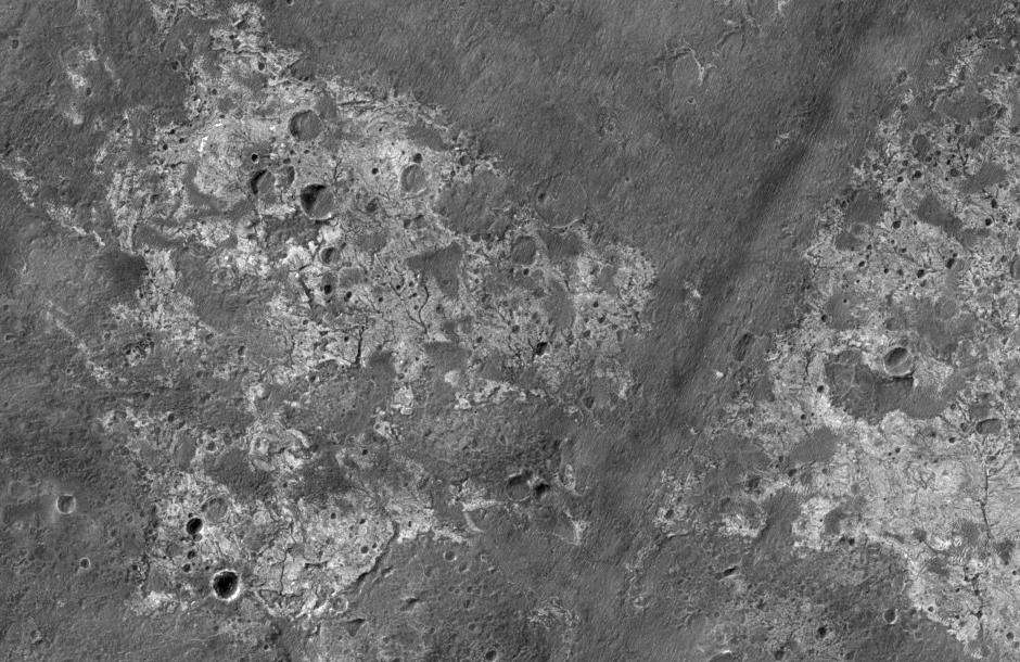
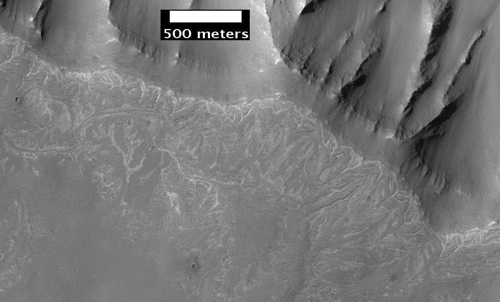
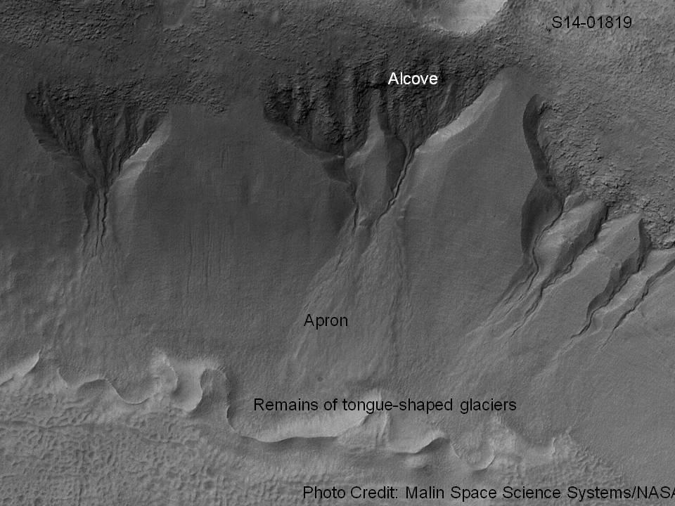
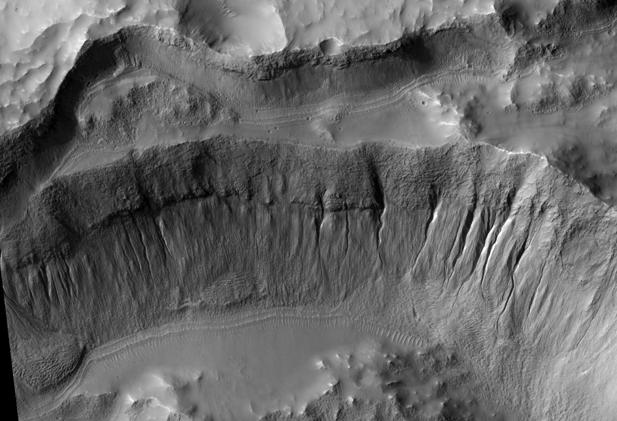
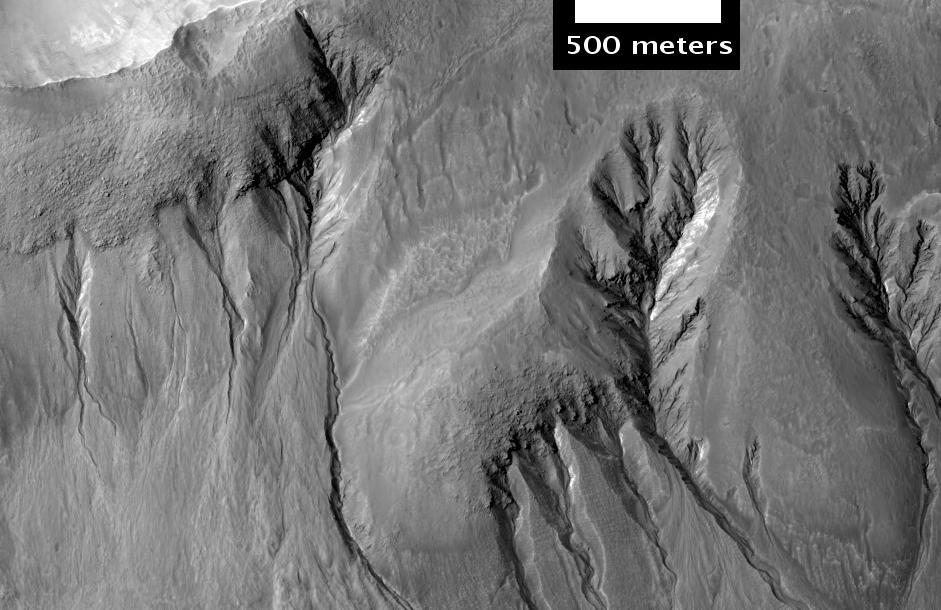
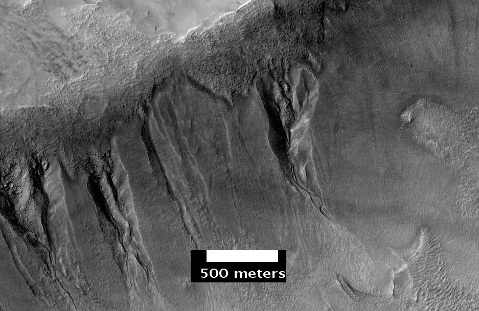
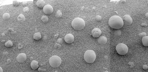
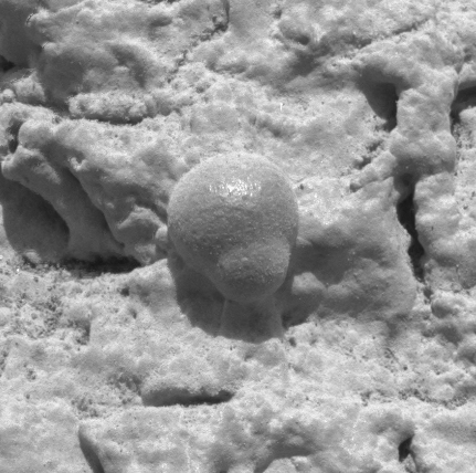
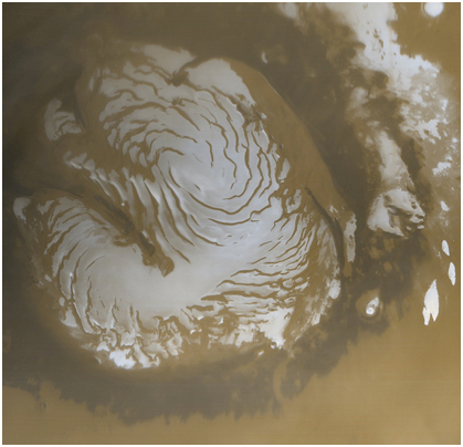

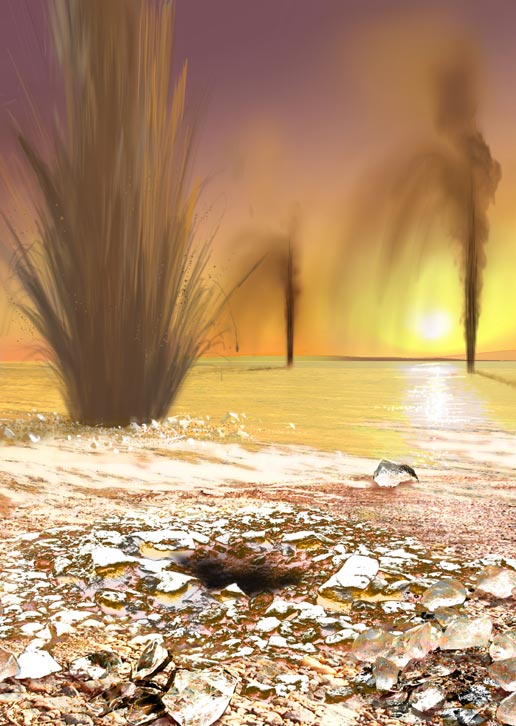
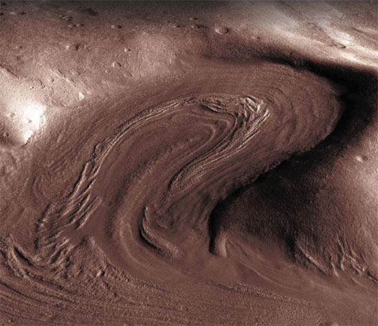
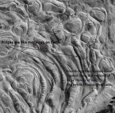
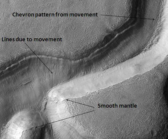

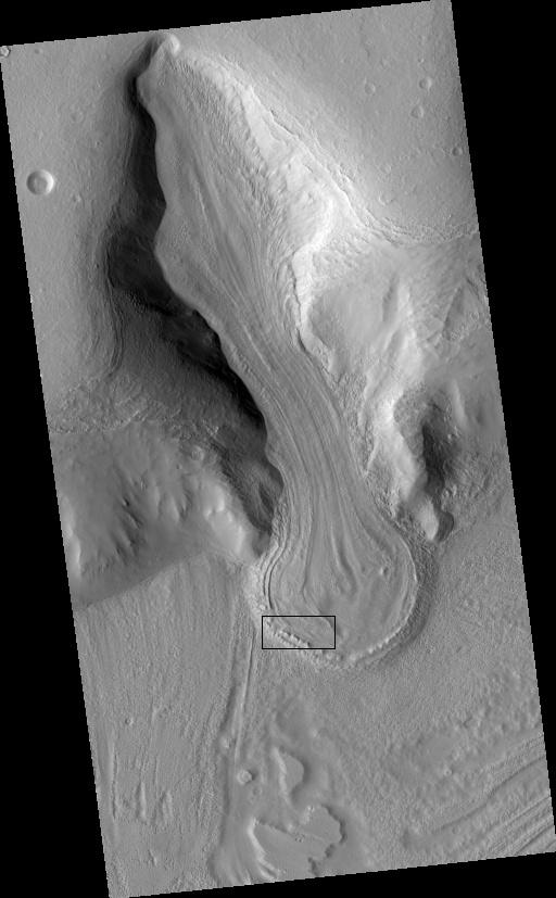

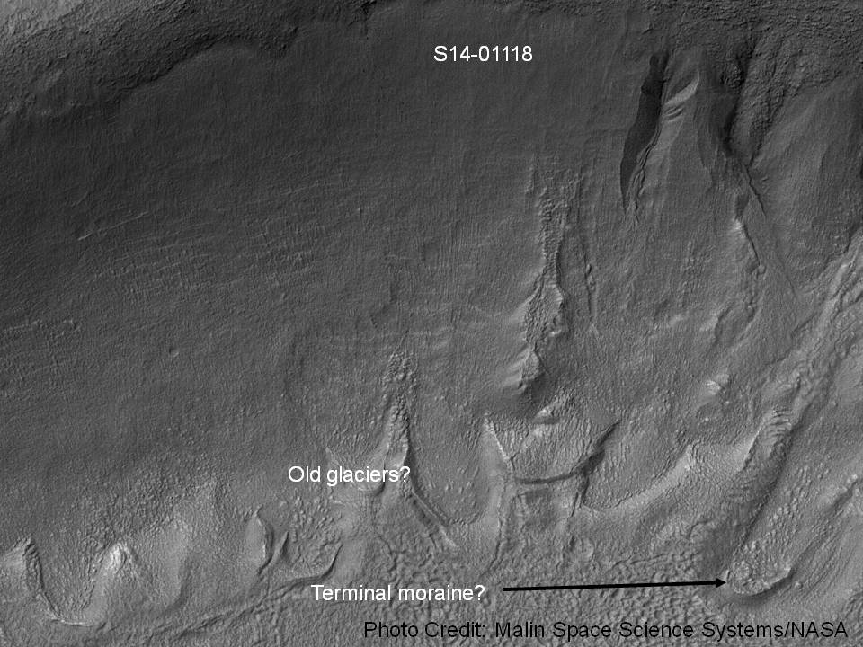
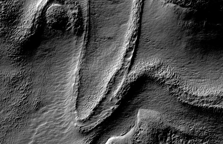

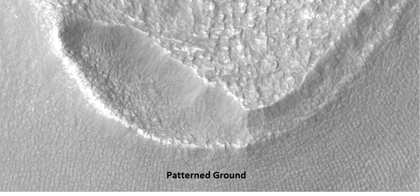
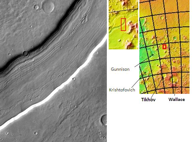
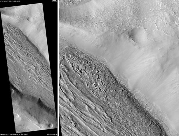
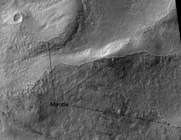
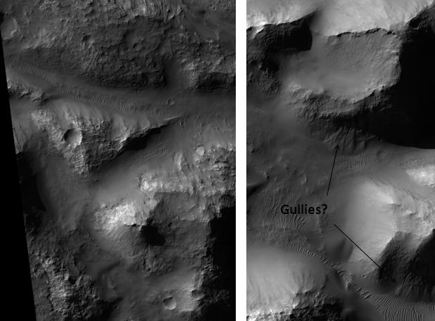

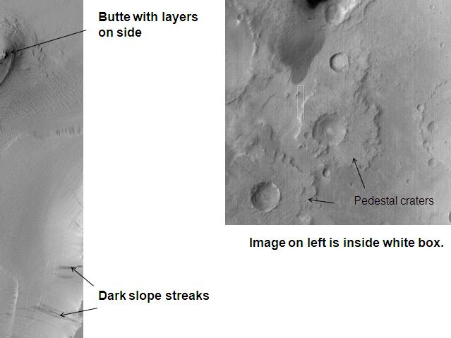
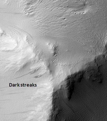

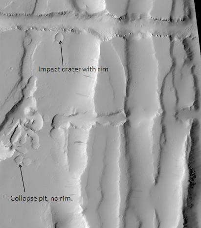
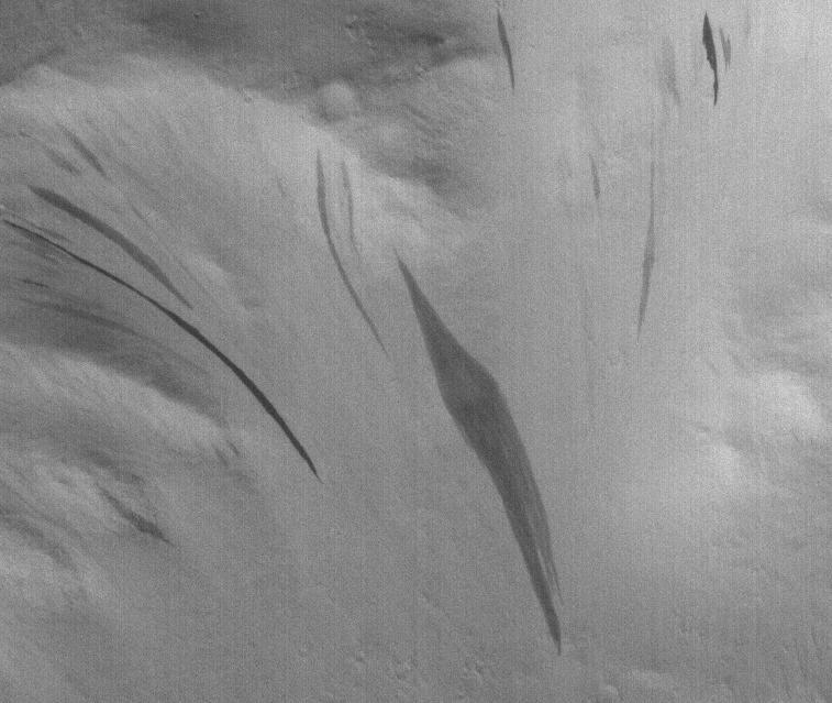


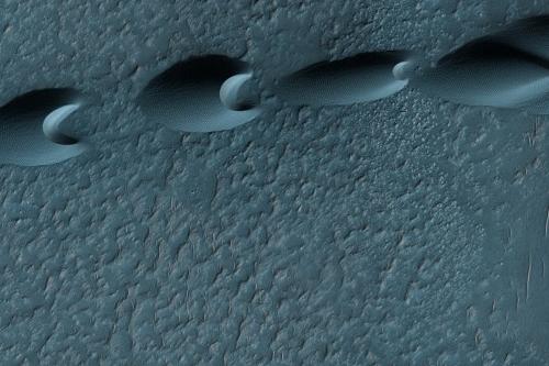
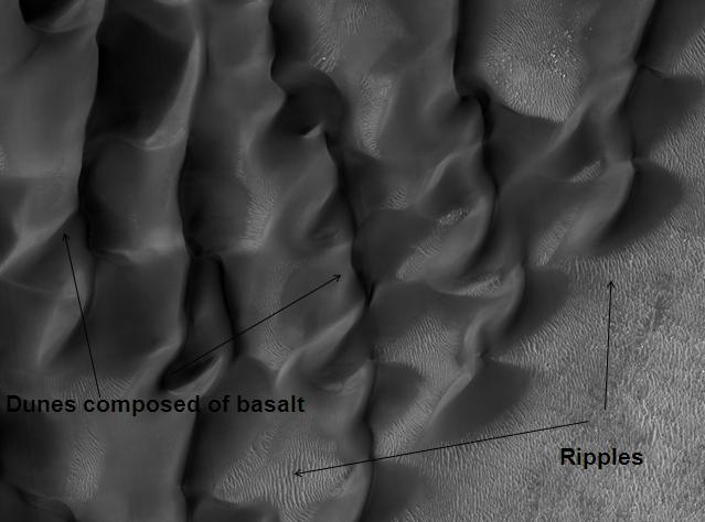
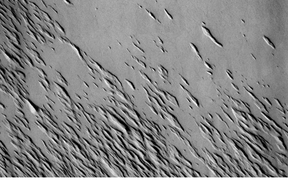

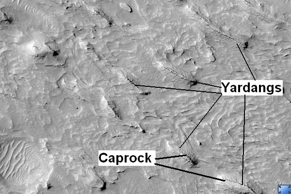
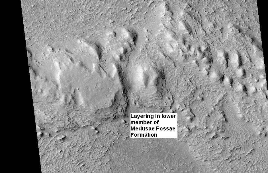
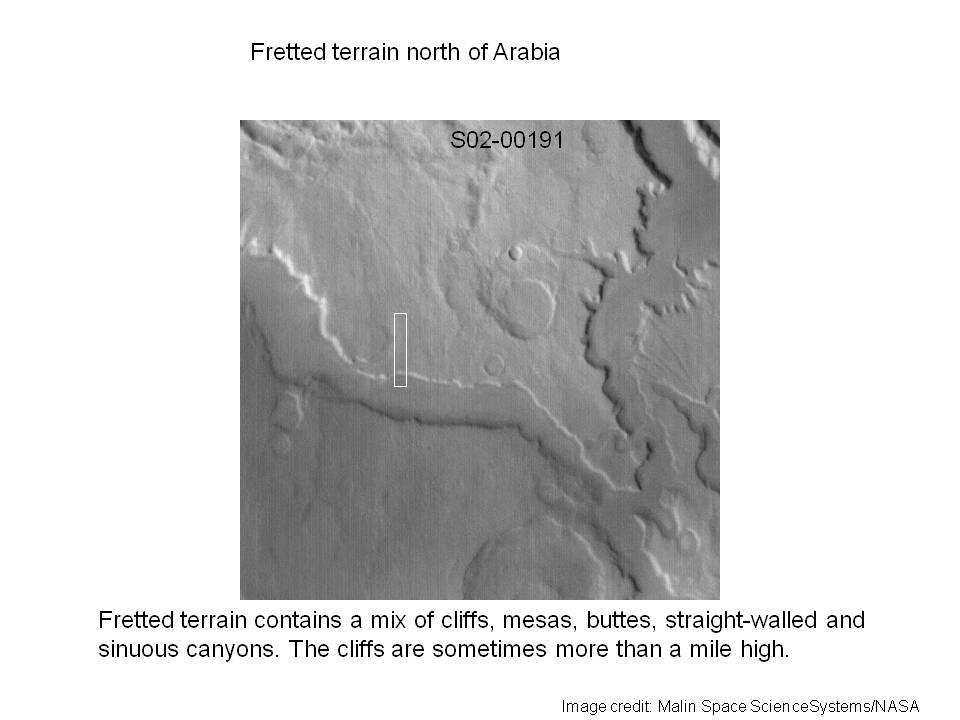

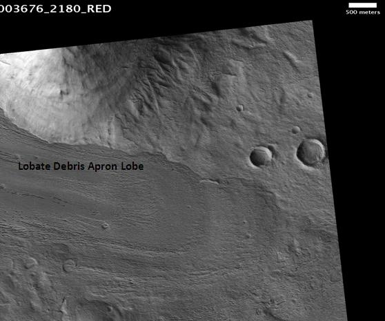
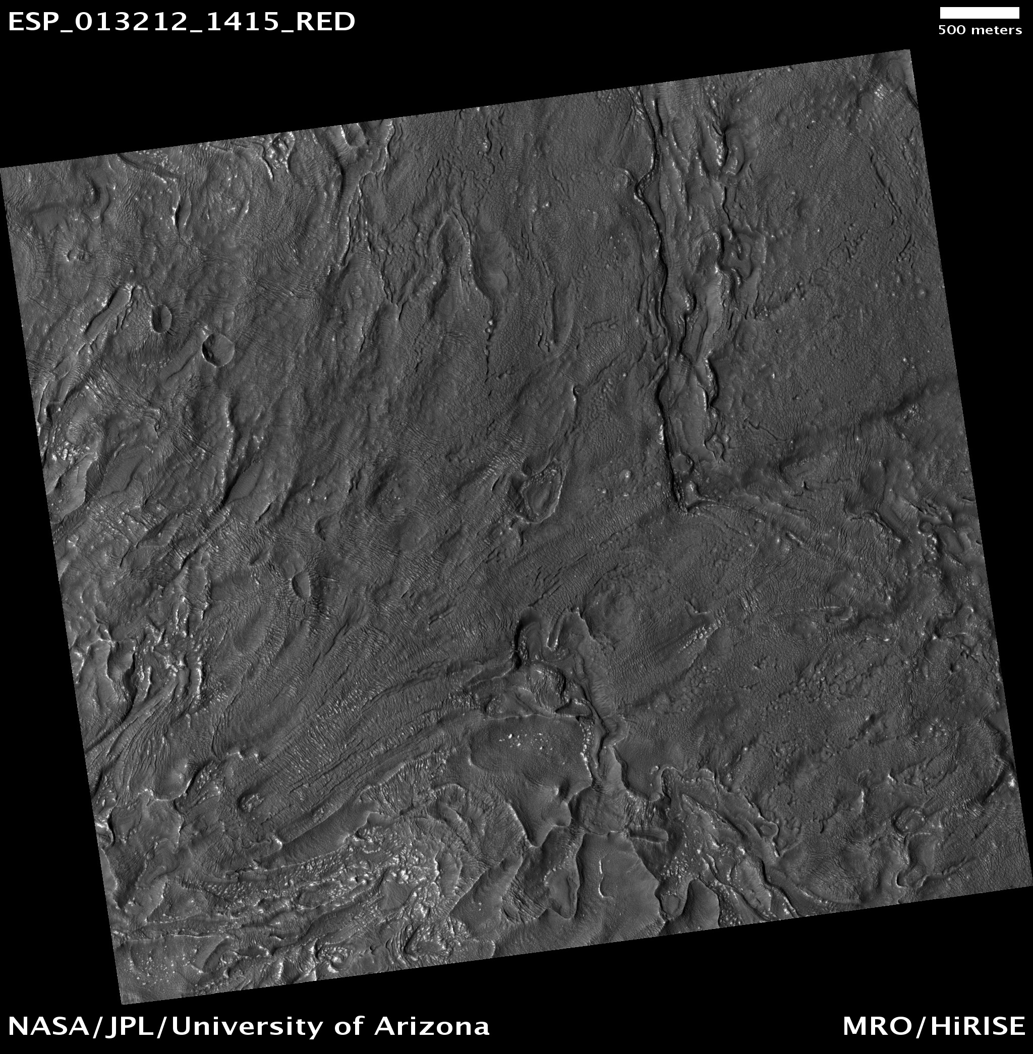
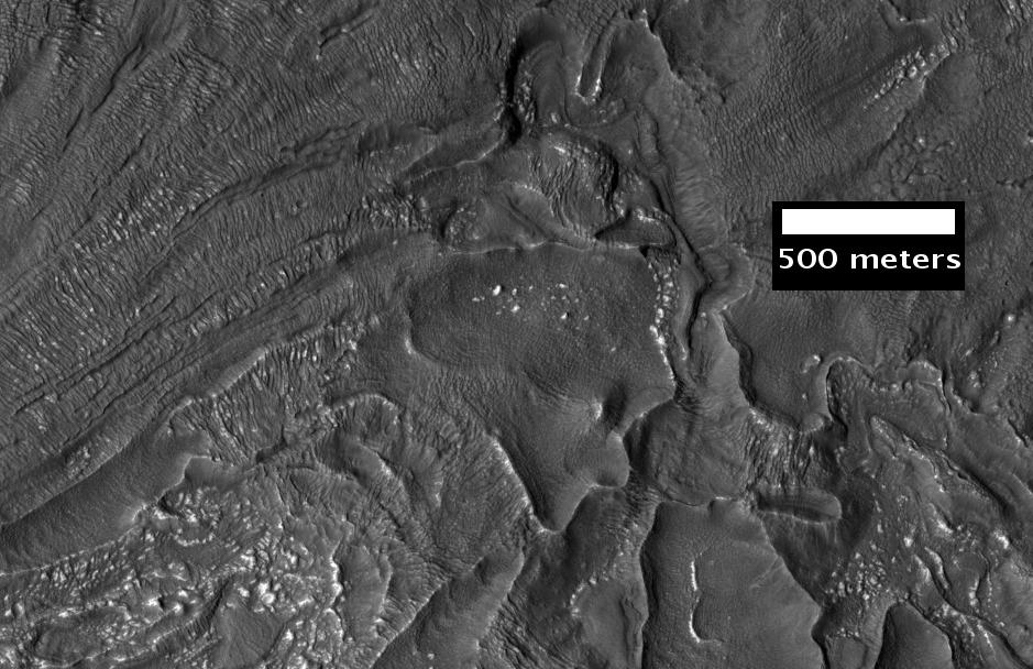
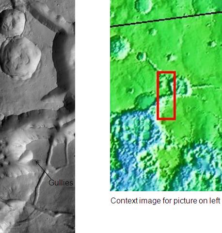
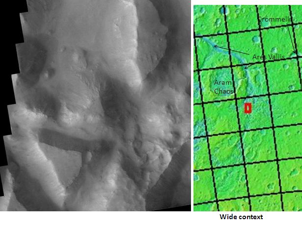
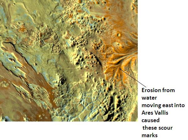
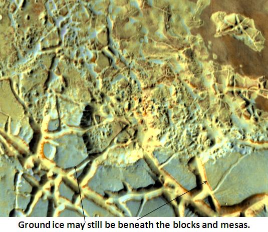
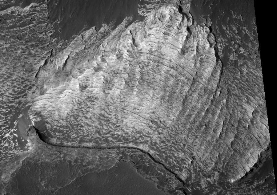

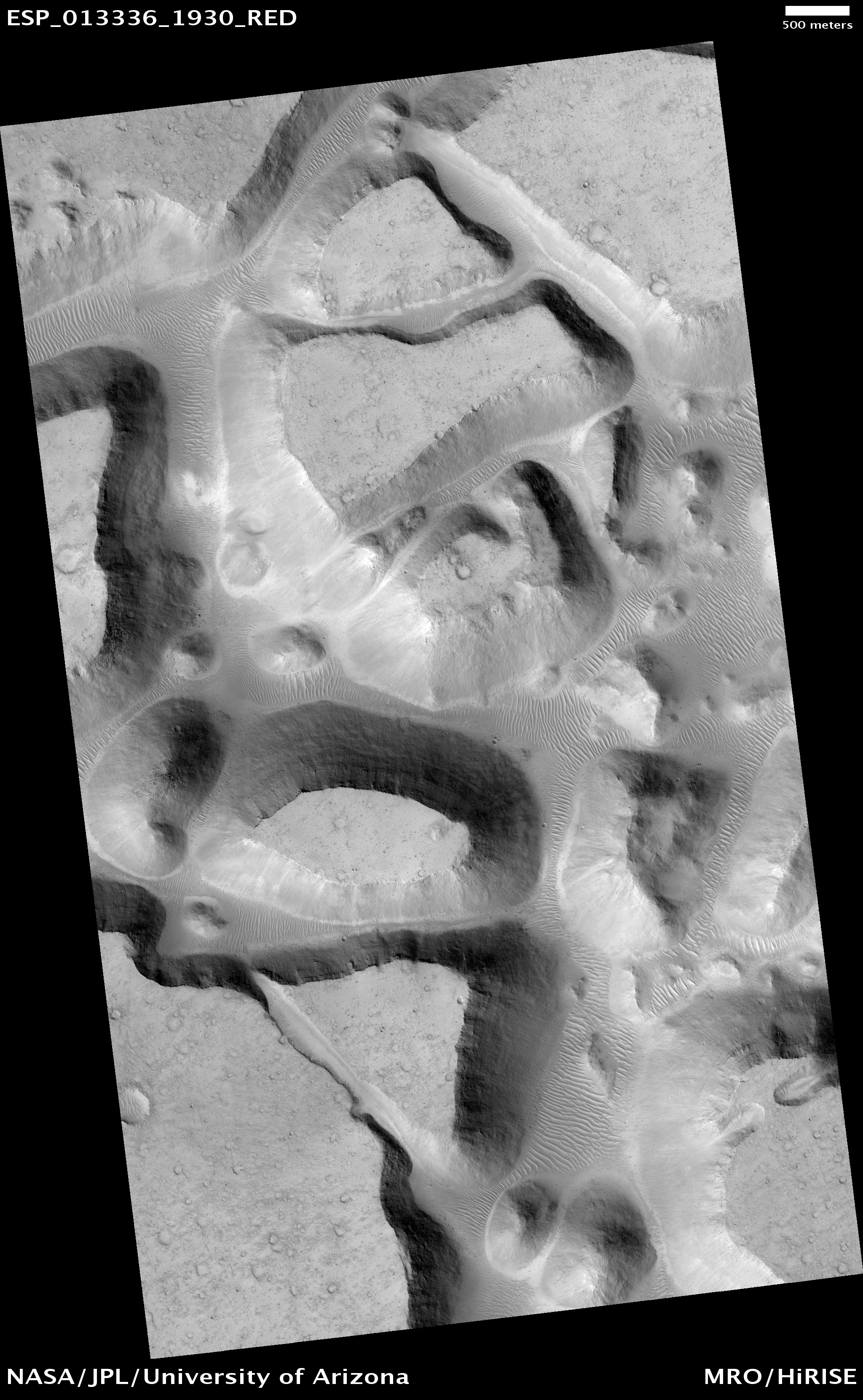
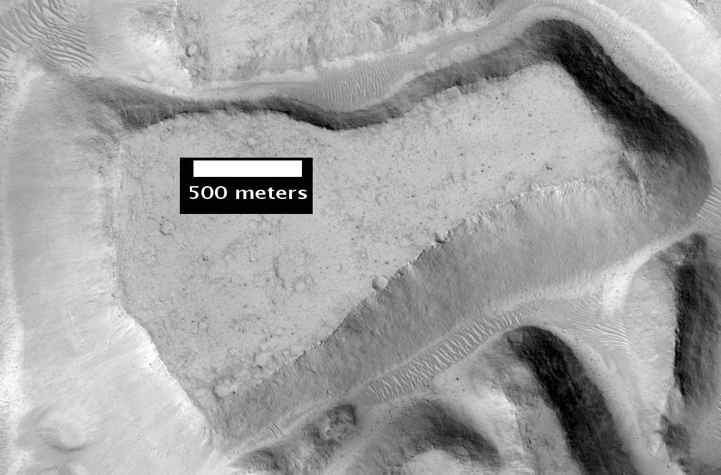
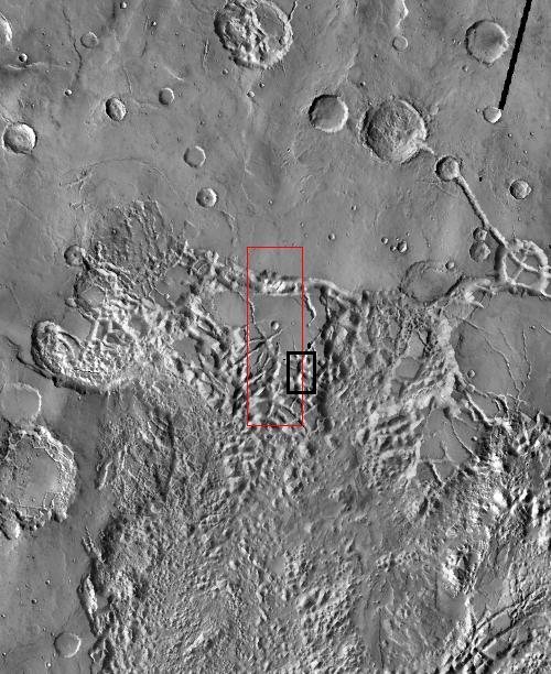
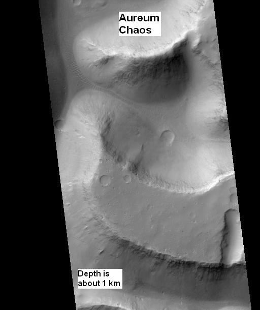
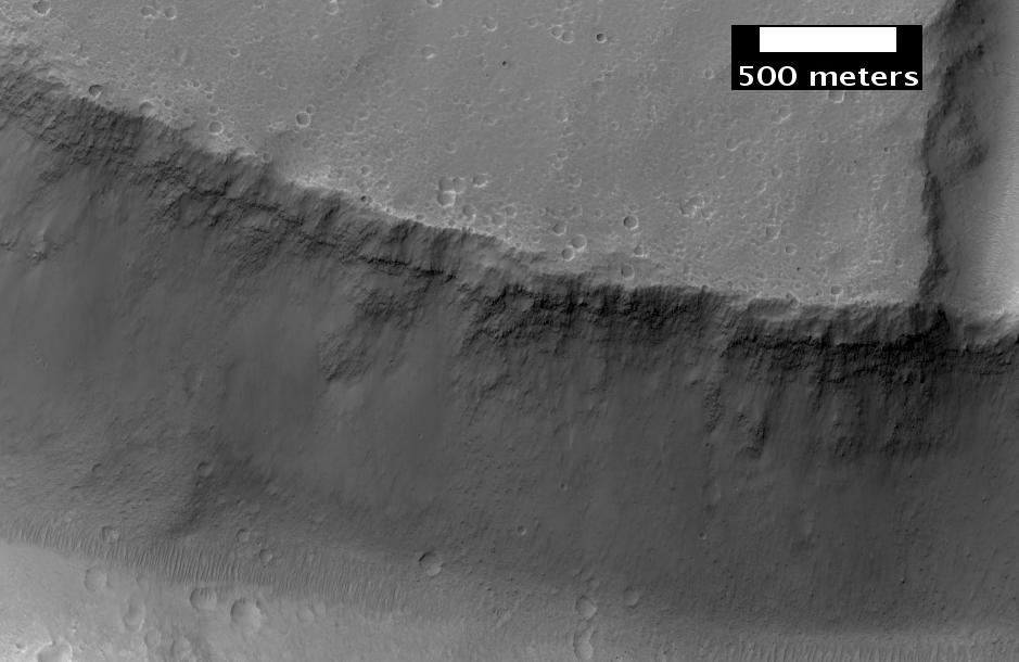

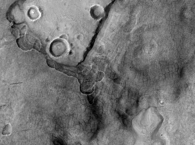

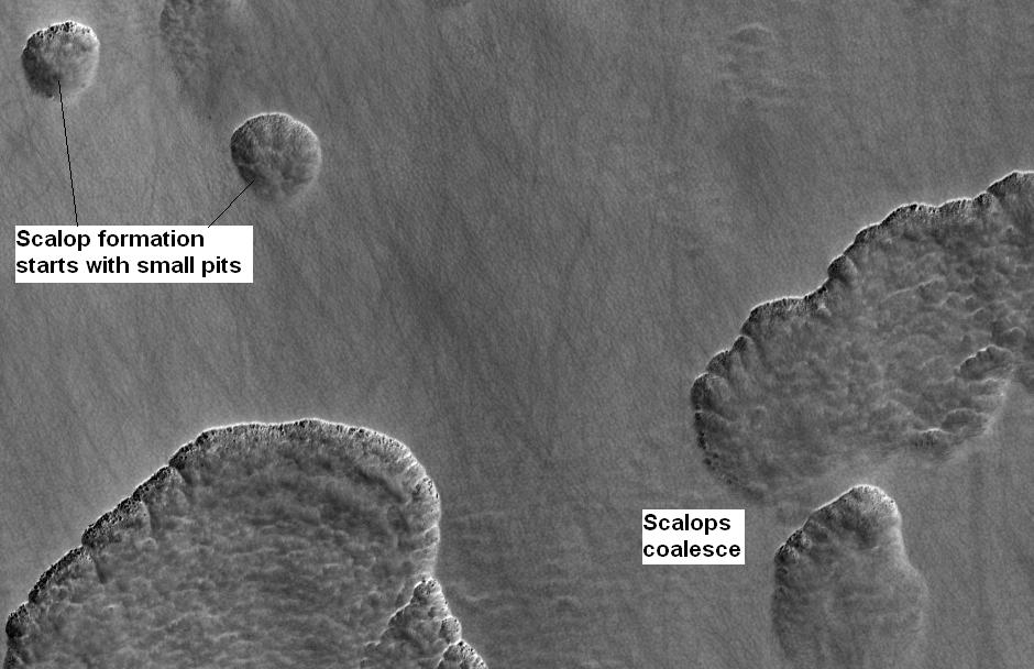
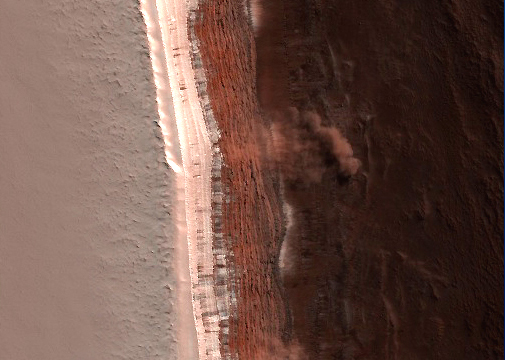
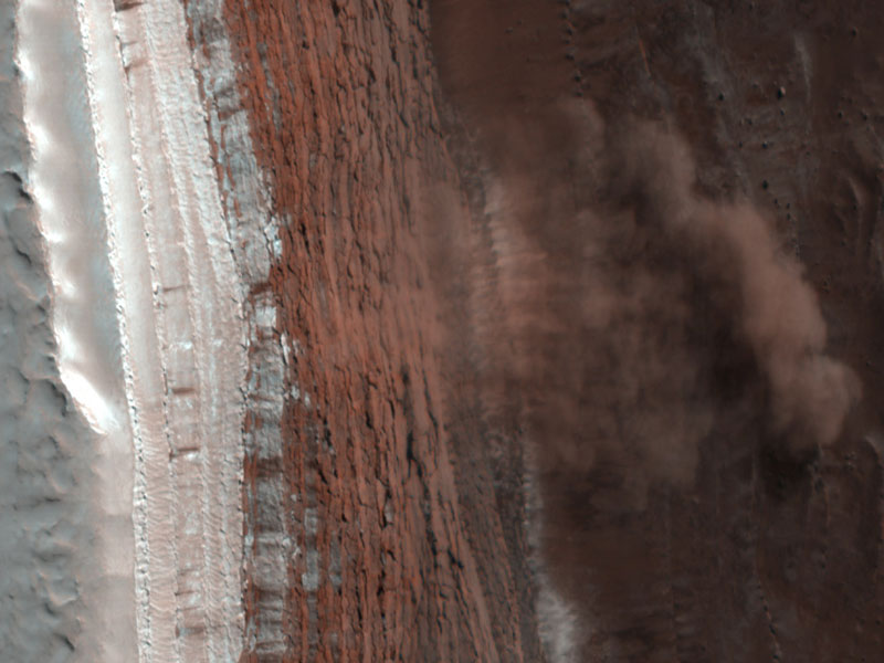

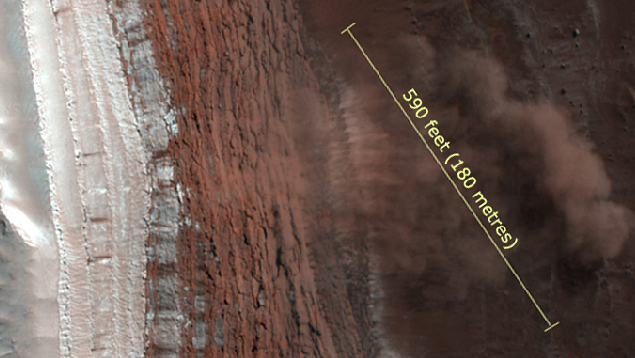
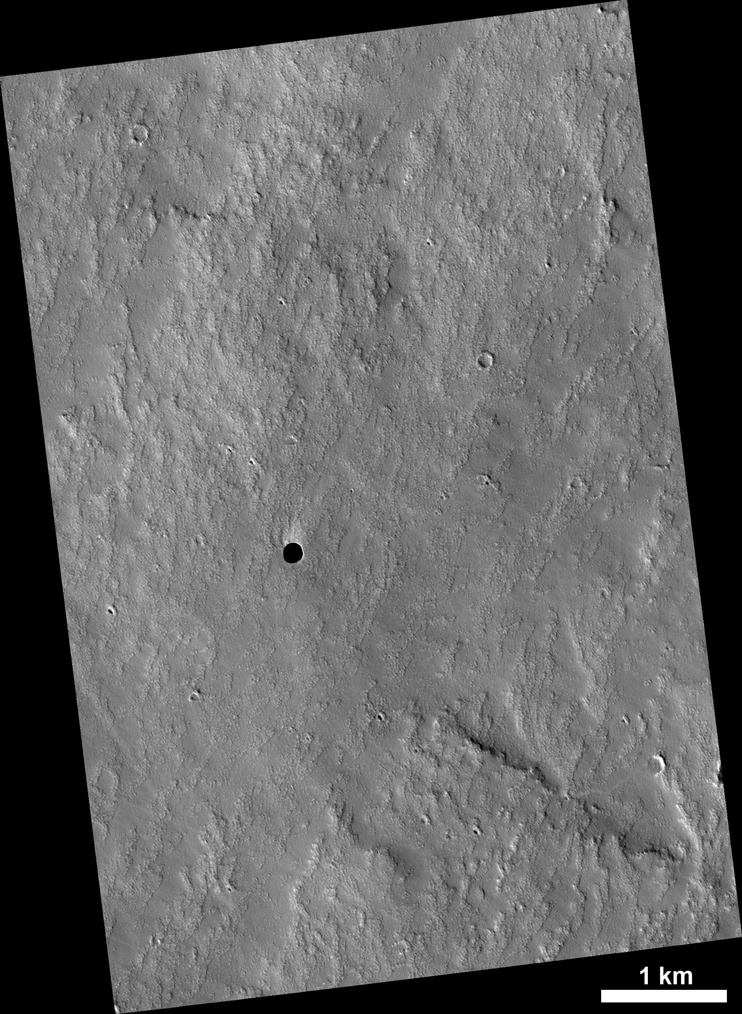


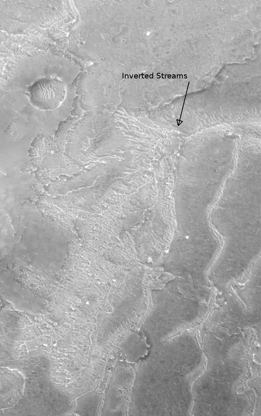

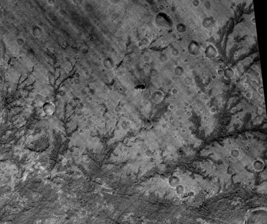
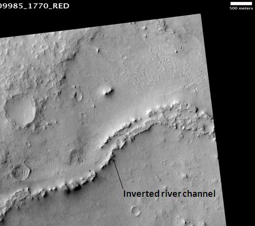
Wikimedia Foundation. 2010.