- Matawan, New Jersey
-
"Matawan" redirects here. For other uses, see Matawan (disambiguation).
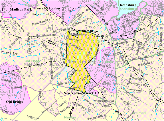
Matawan, New Jersey — Borough — Map of Matawan in Monmouth County. Inset: Location of Monmouth County highlighted in the State of New Jersey. Census Bureau map of Matawan, New Jersey
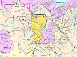
Coordinates: 40°24′44″N 74°14′16″W / 40.41222°N 74.23778°WCoordinates: 40°24′44″N 74°14′16″W / 40.41222°N 74.23778°W Country United States State New Jersey County Monmouth Incorporated June 28, 1895 Government[1] - Type Borough (New Jersey) - Mayor Paul Buccellato - Administrator William Garofalo[2] Area - Total 2.4 sq mi (6.2 km2) - Land 2.3 sq mi (5.9 km2) - Water 0.1 sq mi (0.3 km2) Elevation[3] 10 ft (3 m) Population (2010)[4] - Total 8,810 - Density 3,680.3/sq mi (1,421/km2) Time zone Eastern (EST) (UTC-5) - Summer (DST) EDT (UTC-4) ZIP code 07747 Area code(s) 732 FIPS code 34-44520[5][6] GNIS feature ID 0885293[7] Website www.matawanborough.com Historical populations Census Pop. %± 1930 2,264 — 1940 2,758 21.8% 1950 3,739 35.6% 1960 5,097 36.3% 1970 9,136 79.2% 1980 8,837 −3.3% 1990 9,270 4.9% 2000 8,910 −3.9% 2010 8,810 −1.1% Population 1930 - 1990.[8] Matawan is a borough in Monmouth County, New Jersey, United States. As of the 2010 United States Census, the borough population was 8,810.[4] The name "Matawan" comes from a Native American Lenape word.[9]
Matawan is part of the Bayshore Regional Strategic Plan, an effort by nine municipalities in northern Monmouth County to reinvigorate the area's economy by emphasizing the traditional downtowns, dense residential neighborhoods, maritime history, and the natural beauty of the Raritan Bayshore coastline.
Matawan was formed as a borough on June 28, 1895, from portions of Matawan Township (now Aberdeen Township), based on the results of a referendum held that day. Matawan expanded with portions of Matawan Township in 1931 and 1933, and from Madison Township (now Old Bridge Township) in 1939.[10]
Town was founded by Dutch settlers in the 17th century (Matawan celebrated a tricentennial in the 1980s). Scotch-Irish settlers from New Hampshire later named the town New Aberdeen. It was changed, but neighboring Matawan Township took the name of Aberdeen in 1970s.
Contents
Geography
Matawan is located at 40°24′41″N 74°14′06″W / 40.411290°N 74.234906°W (40.411290, -74.234906).[11]
According to the United States Census Bureau, the borough has a total area of 2.4 square miles (6.2 km2), of which 2.3 square miles (6.0 km2) is land and 0.1 square miles (0.26 km2), or 5.00%, is water.
Demographics
As of the census[5] of 2000, there were 8,910 people, 3,531 households, and 2,376 families residing in the borough. The population density was 3,909.1 people per square mile (1,508.8/km2). There were 3,640 housing units at an average density of 1,597.0 per square mile (616.4/km2). The racial makeup of the borough was 82.35% White, 6.53% African American, 0.02% Native American, 7.99% Asian, 0.02% Pacific Islander, 1.23% from other races, and 1.85% from two or more races. Hispanic or Latino of any race were 6.45% of the population.
There were 3,531 households out of which 30.2% had children under the age of 18 living with them, 54.3% were married couples living together, 9.1% had a female householder with no husband present, and 32.7% were non-families. 25.6% of all households were made up of individuals and 7.8% had someone living alone who was 65 years of age or older. The average household size was 2.52 and the average family size was 3.07.
In the borough the population was spread out with 22.6% under the age of 18, 7.3% from 18 to 24, 36.4% from 25 to 44, 23.3% from 45 to 64, and 10.5% who were 65 years of age or older. The median age was 36 years. For every 100 females there were 97.6 males. For every 100 females age 18 and over, there were 95.8 males.
The median income for a household in the borough was $63,594, and the median income for a family was $72,183. Males had a median income of $51,924 versus $37,113 for females. The per capita income for the borough was $30,320. About 3.8% of families and 5.4% of the population were below the poverty line, including 6.9% of those under age 18 and 7.3% of those age 65 or over.
Government
Local government
Matawan is governed under the Borough form of New Jersey municipal government. The government consists of a Mayor and a Borough Council comprising six council members, with all positions elected at large. A Mayor is elected directly by the voters to a four-year term of office. The Borough Council consists of six members elected to serve three-year terms on a staggered basis, with two seats coming up for election each year.[1]
The Mayor of Matawan is Paul Buccellato.[12] Members of the Matawan Borough Council are Council President Andrew Lopez, Joseph Urbano, Thomas Fitzsimmons, Linda Clifton, Toni Angelini, and Donna Gould.[13]
On January 15, 2008, Republican Councilman Paul Buccellato defeated Democratic Mayor Mary Aufseeser in a special election in Matawan on Tuesday, January 15, 2008. Running again after their initial showdown last November resulted in a tie, Buccellato won with 51.15% of the vote to Aufseeser's 48.70%, according to unofficial results filed with the Monmouth County Clerk's Office Tuesday night. 2,039 residents, a turnout of 38%, participated in Tuesday's special election, according to the clerk's office.
The Borough Administrator and Chief Administrative Officer is Barbara Bascom.[2]
Federal, state and county representation
Matawan is in the 6th Congressional district. New Jersey's Sixth Congressional District is represented by Frank Pallone (D, Long Branch). New Jersey is represented in the United States Senate by Frank Lautenberg (D, Cliffside Park) and Bob Menendez (D, Hoboken).
Matawan is in the 13th district of the New Jersey Legislature, which is represented in the New Jersey Senate by Joseph M. Kyrillos (R, Middletown Township) and in the New Jersey General Assembly by Amy Handlin (R, Middletown Township) and Samuel D. Thompson (R, Old Bridge Township).[14]
Monmouth County is governed by a Board of Chosen Freeholders consisting of five members who are elected at-large to serve three year terms of office on a staggered basis, with one or two seats up for election each year. [15] As of 2011, Monmouth County's Freeholders are Freeholder Director Robert D. Clifton (R, Matawan; term ends December 31, 2013)[16], Freeholder Deputy Director John P. Curley (R, Red Bank; 2012)[17], Thomas A. Arnone (R, Neptune City; 2013), Lillian G. Burry (R, Colts Neck Township; 2011)[18] and Amy A. Mallet (D, Fair Haven, 2011).[19][20][21]
Education
Matawan is part of the Matawan-Aberdeen Regional School District (MARSD), together with the neighboring community of Aberdeen Township. Schools in the district (with 2005-06 enrollment data from the National Center for Education Statistics[22]) are Cambridge Park Developmental Learning Center (Preschool; 55 students), Cliffwood Elementary School (Grades K-3; 431 students), Ravine Drive Elementary School (Grades K-3; 351 students), Strathmore Elementary School (Grades K-3; 472 students), Lloyd Road Elementary School (Grades 4-5; 603 students), Matawan Aberdeen Middle School (Grades 6 - 8; 926 students) and Matawan Regional High School (Grades 9 - 12; 1,052 students). The MARSD Central Offices are located at 1 Crest Way, in Aberdeen, New Jersey.
History
Despite being 11 miles (18 km) from the Atlantic Ocean, Matawan was the site of three shark attacks on July 12, 1916, in Matawan Creek, causing two deaths. They closely followed an attack in Beach Haven on July 1 and one in Spring Lake on July 6.
Further information: Jersey Shore shark attacks of 1916Matawan played an important role in aviation navigation history. In 1944 the first operational Visual Aural Range (VAR) was installed at Matawan. Designed in 1937 at the Bureau of Air Commerce's research center, this system operated in the VHF band around 63 mHz and was an incremental improvement over prior aviation navigation systems such as the four-course radio range.[23] VAR was later redeveloped into VOR.
Transportation locus
In the late 20th century, Matawan became known for its heavily-used train station at Aberdeen-Matawan on New Jersey Transit's North Jersey Coast Line, which attracts riders from all over western Monmouth County and carries them to New York City's Penn Station, either directly or via Secaucus Junction.
NJ Transit provides service to the Port Authority Bus Terminal in Midtown Manhattan on the 135 bus line, with local service available on the 817.[24]
Matawan is traversed by Route 34, Route 79 and County Route 516. The Garden State Parkway skirts the northern end of the borough (with the southbound lanes only passing through briefly); the nearest exits are exits 117 and 120.
Recreation
Matawan is the northern terminus of the middle segment of the Henry Hudson Trail, and the western terminus of the eastern section.
Notable residents
- Joseph D. Bedle (1821–1894), 23rd Governor of New Jersey, in office from 1875-1878.[25]
- Terry Deitz (born 1959), third-place finisher on Survivor: Panama.[26]
- Edward P. Felt (1959–2001), passenger aboard United Airlines Flight 93 on his way who is believed to have made one of the last calls to 911 immediately prior to the fatal crash of the jetliner.[27]
- Philip Morin Freneau (1752–1832), American poet during the American Revolutionary War.[28]
- Elmer H. Geran (1875–1964), represented New Jersey's 3rd congressional district from 1925-1927.[29]
- Delores Holmes (born 1946), soul singer.[30]
- Erison Hurtault, 400m Olympian track runner
- Jim Jeffcoat (born 1961), professional football player for the Dallas Cowboys and the Buffalo Bills from 1983 to 1997.[31]
- Richard Reines, recording industry executive who is co-owner of Drive-Thru Records, a record label specializing largely in pop punk music.[32]
- William H. Sutphin (1887–1972) represented New Jersey's 3rd congressional district from 1931–1943, and was mayor of Matawan from 1915–1916 and 1921–1926.[33]
- Tammy Lynn Sytch, professional wrestling diva
Community
Matawan was ranked by BusinessWeek magazine at #12 in the nation on their list of "The 50 Best Places to Raise Your Kids" in November, 2007.[34]
References
- ^ a b 2005 New Jersey Legislative District Data Book, Rutgers University Edward J. Bloustein School of Planning and Public Policy, April 2005, p. 67.
- ^ a b Office of the Administrator, Borough of Matawan. Accessed July 14, 2008.
- ^ U.S. Geological Survey Geographic Names Information System: Borough of Matawan, Geographic Names Information System. Accessed June 13, 2008.
- ^ a b "Race, Hispanic or Latino, Age, and Housing Occupancy: 2010 Census Redistricting Data (Public Law 94-171) Summary File (QT-PL), Matawan borough, New Jersey". U.S. Census Bureau, American FactFinder 2. http://factfinder2.census.gov. Retrieved September 1, 2011.
- ^ a b "American FactFinder". United States Census Bureau. http://factfinder.census.gov. Retrieved 2008-01-31.
- ^ A Cure for the Common Codes: New Jersey, Missouri Census Data Center. Accessed July 14, 2008.
- ^ "US Board on Geographic Names". United States Geological Survey. 2007-10-25. http://geonames.usgs.gov. Retrieved 2008-01-31.
- ^ New Jersey Resident Population by Municipality: 1930 - 1990, Workforce New Jersey Public Information Network. Accessed March 1, 2007.
- ^ Matawan and Aberdeen: Of Town and Field, By Helen Henderson, Matawan Historical Association, pp 14
- ^ "The Story of New Jersey's Civil Boundaries: 1606-1968", John P. Snyder, Bureau of Geology and Topography; Trenton, New Jersey; 1969. p. 182.
- ^ "US Gazetteer files: 2010, 2000, and 1990". United States Census Bureau. 2011-02-12. http://www.census.gov/geo/www/gazetteer/gazette.html. Retrieved 2011-04-23.
- ^ Mayor's Office, Borough of Matawan. Accessed July 14, 2008.
- ^ Council, Borough of Matawan. Accessed July 14, 2008.
- ^ "Legislative Roster: 2010-2011 Session". New Jersey Legislature. http://www.njleg.state.nj.us/members/roster.asp. Retrieved 2010-02-08.
- ^ Monmouth County Government, Monmouth County, New Jersey. Accessed January 5, 2011.
- ^ Freeholder Director Robert D. Clifton, Monmouth County, New Jersey. Accessed January 7, 2011.
- ^ Deputy Director Freeholder John P. Curley, Monmouth County, New Jersey. Accessed January 7, 2011.
- ^ Freeholder Lillian G. Burry, Monmouth County, New Jersey. Accessed January 7, 2011.
- ^ Freeholder Amy A. Mallet, Monmouth County, New Jersey. Accessed January 7, 2011.
- ^ Board of Chosen Freeholders, Monmouth County, New Jersey. Accessed January 7, 2011.
- ^ Rizzo, Nina. "Monmouth County freeholders sworn into office", Asbury Park Press, January 6, 2011. Accessed January 7, 2011.
- ^ Data for the Matawan-Aberdeen Regional School District, National Center for Education Statistics. Accessed July 14, 2008.
- ^ Nolan, 1999
- ^ Routes by County: Bergen County, New Jersey Transit. Accessed August 8, 2008.
- ^ New Jersey Governor Joseph Dorsett Bedle, National Governors Association. Accessed July 29, 2007. "Joseph D. Bedle, the twenty-ninth governor of New Jersey, was born in Matawan, New Jersey on January 5, 1831."
- ^ Terry Deitz actor profile, The South African TV Authority. Accessed July 29, 2007. "He then attended St. John Vianney High School in Holmdel, New Jersey, where he earned 11 Varsity letters in football (quarterback), baseball (catcher) and wrestling."
- ^ Longman, Jere. " A NATION CHALLENGED: THE PENNSYLVANIA CRASH; Cockpit Tape Offers Few Answers but Points to Heroic Efforts", The New York Times, March 27, 2002. Accessed December 10, 2007. "Earlier reports have said that a previously unidentified passenger, Edward Felt of Matawan, N.J., said in a 911 call from a restroom that he saw a puff of smoke and heard an explosion, leading some to cite this as evidence that the plane was shot down by the military to prevent it from crashing into sensitive targets."
- ^ [1]. Accessed August 23, 2007.
- ^ Elmer Hendrickson Geran, Biographical Directory of the United States Congress. Accessed July 11, 2007.
- ^ Biography - Delores Holmes, West End Arts. Accessed July 28, 2007. "From Matawan, NJ, Delores Holmes (Contralto) was raised in a gospel family."
- ^ Jim Jeffcoat, database Football. Accessed November 27, 2007.
- ^ La Gorce, Tammy. "Finding Emo", The New York Times, August 14, 2005. Accessed October 22, 2007. "We came back, because as label owners we couldn't be away from it, said Mr. Reines, who is from Fort Lee. He recently bought a house in Matawan and, for business reasons, now splits his time between the two states."
- ^ William Halstead Sutphin, Biographical Directory of the United States Congress. Accessed August 30, 2007.
- ^ No. 12: Matawan, N.J., BusinessWeek, November 2007. Accessed November 27, 2007.
Further reading
- Nolan, M.S. (1999). Fundamentals of air traffic control. Pacific Grove, CA: Brooks Cole Publishing Company.
External links
- Borough of Matawan official website
- Matawan-Aberdeen Regional School District
- Matawan-Aberdeen Regional School District's 2009–10 School Report Card from the New Jersey Department of Education
- Data for the Matawan-Aberdeen Regional School District, National Center for Education Statistics
- Matawan First Aid & Rescue Squad
- NYTimes, 2010 feature
 State of New Jersey
Topics Delegations · Demographics · Economy · Elections · Geography · Government · History · Media · Municipalities · Music · People · Politics · Symbols · Transportation · Parks
Regions Atlantic Coastal Plain · Central Jersey · Delaware River Region · Delaware Valley · Gateway Region · Gold Coast · Highlands · Jersey Shore · Meadowlands · New York metro area · North Hudson · North Jersey · Pascack Valley · Piedmont · Pine Barrens · Raritan Bayshore · Ridge-and-Valley Appalachians · Southern Shore Region · Skylands Region · South Jersey · Tri‑State Region · West Hudson
Counties Major cities Atlantic City · Camden · Edison · Elizabeth · Hackensack · Jersey City · Newark · New Brunswick · Ocean City · Paterson · Trenton · Vineland
Categories:- Boroughs in Monmouth County, New Jersey
- Place names in New Jersey of Native American origin


Wikimedia Foundation. 2010.