- Farmingdale, New Jersey
Infobox Settlement
official_name = Farmingdale, New Jersey
settlement_type = Borough
nickname =
motto =
imagesize =
image_caption =
image_
imagesize =
image_caption =
image_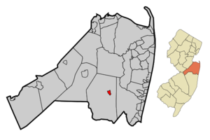
mapsize = 250x200px
map_caption = Map of Farmingdale in Monmouth County. Inset: Location of Monmouth County highlighted in the State of New Jersey.
mapsize1 = 250x200px
map_caption1 = Census Bureau map of Farmingdale, New Jerseysubdivision_type = Country
subdivision_name =United States
subdivision_type1 = State
subdivision_name1 =New Jersey
subdivision_type2 = County
subdivision_name2 = Monmouth
government_footnotes =
government_type =Borough (New Jersey)
leader_title =
leader_name =
leader_title1 =
leader_name1 =
established_title = Incorporated
established_date =April 8 ,1903 unit_pref = Imperial
area_footnotes =
area_magnitude =
area_total_km2 = 1.4
area_land_km2 = 1.4
area_water_km2 = 0.0
area_total_sq_mi = 0.5
area_land_sq_mi = 0.5
area_water_sq_mi = 0.0population_as_of = 2006
population_footnotes =
population_total = 1563
population_density_km2 = 1147.6
population_density_sq_mi = 2972.2timezone = Eastern (EST)
utc_offset = -5
timezone_DST = EDT
utc_offset_DST = -4
elevation_footnotes = [Gnis|885218|Borough of Farmingdale,Geographic Names Information System . AccessedJanuary 4 ,2008 .]
elevation_m = 24
elevation_ft = 79
latd = 40 |latm = 11 |lats = 55 |latNS = N|longd = 74 |longm = 10 |longs = 16 |longEW = Wpostal_code_type =
ZIP code
postal_code = 07727
area_code = 732
blank_name = FIPS code
blank_info = 34-22950GR|2 [ [http://mcdc2.missouri.edu/webrepts/commoncodes/ccc_nj.html A Cure for the Common Codes: New Jersey] , Missouri Census Data Center. AccessedJuly 14 ,2008 .]
blank1_name = GNIS feature ID
blank1_info = 0885218GR|3
website =
footnotes =Farmingdale is a Borough in Monmouth County,
New Jersey ,United States . As of theUnited States 2000 Census , the borough population was 1,587.Farmingdale was incorporated as a borough by an Act of the
New Jersey Legislature onApril 8 ,1903 , from portions of Howell Township."The Story of New Jersey's Civil Boundaries: 1606-1968", John P. Snyder, Bureau of Geology and Topography; Trenton, New Jersey; 1969. p. 179.]Geography
Farmingdale is located at coor dms|40|11|49|N|74|10|11|W|city (40.197049, -74.169677)GR|1.
According to the
United States Census Bureau , the borough has a total area of 0.5square mile s (1.4km² ), all of it land.Demographics
USCensusPop
1930=629
1940=609
1950=755
1960=959
1970=1148
1980=1348
1990=1462
2000=1587
estimate= 1563
estyear=2006
estref= [http://factfinder.census.gov/servlet/SAFFPopulation?_event=Search&geo_id=16000US3419840&_geoContext=01000US%7C04000US34%7C16000US3419840&_street=&_county=farmingdale&_cityTown=farmingdale&_state=04000US34&_zip=&_lang=en&_sse=on&ActiveGeoDiv=geoSelect&_useEV=&pctxt=fph&pgsl=160&_submenuId=population_0&ds_name=null&_ci_nbr=null&qr_name=null®=null%3Anull&_keyword=&_industry= Census data for Farmingdale borough] ,United States Census Bureau . AccessedSeptember 20 ,2007 .]
footnote=Population 1930 - 1990. [ [http://www.wnjpin.net/OneStopCareerCenter/LaborMarketInformation/lmi01/poptrd6.htm New Jersey Resident Population by Municipality: 1930 - 1990] , Workforce New Jersey Public Information Network. AccessedMarch 1 ,2007 .] As of thecensus GR|2 of 2000, there were 1,587 people, 625 households, and 406 families residing in the borough. Thepopulation density was 2,972.2 people per square mile (1,156.1/km²). There were 638 housing units at an average density of 1,194.9/sq mi (464.8/km²). The racial makeup of the borough was 93.64% White, 1.13% African American, 2.33% Asian, 2.08% from other races, and 0.82% from two or more races. Hispanic or Latino of any race were 3.84% of the population.There were 625 households out of which 37.3% had children under the age of 18 living with them, 51.5% were married couples living together, 8.8% had a female householder with no husband present, and 35.0% were non-families. 29.0% of all households were made up of individuals and 6.6% had someone living alone who was 65 years of age or older. The average household size was 2.54 and the average family size was 3.21.
In the borough the population was spread out with 27.0% under the age of 18, 7.4% from 18 to 24, 35.5% from 25 to 44, 21.1% from 45 to 64, and 9.0% who were 65 years of age or older. The median age was 35 years. For every 100 females there were 102.2 males. For every 100 females age 18 and over, there were 107.0 males.
The median income for a household in the borough was $48,889, and the median income for a family was $59,625. Males had a median income of $40,000 versus $27,375 for females. The
per capita income for the borough was $21,667. About 5.6% of families and 5.7% of the population were below thepoverty line , including 7.0% of those under age 18 and 6.3% of those age 65 or over.Government
Local government
Farmingdale operates under the Borough form of New Jersey municipal government, and is governed by a mayor and a six-member borough council. The mayor is directly elected by the voters to a four-year term of office. Borough council members serve three-year terms on a staggered basis, with two seats coming up for election each year."2005 New Jersey Legislative District Data Book",
Rutgers University Edward J. Bloustein School of Planning and Public Policy , April 2005, p. 135.]Federal, state and county representation
Farmingdale is in the Fourth Congressional District and is part of New Jersey's 30th Legislative District. [ [http://www.lwvnj.org/pubs/CG06.pdf 2006 New Jersey Citizen's Guide to Government] , New Jersey
League of Women Voters , p. 57. AccessedAugust 30 ,2006 .]Education
The
Farmingdale School District serves public school students in Kindergarten through eighth grade. Farmingdale Elementary School served 154 students as of the 2005-06 school year. [ [http://nces.ed.gov/ccd/schoolsearch/school_list.asp?Search=1&DistrictID=3405130 Data for the Farmingdale School District] . AccessedApril 28 ,2008 .]Public school students in grades 9-12 attend Howell High School, as part of the
Freehold Regional High School District . The district also serves students from Colts Neck Township, Englishtown, Freehold Borough, Freehold Township, Howell Township, Manalapan Township and Marlboro. [ [http://education.state.nj.us/rc/rc07/narrative/25/1650/25-1650-000.html Freehold Regional High School District 2007 Report Card Narrative] ,New Jersey Department of Education . AccessedApril 28 ,2008 . "Freehold Regional High School District, the largest high school district in New Jersey, has six high schools with almost 12,000 students and over 1,500 employees.... District members include the Townships of Colts Neck, Freehold, Howell, Manalapan, and Marlboro, and the Boroughs of Englishtown, Farmingdale, and Freehold."]Transportation
County Route 547 passes through the borough. In addition, Route 33 and Route 34 pass near the borough, and "overlap" for a mile between the
Collingwood Circle andNaval Weapons Station Earle .Monmouth Executive Airport is a public-use airport located east of Farmingdale.Notable residents
Notable current and former residents of Farmingdale include:
*Jim Gary (1939-2006), sculptor popularly known for his large, colorful creations ofdinosaur s made from discardedautomobile parts. [Fox, Margalit. [http://www.nytimes.com/2006/01/19/arts/design/19gary.html "Jim Gary, Sculptor Inspired by Junk, Dies at 66"] , "The New York Times ",January 19 ,2006 . AccessedNovember 27 ,2007 . "He was 66 and lived in Farmingdale, N.J.... James Gary was born in Sebastian, Fla., on March 17, 1939, and grew up in Colts Neck."]References
External links
* [http://www.farmingdaleschool.com/ Farmingdale Elementary School]
*NJReportCard|25|1490|0|Farmingdale Elementary School
* [http://nces.ed.gov/ccd/schoolsearch/school_list.asp?Search=1&DistrictID=3405130 Data for the Farmingdale School District] ,National Center for Education Statistics
* [http://www.frhsd.com/coltsneck/ Colts Neck High School]
* [http://www.frhsd.com Freehold Regional High School District]
*NJReportCard|25|1650|0|Freehold Regional High School District
* [http://nces.ed.gov/ccd/schoolsearch/school_list.asp?Search=1&DistrictID=3405610 Data for the Freehold Regional High School District] ,National Center for Education Statistics
Wikimedia Foundation. 2010.