- Atlantic Highlands, New Jersey
-
Atlantic Highlands, New Jersey — Borough — Map of Atlantic Highlands in Monmouth County. Inset: Location of Monmouth County in New Jersey.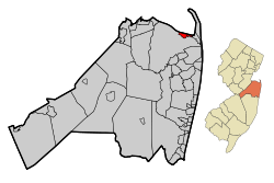 Census Bureau map of Atlantic Highlands, New Jersey
Coordinates: 40°25′15″N 74°00′57″W / 40.42083°N 74.01583°WCoordinates: 40°25′15″N 74°00′57″W / 40.42083°N 74.01583°W Country United States State New Jersey County Monmouth Incorporated February 28, 1887 Government[1] – Type Borough (New Jersey) – Mayor Frederick J. Rast, III (2011)[2] – Administrator Adam Hubeny[3] Area – Total 4.5 sq mi (11.7 km2) – Land 1.2 sq mi (3.2 km2) – Water 3.3 sq mi (8.5 km2) Elevation[4] 0 ft (0 m) Population (2010 Census)[5] – Total 4,385 – Density 974.4/sq mi (374.8/km2) Time zone Eastern (EST) (UTC-5) – Summer (DST) EDT (UTC-4) ZIP code 07716 Area code(s) 732 FIPS code 34-02110[6][7] GNIS feature ID 0885143[8] Website http://www.ahnj.com Atlantic Highlands is a Borough in Monmouth County, New Jersey in the Bayshore Region. As of the 2010 United States Census, the borough population was 4,385.[5] Atlantic Highlands contains the highest point on the eastern seaboard south of Maine.[9]
Atlantic Highlands was incorporated as a borough by an Act of the New Jersey Legislature on February 28, 1887, from portions of Middletown Township, based on the results of a referendum held that day. The borough was reincorporated on September 1, 1891.[10]
Atlantic Highlands is part of the Bayshore Regional Strategic Plan, an effort by nine municipalities in northern Monmouth County to reinvigorate the area's economy by emphasizing the traditional downtowns, dense residential neighborhoods, maritime history, and the natural beauty of the Raritan Bayshore coastline.
Contents
History
The town overlooks where the Atlantic Ocean and Raritan Bay meet at Sandy Hook, and its hills mark the highest point on the eastern seaboard of the U.S.[11]
For thousands of years, the original inhabitants were the Lenape, who lived in and along the cliffs and creeks of Atlantic Highlands. The Lenape traded with the Europeans and sold a group of English settlers an area that covered the entire peninsula that was named Portland Poynt. and was laid out with 10 lots in 1667, making them the first European residents of present day Atlantic Highlands.[12]
Colonists convened the first Assembly of New Jersey in 1667 in what is now Atlantic Highlands.[13] During Revolutionary War years, loyalists to the English crown and patriots of the new America clashed in repeated raids and counterattacks across these lands. And here passed retreating English troops after their 1778 defeat by Washington at the Battle of Monmouth.
During the late 1800s, a handful of farms met an onrush of resort developers, church groups and town builders. They created the Victorian core of the town, attracting thousands of visitors and year-round residents.
In 1879, a surveyor was engaged to lay roads and lots for a permanent community. The Atlantic Highlands Association was formed by prominent members of the Methodist Church. This organization developed the community of Atlantic Highlands.
Individuals and groups came from New York City and the surrounding vicinity to camp along the water in tent colonies. An outdoor amphitheater was created with a large seating capacity and outstanding acoustics. An indoor auditorium was built, which was utilized for entertaining visitors at the camp meetings. In 1887, Atlantic Highlands was incorporated as a borough, containing 1.2 square miles (3.1 km2) of prime real estate bordering on the Raritan Bay.
Major construction occurred from the 1880s through 1900. It included hotels, cottages, rooming houses, and private homes. A pier was built extending well into the bay to accommodate steamboats from New York City. The next twenty years saw rapid development within the community. A water and sewer system was constructed, cottages were erected, and the road system was completed. During this period of development a fire department was organized.
A number of churches saw their beginning in the 1880s: the Central Baptist, First Presbyterian, Saint Agnes Roman Catholic, First Methodist, and Saint Paul Baptist Church.
Atlantic Highlands became a haven for bootleggers during Prohibition.[11]
Steamer service was the most important transport during the formation of the borough, and continued through the 1940s. In the 1890s, rail service came to Atlantic Highlands. This opened up Highlands and points south to vacationers. The 1920s saw 26 passenger trains daily passing through the Borough. The Central Railroad of New Jersey built a major pier at the end of First Avenue. Several trains at a time could continue to the end of the pier to off load steamboat passengers. From the 1910s through the 1940s, the steamers “Sandy Hook” and the “Monmouth” navigated the waters bringing businessmen and vacationers to Atlantic Highlands.
Today, from its ridges and bayside, the Manhattan skyline can be seen. From its harbor sail pleasure, fishing and commuter boats. The municipal harbor was built from 1938 through 1940 with municipal, state, and federal funds. It is the largest on the East Coast, home to 715 craft including high-speed ferry service to New York City which was introduced in 1986. In 1962, the Central Railroad of New Jersey pier was destroyed by fire. Its rail route is now used by the Henry Hudson Trail.
Names that appear in the directories of the 1890s are the same names that populate the borough and run businesses in the community today. The bungalows on the East Side of the borough, which in the 1920s were summer bungalows, are now year-round homes. Portland Pointe, a five-story senior citizen building, provides housing for the elderly.
Geography
Atlantic Highlands is located at 40°24′42″N 74°02′02″W / 40.411703°N 74.033873°W (40.411703, -74.033873).[14]
According to the United States Census Bureau, the borough has a total area of 4.5 square miles (11.7 km2), of which 1.2 square miles (3.1 km2) is land and 3.3 square miles (8.5 km2) (72.51%) is water.

Sandy Hook Bay 
Highlands  Atlantic Highlands

Middletown Demographics
Historical populations Census Pop. %± 1930 2,000 — 1940 2,335 16.8% 1950 3,083 32.0% 1960 4,119 33.6% 1970 5,102 23.9% 1980 4,950 −3.0% 1990 4,629 −6.5% 2000 4,705 1.6% 2010 4,385 −6.8% Population sources:
1930 - 1990[15] 2000[16] 2010[5]As of the census[6] of 2000, there were 4,705 people, 1,969 households, and 1,258 families residing in the borough. The population density was 3,805.4 people per square mile (1,465.0/km2). There were 2,056 housing units at an average density of 1,662.9 per square mile (640.2/km2). The racial makeup of the borough was 94.37% White, 2.30% African American, 0.06% Native American, 1.23% Asian, 1.02% from other races, and 1.02% from two or more races. Hispanic or Latino of any race were 3.51% of the population.[16]
There were 1,969 households out of which 26.5% had children under the age of 18 living with them, 50.7% were married couples living together, 9.6% had a female householder with no husband present, and 36.1% were non-families. 29.7% of all households were made up of individuals and 11.4% had someone living alone who was 65 years of age or older. The average household size was 2.39 and the average family size was 3.00.[16]
In the borough the population was spread out with 21.4% under the age of 18, 6.2% from 18 to 24, 31.8% from 25 to 44, 26.5% from 45 to 64, and 14.1% who were 65 years of age or older. The median age was 40 years. For every 100 females there were 93.5 males. For every 100 females age 18 and over, there were 88.3 males.[16]
The median income for a household in the borough was $64,955, and the median income for a family was $79,044. Males had a median income of $60,857 versus $36,060 for females. The per capita income for the borough was $34,798. About 4.4% of families and 4.9% of the population were below the poverty line, including 5.0% of those under age 18 and 12.9% of those age 65 or over.[16]
Government
Local government
Atlantic Highlands is governed under the Borough form of New Jersey municipal government. The government consists of a Mayor and a Borough Council comprising six council members, with all positions elected at large. A Mayor is elected directly by the voters to a four-year term of office. The Borough Council consists of six members elected to serve three-year terms on a staggered basis, with two seats coming up for election each year.[1]
As of 2011[update], the Mayor of Atlantic Highlands is Frederick J. Rast, III. Members of the Borough Council are Council President Lou Fligor, John Archibald, Jr., Roy Dellosso, Peter T. Doyle, Jacob Hoffmann and Robert Sutton.[17]
Federal, state and county representation
Atlantic Highlands is in the 6th Congressional district and is part of New Jersey's 11th state legislative district.[18] The borough was relocated to the 13th state legislative district based on the results of the 2010 Census.[5] The new district will be in effect for the June 2011 primary and the November 2011 general election, with the state senator and assembly members elected taking office in the new district as of January 2012.[18]
New Jersey's Sixth Congressional District is represented by Frank Pallone (D, Long Branch). New Jersey is represented in the United States Senate by Frank Lautenberg (D, Cliffside Park) and Bob Menendez (D, Hoboken).
11th legislative district of the New Jersey Legislature, which is represented in the New Jersey Senate by Sean T. Kean (R, Wall Township) and in the New Jersey General Assembly by Mary Pat Angelini (R, Ocean Township) and Dave Rible (R, Wall Township).[19] The Governor of New Jersey is Chris Christie (R, Mendham).[20] The Lieutenant Governor of New Jersey is Kim Guadagno (R, Monmouth Beach).[21]
Monmouth County is governed by a Board of Chosen Freeholders consisting of five members who are elected at-large to serve three year terms of office on a staggered basis, with one or two seats up for election each year. [22] As of 2011, Monmouth County's Freeholders are Freeholder Director Robert D. Clifton (R, Matawan; term ends December 31, 2013)[23], Freeholder Deputy Director John P. Curley (R, Red Bank; 2012)[24], Thomas A. Arnone (R, Neptune City; 2013), Lillian G. Burry (R, Colts Neck Township; 2011)[25] and Amy A. Mallet (D, Fair Haven, 2011).[26][27][28]
Transportation
Atlantic Highlands is a stop for the SeaStreak Ferry, which travels from Pier 11 at the World Financial Center in Manhattan daily.[11]
Tourism and recreation
Atlantic Highlands has a large park system with eight borough-owned parks and two county operated parks. One of larger parks is Lenape Woods. It is nestled among tall trees and steep slopes, Lenape Woods offers approximately 51 acres (210,000 m2) of natural woodlands and freshwater wetlands that are the headwaters to Many Mind Creek. Many groups and local residents volunteer their time to maintain the woods. Monmouth County operates two parks in the town, Henry Hudson Trail and Mount Mitchill Scenic Overlook. Henry Hudson Trail runs nine miles (14 km) from the Aberdeen/Keyport border at the intersection of Lloyd Rd. and Clark St. to the Atlantic Highlands border at Avenue D. The trail now connects to Highlands. Mount Mitchill Scenic Overlook is located about 266 feet (81 m) above sea level, at the highest natural elevation from Maine to the Yucatan, providing views of Sandy Hook, Sandy Hook Bay, Raritan Bay and the New York skyline. This 12-acre (49,000 m2) site is also home to Monmouth County's 9/11 Memorial.[29]
Atlantic Highlands Recreation Committee runs many events in town throughout the year including a Summer Concert Series in the harbor youth programs such as basketball in the winter and soccer in the fall.
The town's history can be learned at both the Queen Anne-style Strauss Mansion Museum, and the local maritime museum.[30] Lodgings can be found at a number of cottages and inns, such as the Blue Bay Inn. Entertainment venues include the First Avenue Playhouse, which offers dessert-and-dinner theater and puppet shows. Maritime attractions include a yacht club, marina and charter boats for fishing and touring. Other places of interest include a number of gift shops, galleries, and dining establishments.[11]
Education
The Atlantic Highlands School District serves students in public school for pre-kindergarten through sixth grade. Atlantic Highlands Elementary School had an enrollment of 294 students in the 2009-10 school year.[31]
For grades 7-12, public school students attend Henry Hudson Regional High School, a comprehensive six-year high school and regional public school district that serves students from both Atlantic Highlands and Highlands.[32] The district served a total enrollment of 431 students in the 2009-10 school year.[33]
Many students also attend Ranney School in nearby Tinton Falls, a K-12 preparatory school.
Notable residents
Notable current and former residents of Atlantic Highlands include:
- Jeff Anderson (born 1970), actor, best known as Randal Graves in Kevin Smith's Clerks.[34]
- Engelbert Brenner (c. 1904-1986), soloist with the New York Philharmonic Orchestra. He was active as a conductor with the municipal band, was a tree warden, and was active within the yacht club.[35]
- Donald Brown (born 1987), All-American running back for the University of Connecticut, who led the NCAA in rushing with 2,083 yards in 2008 and currently playing for the Indianapolis Colts.[36]
- Steve Corodemus (born 1952), represents the 11th legislative district in the New Jersey General Assembly, and was a member of the Atlantic Highlands Borough Council from 1986–1988, serving as its President in 1988.[37]
- Knowshon Moreno (born 1987), running back for University of Georgia and currently playing for the Denver Broncos.[38]
References
- ^ a b 2005 New Jersey Legislative District Data Book, Rutgers University Edward J. Bloustein School of Planning and Public Policy, April 2005, p. 58.
- ^ 2011 New Jersey Mayors Directory, New Jersey Department of Community Affairs. Accessed July 17, 2011.
- ^ Business Administrator, Borough of Atlantic Highlands. Accessed June 2, 2011.
- ^ U.S. Geological Survey Geographic Names Information System: Borough of Atlantic Highlands, Geographic Names Information System. Accessed January 4, 2008.
- ^ a b c d 2011 Apportionment Redistricting: Municipalities sorted alphabetically, New Jersey Department of State. Accessed June 2, 2011.
- ^ a b "American FactFinder". United States Census Bureau. http://factfinder.census.gov. Retrieved 2008-01-31.
- ^ A Cure for the Common Codes: New Jersey, Missouri Census Data Center. Accessed July 14, 2008.
- ^ "US Board on Geographic Names". United States Geological Survey. 2007-10-25. http://geonames.usgs.gov. Retrieved 2008-01-31.
- ^ Mount Mitchill Scenic Overlook, Monmouth County, New Jersey Park System. Accessed July 17, 2011. "At 266 feet, this overlook in Atlantic Highlands sits on the highest natural elevation on the Atlantic seaboard (excluding islands) from Maine to the Yucatan providing beautiful views of Sandy Hook, Sandy Hook Bay, Raritan Bay and the New York skyline."
- ^ "The Story of New Jersey's Civil Boundaries: 1606-1968", John P. Snyder, Bureau of Geology and Topography; Trenton, New Jersey; 1969. p. 178.
- ^ a b c d Rounds, Kate. "The Shore Next Door" Palisade magazine; Summer 2010; Pages 38-39
- ^ Nash, Margo. "ON THE MAP; In a Detective Tale Involving a Town's Birth, the Clue Was Framed", The New York Times, September 17, 2000. Accessed July 17, 2011. "On Dec. 14, 1667, the first Europeans to settle in what is today Atlantic Highlands decided to lay out 10 lots in an area they called Portland Poynt on the Navesink peninsula.... Paul Boyd, a Ph.D. candidate in cultural geography at Rutgers University who is the historian of the Atlantic Highlands Historical Society and chairman of the Atlantic Highlands Environmental Commission, worked on the problem for five years."
- ^ Atlantic Highlands, Highlands and Sandy Hook: A brief history, Asbury Park Press, May 17, 2001, accessed April 15, 2007.
- ^ "US Gazetteer files: 2010, 2000, and 1990". United States Census Bureau. 2011-02-12. http://www.census.gov/geo/www/gazetteer/gazette.html. Retrieved 2011-04-23.
- ^ New Jersey Resident Population by Municipality: 1930 - 1990, Workforce New Jersey Public Information Network, backed up by the Internet Archive as of May 2, 2009. Accessed July 6, 2011.
- ^ a b c d e Census 2000 Demographic Profile Highlights: Atlantic Highlands borough, New Jersey, United States Census Bureau. Accessed July 17, 2011.
- ^ Mayor and Council, Borough of Atlantic Highlands. Accessed June 2, 2011. Note that heading states "Mayor and Council - 2010" as of date accessed, though date on photograph of "January 1, 2011" is consistent with reflecting the 2011 membership.
- ^ a b 2011 New Jersey Citizen's Guide to Government, New Jersey League of Women Voters, p. 54. Accessed June 2, 2011.
- ^ "Legislative Roster: 2010-2011 Session". New Jersey Legislature. http://www.njleg.state.nj.us/members/roster.asp. Retrieved 2010-02-08.
- ^ "About the Governor". New Jersey. http://www.nj.gov/governor/about/. Retrieved 2010-01-21.
- ^ "About the Lieutenant Governor". New Jersey. http://www.nj.gov/governor/lt/. Retrieved 2010-01-21.
- ^ Monmouth County Government, Monmouth County, New Jersey. Accessed January 5, 2011.
- ^ Freeholder Director Robert D. Clifton, Monmouth County, New Jersey. Accessed January 7, 2011.
- ^ Deputy Director Freeholder John P. Curley, Monmouth County, New Jersey. Accessed January 7, 2011.
- ^ Freeholder Lillian G. Burry, Monmouth County, New Jersey. Accessed January 7, 2011.
- ^ Freeholder Amy A. Mallet, Monmouth County, New Jersey. Accessed January 7, 2011.
- ^ Board of Chosen Freeholders, Monmouth County, New Jersey. Accessed January 7, 2011.
- ^ Rizzo, Nina. "Monmouth County freeholders sworn into office", Asbury Park Press, January 6, 2011. Accessed January 7, 2011.
- ^ Mount Mitchill Scenic Overlook, Monmouth County Park System. Accessed May 22, 2008.
- ^ Strauss Mansion, Atlantic Highlands Historical Society. Accessed July 17, 2011.
- ^ Data for the Atlantic Highlands Elementary School, National Center for Education Statistics. Accessed May 22, 2008.
- ^ About Henry Hudson, Henry Hudson Regional High School. Accessed July 17, 2011. "Henry Hudson Regional School is located on the hill adjacent to Twin Lights State Park in Highlands, New Jersey, overlooking the Atlantic Ocean and Gateway National Recreation Area at Sandy Hook. This school district serves the towns of Atlantic Highlands and Highlands and students in grades seven through twelve."
- ^ Henry Hudson Regional High School, National Center for Education Statistics. Accessed July 17, 2011.
- ^ O'Sullivan, Eleanor. "Funny, But Flawed", Asbury Park Press, July 21, 2006. Accessed January 27, 2011. "Brian O'Halloran of Old Bridge and Jeff Anderson, formerly of Atlantic Highlands , now in their mid-30s, reprise their roles as clerks Dante and Randal.
- ^ "Engelbert Brenner, 82, A Philharmonic Soloist", The New York Times, September 19, 1986. Accessed October 16, 2007. "Engelbert Brenner, who played in the New York Philharmonic for 41 years, first as an oboist and later as the orchestra's English horn soloist, died Tuesday at his home in Atlantic Highlands, N.J. He was 82 years old."
- ^ Waldstein, David. "Donald Brown Is N.F.L. Prospect With More on His Mind Than the Draft", The New York Times, April 19, 2009. Accessed January 27, 2011. "Brown, who grew up in Atlantic Highlands on the Jersey Shore, is considered the second- or third-best running back available in the draft."
- ^ Assembly Member Steven J. 'Steve' Corodemus, Project Vote Smart. Accessed August 9, 2007.
- ^ Edelson, Stephen. "Knowshon Moreno riding a Mile High", Asbury Park Press, April 25, 2009. Accessed January 27, 2011.
External links
- Atlantic Highlands web site
- Atlantic Highlands Elementary School
- Atlantic Highlands Elementary School's 2009–10 School Report Card from the New Jersey Department of Education
- Data for the Atlantic Highlands Elementary School, National Center for Education Statistics
- Henry Hudson Regional High School
- Henry Hudson Regional Alumni Association
- Atlantic Highlands Historical Society
- Atlantic Highlands Herald web site
Categories:- 1887 establishments in the United States
- Populated places established in 1887
- Boroughs in Monmouth County, New Jersey
- Seaside resorts in the United States
- Jersey Shore
- Raritan Bayshore


Wikimedia Foundation. 2010.