- Shrewsbury Township, New Jersey
Infobox Settlement
official_name = Shrewsbury Township, New Jersey
settlement_type = Township
nickname =
motto =
imagesize =
image_caption =
image_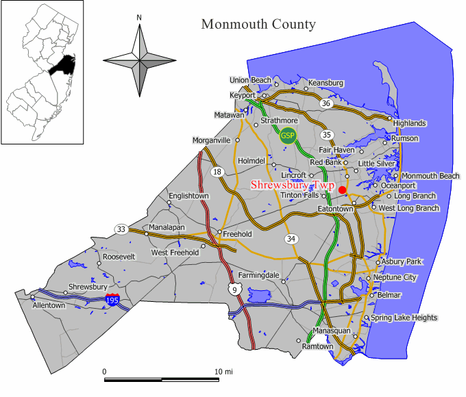
mapsize = 250x200px
map_caption = Map of Shrewsbury Township in Monmouth County. Inset: Location of Monmouth County highlighted in the State of New Jersey.
mapsize1 =
map_caption1 =subdivision_type = Country
subdivision_name =United States
subdivision_type1 = State
subdivision_name1 =New Jersey
subdivision_type2 = County
subdivision_name2 = Monmouth
government_footnotes =
government_type =Township (New Jersey)
leader_title =
leader_name =
leader_title1 =
leader_name1 =
established_title = Formed
established_date =October 31 ,1693
established_title1 = Incorporated
established_date1 =February 21 ,1798 unit_pref = Imperial
area_footnotes =
area_magnitude =
area_total_km2 = 0.2
area_land_km2 = 0.2
area_water_km2 = 0.0
area_total_sq_mi = 0.1
area_land_sq_mi = 0.1
area_water_sq_mi = 0.0population_as_of = 2006
population_footnotes =
population_total = 1073
population_density_km2 = 4488.3
population_density_sq_mi = 11624.7timezone = Eastern (EST)
utc_offset = -5
timezone_DST = EDT
utc_offset_DST = -4
elevation_footnotes = [Gnis|882603|Township of Shrewsbury,Geographic Names Information System . AccessedJanuary 4 ,2008 .]
elevation_m = 8
elevation_ft = 26
latd = 40 |latm = 18 |lats = 45 |latNS = N
longd = 74 |longm = 4 |longs = 19 |longEW = Wpostal_code_type =
ZIP code
postal_code = 07702
area_code = 732
blank_name = FIPS code
blank_info = 34-67365GR|2 [ [http://mcdc2.missouri.edu/webrepts/commoncodes/ccc_nj.html A Cure for the Common Codes: New Jersey] , Missouri Census Data Center. AccessedJuly 14 ,2008 .]
blank1_name = GNIS feature ID
blank1_info = 0882603GR|3
website =
footnotes =Shrewsbury Township is a Township in Monmouth County,
New Jersey ,United States . As of theUnited States 2000 Census , the township population was 1,098.What is now Shrewsbury Township was originally formed on
October 31 ,1693 , and was created as a township by an Act of theNew Jersey Legislature onFebruary 21 ,1798 . Over the centuries, portions of the township have been taken to form Stafford Township (March 3 ,1750 ), Dover Township (March 1 ,1768 , now Toms River Township), Ocean Township (February 24 ,1849 ), Red Bank (March 17 ,1870 ), Eatontown (April 4 ,1873 ), Rumson (May 15 ,1907 ), Fair Haven (March 28 ,1912 ), Little Silver (March 19 ,1923 ), Shrewsbury borough (March 22 ,1926 ) and New Shrewsbury (April 15 ,1950 , now Tinton Falls)."The Story of New Jersey's Civil Boundaries: 1606-1968", John P. Snyder, Bureau of Geology and Topography; Trenton, New Jersey; 1969. p. 185.]Geography
According to the
United States Census Bureau , the township has a total area of 0.1square mile s (0.2km² ), all of it land.Demographics
USCensusPop
1930=1052
1940=1347
1950=1388
1960=1204
1970=1164
1980=995
1990=1098
2000=1098
estimate= 1073
estyear=2006
estref= [http://factfinder.census.gov/servlet/SAFFPopulation?_event=ChangeGeoContext&geo_id=06000US3402567365&_geoContext=01000US%7C04000US34%7C16000US3470110&_street=&_county=shrewsbury&_cityTown=shrewsbury&_state=04000US34&_zip=&_lang=en&_sse=on&ActiveGeoDiv=geoSelect&_useEV=&pctxt=fph&pgsl=010&_submenuId=population_0&ds_name=null&_ci_nbr=null&qr_name=null®=null%3Anull&_keyword=&_industry= Census data for Shrewsbury township] ,United States Census Bureau . AccessedSeptember 30 ,2007 .]
footnote=Population 1930 - 1990. [ [http://www.wnjpin.net/OneStopCareerCenter/LaborMarketInformation/lmi01/poptrd6.htm New Jersey Resident Population by Municipality: 1930 - 1990] , Workforce New Jersey Public Information Network. AccessedMarch 1 ,2007 .] As of thecensus GR|2 of 2000, there were 1,098 people, 521 households, and 254 families residing in the township. Thepopulation density was 11,624.7 people per square mile (4,710.4/km²). There were 546 housing units at an average density of 5,780.6/sq mi (2,342.4/km²). The racial makeup of the township was 66.76% White, 16.67% African American, 10.02% Asian, 2.82% from other races, and 3.73% from two or more races. Hispanic or Latino of any race were 6.65% of the population.There were 521 households out of which 24.6% had children under the age of 18 living with them, 28.6% were married couples living together, 16.3% had a female householder with no husband present, and 51.1% were non-families. 39.5% of all households were made up of individuals and 11.7% had someone living alone who was 65 years of age or older. The average household size was 2.10 and the average family size was 2.89.
In the township the population was spread out with 20.6% under the age of 18, 9.3% from 18 to 24, 37.8% from 25 to 44, 21.5% from 45 to 64, and 10.8% who were 65 years of age or older. The median age was 35 years. For every 100 females there were 93.3 males. For every 100 females age 18 and over, there were 90.0 males.
The median income for a household in the township was $36,875, and the median income for a family was $42,500. Males had a median income of $32,813 versus $30,598 for females. The
per capita income for the township was $23,574. About 6.9% of families and 8.8% of the population were below thepoverty line , including 12.7% of those under age 18 and 11.8% of those age 65 or over.Government
Local government
Shrewsbury Township is governed under the Township form of government with a three-member Township Committee. The Township Committee is elected directly by the voters in partisan elections to serve three-year terms of office on a staggered basis, with one seat coming up for election each year. ["2005 New Jersey Legislative District Data Book",
Rutgers University Edward J. Bloustein School of Planning and Public Policy , April 2005, p. 63.] At an annual reorganization meeting, the Township Committee selects one of its members to serve as Mayor.Federal, state and county representation
Shrewsbury Township is in the Twelfth Congressional District and is part of New Jersey's 12th Legislative District. [ [http://www.lwvnj.org/pubs/CG06.pdf 2006 New Jersey Citizen's Guide to Government] , New Jersey
League of Women Voters , p. 64. AccessedAugust 30 ,2006 .]Education
Public school students in grades K through 8 attend the three schools in the
Tinton Falls School District . The district is a regional district that also serves students from the neighboring community of Tinton Falls. All three of the district's schools are located in Tinton Falls.Students in public school for grades 9 to 12 attend
Monmouth Regional High School , located in Tinton Falls. Thehigh school is part of theMonmouth Regional High School District , which serves students from Shrewsbury Township and Tinton Falls, along with students from Eatontown,Fort Monmouth andNaval Weapons Station Earle . [ [http://education.state.nj.us/rc/rc06/narrative/25/3270/25-3270-050.html Monmouth Regional High School 2006 Report card Narrative] ,New Jersey Department of Education . AccessedApril 23 ,2008 . "Pupils attending reside in the Monmouth County communities of Eatontown, Shrewsbury Township and Tinton Falls. In addition, some students come from the military facilities of Fort Monmouth and Earle Naval Weapons Station."]References
External links
* [http://www.tfs.k12.nj.us/ Tinton Falls Public Schools]
*NJReportCard|25|5185|0|Tinton Falls School District
* [http://nces.ed.gov/ccd/schoolsearch/school_list.asp?Search=1&DistrictID=3416200 Data for the Tinton Falls School District] ,National Center for Education Statistics
* [http://www.monmouthregional.net Monmouth Regional High School District]
Wikimedia Foundation. 2010.