- Avon-by-the-Sea, New Jersey
Infobox Settlement
official_name = Avon-by-the-Sea, New Jersey
settlement_type = Borough
nickname =
motto =
imagesize =
image_caption =
image_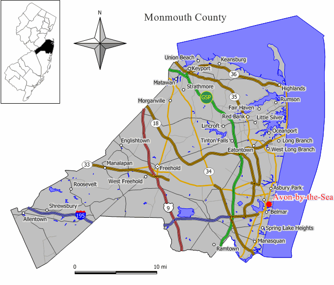
mapsize = 250x200px
map_caption = Map of Avon-by-the-Sea in Monmouth County. Inset: Location of Monmouth County highlighted in the State of New Jersey.
mapsize1 = 250x200px
map_caption1 = Census Bureau map of Avon-by-the-Sea, New Jerseysubdivision_type = Country
subdivision_name =United States
subdivision_type1 = State
subdivision_name1 =New Jersey
subdivision_type2 = County
subdivision_name2 = Monmouth
government_footnotes =
government_type =Walsh Act (New Jersey)
leader_title =Mayor
leader_name = Robert Mahon
leader_title1 = Administrator
leader_name1 = Timothy M. Gallagher [ [http://www.avonbytheseanj.com/avonbythesea_borough.htm Borough Information] , Borough of Avon-by-the-Sea. AccessedJuly 14 ,2008 .]
established_title = Incorporated
established_date =March 23 ,1900 unit_pref = Imperial
area_footnotes =area_magnitude =
area_total_km2 = 1.4
area_land_km2 = 1.1
area_water_km2 = 0.3
area_total_sq_mi = 0.6
area_land_sq_mi = 0.4
area_water_sq_mi = 0.1population_as_of = 2006
population_footnotes =
population_total = 2166
population_density_km2 = 2014.9
population_density_sq_mi = 5262.9timezone = Eastern (EST)
utc_offset = -5
timezone_DST = EDT
utc_offset_DST = -4
elevation_footnotes = [Gnis|885147|Borough of Avon-by-the-Sea,Geographic Names Information System . AccessedJune 13 ,2008 .]
elevation_m = 3
elevation_ft = 10
latd = 40 |latm = 11 |lats = 28 |latNS = N
longd = 74 |longm = 00 |longs = 53 |longEW = Wpostal_code_type =
ZIP code
postal_code = 07717
area_code = 732
blank_name = FIPS code
blank_info = 34-02440GR|2 [ [http://mcdc2.missouri.edu/webrepts/commoncodes/ccc_nj.html A Cure for the Common Codes: New Jersey] , Missouri Census Data Center. AccessedJuly 14 ,2008 .]
blank1_name = GNIS feature ID
blank1_info = 0885147GR|3
website = http://www.avonbytheseanj.com
footnotes =Avon-by-the-Sea is a Borough in Monmouth County,
New Jersey ,United States , although many of the vacationers and locals call it Avon. As of theUnited States 2000 Census , the borough population was 2,244.Avon-by-the-Sea was incorporated as a borough by an Act of the
New Jersey Legislature onMarch 23 ,1900 , from portions of Neptune City."The Story of New Jersey's Civil Boundaries: 1606-1968", John P. Snyder, Bureau of Geology and Topography; Trenton, New Jersey; 1969. p. 178.]Geography
Avon-by-the-Sea is located at coor dms|40|11|31|N|74|1|1|W|city (40.191809, -74.016886)GR|1.
According to the
United States Census Bureau , the borough has a total area of 0.6square mile s (1.4km² ), of which, 0.4 square miles (1.1 km²) of it is land and 0.1 square miles (0.3 km²) of it (21.82%) is water.Demographics
USCensusPop
1930=1220
1940=1211
1950=1650
1960=1707
1970=2163
1980=2337
1990=2165
2000=2244
estimate= 2166
estyear=2006
estref= [http://factfinder.census.gov/servlet/SAFFPopulation?_event=Search&geo_id=16000US3400730&_geoContext=01000US%7C04000US34%7C16000US3400730&_street=&_county=avon&_cityTown=avon&_state=04000US34&_zip=&_lang=en&_sse=on&ActiveGeoDiv=geoSelect&_useEV=&pctxt=fph&pgsl=160&_submenuId=population_0&ds_name=null&_ci_nbr=null&qr_name=null®=null%3Anull&_keyword=&_industry= Census data for Avon-by-the-Sea borough] ,United States Census Bureau . AccessedAugust 10 ,2007 .]
footnote=Population 1930 - 1990. [ [http://www.wnjpin.net/OneStopCareerCenter/LaborMarketInformation/lmi01/poptrd6.htm New Jersey Resident Population by Municipality: 1930 - 1990] , Workforce New Jersey Public Information Network. AccessedMarch 1 ,2007 .] As of thecensus GR|2 of 2000, there were 2,244 people, 1,043 households, and 535 families residing in the borough. Thepopulation density was 5,262.9 people per square mile (2,014.9/km²). There were 1,387 housing units at an average density of 3,253.0/sq mi (1,245.4/km²). The racial makeup of the borough was 97.15% White, 0.53% African American, 0.45% Native American, 0.89% Asian, 0.62% from other races, and 0.36% from two or more races. Hispanic or Latino of any race were 2.41% of the population.As of the 2000 census, 36.5% of Avon-by-the-Sea residents were of Irish ancestry, the third-highest percentage of any municipality in the United States, and second-highest in New Jersey, among all places with more than 1,000 residents identifying their ancestry. [ [http://www.epodunk.com/ancestry/Irish.html Irish Communities] ,
Epodunk . AccessedJune 9 ,2007 .]There were 1,043 households out of which 18.6% had children under the age of 18 living with them, 42.8% were married couples living together, 6.4% had a female householder with no husband present, and 48.7% were non-families. 41.1% of all households were made up of individuals and 18.5% had someone living alone who was 65 years of age or older. The average household size was 2.15 and the average family size was 3.04.
In the borough the population was spread out with 18.4% under the age of 18, 4.8% from 18 to 24, 28.7% from 25 to 44, 25.8% from 45 to 64, and 22.3% who were 65 years of age or older. The median age was 44 years. For every 100 females there were 93.4 males. For every 100 females age 18 and over, there were 87.4 males.
The median income for a household in the borough was $60,192, and the median income for a family was $80,605. Males had a median income of $53,125 versus $35,857 for females. The
per capita income for the borough was $41,238. About 2.3% of families and 2.7% of the population were below thepoverty line , including 3.0% of those under age 18 and 4.4% of those age 65 or over.Government
Local government
Avon-by-the-Sea has governed under the Walsh Act since 1919, by a three-member commission. [ [http://www.njstatelib.org/NJ_Information/Digital_Collections/MFMG/MFMGCH4.PDF The Commission Form of Municipal Government] , p. 53. Accessed
August 10 ,2007 .] Members of the commission are elected at-large innonpartisan elections to serve four-year terms of office on a concurrent basis."2005 New Jersey Legislative District Data Book",Rutgers University Edward J. Bloustein School of Planning and Public Policy , April 2005, p. 58.]Members of the Avon-by-the-Sea Commission are: [ [http://www.avonbytheseanj.com/avonbythesea_electedofficials.htm Elected Officials] , Avon-by-the-Sea Borough. Accessed
July 14 ,2008 .]
*Mayor Robert Mahon -Commissioner of Revenue and Finance
*Francis Gorman -Commissioner of Public Affairs and Public Safety
*Robert P. McGovern -Commissioner of Public Works, Parks and Public Property Federal, state and county representation
Avon-by-the-Sea is in the Sixth Congressional District and is part of New Jersey's 11th Legislative District. [ [http://www.lwvnj.org/pubs/CG06.pdf 2006 New Jersey Citizen's Guide to Government] , New Jersey
League of Women Voters , p. 54. AccessedAugust 30 ,2006 .]Education
The
Avon School District serves public school students in kindergarten through eighth grade. Avon Elementary School served an enrollment of 132 students during the 2005-06 school year. [ [http://nces.ed.gov/ccd/schoolsearch/school_list.asp?Search=1&DistrictID=3401140 Data for the Avon Elementary School] ,National Center for Education Statistics . AccessedJune 18 ,2008 .]For grades 9-12, public school students attend
Manasquan High School , in Manasquan, as part of asending/receiving relationship . The high school also serves students from Belmar, Brielle, Lake Como, Sea Girt, Spring Lake, Spring Lake Heights who attended Manasquan High School as part of sending/receiving relationships with their respective districts. [ [http://education.state.nj.us/rc/rc07/narrative/25/2930/25-2930-000.html Manasquan Public Schools 2007 Report Card Narrative] ,New Jersey Department of Education . AccessedFebruary 18 ,2008 . "Manasquan High School receives students from seven different districts; Avon, Brielle, Belmar, Lake Como, Sea Girt, Spring Lake, and Spring Lake Heights."] [ [http://151.198.211.155/public/about/index.asp About MBOE] , accessedSeptember 7 ,2006 .] During the 2004-2005 school year, there were seven students from Avon-by-the Sea who attended Manasquan High School. Students may also apply to academy schools in theMonmouth County Vocational School District , which include theAcademy of Allied Health & Science ,Biotechnology High School ,High Technology High School ,Marine Academy of Science and Technology andCommunications High School .Students may also attend
Academy Charter High School , located in Lake Como, which serves residents of Allenhurst, Asbury Park, Avon-by-the-Sea, Belmar, Bradley Beach, Deal, Interlaken and Lake Como, and accepts students on a lottery basis. [ [http://education.state.nj.us/rc/rc07/narrative/80/6010/80-6010-910.html Academy Charter High School 2007 Report Card Narrative] ,New Jersey Department of Education . AccessedMarch 12 ,2008 .]References
External links
* [http://www.avonbytheseanj.com/ Avon-by-the-Sea official web site]
* [http://avonschool.schoolwires.com/avonelementary/site/default.asp Avon Elementary School]
*NJReportCard|25|0180|0|Avon Elementary School
* [http://nces.ed.gov/ccd/schoolsearch/school_list.asp?Search=1&DistrictID=3401140 Data for the Avon Elementary School] ,National Center for Education Statistics
Wikimedia Foundation. 2010.