- Toronto Islands
-
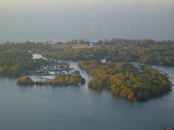
 The Toronto Islands as seen from the lower observation deck of the CN Tower. The meandering channels between the sandy and tree-covered islands can clearly be seen from this vantage point. Access is restricted to private watercraft, public ferries or small plane transports that frequently land at the airport that currently resides at the far western end of these islands.
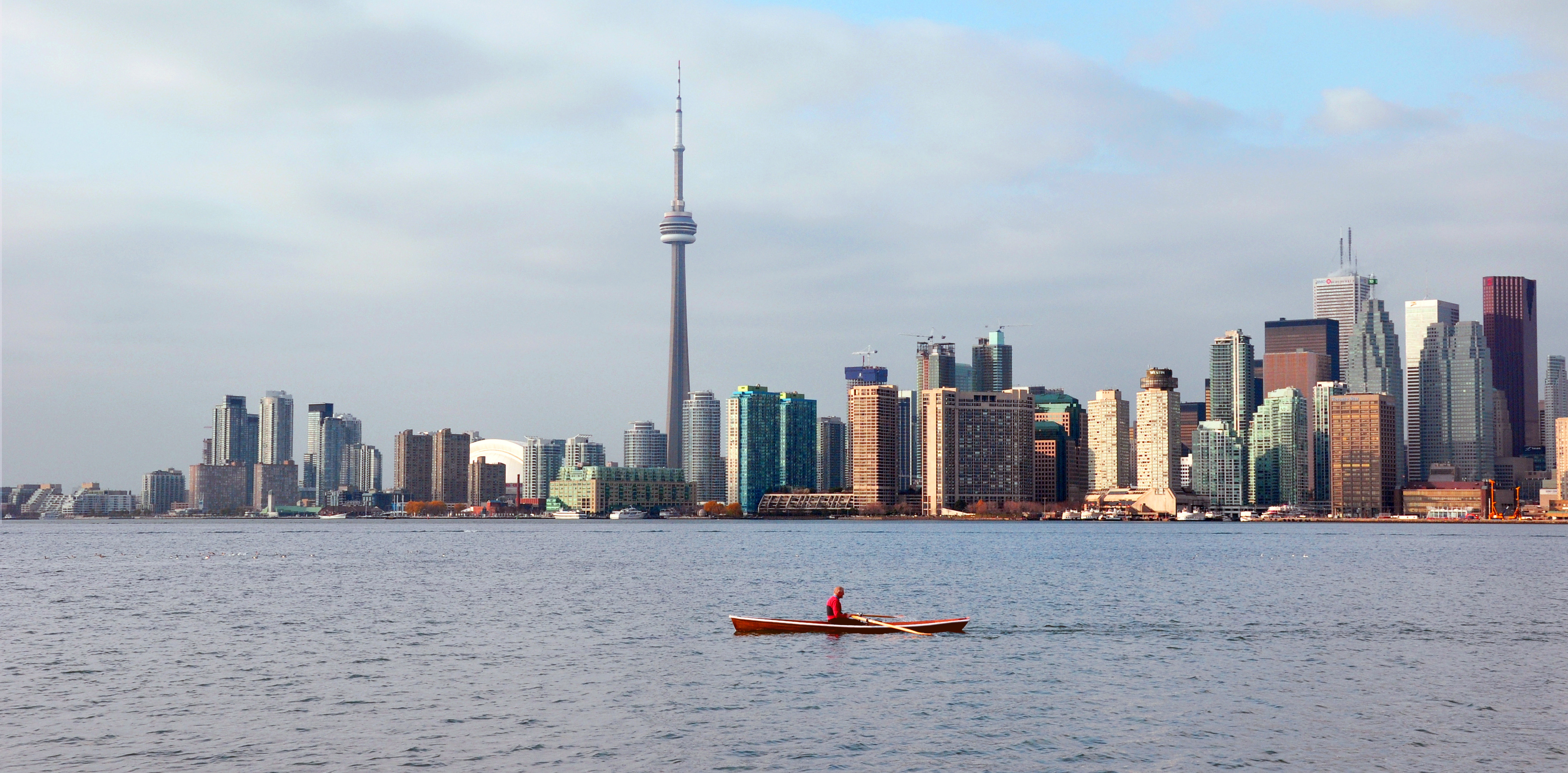
 The Toronto night skyline as seen from one of the islands
The Toronto Islands are a chain of small islands in the city of Toronto, Ontario. Comprising the only group of islands in the western part of Lake Ontario, the Toronto Islands are located just offshore from the city centre, and provide shelter for Toronto Harbour. The islands are a popular recreational destination, and are home to a small residential community and to the Billy Bishop Toronto City Airport. They are connected to the mainland by several ferry services.
The islands comprise the largest urban car-free community in North America, though some service vehicles are permitted. Recreational bicyclists are accommodated on the ferries, and bicycles, quadracycles, and canoes can be rented on the islands as well.
Contents
Geography
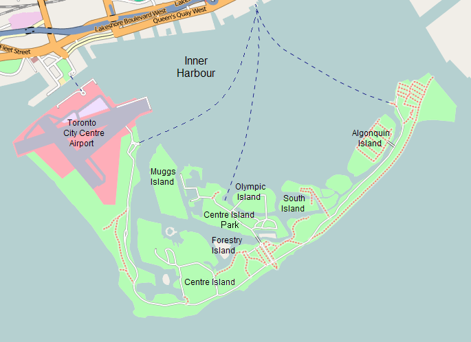
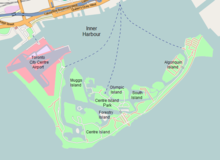 Map of the islands
The area of the islands is about 230 hectares (570 acres). The largest, outermost island, called Centre Island, is crescent-shaped and forms the shoreline of both the Eastern and Western Channels. Algonquin (Sunfish Island) and Olympic are two of the other major islands. The former is mostly a residential area and the latter home to the city's Island Public Science School. What is commonly called Ward's Island is actually the eastern end of Centre Island and like Alqonquin is a residential area. Confusingly, Centre Island Park is located on Middle Island, which is as a consequence often mistaken for Centre Island. Centre Island is sometimes referred to as Toronto Island (note the singular form) to prevent this type of confusion.[1] Other smaller islands include:
- Forestry Island – heavily forest and no fixed link to other islands
- Snake Island – partially forest and beach facing Toronto Harbour (Snake Island Park); access from bridge to Centre Island
- South Island – used for mooring and on land storage of boats by the Royal Canadian Yacht Club; east end of island cut off at Chippewa Avenue
- RCYC Island – occupied by Royal Canadian Yacht Club
Two unnamed islands occupy what was once Block House Bay:
- ringed island in Long Pond (the former water intake of the City of Toronto) – located across from Mugg's Island
- small island in Lighthouse Pond
The islands were originally a 9 km peninsula or sand spit extending from the mainland. The islands are composed of alluvial deposits from the erosion of the Scarborough Bluffs. The flow from the Niagara River to the south across Lake Ontario causes a counter-clockwise east-to-west current which has, over time, deposited sediments at the south end of the harbour to form a sand spit.
In 1852, a storm flooded sand pits on the peninsula, creating a channel east of Ward's.[2] The channel was widened and made permanent by a violent storm in 1858. The channel became known as the Eastern Gap.[1][3] The peninsula to the west became known as the Toronto Islands. To the east of the Gap, the area of today's Cherry Beach was known as "Fisherman's Island".
Sediment deposition was halted in the 1960s when the Leslie Street Spit was extended beyond the southern edge of the islands. Left to nature, the islands would diminish over time, but this is limited due to hard shore lines built to limit erosion. Over the years land reclamation has contributed to an increase in the size of the islands. The harbour was shallow with a sandy bottom and the sands were moved by dredging or suction methods. Ward's Island was expanded by dredging. Today's Algonquin Island, formerly known as Sunfish Island, was created from harbour bottom sands.
The area now occupied by the airport has been subject to several landfills over what was once sandy shoal, initially to accommodate the amusement park that preceded the airport, and then to accommodate the airport itself.[1][3] The Western Channel to the north of the airport is several hundred feet of the original western channel, which was just south of today's Fort York. It was opened in 1911 as part of a program to improve boat navigation into the harbour. The airport lands were created from harbour sands in the late 1930s.
A series of waterways allow boat traffic to navigate the island:
- Allan Lamport Regatta Course - located between Centre Island and Middle Island from Long Pond to east end of Farm Enough Farm
- Block House Bay - located on east side of Hanlan's Point
- Lighthouse Pond - located next to Gibratar Point lighthouse
- Long Pond - located between Allan Lamport Regatta Course and Block House Bay
- Snake Pond - located between Snug Harbour and Algonquin Island
- Snug Harbour - located between Snake Island and Olympic Island
- Trout Pond - loocated west of Lighthouse Bay on the south end of Hanlan's Point
History
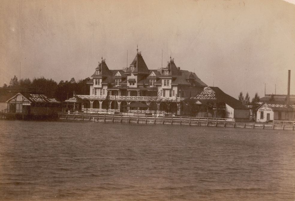
 Hanlan Hotel on the Toronto Islands in the late 19th century
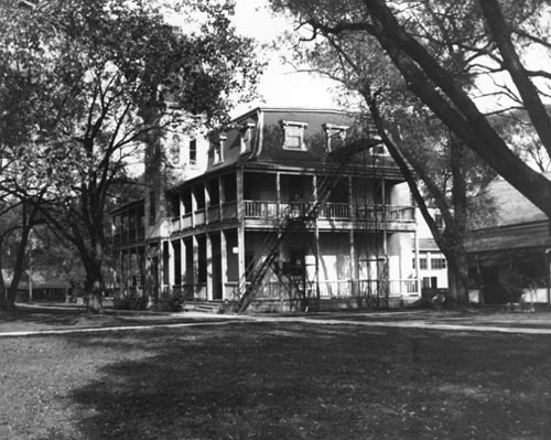
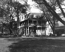 Ward's Hotel on Ward's Island, ca. 1900
Prior to European colonization, the Toronto area was home to various native tribes, including the Ojibwa who were the last people to occupy the area. The peninsula and surrounding sand-bars that now form the Toronto Islands were first surveyed in 1792 by Lieutenant Joseph Bouchette of the Royal Navy. D. W. Smith's Gazetteer recorded in 1813 that "the long beach or peninsula, which affords a most delightful ride, is considered so healthy by the Indians that they resort to it whenever indisposed". Many Indian encampments were located between the peninsula's base and the Don River.[3] The peninsula was actually a series of many sand spits and ponds.
The Gibraltar Point Lighthouse was constructed at Gibraltar Point, the south-western extremity of the peninsula in 1808. In 1815 the lighthouse keeper, J.P. Rademuller, died in suspicious circumstances. The exact truth of his death is unknown, but there are indications that he was murdered by soldiers from Fort York.[4][5]
After the peninsula became an island, the Hanlan family were among the first year-round inhabitants, settling at Gibraltar Point in 1862. In 1867 the City of Toronto acquired the islands from the federal government, and the land was divided into lots, allowing cottages, amusement areas and resort hotels to be built. The west side of the island became a resort destination for the people of Toronto and the first summer cottage community was built there. In 1878, a hotel was built by John Hanlan at the north-west tip of the island and soon after the area became known as Hanlan's Point. John's son, Edward "Ned" Hanlan, earned international recognition as a rower before taking over his father's business.[3]
Other notable families on the islands include the Durnans (James James Durnan was the Gibraltar Point Lighthouse keeper in 1832) and Wards (David Ward settled on the eastern end in 1830).[6]
At the same time as Hanlan's Point was developing as a summer suburb of Toronto, developments were going on elsewhere on the islands. Along the lakefront of Centre Island, large Victorian summer homes were built by Toronto's leading families looking for refuge from the summer heat and drawn by the prestigious Royal Canadian Yacht Club, which had moved to a location on the harbour side of Centre Island in 1881. By contrast the Ward's Island community began in the 1880s as a settlement of tents. By 1913, the number of tents pitched had increased to the point where the city felt it necessary to organize the community into streets, and the tents eventually evolved into a cottage community.[7][8]
In 1894, a land reclamation project by the Toronto Ferry Company created space for an amusement park at Hanlan's Point. In 1897, the Hanlan's Point Stadium was built alongside the amusement park for the Toronto Maple Leaf baseball team. The stadium was rebuilt several times over the years, and in 1914, Babe Ruth hit his first professional home run into the waters of Lake Ontario from this stadium. In the 1920s the Maple Leaf team moved to a new stadium on the mainland.
From 1915 to 1916 a temporary wooden hanger (see image at [1]) was built at the beach by the Curtiss Flying School.[9] This floatplane aerodrome was used for flight training for World War I.
In 1937 construction started on a new airport on the site of the park and stadium.[3] The construction of the airport on infill led to the demolition of the stadium and most of the amusement park. It also meant that the cottage community at Hanlan's Point needed to be relocated. The residents were given the choice of either moving their cottages further south at Hanlan's Point, or resettling on Algonquin Island. Originally, Algonquin Island was simply a sandbar known as Sunfish Island that was expanded by land reclamation operations. In 1938 streets were laid out to accommodate 31 cottages that were moved by barge from Hanlan's Point. The original aspect of Algonquin Island was of unvegetated sand, and the current lush environment of the island is the result of many years of work by residents.[7]
The airport opened in 1939, formally named the Port George VI Island Airport, after the reigning monarch of the time. During the first few years of the Second World War, expatriate Norwegian (RNAF) pilots-in-training used the Toronto Island Airport as a training field for both fighter and bomber pilots. Several accidents, including one where a pilot under instruction clipped the funnel and mast of the island ferry boat Sam McBride and crashed, led to the training school being moved north to Muskoka, Ontario. (The park on the mainland called Norway Park commemorates this period.)
At its peak in the 1950s, the Island residential community extended from Ward's Island to Hanlan's Point, and was made up of some 630 cottages and homes, in addition to such amenities as a movie theatre, a bowling alley, stores, hotels, and dance halls.[10] Not long after its creation in 1953, Metropolitan Toronto Council undertook to remove the community and replace it with parkland.[11] The construction of the Gardiner Expressway had removed many acres of recreational land along the Toronto waterfront, and the Islands lands were to replace the acreage. In 1955, after the City had transferred the lands to Metro, the new Metro Parks Department started to demolish homes and cottages whose lease had expired or whose lease holders gave up their leases. In 1959, the Metro Parks Department opened 'Far Enough Farm', and in 1967, opened the Centreville Amusement Park, along with a new public marina. In 1971, Metro Parks opened a new ferry terminal at the foot of Bay Street. Unlike the previous terminal, no waiting room was provided.[12] In 1976, the Trillium, a 1910 paddle-wheeler ferry which had been abandoned in a lagoon, was refurbished and relaunched for use as an island ferry.
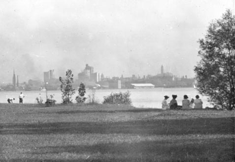
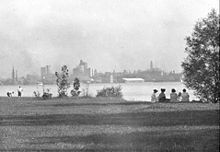 View of the Toronto skyline in 1915 from the Toronto Islands
 Toronto skyline in 2009 as seen from Centre Island Park
By 1963, all Islanders willing to leave the island had left and the remaining Islanders started to fight the plans of Metro to remove their homes. While demolitions still proceeded, the Islanders' alderman David Rotenberg pushed the Islanders' cause and the number of demolitions dwindled. In 1969, the Toronto Islands' Residents Association (TIRA) was formed. Still, by 1970 only 250 homes, on Ward's and Algonquin Islands, had escaped the bulldozer. The 1970s saw no further demolitions as the Metro Parks plans were thwarted by year-to-year leases and the changing of the guard on Toronto City Council to a group more sympathetic to the Islanders. In 1973, City Council voted 17–2 to preserve the community and transfer those lands back to the City. However, Metro Council remained opposed and the Islanders started legal challenges to Metro's plans in 1974 to delay Metro's plans of expropriation. By 1978, Metro Council had won several legal battles and had obtained 'writs of possession' for the 250 homes. At the time, a minority provincial Conservative government was in place with both the Liberals and NDP opposition parties in favour of the Islanders and the Islanders appealed to the provincial government, winning more time when the province agreed to act as mediator between the City and Islanders and Metro.[13]
Matters came to a head on July 28, 1980, when a sheriff sent to serve eviction notices to remaining residents was met at the Algonquin Island bridge by much of the community, whose leaders persuaded the sheriff to withdraw.[14] On July 31, the community won the right to challenge the 1974 evictions. The Islanders lost the challenge, but by this time, the province had started a formal inquiry headed by Barry Swadron into the Toronto Islands. On December 18, 1981, the province of Ontario passed a law legalizing the Islanders to stay until 2005. This kept the lands in Metro's ownership, to be leased to the City who would lease it to the Islanders.[15] Wrangling over the terms of the lease payments to Metro took several years.
The community's fight for survival was finally rewarded in 1993, when the Ontario Government passed the Toronto Islands Residential Community Stewardship Act, which enabled Islanders to purchase 99-year land leases from a Land Trust.[16]
To the descendants of the Ojibwa, now the Mississauga First Nation, the Toronto Islands are sacred land. Their aboriginal title to the islands has been acknowledged by the federal government of Canada[citation needed]. The land is currently owned by the City of Toronto, and the Mississaugas are considering how they will exercise their aboriginal title and have a presence there.
In culture
The Toronto Islands have appeared as significant settings in Canadian literature. Examples includes Margaret Atwood's The Robber Bride and Robert Rotenberg's Old City Hall.
The islands today
Recreation
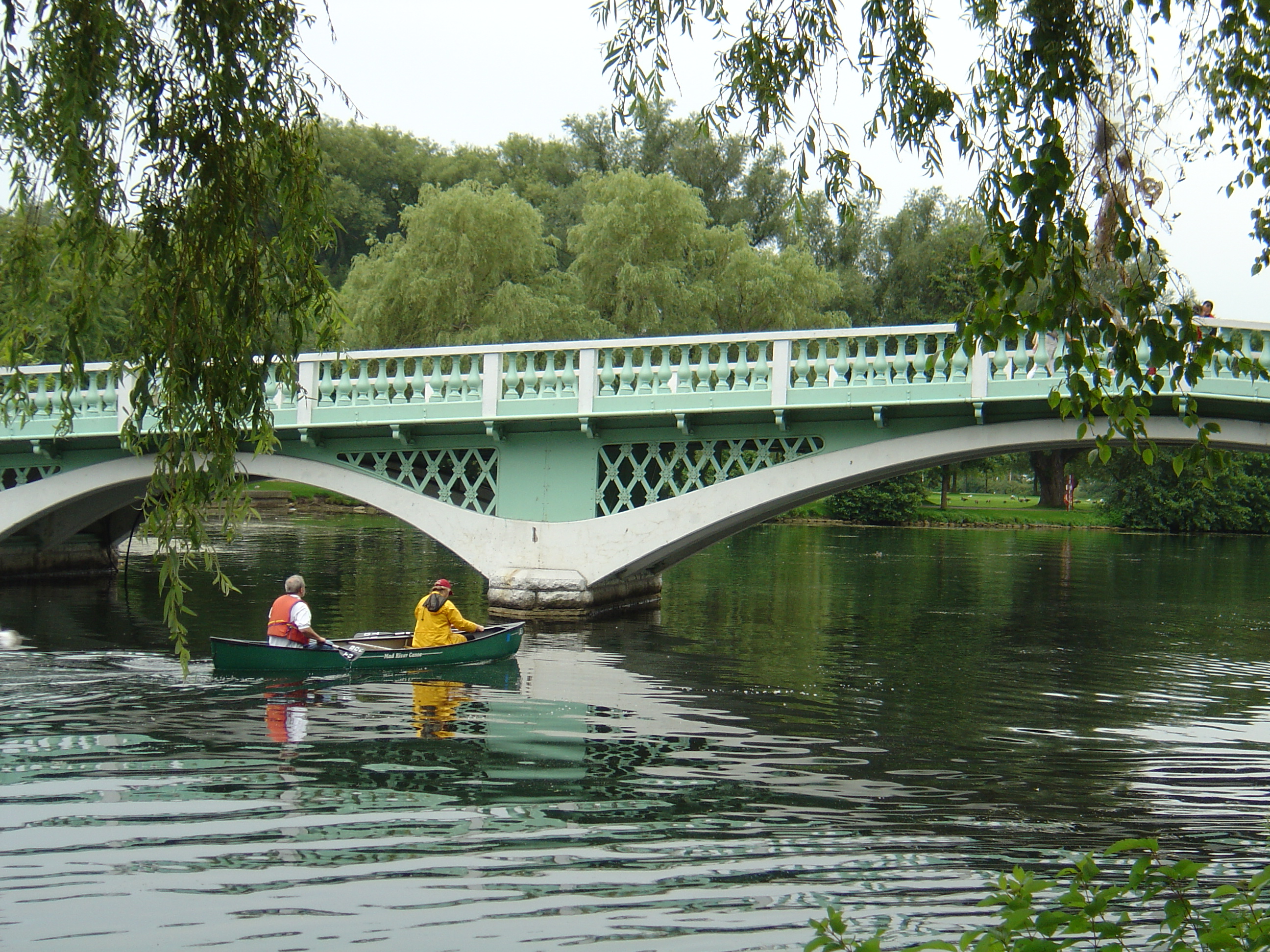
 Paddling among the Toronto Islands
The central area hosts Centreville, a children's amusement park which was built in 1967 with a 1900s-style turn-of-the-century theme. The park includes a miniature railway and antique carousel, and is open daily in summer. The Far Enough Farm is nearby and displays common farm livestock and birds.[3] The Franklin's Garden children's garden was created in the 2000s and is located to the west of the Avenue of the Islands. A splash pad and playground is also located nearby. On the western side of Ward's Island is a frisbee golf course.
There are several swimming beaches on the islands, including Centre Island Beach, Manitou Beach, Gibraltar Point Beach, Hanlan's Point Beach and Ward's Island Beach. Hanlan's Point Beach includes an officially recognized clothing optional section.[17][18]
Recreational boating has been popular on the islands for over a century. The Islands are home to four yacht clubs: Harbour City Yacht Club, Island Yacht Club, Queen City Yacht Club and the Royal Canadian Yacht Club. There is a public marina, the Toronto Island Marina, and several smaller clubs including the Toronto Island Sailing Club, the Sunfish Cut Boat Club and the Toronto Island Canoe Club. There is also a dragon boat regatta course and grandstand, where the Toronto International Dragon Boat Race Festival is held annually.[3]
For many years the Caribana has held an annual arts festival at Olympic Island on the Simcoe Day weekend. Other Island events include the Olympic Island Festival, an annual rock concert initiated in 2004 by Sloan's Jay Ferguson. The Wakestock festival has also been held on the islands.
Community
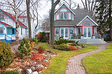 One of the houses on Algonquin Island
A community of 262 homes still remain on the Toronto Islands, concentrated at the eastern end of the island chain on Ward's Island and Algonquin Island. Under the terms of the Toronto Islands Residential Community Stewardship Act there are strict rules under provincial law governing the buying and selling of these homes.[7][16]
There is one school, two daycares, and one church on the islands. The Toronto Island Public School, a public school located at Gibraltar Point, operates a day programme for island residents up to grade 6, a residential natural science programme for visiting grade 5/6 students from the mainland, and a pre-school nursery. The Waterfront Montessori Children's Centre, a non-profit, parent run co-operative pre-school nursery for children aged 2½ to 5, is located on Algonquin Island. St. Andrew-by-the-Lake Church is an Anglican church located on Centre Island which serves the islands' residents and visitors.[19][20][21][22]
Artscape Gibraltar Point (formerly The Gibraltar Point Centre for the Arts) occupies buildings previously used by the Toronto Island Public School, and comprises more than 15 artist work studios occupied by a mix of painters, ceramists, sculptors, musicians, theatre companies, and a recording studio. The centre provides a long and short-term studio and bedroom rental service for artists, together with meeting, conference and special event services and an artist residency program.[23]
Politics
Municipal
The islands are part of Toronto Ward 28 Toronto Centre—Rosedale and represented by Pam McConnell. The area was once part of St. Andrew Ward and Metro Toronto Ward 20 Trinity-Niagara.
Provincial
The islands have been part of the riding of Trinity—Spadina since 2007 and are represented by NDP MPP Rosario Marchese. From 1999 to 2007 the area was part of Toronto Centre—Rosedale, and from 1987 to 1999 it was part of Fort York.
Federal
The islands have been part of the riding of Trinity—Spadina since 2004 and are represented by NDP MP Olivia Chow. From 1997 to 2004 the area was part of Toronto Centre—Rosedale, from 1966 to 1997 it was part of Rosedale, from 1933 to 1966 it was part of Spadina and from 1903 to 1933 it was part of Toronto South.
Commercial activity
Other than the airport, Toronto Islands have other commercial oriented business:
- Beasley Entertainment – Etobicoke based operator of Centreville and related food stands in the park
- Royal Canadian Yacht Club
- Island Yacht Club
Transportation
Airport
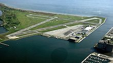
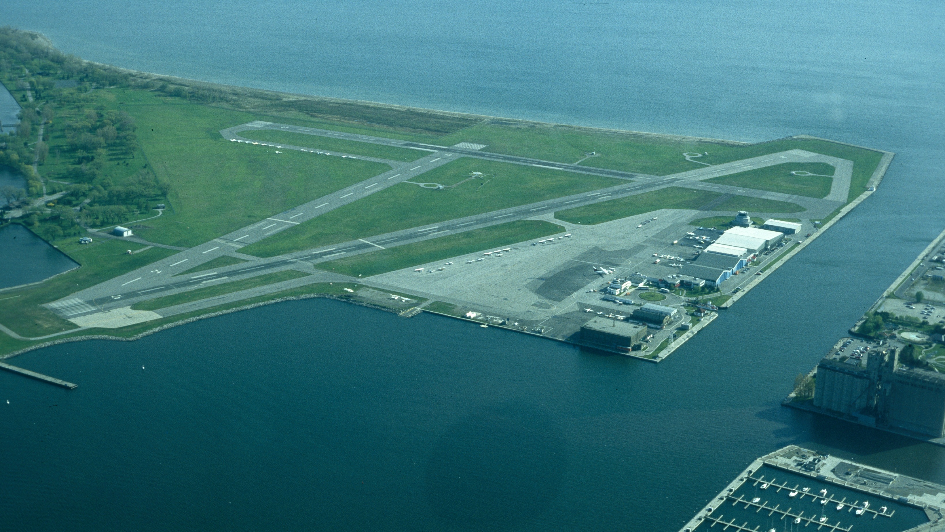
The north-western tip of the Toronto Islands is home to the Billy Bishop Toronto City Airport, more often known as the Toronto Island Airport. The airport is used for civil aviation, including airlines, flight training, medevac flights and private aviation. Since 1984, it has been used for regional airlines using approved STOL-type aircraft. In recent years, the airport has become the centre of controversy between those who wish to close it down, and those who want to expand its usage. One focus of this controversy had been a plan to construct a road bridge to the airport; this was a major issue in the 2003 election for mayor and was cancelled by Toronto mayor David Miller soon after his victory.
Ferry services
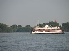 One of the ferries that links the Toronto Islands to the mainland
There is no fixed road link from the mainland to the Toronto Islands, which therefore rely on ferries, water taxis and other boats for their transport needs.
Three public ferry routes provide links for passengers and service vehicles from the central Toronto waterfront to docks at Hanlan's Point, Centre Island Park and Ward's Island, and are used by recreational visitors and residents. The fourth public ferry service provides a vehicle and passenger connection from a dock at the foot of Bathurst Street to the airport. There is no public access between the airport and the rest of the island chain.
Beside the public ferry services, several yacht clubs and marinas located on the islands provide private ferry services for their members and guests.
Roads
All roads on the islands are paved, the only exception being a long wooden boardwalk on the South end of Ward's Island. The use of motor vehicles is limited to City of Toronto service vehicles (Toronto Parks and Recreation, Toronto Water and Toronto Works). However, bicycles are welcome on the ferries and the island, and there are rental bikes available on the island. Lakeshore Avenue is the main road handling vehicular traffic. The single lane paved road traverses the east, south and west sides of the park. Most bridges on the island are for pedestrian traffic, bicycles and all-terrain vehicles only. The bridge carrying traffic from Avenue of the Islands can support large vehicles, but not cars or heavy truck traffic. Two TTC GM TC40-102N buses provide service on the Island. For the Islanders it is the only way to get around quickly.[citation needed].
Notable dates
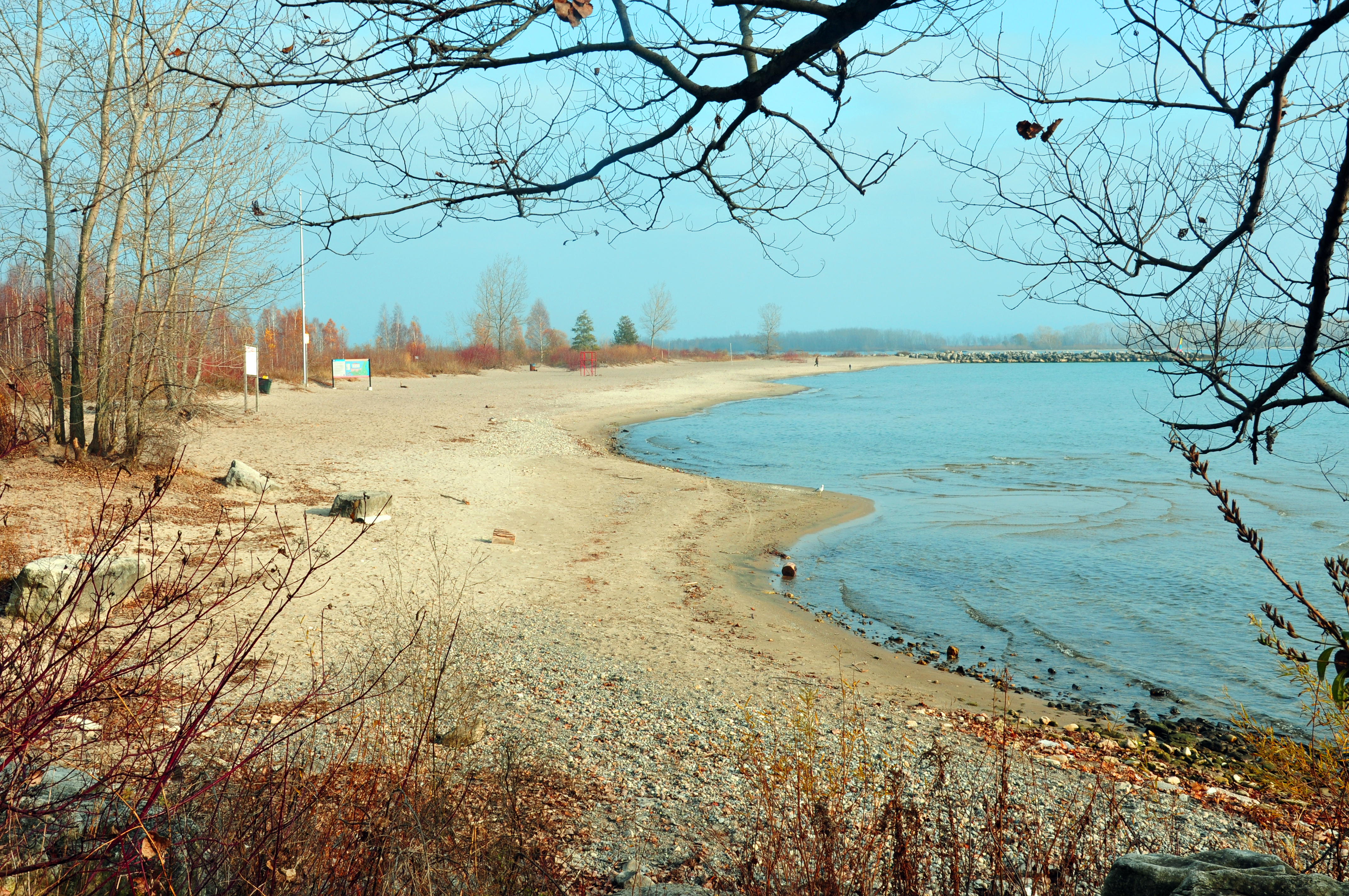
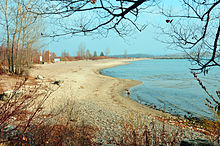 Beach on Ward's Island
- 1787 – Toronto Purchase. Mississauga Indians receive 10 shillings for 250,800 acres (101,500 ha)
- 1793 – Blockhouse built by the Queen's Rangers at Gibraltar Point.
- 1808 – Lighthouse constructed at Gibraltar Point.
- 1834 – Fisherman David Ward and family one of first settlers on island.
- 1830–1840 – First island hotels built. Start of ferry services.
- 1850 – Filtration plant on island starts supplying water to Toronto.
- 1855 – Ned Hanlan born.
- 1858 – Storm separates Toronto Islands from mainland.
- 1867 – Islands become property of City of Toronto. Lot leases are established.
- 1870–80 – Summer homes established on island. Cottages from Hanlan's Point to Centre Island.
- 1874 – Hanlan's Hotel opens.
- 1880 – Royal Canadian Yacht Club established on island.
- 1882 – William Ward, son of David Ward opens Ward's Hotel; closed 1966.
- 1884 – St. Rita's and St. Andrew-on-the-Lake churches built.
- 1897 – First amusements on Hanlan's Point established.
- 1897 – Baseball and lacrosse stadium on Hanlan's Point.
- 1899 – First summer colony established on Ward's.
- 1903 – Baseball stadium destroyed by fire and rebuilt.
- 1909 – Hanlan Hotel destroyed by fire.
- 1909 – Baseball stadium again destroyed by fire and rebuilt.
- 1913 – First 'tent city' on Ward's.
- 1914 - First professional home run of Babe Ruth's career hit at Hanlan's Point Stadium.
- 1926 – Baseball stadium vacated by Toronto Maple Leafs baseball team.
- 1937 – Construction of Island airport. Some cottages moved to Algonquin Island.
- 1939 – The Sam McBride ferry enters service.
- 1947 – City approves year-round residency to cope with housing shortage.
- 1956 – New Metro Toronto government takes over Island and leases. Starts demolishing cottages.
- 1959 – Far Enough Farm opens.
- 1967 – Centreville Amusement Park opens.
- 1967 – Toronto Island Marina opens.
- 1977–1993 – Supreme Court approves of cancellation of leases by Metro. Remaining residents fight to remain.
- 1984 - Start of scheduled regional airlines at Island airport.[24]
- 1991 – Transfer of cottage lands and lease to City allowing residents to stay.
Source: Sward, p. xv, pp. 42–51
References
- ^ a b c Kidd, Joanna. "Nature on the Toronto Islands: An Explorer's Guide" (PDF). City of Toronto. Archived from the original on 2008-04-11. http://web.archive.org/web/20080411084823/http://www.toronto.ca/parks/brochures/explorers_guide.pdf. Retrieved 2008-03-26.
- ^ Wickson, pg. 30
- ^ a b c d e f g "Toronto Island Park". City of Toronto. http://www.toronto.ca/parks/island/index.htm. Retrieved 2008-03-26.
- ^ Sward, p. 48
- ^ "Gibraltar Point Lighthouse". City of Toronto. http://www.toronto.ca/parks/island/lighthouse.htm. Retrieved 2008-03-26.
- ^ http://www.thestar.com/article/107794
- ^ a b c "The Place of My Dreams". Toronto Island Community. http://www.torontoisland.org/Home/BriefIslandHistory/tabid/120/Default.aspx. Retrieved 2008-03-26.
- ^ "Our Heritage". Royal Canadian Yacht Club. Archived from the original on 2008-02-29. http://web.archive.org/web/20080229043825/http://www.rcyc.ca/AboutRCYC/OurHeritage/tabid/86/Default.aspx. Retrieved 2008-03-26.
- ^ http://www.heritagemississauga.com/assets/Curtiss%20Aviation%20School%20-%20Final%20Report%20-%20by%20Liwen%20Chen.pdf
- ^ "Toronto Islands Community web site". http://www.torontoisland.org.
- ^ Gibson, p 236-250.
- ^ Gibson, p. 271
- ^ Gibson, pp. 254–288.
- ^ Gibson, p 290-291.
- ^ Gibson, p.293
- ^ a b "Toronto Islands Residential Community Stewardship Act, 1993". Government of Ontario. http://www.e-laws.gov.on.ca/html/statutes/english/elaws_statutes_93t15_e.htm. Retrieved 2008-02-19.
- ^ "Toronto Blue Flag Beaches". Tourism Toronto. http://www.torontotourism.com/DynamicContent/Members/17835-Toronto+Blue+Flag+Beaches.htm. Retrieved 2008-03-28.
- ^ "Toronto Islands". Tourism Toronto. http://www.torontotourism.com/Visitor/WhatToSeeAndDo/Neighbourhoods/TorontoIslands.htm. Retrieved 2008-03-28.
- ^ "Toronto Island Public School". Toronto Island Public School. http://torontoislandschool.com/. Retrieved 2008-03-28.
- ^ "Gibraltar Point Day Nursery". Gibraltar Point Day Nursery. http://www.gibraltarpointdaycare.com/. Retrieved 2010-03-28.
- ^ "Waterfront Montessori Daycare". Canadian Council of Montessori Administrators. http://www.ccma.ca/page.aspx?page=506. Retrieved 2008-03-28.
- ^ "St. Andrew-by-the-Lake Anglican Church". Toronto Island Community. http://www.torontoisland.org/Home/StAndrewbytheLakeChurch/StAndrewByTheLakeHome/tabid/157/Default.aspx. Retrieved 2008-03-28.
- ^ "Gibraltar Point Centre for the Arts". Artscape. http://www.torontoartscape.on.ca/places-spaces/artscape-gibraltar-point. Retrieved 2010-05-02.
- ^ Harding, Katherine (July 26, 2001). "Group urges turning airport to park". Toronto Star: p. B07.
Bibliography
- "Little Norway – the history". Norwegian embassy in Canada. http://www.emb-norway.ca/norwaycanada/littlenorway/history/history.htm.
- Gibson, Sally (1984). More Than an Island. Toronto: Irwin Publishing. ISBN 0-7720-1446-9.
- Rosenbaum, Linda; Dean, Peter (2004). The Essential Toronto Island Guide. Toronto: Island Ad/Ventures. ISBN 0-9735855-0-1. http://torontoisland.org/Soyouwant/IslandAuthors/LindaRosenbaumPeterDean/tabid/151/Default.aspx.
- Swadron, Barry B. (1981). Pressure Island: The Report of the Commission of Inquiry into the Toronto Islands. Government of Ontario.
- Sward, Robert (1983). The Toronto Islands. Toronto, Ontario. ISBN 0919567223.
- Hurdon, David (August 2006). "The Toronto Islands Then & Now: A guided tour through 200 years of history" (DVD). The Content Shop. http://www.toronto-island.com. Retrieved 2006-09-02.
External links
- City of Toronto website about the Islands
- Toronto Island community website
- Toronto Island Marina website
- Centreville Amusement Park Website
- Closed Canadian Parks – Hanlan's Point is a history of the early amusement park (Hanlan's Point Park) that existed on the Toronto Islands during the 1860s – 1880s – 1937 period. It includes historical photographs of the roller coaster, midway, roller rink, hotel, stadium and others.
- Friends of Toronto Islands website
- Toronto Islands historical plaque
- Outdoor recreation such as paddling to and among the Toronto Islands
- Small video for a quick overview of the Islands
Neighbourhoods in Toronto Old Toronto Alexandra Park · The Annex · The Beaches · Bedford Park · Bickford Park · Bloor West Village · Bloordale Village · Bracondale Hill · Brockton Village · Cabbagetown · Carleton Village · Casa Loma · Chaplin Estates · Chinatown · Church and Wellesley · CityPlace · Corktown · Corso Italia · Davenport · Davisville Village · Deer Park · Discovery District · Distillery District · Dovercourt Park · Dufferin Grove · Earlscourt · East Bayfront District · East Danforth · East Toronto · Entertainment District · Fashion District · Financial District · Forest Hill · Garden District · Grange Park · Greektown · Harbord Village · Harbourfront · High Park North · The Junction · Junction Triangle · Kensington Market · Koreatown · Lawrence Park · Leslieville · Liberty Village · Little India · Little Italy · Little Portugal · Lytton Park · Midtown · Moore Park · Moss Park · Niagara · North Toronto · Norway · Palmerston · Parkdale · Playter Estates · Port Lands · Queen Street West · Regent Park · Riverdale · Roncesvalles · Rosedale · Runnymede · St. James Town · St. Lawrence · Seaton Village · South Hill · Summerhill · Swansea · Toronto Islands · Trefann Court · Trinity–Bellwoods · Upper Beaches · Uptown Toronto · The Ward · West Don Lands · Wychwood Park · Yonge and Eglinton · Yorkville
North York Amesbury · Armour Heights · Bathurst Manor · Bayview Village · Bayview Woods – Steeles · Bermondsey · Bridle Path · Clanton Park · Don Mills · Don Valley Village · Downsview · Flemingdon Park · Glen Park · Henry Farm · Hillcrest Village · Hoggs Hollow · Humber Summit · Humbermede · Jane and Finch · Lansing · Lawrence Heights · Lawrence Manor · Maple Leaf · Newtonbrook · North York Centre · Parkway Forest · Parkwoods · Pelmo Park – Humberlea · Pleasant View · Victoria Park Village · Westminster–Branson · Willowdale · York Mills · York University Heights
Scarborough Agincourt · Armadale · Bendale · Birch Cliff · Brown's Corners · Clairlea · Cliffcrest · Cliffside · Dorset Park · Eglinton East · Golden Mile · Guildwood · Highland Creek · Ionview · L'Amoreaux · Malvern · Maryvale · Milliken · Morningside · Morningside Heights · Oakridge · Port Union · Rouge · Scarborough City Centre · Scarborough Junction · Scarborough Village · Steeles · Tam O'Shanter – Sullivan · West Hill · West Rouge · Wexford · Woburn
Etobicoke Alderwood · Clairville · Eatonville · Edenbridge–Humber Valley · The Elms · Eringate – Centennial – West Deane · Humber Heights – Westmount · Islington-City Centre West · Humberwood · Kingsview Village–The Westway · The Kingsway · Long Branch · Markland Wood · Mimico · New Toronto · Princess–Rosethorn · Rexdale · Richview · The Queensway – Humber Bay · Smithfield · Thistletown
York Baby Point · Fairbank · Humewood–Cedarvale · Lambton · Little Jamaica · Mount Dennis · Oakwood–Vaughan · Old Mill · Rockcliffe–Smythe · Silverthorn · Weston
East York Bermondsey · Crescent Town · Governor's Bridge · Leaside · O'Connor–Parkview · Old East York · Pape Village · Thorncliffe Park
Italics indicate neighbourhoods now defunct. For information on the evolution of each neighbourhood in general, see History of neighbourhoods in Toronto. Toronto
Features History Toronto Carrying-Place Trail · Fort Rouillé · Fort York · Toronto Purchase · York · Battle of York · Battle of Montgomery's Tavern · Great Fire of 1904 · Centennial of the City · Metro Toronto · Hurricane Hazel (effects) · Amalgamation of Toronto · Oldest buildings · National Historic Sites · Timeline · Former municipalitiesGeography Greater Toronto Area · Golden Horseshoe · Neighbourhoods (History) · Downtown · Parks · Waterfront · Harbour · Don River · Humber River · Rouge River · Toronto Islands · Leslie Street Spit · Scarborough Bluffs · Ravine system · Native trees · FaunaEconomy Politics Municipal government · Elections · City of Toronto Act · Mayors · City Council · City Hall (Toronto Government and Public Services) · CrimePublic Services Education Culture Attractions (Landmarks) · Architecture · Cinemas · Media outlets · Cuisine · Sports (Sports teams · Amateur sports) · Malls · Annual events · Films set in Toronto · Films shot in Toronto · Hollywood North · Let's All Hate TorontoPlaces of worship Churches in Toronto · Synagogues in TorontoTransportation Toronto Transportation Services · Port Authority · Pearson International Airport (in Mississauga) · Billy Bishop Airport · TTC · GO Transit · Metrolinx · Island Ferry · Roads (North–South · East–West) · Bridges · CyclingCoordinates: 43°37′15″N 79°22′43″W / 43.62083°N 79.37861°W
Categories:- Islands of Ontario
- Parks in Toronto
- Neighbourhoods in Toronto
- Geography of Toronto
- Venues of the 2015 Pan American Games
- New islands
- Islands of Lake Ontario


Wikimedia Foundation. 2010.