- Palmerston–Little Italy
-
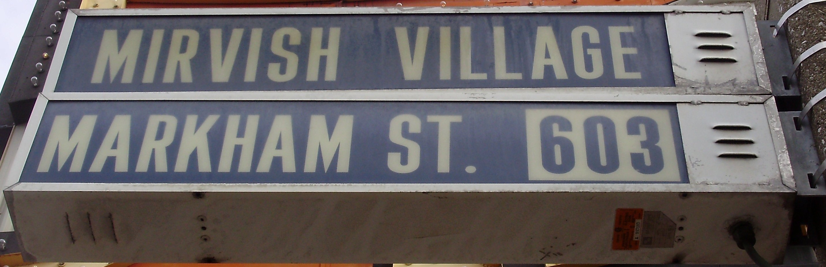
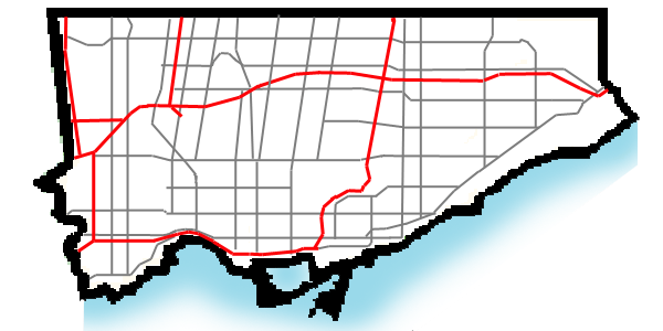
Palmerston-Little Italy — Neighbourhood — A Mirvish Village street sign The areas of Palmerston-Little Italy. Boundaries are approximate.
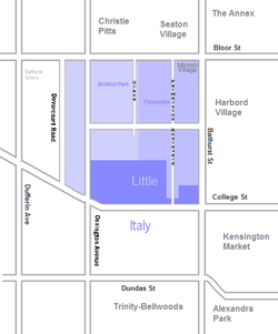 Location of Palmerston-Little Italy in Toronto

Coordinates: 43°39′30″N 79°25′00″W / 43.65833°N 79.4166667°WCoordinates: 43°39′30″N 79°25′00″W / 43.65833°N 79.4166667°W Country  Canada
Province  Ontario
City  Toronto
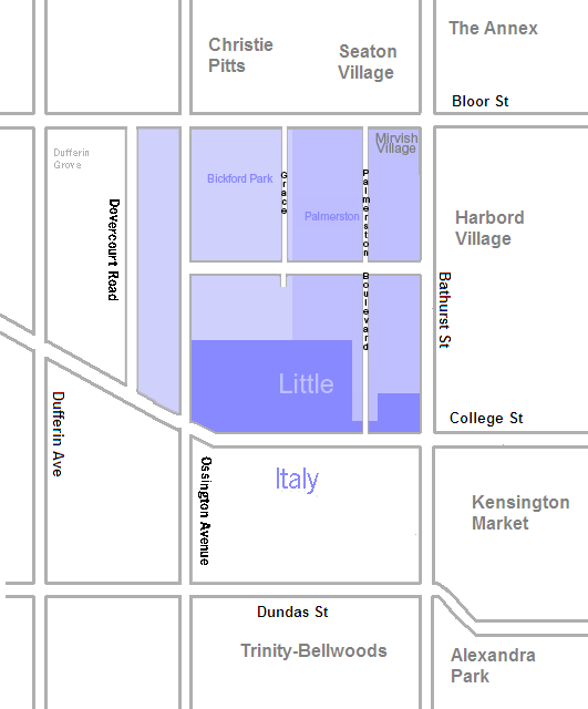
Palmerston–Little Italy is a neighbourhood in central Toronto, Ontario, Canada. Its boundaries, according to the City of Toronto, are by Bathurst Street to the east, Bloor Street to the north, Dovercourt Road to the west and College Street to the south. It is a mature downtown neighbourhood. Within this official neighbourhood of the City of Toronto are two neighbourhoods, Palmerston and Little Italy and the commercial enclave of Mirvish Village.
Contents
Character
The neighbourhood is primarily residential, consisting mainly of residential side streets full of semi-detached homes, mostly built in the early 20th century. The major streets are Bloor Street to the north, running east-west, a four-lane arterial road commercial in nature. Bloor Street has many commercial storefronts and businesses. To the east is Bathurst Street, running north-south, another four-lane arterial road with mostly residences along both sides. Running east-west is Harbord Street, a four-lane arterial road with a mix of residences and commercial storefronts and restaurants. Also running east-west is College Street a four-lane arterial road with a vibrant commercial strip named Little Italy, one of the original ethnically-Italian districts of Toronto. To the west, north-south streets include Ossington Avenue, a four-lane arterial road, mainly residential and Dovercourt Road, a four-lane road, entirely residential. In the north-east corner of the neighbourhood is "Mirvish Village", a one-block long enclave of businesses, mostly of arts, immediately west and extending south of the "Honest Ed's" discount department store at Bathurst and Bloor.
Schools
- Central Commerce Collegiate
Central Commerce Collegiate is located on Shaw Street, built in 1916.
- Harbord Collegiate
Along Harbord is Harbord Collegiate Institute, built in 1892.
- King Edward Public School
King Edward is a public Junior and Intermediate school on Lippincott Street. King Edward offers Extended French and French Immersion programs that is only available by applying. In order to be eligible for the Gifted Program, students are required to pass an entrance test after grade 3. King Edward offers a wide variety of extra curricular programs, including Band, Basketball Team, Chess Club, Choir, Strings, and Volleyball Team.
Mirvish Village
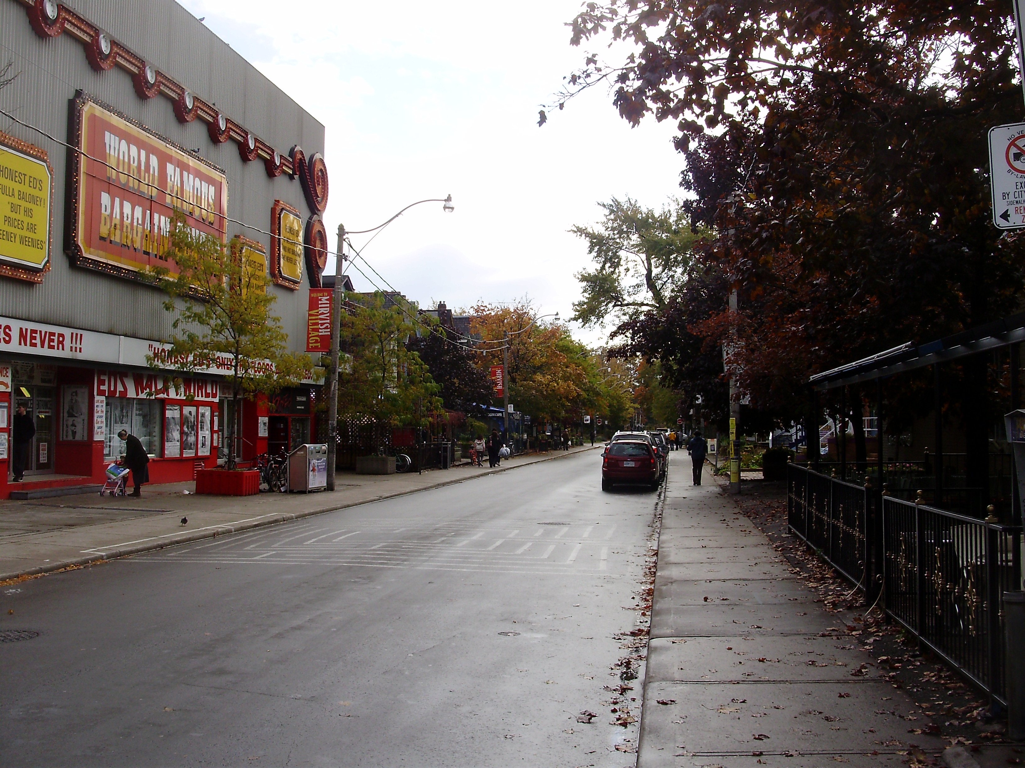
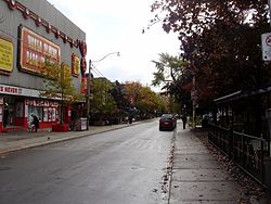 Victorian homes share space with Honest Ed's on Markham Street.
Mirvish Village is a commercial enclave on Markham Street, which is one block west of Bathurst Street, and encompasses the two sides of the street for one block south of Bloor Street.
Made up of a series of Victorian homes on Markham Street which now house independently-owned shops, art studios, cafes, bookstores, boutiques and galleries. Between 1959 and 1963, the late Ed Mirvish of Honest Ed's bought up the east side of the block, immediately south of his store, with the intention of tearing down the houses and building a customer parking lot. Toronto's municipal government refused to issue a building permit; therefore, Mirvish converted the buildings into art studios and galleries with the help of his wife, Anne, a sculptor. Later, he purchased the houses on the other side of the street. His son is the owner of David Mirvish Gallery, which opened in 1963 as one of Mirvish Village's first shops; along with David Mirvish Books, the enterprises act as anchors to additional retail stores and galleries.[1]
Landmarks
- Harbord Collegiate Institute, built in 1892
- Honest Ed's
- Bathurst Street Theatre
- Harbord Street Bridge
Christie Expressway
In the 1950s and 1960s, the Ontario provincial and Metropolitan Toronto governments proposed running a six-lane north-south expressway to the east of Grace Street. This was an extension of Highway 400 and would have gone from a proposed Crosstown Expressway in the vicinity of Davenport and Dupont, south to the Gardiner Expressway. In the 1960s, opposition to the Spadina, Crosstown and Christie expressway projects led the then City of Toronto to oppose the Christie and Crosstown projects. After the cancellation of the Spadina Expressway by the province, the Crosstown and Christie expressway projects were abandoned as well.
See also
References
- ^ Fulford, Robert (July 19, 2000). "Ed's Warehouse is closing". National Post (CanWest): pp. A1.
External links

Seaton Village, The Annex Dufferin Grove 
Harbord Village, Kensington Market  Palmerston-Little Italy

Little Italy Categories:- Neighbourhoods in Toronto
Wikimedia Foundation. 2010.