- Wexford, Toronto
-
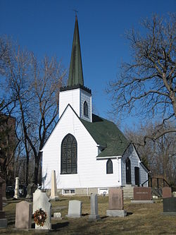
Wexford — Neighbourhood — St Jude's Anglican Church Coordinates: 43°44′35″N 79°18′16″W / 43.74306°N 79.30444°WCoordinates: 43°44′35″N 79°18′16″W / 43.74306°N 79.30444°W Country  Canada
Province  Ontario
City  Toronto
Community Scarborough Changed Municipality 1998 Toronto from  Scarborough
Government – MP Roxanne James (Scarborough Centre) – MPP Brad Duguid (Scarborough Centre) – Councillor Michael Thompson (Ward 37 Scarborough Centre) Wexford is a neighbourhood in Toronto, Ontario, Canada. It is located in the eastern part of the city, on the western end of the district of Scarborough, spanning Lawrence Avenue East between Victoria Park Avenue and Birchmount Road. There are many Greeks in this neighbourhood.
The Church of St. Jude (Wexford) was once the Anglican church to the small village of Wexford, and survives today as a landmark in the modern suburb. The area consists of mostly post-World War II type bungalow housing, apartments, retail and commercial space.
Scarborough was merged with five other municipalities and a regional government to form the new "City of Toronto" in 1998.
according to the 2006 Census Visible Minorities comprised 45.4% of the total population, the largest minority group being South Asian at 12.0%.
- Westford Shopping Centre
- Precious Blood Roman Catholic Church
- St. John's Greek Orthodox Church
- St. Jude's Anglican Church
- Scarborough Citadel of the Salvation Army
- Wexford Collegiate School for the Arts (high school)
- Wexford Heights Plaza
- Wexford Heights United Church (2002 Merger of the historic Zion-Wexford and Wilmar Heights congregations)
- Wexford Presbyterian Church
- Wexford Public School
- Wexford Soccer Club
- St. Kevin Catholic School

Maryvale 
Parkwoods, Victoria Park Village (North York) 
Dorset Park  Wexford

Golden Mile Categories:- Neighbourhoods in Toronto
- Toronto geography stubs
Wikimedia Foundation. 2010.


