- Dufferin Grove
-
Dufferin Grove — Neighbourhood — Neighbourhood map Location of Dufferin Grove in Toronto Country  Canada
Province  Ontario
City  Toronto
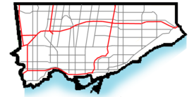
Dufferin Grove is a neighbourhood located in Toronto, Ontario, Canada, west of downtown. The neighbourhood is bordered by Bloor Street West to the north, Ossington Ave to the east, College Street to the south, and Dufferin Street to the west.
Contents
Character
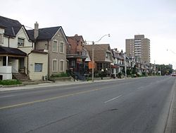
It is a working class neighbourhood with a large diversity in cultures and to an extent, class. From street to street, corner to corner, this neighbourhood is full of diversity. The main streets of the neighbourhood are Bloor, College and Dufferin Streets. Dufferin, a four-lane arterial, which is mostly residential except for the Dufferin Mall on the west side south of Bloor. College Street is a four-lane arterial road, with a mix of commercial storefronts and residences.
- Residences
The neighbourhood is predominantly two or three-storey detached or semi-detached homes at a fairly high-density. Most of the homes are of Victorian or Edwardian vintage, dating to the late 19th century or early 20th century.
Dufferin Grove Park
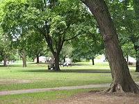
Dufferin Grove Park on the east side of Dufferin Avenue south of Bloor is the largest green space in the neighbourhood. It has playground facilities, picnic areas and in the winter an ice hockey rink. The Park has become a community space in the 1990s and more recently with the opening of a regular organic market, a community pizza oven, and internet 'wi-fi'. A community support group, the 'Friends of Dufferin Grove Park' organizes most events and activities in the park, unlike most parks in the City, where events are organized by the City of Toronto Parks and Recreation Department.
Schools
The neighbourhood is home to several elementary schools:
- Brock Jr Public School is a public elementary school on Margueretta Street.
- Dewson Street Jr Public School is a public elementary school on Concord Avenue, west of Ossington.
- Kent Sr Public School is a public middle school on Dufferin Avenue at Bloor.
Demographics
In the west (and to an extent east) end of the neighbourhood there is a large population of Portuguese, spreading out from Little Portugal located to the south-west.
The area has a larger than average population (compared to the rest of Toronto) in the age groups between 25–39, according to 2006 census data.[1]
References
External links
- City of Toronto - Dufferin Grove Neighbourhood Profile
- Friends of Dufferin Grove Park
- Historic photos from the Dufferin Grove area
Coordinates: 43°39′25″N 79°25′41″W / 43.657°N 79.428°W

Wallace Emerson Bloordale Village, Dovercourt Park 
Brockton 
Palmerston-Little Italy  Dufferin Grove

Little Portugal Categories:- Neighbourhoods in Toronto
Wikimedia Foundation. 2010.


