- Don Mills
-
For other uses, see Don Mills (disambiguation).
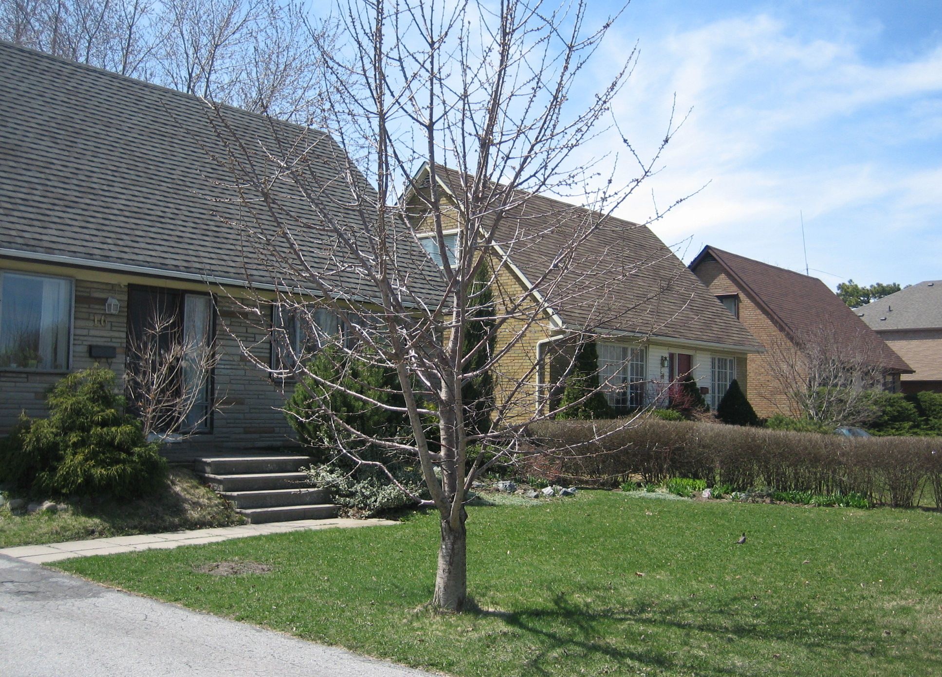
Don Mills — Neighbourhood — Homes in the Don Mills area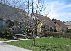
 Location of Don Mills in Toronto

Coordinates: 43°44′14″N 79°20′36″W / 43.73722°N 79.34333°W Country  Canada
Province  Ontario
City  Toronto
Community North York Changed Municipality 1922 North York from York
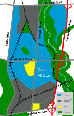
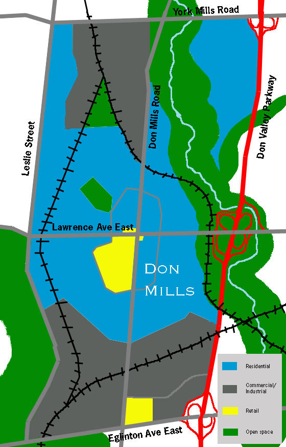
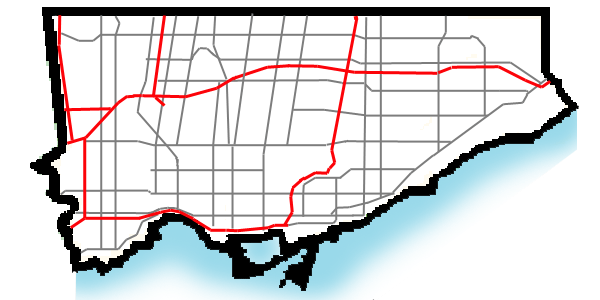
1998 Toronto from North YorkGovernment - MP John Carmichael (Don Valley West) - MPP Kathleen Wynne (Don Valley West) - Councillor Denzil Minnan-Wong (Ward 34 Don Valley West) Don Mills is a mixed-use neighbourhood in the North York district of Toronto, Canada. It was developed to be a self-supporting "new town" and was at the time located outside of Toronto proper. Consisting of residential, commercial and industrial sub-districts, it was planned and developed by private enterprise. In several ways it became the blueprint for post-war suburban development in Toronto and contemporary residential neighbourhoods. It is bounded by York Mills Road to the north, Eglinton Avenue to the south, Leslie Street to the west, and the Don Valley Parkway to the east. It is part of federal and provincial electoral district Don Valley West, and Toronto electoral wards 25: Don Valley West (North) and 26: Don Valley West (South).
Contents
Early history
The Don Mills area was first settled by Europeans in 1817. The area was a considerable distance from the town of York, but the Don River provided an easy means of transportation, and also a source of power for a number of mills along its length. While the city of Toronto steadily expanded, the Don Mills area remained rural until after the Second World War. It was cut off from the city by ravines to the south, east, and west. Only two roads connected to the area: York Mills Road and Don Mills Road. In 1950 the area consisted of about 20 farms.
Don Mills project
Don Mills was designed as a model community between 1952 and 1965. Land use, architectural design and building materials were carefully regulated. Many aspects of its design have been imitated in suburban developments across Canada. Its planners would give people priority over industry and cars.[1]
This combination of emptiness and proximity to the city attracted the attention of industrialist E.P. Taylor. His original plan was to erect a brewery on the site, along with a small community to house the workers. Taylor had limited previous experience in the property development business, but had built a project named the Wrentham Estates in York Mills. Seeing the profit to be made with such projects, Taylor abandoned the brewery idea and decided to simply build a new town on the 2,000 acres (8.1 km2) he had acquired.
In 1951 he began planning the Yorktown community (as it was first known), and it was announced on March 11, 1953.[2] The community was to be built on about 8.35 km2 (3.22 sq mi) of farmland centred at the intersection of Don Mills Road and Lawrence Avenue East, with an expected cost of $200 million. Development was headed by the Taylor-owned Don Mills Development Company, (known as O'Keefe Realty in the days of the brewery development).
Design principles
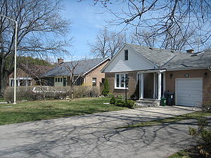 Ranch-style houses are some of the most common houses in Don Mills
The design of Don Mills was influenced by Ebenezer Howard's Garden City, and by the principles of two American town planners, Clarence Stein and Henry Wright, who developed the garden city community of Radburn, New Jersey. Design of the project was entrusted to Macklin Hancock, the son-in-law of Taylor's executive assistant. Still in his mid-20s, Hancock was a graduate student at Harvard when approached for the job. At Harvard Hancock had studied under a number of the founders of modernism and new town planning including Walter Gropius, William Holford, and Hideo Sasaki. These studies lead Hancock to envision a self-contained community distinguished by consistent design principles and a modernist style. Several names were proposed for the new development, including Eptown after Taylor. It was called Yorktown at its initial unveiling, but the name Don Mills was finally adopted at the suggestion of Hancock.
The design was based on five planning principles, which had not been implemented in Canada before:
- The neighbourhood principle – which broke down the community into four neighbourhood quadrants, all surrounding a regional shopping centre, Don Mills Centre, at the southwest corner of Don Mills and Lawrence. Each quadrant was to contain a school, a church, and a park.
- Separation of pedestrian and vehicle traffic – which was accomplished through the creation of a network of pedestrian paths providing easy access through parks to area schools and the town centre, while roads were designed to slow vehicular traffic through the use of winding roads, T-intersections, and cul-de-sacs.
- Promotion of modernist architecture and the modern aesthetic – Don Mills Development controlled the architectural design, colours, and materials of all buildings in Don Mills. As well, the corporation insisted that builders use company-approved architects who had been educated according to Bauhaus principles, to prevent the project from deteriorating into a typical post-war subdivision of builder's homes.
- Creation of a greenbelt – linked to a system of neighbourhood parks that would preserve the beauty of the surrounding ravines.
- Integration of industry into the community – which followed Howard's ideals for the Garden City. Planners felt that it was important for residents to live and work in the same satellite town so that Don Mills would not become a bedroom community. A sizable number of high residential densities—rental townhouses and low-rise apartments—was essential if the town were to attract a cross-section of residents working in local industries.
Home situation design was also influential to subsequent subdivisions in Canada. The homes were located on square lots with long street frontages. Houses were previously situated on rectangular lots, narrow end to the street. The square lots meant that houses faced the street with their long side, but has less deep backyards.
The developers also affected two highway projects being developed concurrently. The 'Toronto Bypass', now known as Ontario Highway 401 does not have an interchange at Don Mills Road due to the development.[3] The Don Valley Parkway, built in part to service the community, was originally to be built on Don Mills Road, but was moved east to the Woodbine Avenue right-of-way north of Lawrence.
Landmarks
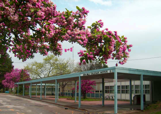
The local high school is the Don Mills Collegiate Institute, which opened in 1959. In 2003, the parkette at the corner of Don Mills and Lawrence was renamed the Macklin Hancock Parkette. An area elementary public school is Norman Ingram Memorial School, located on Duncairn Rd.
The main shopping centre is the Shops at Don Mills, a large mall located at the southwest corner of Lawrence Avenue and Don Mills Road on the site of the former Don Mills Centre. There is also a strip mall southwest of Don Mills and Barber Greene Road, and a Loblaw Real Canadian Superstore northeast of Don Mills and Eglinton.
Parks includes Bond Park which has sports fields and an arena, and Moccasin Trail Park where a remote, undeveloped section of ravine can be reached by a pedestrian tunnel under the Don Valley Parkway.
At Wynford Drive and the Don Valley Parkway, a new $300 million cultural project is being constructed on 6.8 hectares (17 acres). The Ismaili Centre, the Aga Khan Museum and a public park,[4] will provide an exhibition space for Islamic art and history[5] and will provide a centre for the Ismaili community in Canada.[6] The project, whose foundation was laid on May 28, 2010 by Prime Minister Stephen Harper and His Highness the Aga Khan, is designed by award-winning architects: India-based Charles Correa, Japanese architect Fumihiko Maki, Lebanese landscape architect Vladimir Djurovic and the Toronto-based Moriyama & Teshima Architects.[5]
Demographics
The city places Don Mills in a community called Banbury-Don Mills. In 2006, it had a population of 25,435.[7]
Major ethnic and cultural groups (by ancestry) in 2001:[7]
- Chinese - 12%
- English - 11%
- Canadian - 11%
- Jewish - 7%
- Scottish - 7%
- Irish - 5%
- East Indian - 4%
- German - 3%
- French - 2%
- Polish - 2%
- Other - 36%
The percentage of population below the poverty line dropped from 13% (in 1996) to 12% (in 2001).[7]
References
- ^ http://www.heritagefdn.on.ca/userfiles/HTML/nts_1_6148_1.html Ontario Heritage Trust Don Mills
- ^ Fox, Paul L. (March 12, 1953). "Plan town of 45,000 on Don Mills farms; Will cost $200,000,000". Toronto Star: p. 3.
- ^ Slightham, Chris (1999). Don Mills: The 45th Anniversary of Canada's first planned community. Slightham Real Estate Limited & Shoppers Drug Mart. p. 6.
- ^ "Media Advisory: Aga Khan to Launch New Institutions in Toronto, Canada" (Press release). Aga Khan Council for Canada, Aga Khan Foundation Canada, TheIsmaili.org. 26 May 2010. http://www.theismaili.org/cms/1007/Media-Advisory-Aga-Khan-to-Launch-New-Institutions-in-Toronto-Canada. Retrieved 2010-06-01.
- ^ a b "Toronto Islamic arts centre breaks ground". CBC News (Toronto). 28 May 2010. http://www.cbc.ca/arts/story/2010/05/28/toronto-arts-aga-khan-ismaili.html. Retrieved 2010-06-01.
- ^ Tamizan Esmail and Nikhat Ahmed (26 May 2010). "New chapter in Canadian Ismaili story set to unfold in the Don Mills neighbourhood of Toronto". TheIsmaili.org. http://www.theismaili.org/cms/1005/New-chapter-in-Canadian-Ismaili-story-set-to-unfold-in-the-Don-Mills-neighbourhood-of-Toronto. Retrieved 2010-06-01.
- ^ a b c City of Toronto Demographics for Banbury-Don Mills
- Sewell, John. "Don Mills." The Second City.
External links

Graydon Hall, Henry Farm York Mills, Bridle Path 
Parkwoods  Don Mills

Flemingdon Park A downloadable audio/video "iTour" of Don Mills from 2010 by Globe & Mail columnist Dave LeBlanc:
Coordinates: 43°44′13.72″N 79°20′36.30″W / 43.7371444°N 79.343417°W
Categories:- Neighbourhoods in Toronto
- Modernist architecture in Canada
- Planned cities in Canada

Wikimedia Foundation. 2010.