- CityPlace, Toronto
-
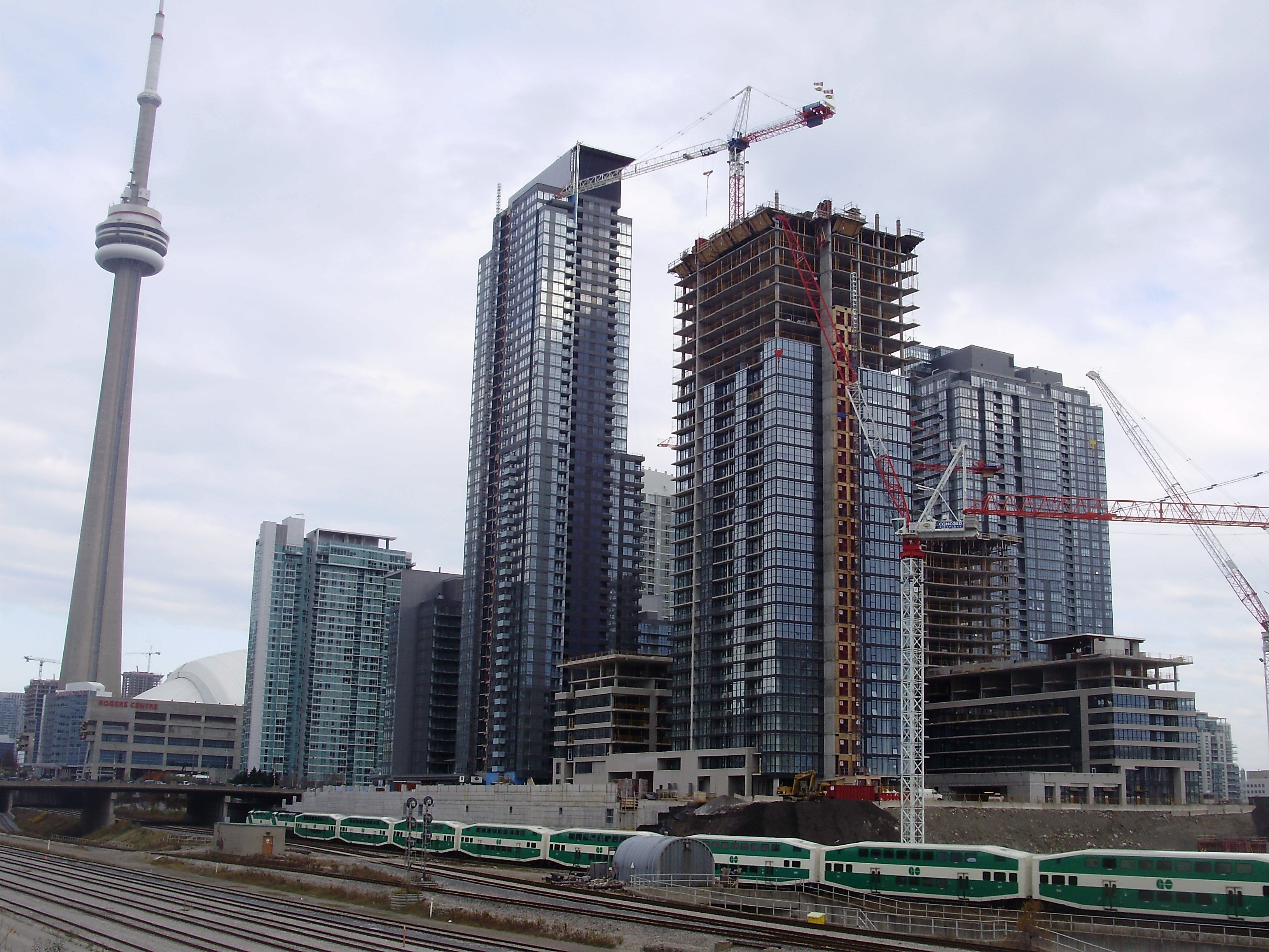
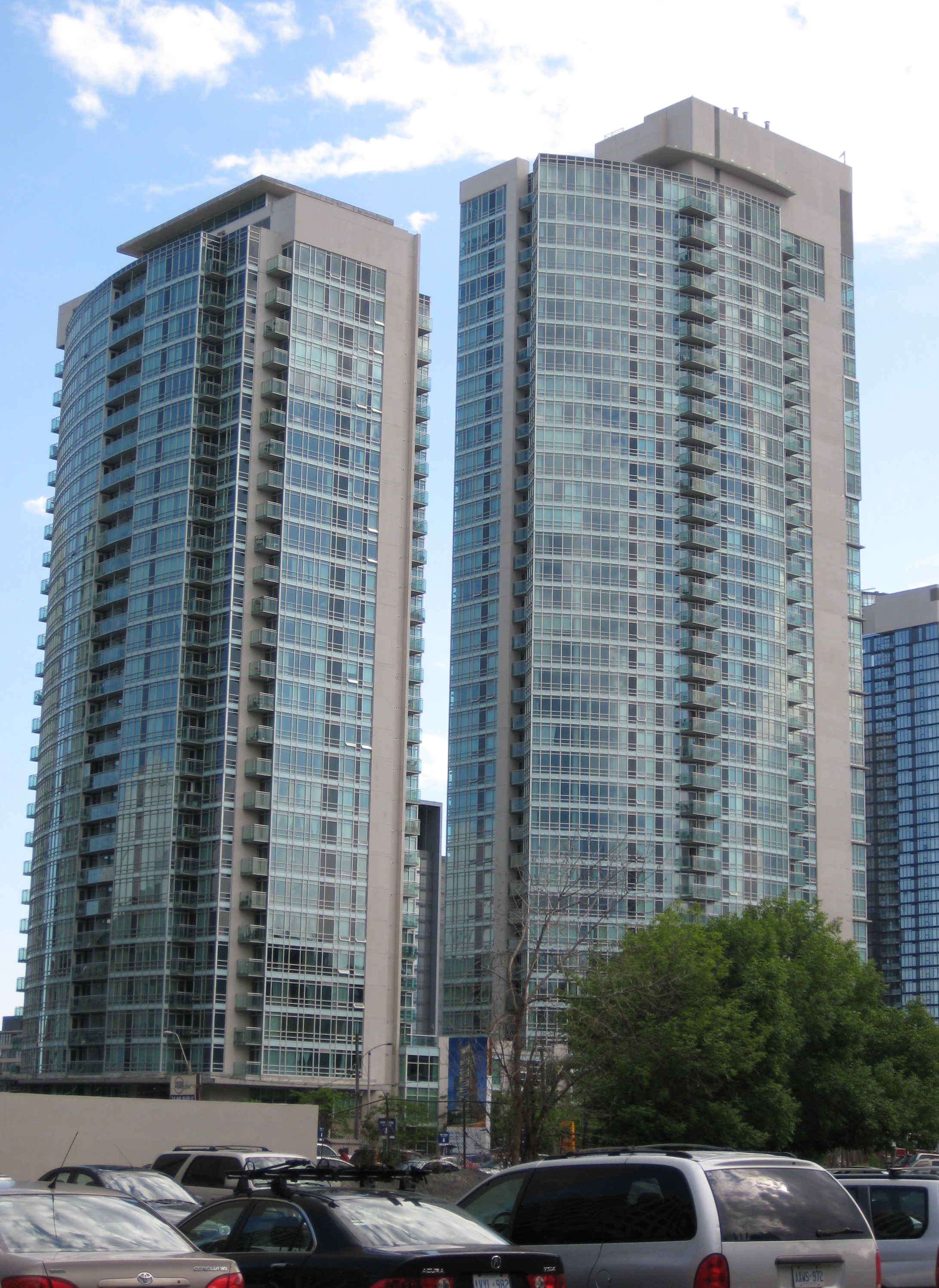
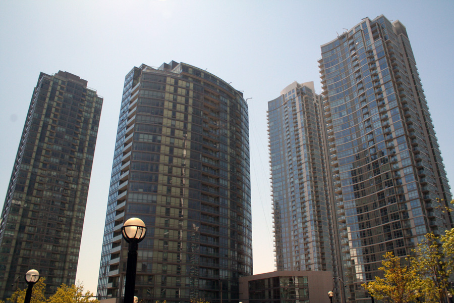
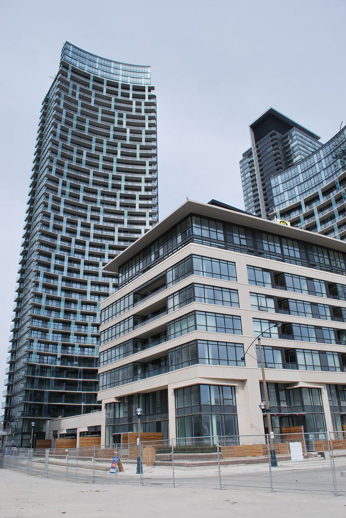
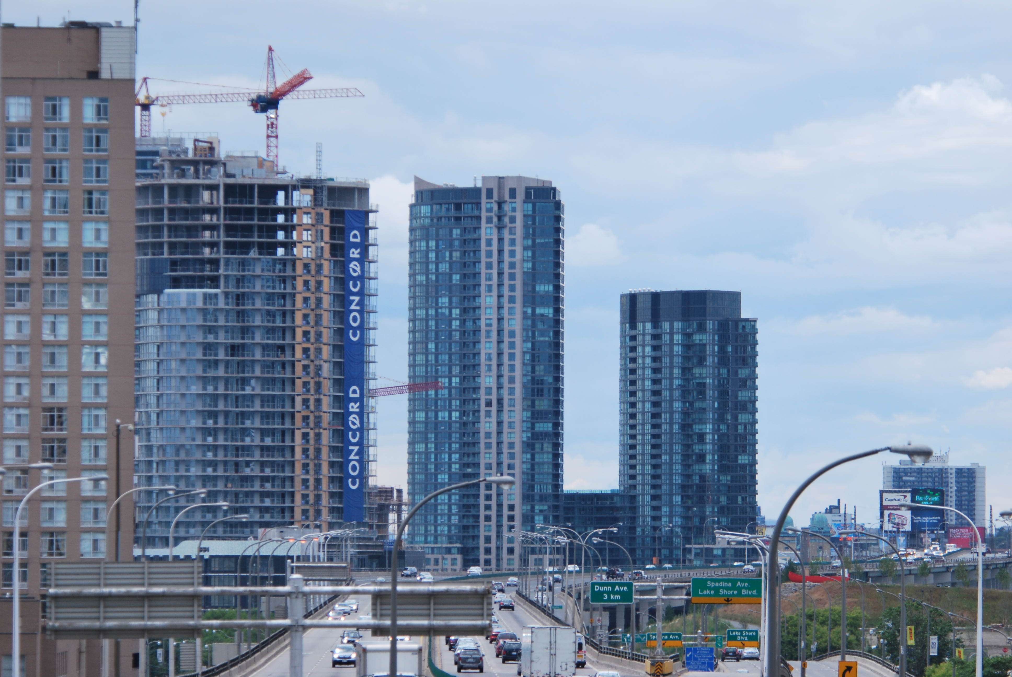
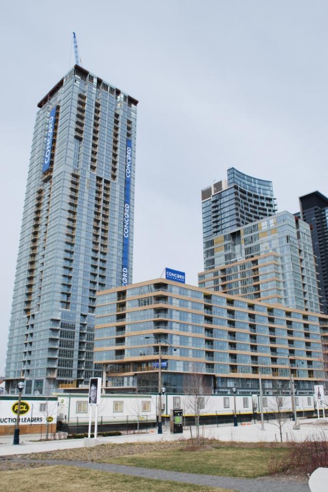
CityPlace — Neighbourhood — The rising towers of CityPlace in November 2008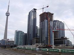 Vicinity
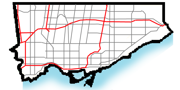
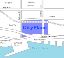 Location within Toronto

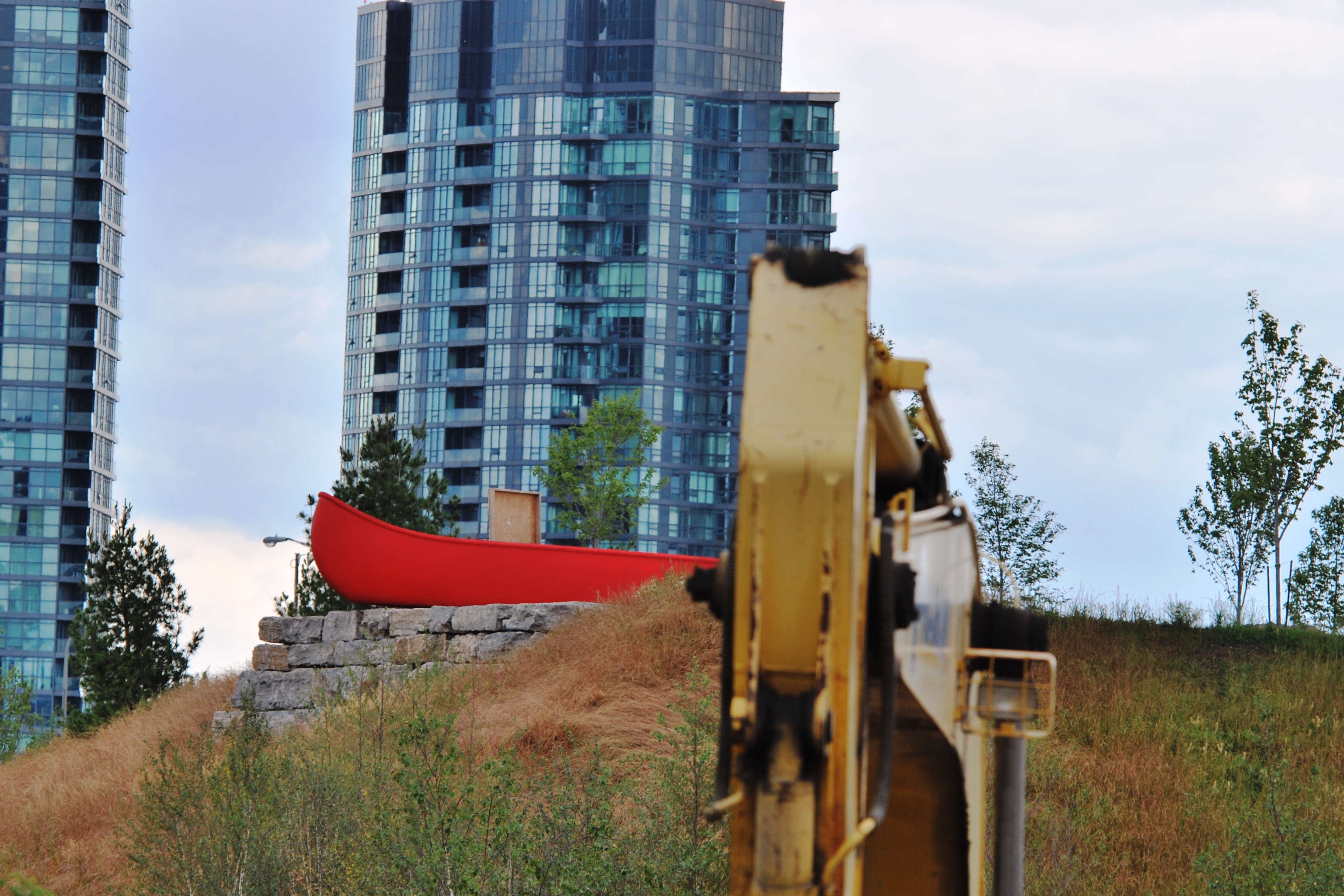
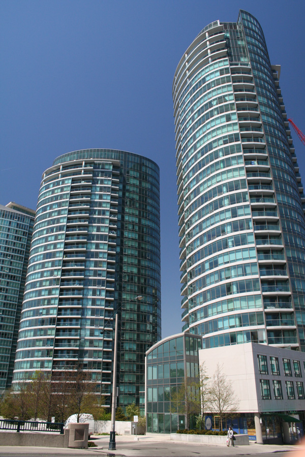
Country Canada Province Ontario City Toronto CityPlace is the name given to a large section of former railway land in downtown Toronto, Ontario, Canada that has been redeveloped for multi-use purpose. The term has been more recently used for a large up-scale multi-tower condo development in the Harbourfront district. When completed, this area will be the largest residential development ever created in Toronto's history. The area is bordered by Bathurst Street to the west, Lake Shore Boulevard to the south, and Front Street to the north and Blue Jays Way and the Rogers Centre to the east. Cityplace is also a 5-10 minute walk from King Street West and Liberty Village and a 10-20 minute walk from Toronto's financial district. The neighborhood is also home to the Canoe Landing Park designed by famed Canadian writer and artist Douglas Coupland.
Contents
History
CityPlace was originally conceived as a way to revitalize what was Canadian National's former Spadina Street Yard Facility. Going as far back as 1965, when CN began to shift the functions of many of its yards in the Greater Toronto Area to a centralized facility in the northern suburb of Vaughan, there had been plans to revitalize this part of downtown. One of them called for the construction of a large television/telecommunications tower as a showcase of Canadian industry, which was realized in the 1970s with the CN Tower. Further development took place in the 1980s, with the 1984 completion of the Metro Toronto Convention Centre drawing new attention to the area.
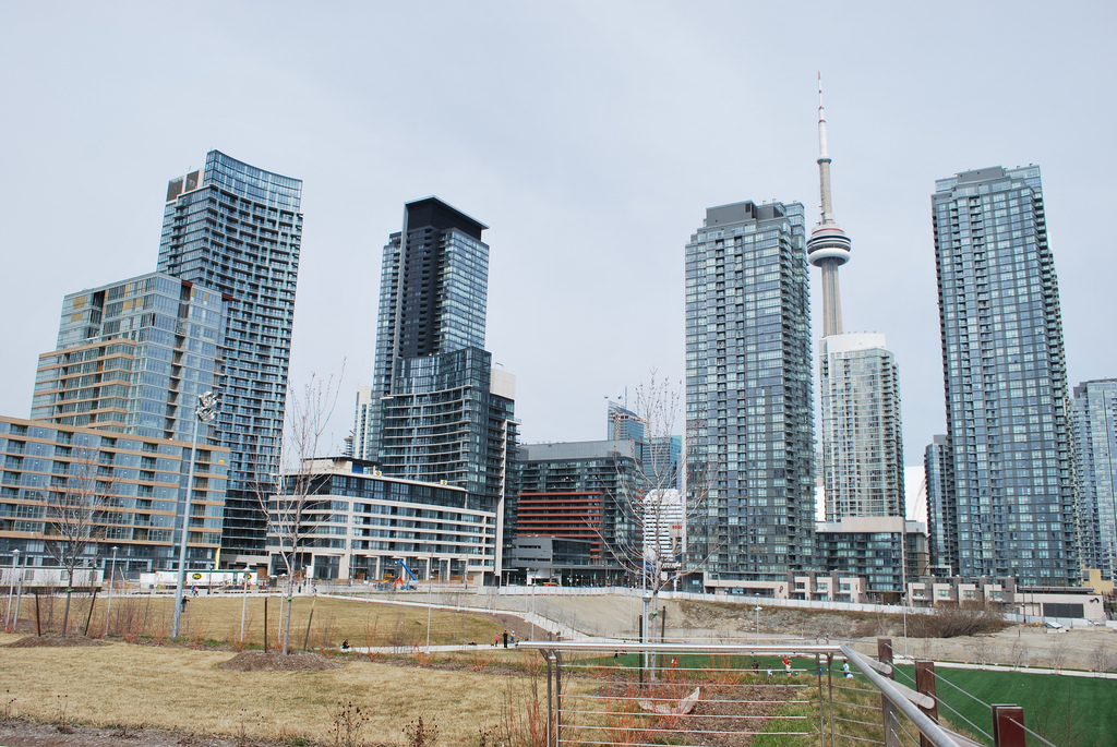
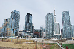 View from Canoe Landing Park
With the arrival of new visitors and development of new commercial draws, a fresh master plan was drawn up by the City of Toronto for revitalization of this area. At the same time Via Rail, the sole remaining occupant of the Spadina Street Yards, relocated their local operations to the newly built Toronto Maintenance Centre in New Toronto, freeing up the lands necessary for the planned revitalization. Work commenced after the demolition of the last railway buildings with the construction of SkyDome, which was completed in 1989. At the same time, a new network of roads, parks and infrastructure began to take shape. The project proceeded smoothly until an economic downturn caused many of the development plans to be shelved, and much land stood abandoned until 1997 when construction of the Air Canada Centre arena commenced. This began the third and final phase of CityPlace which called for a multipupose development of commercial, residential, and retail.
As of 2009, the lands have been nearly completely developed, with the remaining parcels of land soon to see construction.
The current CityPlace development
The current CityPlace development was conceived by Concord Adex Developments, the same company that helped revitalize a large section of former Expo 86 lands in Vancouver.
Project Scope
- Project Size: 44 acres (182 108.5 m2) including a 8 acre (32 375 m2) community park. 7500 residential units upon completion.
- Residential development is divided into 10 street blocks, numbered from 1 to 10. Each street block contains a number of residential towers with its own sets of common facilities.
- Block 1 was developed first with 4 towers, namely Matrix A/B and Apex C/D, all with Front Street West addresses. The street block features buildings directly facing the entertainment district and the closest walk to the Financial District.
- Block 2 features 1 building (Optima) only, directly behind the Rogers Centre, fronting on Navy Wharf Court. It features a heightened privacy comparing to the other interconnected towers. Both Block 1 and 2 were completed before 2003.
- Block 3 is the largest street block in the entire CityPlace complex, with 4 towers and a mid-rise building, as well as townhouses to decrease the tension of high density development. The project was named Harbour View Estates and was completed in 2006.
- Block 4 features 2 towers and a mid-rise, mirroring the Harbour View Estates both in location and in design. The buildings are named as WestOne, N1/N2 and The Gallery, was completed in late 2007.
- Block 5 contains one tower (Montage), completed in early 2009, and a mid-rise building (Neo), completed in late 2008.
- Block 6 has further progressed in design as trend evolves, with 2 towers and 1 mid-rise, the project is named as Luna.
- Block 7-8 (Parade) Two 38 story towers with a 2 story bridge at floors 28 and 29, 2 podium buildings and 2 mid-rise buildings
- Block 9 An 8-acre (32,000 m2) park
- Block 10 will contain the Panorama building with a 7 story podium/mid-rise and a luxury high rise. The high-rise will feature a number of 1500+sqft units with private elevators. Estimated completion for summer 2010.
- Number of Units: over 5,000 residential units to date.
City Place Buildings
 City Place
 Canoe Landing Park
Rank Name Height
ftFloors Year Notes Image Apex[A] 273 ft (83.2 m) 28 2005 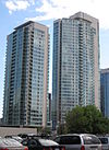
Apex 2[A] 371* 36 2005 Harbourview Estates [A] 402 ft (122.5 m) 40 2006 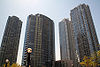
Harbourview Estates 2[A] 503 ft (153.3 m) 49 2006 Harbourview Estates 3 North[A] 278 ft (84.7 m)* 26 2006 Harbourview Estates 3 South[A] 378 ft (115.2 m)* 36 2006 Luna[A] 413 ft (125.9 m) 38 2009 
Matrix 1[A] 320 ft (97.5 m) 32 2004 
Matrix 2[A] 274 ft (83.5 m) 28 2004 Montage[A] 476 ft (145.1 m) 47 2008 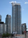
N1[A] 425 ft (129.5 m)* 41 2007 
N2[A] 27 2009- TCHC Block 31 (separate developer, but within the community)[A] 434 ft (132.3 m)* 43 Panorama[A] 315 ft (96.0 m)* 28 2009 
Parade East[A] 366 ft (111.6 m) 39 u/c 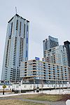
Parade West[A] 418 ft (127.4 m) 44 u/c West One[A] 486 ft (148.1 m) 49 2007 
(*) - denotes estimate
See Concord Pacific Masterplan in External LinksGetting Around
With its location nestled between the Gardiner Expressway and Union Station, CityPlace is a very accessible area. The development is also serviced by the Toronto Transit Commission's 509 Harbourfront, 510 Spadina, and 511 Bathurst streetcar lines.
In addition, a median is being set aside along Bremner Boulevard, the main thoroughfare through Cityplace, so that it can be used for a streetcar route by the TTC in the future.
Criticism
Some planners, architects and politicians have questioned the prudence of the development's urban design. Critics have lauded the architectural excellence of the buildings themselves, but believe suburban ideals have been engineered into the streetscape.[1] While not opposed to high density, critics cite the project's isolation as a potential hindrance to the future health of the fledgling community. They believe that as with other Toronto high rise developments in the past, CityPlace's lack of interconnectedness with the surrounding city may lead to ghettoization of residents.[2] Others believe community prosperity may be affected by the upward mobility of current purchasers. A lack of large units deters families from choosing CityPlace as a desirable place to live, threatening to recreate the conditions experienced in St. James Town and Regent Park.[3] Some, even major figures in the industry, have questioned the sustainability of such large projects.[4] However, as the debate rages on, proponents with a more optimistic views towards Cityplace's future have cited recent developments such Canoe Landing Park, the rising prestige of the adjacent King West area and other future developments on the horizon in the Toronto Entertainment District as evidence of Cityplace's success. [5]
Remaining Railway Lands
East of Spadina, the former railway lands does not have an official name. The land in this area is occupied by several buildings:
- CN Tower
- Rogers Centre
- Metro Toronto Convention Centre - InterContinental Toronto Centre
- John Street Roundhouse - Roundhouse Park, Steam Whistle Brewing, Leon's Furniture Stores and Toronto Railway Heritage Centre
- John Street Pumping Station
- Union Station, Toronto - with tracks and train shed
- Telus Tower
- Air Canada Centre and Maple Leaf Square
Facts and Figures

Fashion District
Entertainment DistrictFort York Neighbourhood 
Financial District
St. Lawrence CityPlace

Harbourfront Toronto skyscrapers and towers Over 150 metres
(by height)CN Tower · First Canadian Place · Scotia Plaza · Brookfield Place · Commerce Court · Toronto-Dominion Bank Tower · Bay Adelaide Centre · Ritz-Carlton Toronto · Maple Leaf Square · RBC Centre · Royal Trust Tower · Royal Bank Plaza South · One King Street West · Manulife Centre · Pinnacle Centre · The Uptown Residences · Minto Midtown · Bell Lightbox · Residences of College Park · TD Waterhouse Tower · Harbourview Estates · The 250 · Spire ·
Under 150 metres
(alphabetically)25 The Esplanade · Casa Condominio Residenza · Canada Life Building · Canada Permanent Trust Building · Continental Bank of Canada Building · Exchange Tower · Ernst & Young Tower · Four Seasons Hotel · Hudson Bay Centre · Imperial Oil Building · The Met · Metro Hall · Murano · One King West · One Yonge Street · Palace Pier · Pantages Tower · Royal Bank Plaza North · Simcoe Place · Simpson Tower · Sun Life Centre · TELUS House Toronto · Toronto City Hall · Two Bloor West · World Trade Centre · X Condominium
Proposed or
under constructionAura · Burano · Four Seasons Hotel and Residences (topped out) · L Tower · Number One Bloor · Shangri-La Toronto · Trump Hotel & Tower (topped out)
Cancelled or
never builtOther See also
External links
Footnotes
- ^ Hume, Christopher. (July 14, 2007). City Place Hurt by New Spadina Expressway The Toronto Star.
- ^ Hume, Christopher. (April 21, 2007). "Some causes for concern in condo design." Retrieved on 2008-08-16
- ^ Tossell, Ivor. (September 1st, 2007). High Stakes The Globe and Mail.
- ^ Thorpe, Jacqueline. (June 2, 2008). Toronto's Condo Kings: Is their boom sustainable? The Financial Post.
- ^ Hume, Christopher. (March 13, 2010). Cityplace proving its critics wrong The Toronto Star.
Coordinates: 43°38′24″N 79°23′43″W / 43.640044°N 79.395179°W
Categories:- Neighbourhoods in Toronto
- Parks in Toronto
- Culture of Toronto
- Redeveloped ports and waterfronts
- Condominiums in Canada
- Skyscrapers in Toronto
- Buildings and structures in Toronto
- Modernist architecture in Canada


Wikimedia Foundation. 2010.