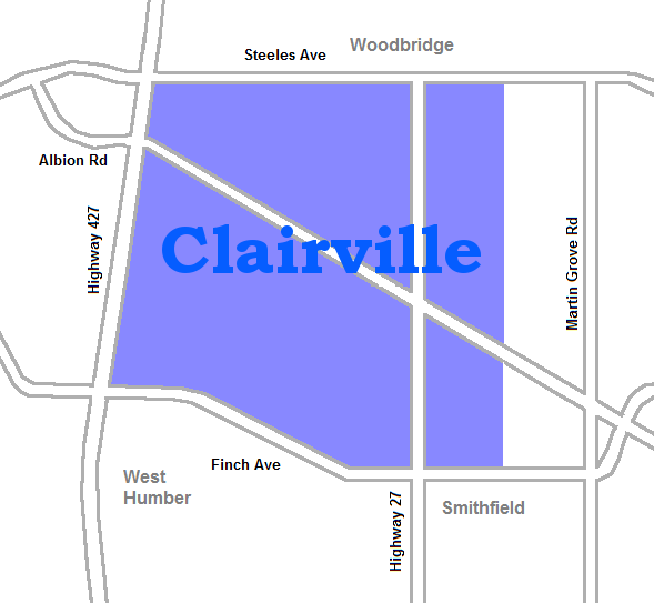
- Clairville, Toronto
-
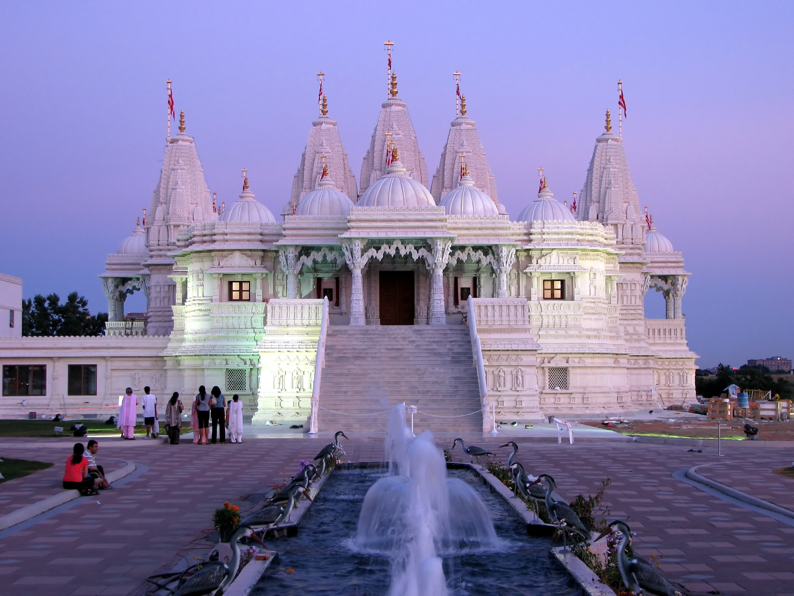
Clairville — Neighbourhood — The Hindu Mandir near the West Humber River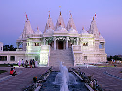

Coordinates: 43°45′00″N 79°38′20″W / 43.75°N 79.63889°W Country  Canada
Province  Ontario
City  Toronto
Community Etobicoke-York Established 1849 (Subdivision) Changed Municipality 1998 Toronto from Etobicoke Government – MP Kirsty Duncan (Etobicoke North) – MPP Shafiq Qaadri (Etobicoke North) – Councillor Vincent Crisanti (Ward 1 Etobicoke North) Clairville is the northwestern most neighbourhood in the city of Toronto, Ontario, Canada. The neighbourhood is part of Rexdale, in north Etobicoke. Today Clairville is almost wholly industrial/commercial.
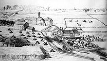 Guardhouse estate at top of Rexdale Blvd, 1878
History
The town of Clairville was established in 1850 at the intersection of Albion Road and Steeles. It was built on land owned by Jean du Petit Pont de la Haye, a French teacher at Upper Canada College. He developed the community on his estate which he named after his daughter Claire.[1] A private street was built diagonally across northern Etobicoke as a shortcut to Albion Township (now part of Brampton), with a toll at Clairville. The street was originally named Clairville but was also called the Albion Road (the current name for this street)[2].
Clairville largely disappeared after a dam was built on the West Branch of the Humber creating the Lake Clairville reservoir. In the 1970s Highway 427 was built north along the western edge of the neighbourhood and in the 1990s Highway 407 was built just to the north. This combined with the existing rail lines and proximity to Pearson Airport to make the area prime industrial land. Today almost all residents have left the area, and it is almost entirely warehouses and factories. Clairville was divided between municipalities, the portion west of Indian Road is today in Brampton. Unlike in Toronto, Claireville, Brampton largely consists of new residential subdivisions and the Clairville Conservation Area.
The area is close to the large south Asian communities of Brampton and Rexdale. The accessible area with large cheap lots has become home to several Hindu temples, most notably the BAPS Shri Swaminarayan Mandir Toronto.
Institutions
- Skyway Industrial Park
- Glendale Memorial Gardens
- Westwood Arena
Notes

Vaughan, Ontario Claireville, Brampton 
Smithfield  Clairville

Humberwood Categories:- Neighbourhoods in Toronto

Wikimedia Foundation. 2010.