- West Humber-Clairville
Infobox City
official_name = West Humber-Clairville
subdivision_type2 = Country
subdivision_name2 =Canada
subdivision_type1 = Province
subdivision_name1 =Ontario
subdivision_type = City
subdivision_name =Toronto 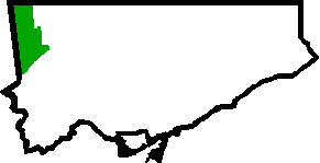
mapsize=150px
map_caption=Location of West Humber-Clairville within TorontoWest Humber-Clairville is a neighbourhood within the city of
Toronto ,Ontario ,Canada .The neighbourhood is comprised with part of
Rexdale , West Humber Estates and other smaller neighbourhoods of north Etobicoke.The northwest area of West Humber-Clairville is mostly industrial/commercial. The rest of this neighbourhood is a mix of residential and commercial developments.
External links
* [http://www.toronto.ca/demographics/cns_profiles/cns1.htm City of Toronto - West Humber-Clairville Neighbourhood Profile]
Toronto Neighbourhood Geography
North =Vaughan, Ontario
East =Mount Olive-Silverstone-Jamestown , Rexdale-Kipling, Elms-Old Rexdale
South = Kingsview Village-The Westway,Willowridge-Martingrove-Richview ,Eringate-Centennial-West Deane
West =Mississauga, Ontario ,Brampton, Ontario
Center = West Humber-Clairville
Wikimedia Foundation. 2010.