- Eringate
-
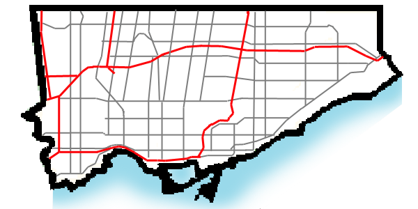
Eringate-Centennial-West Deane — Neighbourhood — Location within Toronto

Country  Canada
Province  Ontario
City  Toronto
Community Etobicoke-York Changed Municipality 1998 Toronto from Etobicoke Government – MP Borys Wrzesnewskyj (Etobicoke Centre) – MPP Donna Cansfield (Etobicoke Centre) – Councillor Doug Holyday (Ward 3 Etobicoke Centre) Eringate-Centennial-West Deane is a neighbourhood in the city of Toronto, Canada.
Contents
Location
Eringate-Centennial-West Deane is a neighbourhood located in the north western corner of the city of Toronto, Ontario, Canada, in close proximity to Pearson Airport and Highway 427. It is bounded on the west by Centennial Park and golf course, to the north by Eglinton Avenue West, on the east by Martin Grove Road, and on the south by Rathburn Road. The neighbourhood itself is fairly large, and encompasses several communities including West Deane Park and Centennial Park.
History
West Deane Park
West Deane Park was farmland before the land was bought in the 1930s by construction magnate Percy Law. On the land, Law raised cattle and racehorses, kept a storage depot for construction equipment and built a Colonial Revival style home. In the 1960s the land was sold to developer, Edmund Peachey, who built much of the development. Peachey named the area West Deane Park after his wife, whose maiden name was Deane.[1] Today the area is populated with a variety of income levels, backgrounds and housing types.
Vallengrove Park
Vallengrove Park is a subdivision developed in 1961 between Wellesworth area and highway 27 by Vallen- Grove Developments. The three bedroom- one bath simple brick bungalows with garage on approx. fifty foot wide lots sold for approx. seventeen thousand dollars new. Their real estate value in 2011 sells from four hundred and seventy five thousand and up. It was marked in the early 1960s by a red brick entrance (West Deane still has its named entrance) at the then- connecting Birgitta Crescent- to the long-gone off entrance from the southbound service road of then Highway 27 (a farm house stood here right at the ramp), and leading into the suburb between that west of 27 towards Wellsworth Park, and halfway north along Odessa Ave. and as far as Renforth. That new area was built in 1961/ the older area further north along Odessa and out branching roads was built a few years earlier: wherever one sees the old wood hydro poles instead of concrete. Vallengrove Park was once farmland- cows bones were found by children digging around before all areas were paved and settled, and another farm was at the location of Catholic church-Nativity of Our Lord and was torn down at same time. When the 27 was expanded into the 427, the east loop homes of Summerfield Crescent were expropriated around 1967, and moved to Bramalea- part of their front lawns can be seen today at the sound barrier wall. Wellsworth school was opened in 1960 when hundreds of tulips were given by Holland for planting- tulips are still grown there almost 50 years later. The area's high school was Vincent Massey Collegiate Institute. It closed in 1986 with a reunion there. The northern most part of The West Mall- an important and very busy artery today- ended as a bumpy, dirt bicycle path a short distance south of its intersection at Rathburn. The south end of that unfinished part continued to the edge of Burnhamthorpe, where Percy Bishop built the new Etobicore Mall across from the Shaver/Bishop farm house- then directly at the corner of Burnhamthorpe and The West Mall. Mr. Bishop gave land to Etobicoke in order for the road to be opened up, and had it built, around 1964.
Schools
- Briarcrest Junior School - A public elementary school located at 60 Wellesworth Drive, east of Renforth Drive. It was opened on September 1958.
- Hollycrest Middle School - A middle school located close to the intersection of Renforth Drive and Rathburn Road. It is on the western boundary of the Toronto District School Board. It was built in 1967 as a special Centennial project. It has wide, open spaces, bordering the Etobicoke Olympium. Students from elementary schools such as Wellesworth Junior School, Briarcrest Junior School, Mill Valley Junior School and Broadacres Junior School are most likely to be in Hollycrest. There are also students from all over Etobicoke.
- Josef Cardinal Slipyj Elementary Byzantine Rite Catholic School
- Michael Power/St. Joseph High School
- Mother Cabrini Catholic Elementary School
- Nativity of Our Lord Elementary School - A Catholic elementary school located at 35 Saffron Crescent, close to the intersection of Renforth Drive and Rathburn Road. It is situated next door to the church of the same name. The school has 2 floors and 9 outdoor portable classrooms. The school has an optional French immersion program that begins in Grade 5. It is a feeder school for Etobicoke's first Catholic secondary school, Michael Power-St. Joseph High School, which moved to a nearby location in the 1990s.
- Seneca School is a public elementary school located on Rathburn Road close to the intersection of Renforth Drive, beside the Etobicoke Olympium and in Centennial Park. The school was originally built by the Metropolitan Toronto Association for the mentally challenged in 1967. At that time, it served students from ages seven to twenty-one years of age. Currently, the school provides a structured team approach to support primary and junior students, aged 4 to 12, who have developmental challenges.
- Wellesworth Junior School is a public elementary school located at 60 Wellesworth Drive, north of Rathburn Road, east of Renforth Drive and west of Highway 427. It was opened in 1960.
Institutions
- Centennial Park
- Centennial Park Golf Centre
- Elmbrook Park Library[2]
- Eringate Mall
- Eringate Park
- Wellesworth Park
- West Deane Park
- Churches
- Richview United Church
- Graceview Presbyterian Church
- St Philip's Evangelical Lutheran Church
- Gospel of Christ Church
- Nativity of Our Lord Roman Catholic Church
- Local meetinghouse of The Church of Jesus Christ of Latter-day Saints
References
- ^ "Neighbourhood History". West Deane Park. http://www.westdeanepark.com/index.php?pageId=2044. Retrieved 2006-06-11.[dead link]
- ^ http://www.torontopubliclibrary.ca/hou_az_eb.jsp
External links

West Humber-Clairville Mississauga 
Princess-Rosethorn  Eringate-Centennial-West Deane

Markland Wood, Eatonville Categories:- Neighbourhoods in Toronto
Wikimedia Foundation. 2010.