- North Toronto
-
North Toronto — Dissolved municipality — Lascelles Blvd. in North Toronto Location of North Toronto in Toronto
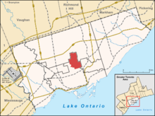
Country  Canada
Province  Ontario
City  Toronto
Community Toronto Established 1890 Annexed 1912 into Toronto North Toronto was a town located in the northern part of the Old Toronto district in Toronto, Ontario, Canada. It occupies a geographically central location within the current boundaries of the city of Toronto. It is a relatively narrow strip, centred around Yonge Street; it extends from the CP tracks south of St. Clair Avenue north to Yonge Boulevard, with its core area between Davisville Avenue and Blythwood Road. The Town of North Toronto was incorporated in 1890, when much of the area was still farmland, and annexed by the old City of Toronto in 1912.
Contents
Origins
Toronto's Yonge Street streetcar line was then extended through North Toronto, replacing the former radial railway service. North Toronto soon emerged as a popular streetcar suburb, with the area becoming completely developed by the 1940s. The streetcar was replaced in 1954 by the Toronto Transit Commission's Yonge subway as far as Eglinton Avenue and a trolleybus running north from there, which was replaced in turn by a subway extension in 1973. Today North Toronto is a relatively affluent community, and very popular with young families.
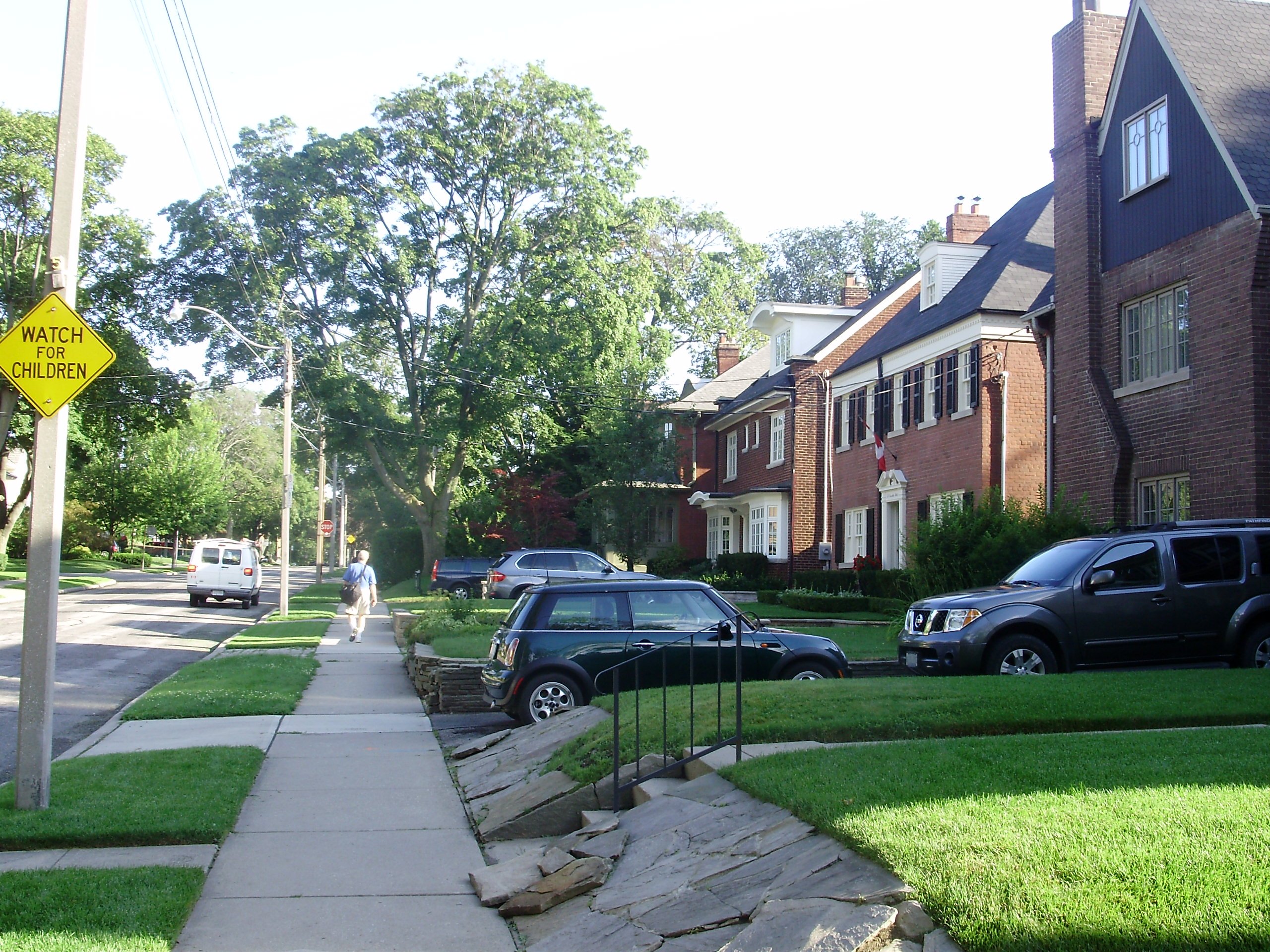
Character
The neighbourhood has had a mixed-density design for some time, but this is rapidly changing to a greater density with the construction of residential condominium buildings in the area. The southern part of the neighbourhood is densely populated, with the entire section between Yonge Street and Mount Pleasant Road south of Davisville Avenue built up with high rise apartment buildings. More recently, condo buildings have further added to this density, especially south of Merton Street (backing onto historic Mount Pleasant Cemetery). Additional condo developments have begun on Mount Pleasant Road, and the existing medium-rise dwellings southeast of Yonge and Eglinton have been joined by developer Minto's Quantum towers of 37 and 54 stories.
Mount Pleasant Cemetery serves as a major green space for the southern end of the neighbourhood. South of the cemetery are trails in two ravines of the former Mud Creek and Yellow Creek, which lead to the Don River. On the north side of the cemetery is the Kay Gardner Beltline Park, a heavily-used pedestrian and cycling path on the route of a former railway line. The Belt Line Railway was a short-lived commuter route in the 1890s. It was subsequently purchased by Canadian National Railway and used for freight until service was discontinued in the 1960s. The path goes northwest to Eglinton Avenue, then curves west, and ends at the William R. Allen Road, known locally as the Allen Expressway. Other green spaces includes Eglinton Park just west of Yonge Street and Alexander Muir Memorial Gardens at Yonge Street and Lawrence Avenue, which connects to Sherwood Ravine Park and Sunnybrook Park to the east.
North Toronto is served by north-south commercial strips on Yonge Street, Mount Pleasant Road, and Bayview Avenue, and an east-west strip on Eglinton Avenue. These offer an array of shopping and dining aimed primarily at the local market, and as with many main streets in Toronto neighbourhoods, are largely given to small, locally-owned shops in free-standing buildings. The corner of Yonge and Eglinton features the Yonge Eglinton Centre complex, which includes a shopping mall, multiplex cinema, and both office and residential towers; and Canada Square, an office complex with a small shopping concourse and another, older multiplex. Both are connected to Eglinton subway station.
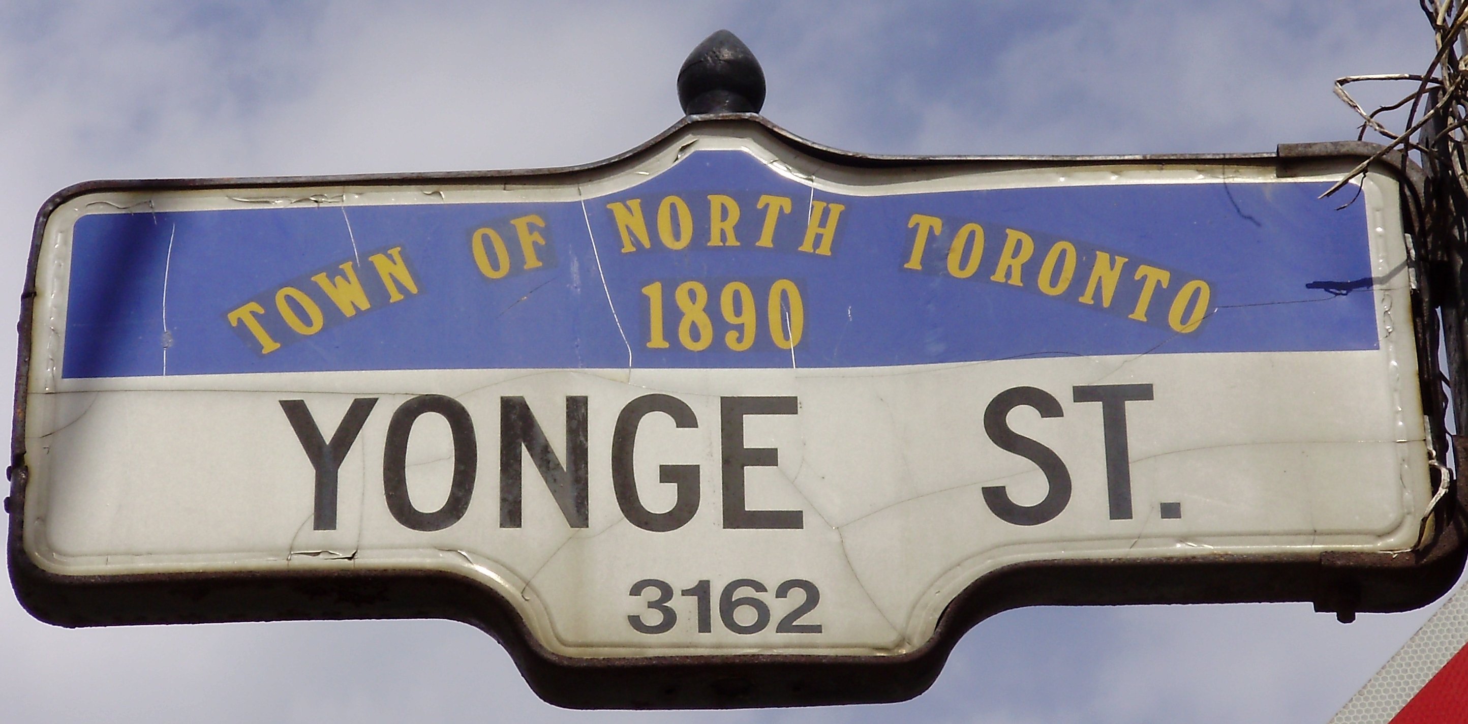
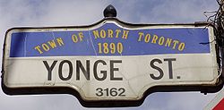 A street sign designed in honour of North Toronto
Libraries can be found on Bayview Avenue, at Yonge and Lawrence, and near Yonge and Eglinton, along with a children's-focused library on Mount Pleasant. There are two community centres in North Toronto; Central Eglinton Community Centre, at Eglinton and Redpath, offers a wide variety of programs and services for caregivers & young children, adults. and people 50+. North Toronto Memorial Community Centre is located at Eglinton Park (Eglinton Avenue and Oriole Parkway). What was once North America's largest bridge club, Kate Buckman's, was on Mount Pleasant near Eglinton for many years until its closure in 2007; the Toronto Bridge Club is on St. Clair near Yonge. The Toronto Camera Club finds its home on Mount Pleasant Road near Millwood Road.
Neighbourhoods
North Toronto is composed of a number of distinct neighbourhoods. It has more recently also become synonymous with Midtown.
- Bedford Park
- Chaplin Estates
- Davisville Village
- Lawrence Park
- Lytton Park
- Wanless Park
- Yonge and Eglinton
See also
- TTC Davisville, Eglinton, and Lawrence stations
External links
Former municipalities of Toronto by year of amalgamation 1883-1912 1883: Yorkville · 1884: Brockton · Riverdale · 1888: Seaton Village · 1889: Parkdale · 1890: Bedford Park · Davisville · 1905: Rosedale · 1908: Deer Park · East Toronto · 1909: Bracondale · West Toronto · Wychwood · 1910: Moore Park · North Toronto · 1912: Dovercourt · Earlscourt1967 1998 Categories:- Neighbourhoods in Toronto
- Streetcar suburbs
- Former municipalities in Toronto

Wikimedia Foundation. 2010.