- Rouge, Toronto
:"Rouge Hill redirects here. For the station in the GO Transit system, see
Rouge Hill GO Station ."Infobox City
official_name = Rouge
subdivision_type2 = Country
subdivision_name2 =Canada
subdivision_type1 = Province
subdivision_name1 =Ontario
subdivision_type = City
subdivision_name =Toronto 
mapsize=150px
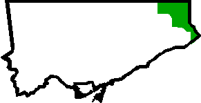
map_caption=Location of Rouge within TorontoRouge is a neighbourhood in the North East corner of the city of Toronto, more specifically Scarborough. The neighbourhood as defined by the city of Toronto contains many 'niche' areas that are more common to residents in the area. The boundaries of the neighbourhood are roughly Steeles Ave to the North, Pickering town line to the East and the lake to the South. The West border of the neighbourhood runs down from Finch Ave, along Morningside and then the 401 and finally Kingston Rd. The city of Toronto provides maps to outline the borders of each neighbourhood.
Within Rouge are several unique areas known more commonly as West Rouge, Rouge Hill, and Hillside.
External links
* [http://www.toronto.ca/demographics/cns_profiles/cns131.htm City of Toronto - Rouge Neighbourhood Profile]
Toronto Neighbourhood Geography
North =Markham, Ontario
East =Pickering, Ontario
South = Lake Ontario
West =Centennial Scarborough , Highland Creek, Malvern, Milliken
Center = Rouge
Wikimedia Foundation. 2010.
