- Maryvale, Toronto
-
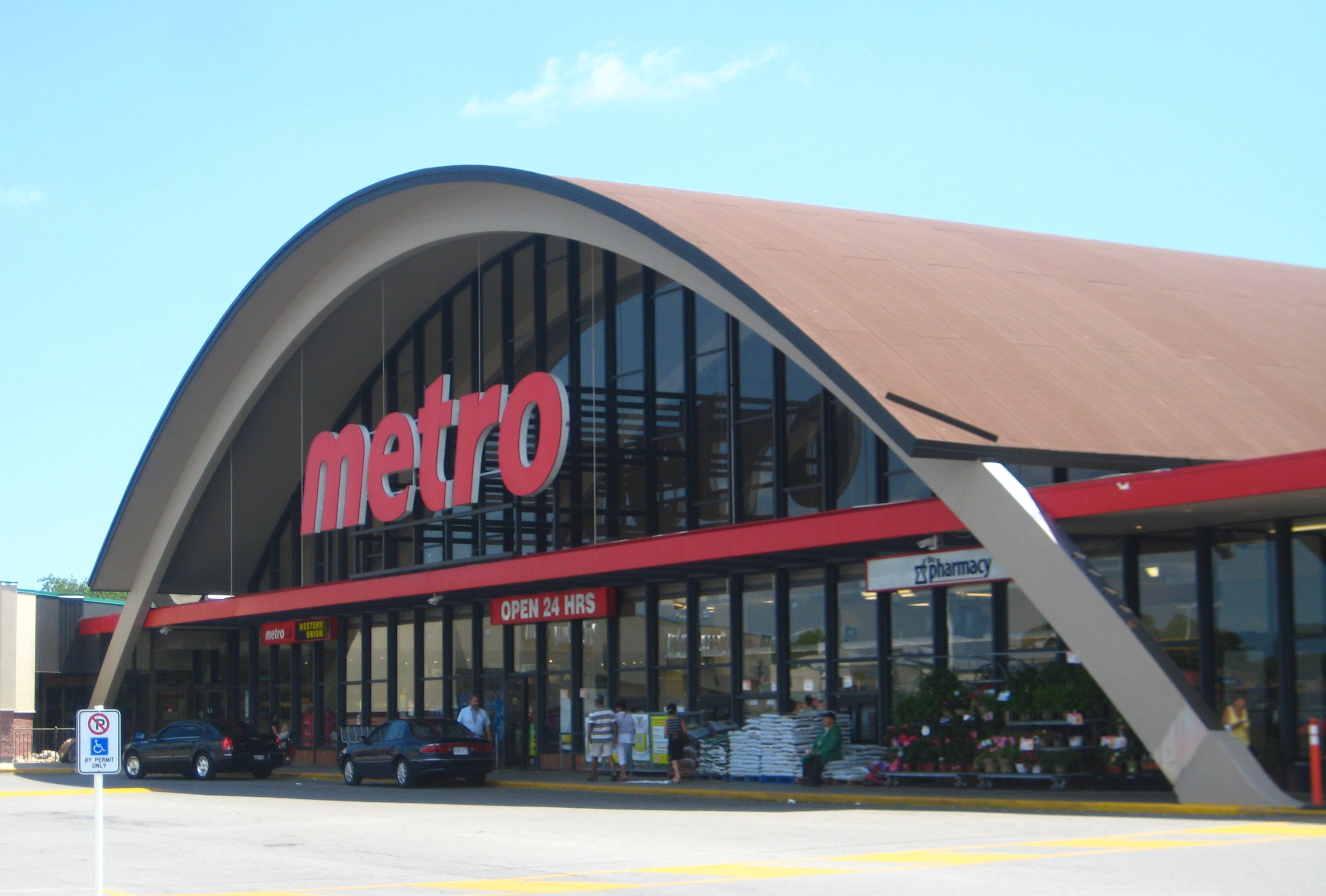
Maryvale — Neighbourhood — The unique design of the Parkway Mall Metro is a local landmark and registered heritage building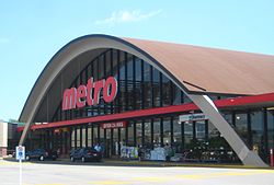

Coordinates: 43°44′35″N 79°18′16″W / 43.74306°N 79.30444°WCoordinates: 43°44′35″N 79°18′16″W / 43.74306°N 79.30444°W Country  Canada
Province  Ontario
City  Toronto
Community Scarborough Changed Municipality 1998 Toronto from  Scarborough
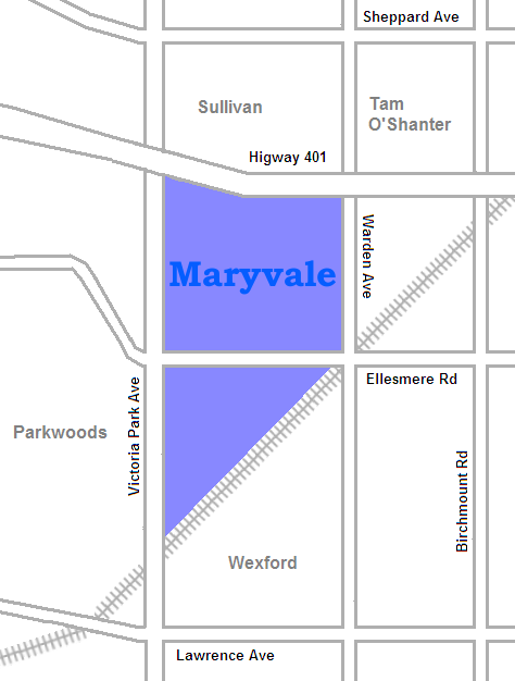
Maryvale is a neighbourhood in the Scarborough section of Toronto, Canada. It is located on the edge of Scarborough with its western border being Victoria Park Avenue. To the north it is bordered by Highway 401, to the east by Warden and to the south by the railroad tracks.
The area was first settled as farmland and the neighbourhood is named after the Maryvale farm that once covered part of the area. It was an early part of Scarborough to be developed, being turned into a new suburb in the early 1950s.
The most prominent monument in the community is the Metro store at Parkway Mall which has a distinctively curved roof, that was the largest wooden arch in Canada at the time of its construction. Originally built as a Grand Union store in 1958 it was declared a heritage building in 2009.[1]
References
- ^ "Metro store nominated as heritage property Suburban supermarket reflects Scarborough community's history, future, councillor says." John Spears Toronto Star. Wed Jan 14 2009

Tam O'Shanter-Sullivan Parkwoods (North York) 
Dorset Park  Maryvale

Wexford Categories:- Neighbourhoods in Toronto
Wikimedia Foundation. 2010.