- Weston, Ontario
Infobox City
official_name = Weston
subdivision_type2 = Country
subdivision_name2 =Canada
subdivision_type1 = Province
subdivision_name1 =Ontario
subdivision_type = City
subdivision_name =Toronto 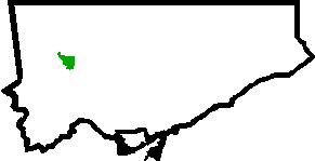
mapsize=150px
map_caption=Location of Weston within Toronto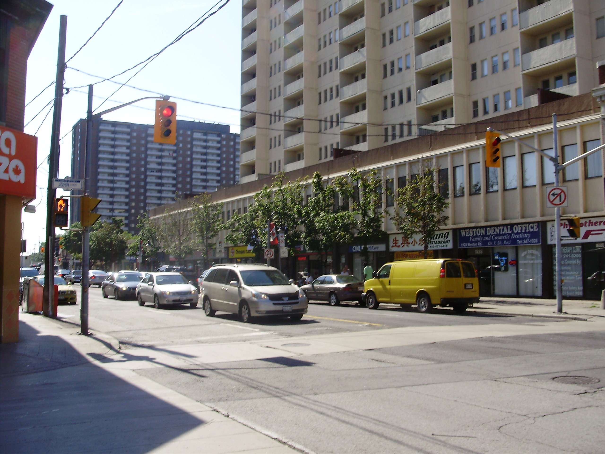
established_title = Settled
established_date = ca 1790s
established_title1 = Incorporated
established_date1 = 1881 Village
1914 Town
established_title2 = Annexed
established_date2 = 1967 into Borough of York 1998 into City of Toronto
population_note =
population_as_of = 2006
population_total = 16470
population_footnotes = [cite web|url=http://www.toronto.ca/demographics/cns_profiles/2006/pdf1/cpa113.pdf|title=Weston 2006 Social Profile #1|publisher=City of Toronto|accessdate=2008-08-28]
website = [http://www.welcometoweston.ca/ welcometoweston.ca]
latd=43 |latm=42 |lats=3.56 |latNS=N
longd=79 |longm=31 |longs=10.92 |longEW=WWeston is a neighbourhood in
Toronto ,Ontario ,Canada in the northwest end of the city, within the former boundaries of the old city of York. The neighbourhood generally lies south of Highway 401, east of the Humber River, north ofEglinton Avenue , and west ofJane Street .cite web|url=http://www.toronto.ca/demographics/cns_profiles/cns113.htm|title=Weston neighbourhood profile|work=Toronto Neighbourhood Maps |publisher=City of Toronto|accessdate=2008-08-27]Weston Road just north ofLawrence Avenue is the "downtown" core of Weston, with many small businesses and services.In addition to its traditional Anglo-Canadian roots, Weston is currently home to people of various cultures and ethnicities from around the world. [cite web|url=http://www.toronto.ca/demographics/pdf2/cpa113.pdf|title=Weston 2006 Social Profile #2|publisher=City of Toronto|accessdate=2008-08-28]
History
The first European settlement in the Weston area took place in the 1790s, when a
saw mill was built on an old native trading path along the west side of the Humber River, named after the well-knownHumber estuary inYorkshire ,England . In 1815 James Farr, a prominent local mill owner, named the growing settlement "Weston" after his birthplace,Weston, Hertfordshire . Weston initially developed along both sides of the river until a disastrous flood in 1850 destroyed the west bank settlement.cite web|url=http://www.westonplace.ca/aboutweston.html|title=About Weston|publisher=WestonPlace.ca|accessdate=2008-08-27] The former west bank settlement is now the site of the Weston Golf and Country Club. Improvements to the Main Street, nowWeston Road , and the 1856 arrival of theGrand Trunk Railway brought growth on the east side. On October 5, 1869,Prince Arthur, Duke of Connaught and Strathearn attended the sod turning ceremony for the construction of theToronto Grey and Bruce Railway . The spade which he used for the event is kept in the public library.The town of Weston grew, and over the 19th century became an important industrial centre for the Toronto area. The symbol adopted for the town, an outline of an old-fashioned bicycle, was based on this history of manufacturing and especially the old CCM bicycle factory on Lawrence Avenue just east of Weston Road. Models of bicycles now hang from the streetlights along Weston Road.
In October 1954,
Hurricane Hazel flooded the Humber River valley, causing death and destruction of property. [http://www.atl.ec.gc.ca/weather/hurricane/hazel/en/hr.html#west/ Remembering Hurricane Hazel] .Environment Canada website. Accessed 2008-08-21.] In response, low-lying areas in the Humber River valley were converted to parkland and property zoning standards were changed across Ontario to avoid building encroachment onfloodplains . There is a memorial in the south end of Lions Park near a pedestrian bridge which incorporates the original footing of a bridge that once crossed the Humber. The other footing of the bridge is the square chunk of concrete that is in the middle of the river nearby.Weston was incorporated as a village in 1881, and then as a town in 1914. In 1967 it became part of the Borough (later City) of York. In 1998, York was in turn amalgamated with the five other members of
Metropolitan Toronto , (Toronto,Etobicoke , North York, East York, and Scarborough) in the new "megacity" of Toronto.Although the Town of Weston has not existed as a legal reality for almost forty years, the area continues to be known as "Weston" and Weston is still a valid mailing address. [ [http://www.canadapost.ca/cpc2/addrm/hh/current/details/cdONuM9L-e.asp Summary for Weston] .
Canada Post . Accessed 2008-08-21.]Today
Weston's building stock consists mostly of Victorian homes east of the railway with apartment and condominium towers on Weston Road overlooking the Humber River valley. Weston's main shopping district is located on Weston Road between Church Street in the north and Wilby Crescent (just south of Lawrence Avenue) in the south. Most buildings in this area reflect early-mid 1900's Ontario town architecture, brick buildings with decorative masonry. The town has a historic library (previously a Mechanics' Institute and
Carnegie library ). The community is also dotted with grand old churches with historical architectural significance. There has been a recent move in Weston to designate certain areas as a historical district [ [http://www.toronto.ca/heritage-preservation/hcd_weston.htm Heritage Conservation Districts – Weston] . City of Toronto. Accessed 2008-08-21.] . Most streets in Weston are lined with huge mature trees, some well over 100 years old. This is more common east of the railway tracks. Recently there has been some infill development on former industrial and commercial lands bringing some new housing stock to the area. An art community is beginning to develop around Weston Road and John Street.The Weston Farmers' Market opens weekly from mid-May to the end of October near the centre of Weston. [ [http://www.farmersmarketsontario.com/MarketDetails.cfm?uMarketID=126 Weston Farmers' Market] . Accessed 2008-08-21.] The Weston BIA also hosts the "Weston Santa Claus Parade" each November [ [http://www.westonbia.com/ Weston Village BIA] . Accessed 2008-08-21.] .
Public transportation
Weston falls within the service area of the
Toronto Transit Commission (TTC). Transit is provided entirely by buses linking to the subway system. The 32 Eglinton West [cite web|url=http://www3.ttc.ca/Routes/32/Eastbound.jsp|title=32 Eglinton West|work=Bus Routes|publisher=Toronto Transit Commission|accessdate=2008-08-27] , 35 Jane [cite web|url=http://www3.ttc.ca/Routes/35/Northbound.jsp|title=35 Jane|work=Bus Routes|publisher=Toronto Transit Commission|accessdate=2008-08-27] , 52 Lawrence [cite web|url=http://www3.ttc.ca/Routes/52/Eastbound.jsp|title=52 Lawrence|work=Bus Routes|publisher=Toronto Transit Commission|accessdate=2008-08-27] , 58 Malton [cite web|url=http://www3.ttc.ca/Routes/58/Eastbound.jsp|title=58 Malton|work=Bus Routes|publisher=Toronto Transit Commission|accessdate=2008-08-27] , 59 Maple Leaf [cite web|url=http://www3.ttc.ca/Routes/59/Eastbound.jsp|title=59 Maple Leaf|work=Bus Routes|publisher=Toronto Transit Commission|accessdate=2008-08-27] , 73 Royal York [cite web|url=http://www3.ttc.ca/Routes/73/Northbound.jsp|title=73 Royal York|work=Bus Routes|publisher=Toronto Transit Commission|accessdate=2008-08-27] , 79 Scarlett [cite web|url=http://www3.ttc.ca/Routes/79/Northbound.jsp|title=79 Scarlett|work=Bus Routes|publisher=Toronto Transit Commission|accessdate=2008-08-27] , and 89 Weston [cite web|url=http://www3.ttc.ca/Routes/89/Northbound.jsp|title=89 Weston|work=Bus Routes|publisher=Toronto Transit Commission|accessdate=2008-08-27] all pass through the boundaries of Weston.Weston is also served by GO Transit's
Weston GO Station which is a station on theGeorgetown line , providing heavy interurban transit throughout the Greater Toronto Area.Public transit accessibility for the disabled
As of February 2008 [cite web|url=http://www.toronto.ca/ttc/pdf/accessmap0802.pdf|title=Accessible Transit Network map|publisher=TTC website|accessdate=2008-08-28] , the 79 Scarlett, which travels on Lawrence Avenue, and the 35 Jane on the eastern border of Weston, are the only
accessible TTC bus routes that serve areas within Weston's recognized borders.The Weston GO Transit railway station is also wheelchair accessible.
Parkland and recreation
Weston has many small parks throughout but most notable is Cruickshank Park in the Humber River valley with many mature trees and paved
bicycle paths [ [http://www.toronto.ca/parks/brochures/parks_trails_2.pdf Toronto Parks & Trails Map 2001] . Accessed 2008-08-27.] lined with largeweeping willow trees. The bicycle path continues south toLake Ontario . Sometimessalmon can be seen swimming upstream in the river. The park has a population ofbeaver as can be seen the from the tell-tale marks left behind on trees. In order to protect some trees, park staff have wrapped the tree trunks with wire screen in some areas. There are also somefrog s closer to the waters edge andGarter snake s hidden away in the more secluded areas.Canada geese ,loon s,mallard s andseagull s are a common sight. In some areas of the park, you can see exposedSedimentary rock in the walls of the valley, made visible by the action of glaciers that carved out the valley during thelast glacial period about 20000 years ago. The same rock was used to build many stone retaining walls throughout the town; an example of this use can be seen on the south end of the Lawrence Avenue bridge in the north end of Lions Park.Weston Lions Park, located south of Lawrence Avenue, fills convert|22.13|acre|m2 and contains facilities for playing football,
rugby union , soccer,tennis , andbaseball , as well as an ice rink and swimming pool. [ [http://www.toronto.ca/parks/parks_gardens/westonlions.htm City of Toronto: Parks and Recreation - Weston Lions Park ] ]Current issues
Of late, the issue of the proposed
Blue22 high-speed rail link betweenToronto Pearson International Airport and Union Station downtown has become a hot political issue in Weston. So called for its planned 22 minute travel time from end to end, it had originally been proposed for completion by 2009. Under the current proposal, there is no plan for the line to stop in Weston where the route would pass. Weston is currently a station stop on theGeorgetown line operated byGO Transit . If approved, the link would see the construction of three additional tracks through the neighbourhood and would increase rail traffic more than fourfold. Community activists are worried about the link severing the community (vehicle traffic on one street will be permanently blocked from crossing the tracks, replaced by a pedestrian bridge) and the possibility of lower future property values due to increased noise anddiesel fumes. It was an issue during the Canadian federal election held onJanuary 23 ,2006 where incumbent Liberal Member of Parliament,Alan Tonks , supported the link, while the other candidates opposed it. It is also an issue in the February 2007 provincial by-election, where all local candidates came out against the link, but which was still supported by the governing Liberals. Current plans for the link are still on the table and the project is expected to go ahead in its original form despite the various alternatives presented by the Weston Community Coalition (WCC). The WCC has proposed a subway line as an alternative to run through the Weston rail corridor to the airport that would have stops along the way which would serve many communities throughout Toronto and be operated by the TTC rather than a private company. Various other alternatives were presented by community activists such as an Eglinton subway to the airport or a route down Highway 427.Historic gallery
External links
* [http://www.welcometoweston.ca/ Welcome To Weston]
* [http://www.westonplace.ca/ Weston Place]
* [http://heritageweston.com/ The Weston Heritage Conservation District]
* [http://www.toronto.ca/bia/weston_village.htm Weston Village BIA]
* [http://www.tpl.toronto.on.ca/hou_az_we.jsp Toronto Public Library - Weston Branch]
* [http://www.westoncommunitycoalition.ca Weston Community Coalition]
* [http://www.westoncommunitycoalition.ca/Rapid%20Public%20Transit%20to%20Airport.pdf Weston Community Coalition rapid transit proposal]
* [http://www.toronto.ca/ttc/schedules/89map.gifTTC 89 Weston route map]
* [http://www.toronto.ca/demographics/cns_profiles/cns113.htm Weston Neighbourhood Profile from City of Toronto website]
* [http://blogto.com/weston Weston Neighbourhood Profile from blogTO]
* [http://www.youtube.com/watch?v=M_6QPxdRedM Youtube video- Deindustrialization of Weston and Mount Dennis]
* [http://www.atl.ec.gc.ca/weather/hurricane/hazel/en/hr.html#west Site with info on Hurricane Hazel damage]
* [http://maps.google.com/maps?f=q&hl=en&q=toronto+ontario&ie=UTF8&z=15&ll=43.704926,-79.521618&spn=0.014054,0.043259&t=h&om=1m Google Maps Image Of Weston]Government links
* [http://www.toronto.ca/councillors/nunziata1.htm City Councilor-Frances Nunziata]
* [http://www.ontla.on.ca/web/members/members_detail.do?locale=en&ID=7085&detailPage=members_detail_contacts Member of Provincial Parliament-Laura Albanese]
* [http://www2.parl.gc.ca/Parlinfo/Files/Parliamentarian.aspx?Item=7be31897-2aa9-4cff-8581-8f6eb0edff6e&Language=E&Section=FederalExperience/ Member of Parliament-Alan Tonks]People from Weston
* List of people from Weston
See also
*
York South—Weston
*Weston Collegiate Institute
*Humber River
*Weston Road
*Canada Cycle & Motor Co. Ltd
* Knob Hill FarmsReferences
Toronto Neighbourhood Geography
North =Pelmo Park-Humberlea
East = Rustic, Brookhaven-Amesbury
South =Mount Dennis
West =Humber Heights-Westmount , Kingsview Village-The Westway
Center = Weston
Wikimedia Foundation. 2010.