- List of east–west roads in Toronto
-
The following is a list of the east–west arterial thoroughfares in the Canadian city of Toronto. The city is organized in a grid pattern dating back to the plan laid out by Augustus Jones between 1793 and 1797. Most streets are aligned in the north-south or east-west direction, based on the shoreline of Lake Ontario. In other words, major north–south roads are generally perpendicular to the Lake Ontario shoreline and major east–west roads are generally parallel to the lake's shoreline. The Toronto road system is also influenced by its topography as some roads are aligned with the old Lake Iroquois shoreline, or the deep valleys. Minor streets with documented history or etymology are listed in a separate section.
East–west roads
Listed south to north
Queen's Quay
Main article: Queen's Quay (Toronto)
Queen's Quay
Location: Stadium Road – Lakeshore Boulevard East
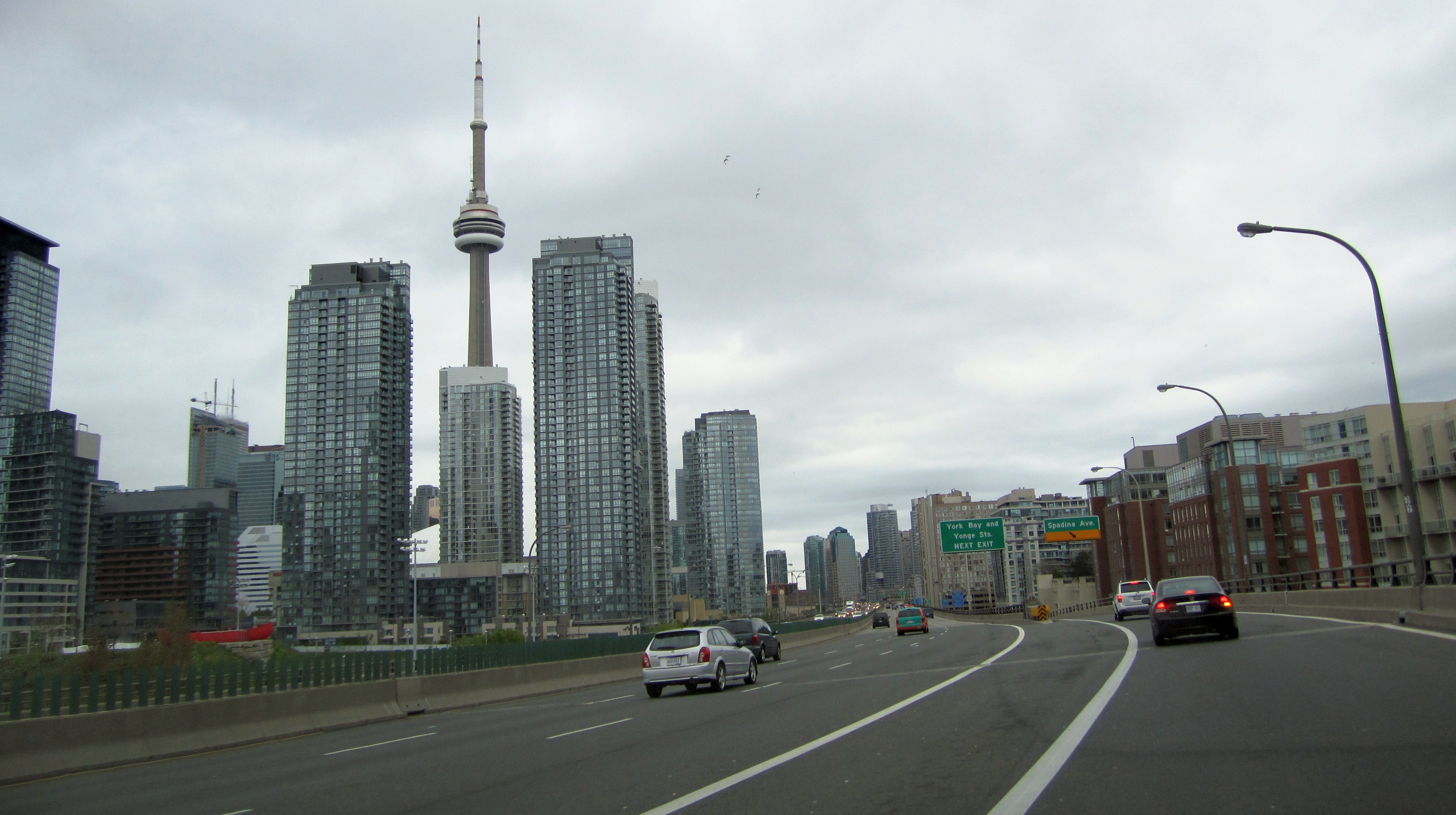
(continues north as Parliament Street)Length: 3.6 km[1] (2.2 mi)  Queen's Quay in 1910
Queen's Quay is built entirely on infill, and is the closest road to Lake Ontario throughout the downtown core. Though once abutted by warehouses from end to end, much of its length has seen rapid gentrification in the past two decades, with dozens of condominium towers rising. In 1999, the Toronto Transit Commission opened a dedicated streetcar right-of-way in the median from Bay Street to Bathurst Street.
In 2009, Waterfront Toronto announced its plans to turn Queens Quay into a grand lakefront boulevard by placing streetcar lanes in the centre, traffic only on the north side and a pedestrian focussed space on the south side. The plan will restrict Queen’s Quay to two traffic lanes, on the north side of the streetcar tracks, similar to the design of the 2006 experiment. Additionally, the plan calls for the beautification and extension of the Harbourfront streetcar line along Queen’s Quay East between Yonge and Cherry Street. The transit right-of-way will be grass-covered.[2]
Queen's Quay begins west of Bathurst Street at Stadium Road and ends at Lakeshore Boulevard East, where it continues north as Parliament Street.[3]
Lake Shore Boulevard
Main article: Lake Shore Boulevard
Lake Shore Boulevard
Location: Etobicoke Creek – Ashbridge's Bay
(continues north as Woodbine Avenue)Lake Shore Boulevard, often misspelled as Lakeshore Boulevard, is so named because of its position along the Lake Ontario shoreline. Although the route west of the humber has existed since ancient times, much of the remainder of the route was created during massive shoreline reclamation projects carried out by the Harbour Commission between 1900 and 1915. Lakeshore Road travelled as far east as Roncesvalles, where it connected to Queen Street. Incorporating various side streets such as Laburnam Avenue, Starr Avenue and Dominion Street, the route was pushed east to Bathurst Street on January 28, 1924.[4] From there it continued as Fleet Street to Cherry Street. Keating Street continued east from a point just south of that intersection to Woodbine Avenue. These two streets were reconstructed to form a continuous roadway, and renamed as part of Lakeshore Road on August 25, 1959.[5]
Gardiner Expressway
Gardiner Expressway
Location:  Highway 427 – Carlaw Avenue
(continues west as Queen Elizabeth Way)Main article: Gardiner Expressway The Gardiner Expressway in downtown Toronto
The Frederick G. Gardiner Expressway, known locally as "the Gardiner", is an expressway connecting downtown with the western suburbs. Running close to the shore of Lake Ontario, it now extends from the junction of Highway 427 and the Queen Elizabeth Way in the west to the foot of the Don Valley Parkway in the east, just past the mouth of the Don River. East of Dufferin Street, the roadway is elevated, running above Lake Shore Boulevard east of Bathurst Street. Elevated sections east of the Don were demolished and integrated into Lake Shore Boulevard.
The highway is named for the first chair of the now-defunct Metro Council, Frederick G. Gardiner, who championed it, the Don Valley Parkway and Spadina Expressway projects. The six-lane section east of the Humber River was built in segments from 1955 until 1964 by the Metropolitan Toronto government with provincial highway funds. The ten-lane section west of the Humber was formerly part of the QEW. The Gardiner Expressway is now wholly owned and operated by the City of Toronto.
When the Gardiner was built, it passed through industrial lands, now mostly converted to residential lands. Extensive repairs became necessary in the early 1990s, and since then the Gardiner has been the subject of several proposals to demolish it or move it underground as part of downtown waterfront revitalization efforts. One elevated section east of the Don River was demolished in 2001, and a current study is underway to demolish that part of the elevated section east of Jarvis Street to the Don.
Front Street
Main article: Front Street (Toronto)
Front Street
Location: Bathurst Street – east of Cherry Street Length: 3.8 km[6] (2.4 mi) Front Street is so named because it fronted the Lake Ontario shoreline at the time of the original layout of York. In the early years of the 20th century, the Toronto Harbour Commission revitilized the stagnant industrial waterfront. Largely as a result of this process, the shoreline was filled several hundred metres south to Queen's Quay.
Front Street begins at Bathurst Street and crosses through downtown Toronto north of the rail viaduct. The road passes the Rogers Centre, CN Tower and Union Station before eventually forcing drivers onto Eastern Avenue. A short side street continues east to the Bayview Avenue alignment with the name Front Street.d[3]
Eastern Avenue
Main article: Eastern Avenue (Toronto)
Eastern Avenue
Location: Trinity Street – Queen Street
(continues west as Front Street
east as Kingston Road)Eastern Avenue, formerly South Park Street, was named on November 27, 1876.[7] It was connected with Kingston Road in 1998 following the removal of the old Woodbine Racetrack.[8] Eastern Avenue begins at a curve along Front Street east of Parliament Street; eastbound traffic on Front is defaulted onto Eastern Avenue, vice-versa for westbound traffic on Eastern. The road crosses the Don River, merging with Richmond Street and Adelaide Street and providing access to the Don Valley Parkway. East of Broadview Avenue, it travels parallel to and three blocks south of Queen Street East along the King Street alignment to east of Coxwell Avenue, where it curves northward and meets Queen Street. North of Queen Street, the road becomes Kingston Road.[3]
King Street
Main article: King Street (Toronto)King Street Location: Roncesvalles Avenue – Don River
(continues west as The Queensway
east as Queen Street East)King Street was named in honour of King George III by John Graves Simcoe when it was laid out in the original plan of York in 1793. It existed by various names over the years.[9][10] The street travels east from The Queensway, splitting off to the south-east at Queen Street West and Roncesvalles Avenue, to the Don River where it ends at Queen Street. King Street once crossed the Don River on an abandoned steel and concrete bridge. On the west side the roadway is now Eastern Avenue and Cypress Street. East of the Don, a short stretch begins as Sunlight Park Road and then as Eastern Avenue to Kingston Road.[3]
Adelaide Street
Adelaide Street Location: Shaw Street – Don River
(begins from Eastern Avenue)Adelaide Street was named for Princess Adelaide of Saxe-Meiningen (wife of William IV) by Peter Russell, second Lieutenant Governor of Upper Canada, in his 1797 plan of Toronto. The original section of Adelaide was only a portion of the present street. In 1844, Little Adelaide Street, Adelaide Street and Newgate Street were amalgamated to form Adelaide Street.[11] The street was split into east and west sections in 1884.[12] In 1926, at the request of property owners, Adelaide Street West was extended from Bathurst Street to Shaw Street, incorporating the entirety of Defoe Street and McDonnell Square.[13] The most recent extension came in 1965, when Adelaide Street East was routed onto Duke Street, which crossed between Jarvis Street and Parliament Street.[14] This was done in advance of the opening of the lower section of the Don Valley Parkway and eastern section of the Gardiner Expressway. Newgate and Duke Streets were amalgamated into Adelaide Street East.
Richmond Street
Richmond Street Location: Strachan Avenue – Don River
(continues east as Eastern Avenue)Richmond Street remembers Charles Lennox, 4th Duke of Richmond. Lennox came to Canada in 1818 as Governor-in-Chief of British North America, only to die a year later after being bitten by a rabid fox while touring the countryside.[15] Richmond street absorbed Duke Street and became a one-way road in 1958 as part of a process to build ramps to Eastern Avenue and the Don Valley Parkway. Richmond Street is a westbound one-way street east of Bathurst Street. Between its western terminus at Strachan Avenue and Bathurst Street, the street is one-way, alternating directions twice.[3]
The Queensway
Main article: The Queensway
The Queensway
Location: Etobicoke Creek – Roncessvalles Avenue
(continues east as Queen Street
west into Mississauga)The Queensway was named in the 1950s following the ascention of Queen Elizabeth II.[citation needed]
Queen Street
Queen Street
Location: Roncessvalles Avenue – Fallingbrook Road
(continues west as The Queensway)See also: Queen Street WestQueen Street, known as Lot Street until 1844, was named in honour of Queen Victoria, who reigned from 1837 until her death in 1901. For a time, Lot Street served as the northern limit of York. On the north side of the street, large 0.8 km2 (200 acres) were granted to loyalists and government officials, many of whom never visited Upper Canada during their lives.[16] The central portion of Lot Street was constructed as the baseline for surveys along Yonge Street by the Queen's Rangers in 1793. It was later extended west to Ossington Street as part of the Governor's Road (Dundas Street).[17]
Queen Street begins at an intersection with The Queensway, Roncesvalles Avenue and King Street and crosses through Parkdale, the Fashion District, downtown Toronto, Riverdale, East Toronto and The Beaches, ending east of Victoria Park Avenue at a residential street named Fallingbrook Road. The entirety of the street is served by the 501 Queen streetcar route.[18]
Dundas Street
Main article: Dundas Street
Dundas Street
Location: Etobicoke Creek – Kingston Road
(continues west into Mississauga)Dundas Street was named by John Graves Simcoe in honour of the Right Honourable Henry Dundas, 1st Viscount Melville. Like Yonge Street, named in a similar example of cronyism, Dundas Street was created as a defense road. Simcoe feared the impending invasion of the Americans following the Revolutionary War, an event which would occur in 1812. Dundas Street was to connect York with Detroit, then a British settlement; it reached as far as London, Simcoe's proposed new capital. The street was initially constructed by the Queen's Rangers between Dundas and the Thames River in 1794, but later extended east to York by pioneer road builder Asa Danforth in 1797.
Dundas Street originally began at the present-day intersection of Queen Street West and Ossington Avenue. It travelled north along Ossington, then turned west at Garrison Creek along the current Dundas Street. By the 1920s, Dundas was extended east through downtown Toronto to Broadview Avenue along several existing but discontinuous streets, comprising Arthur Street (Ossington to Bathurst), St. Patrick (Bathurst to McCaul), Anderson (McCaul to University), Agnes (University to Yonge), Crookshank (Yonge to Victoria, now separated and known as Dundas Square) and Wilton Avenue (Victoria to Broadview). This was done by correcting several irregularities, or "jogs", between the streets. These jogs are evident east of Bathurst Street and Yonge Street.[19][20]
Gerrard Street
Main article: Gerrard Street (Toronto)
Gerrard Street
Location: University Avenue – Clonmore Drive  The Little India section of Gerrard Street
Gerrard Street was established on January 6, 1875 by incorporating Don Street and Lake View Avenue. It is named after Irish businessman Samuel Gerrard, a personal friend of the Honourable John McGill. The bridge over the Don River was completed and opened December 16, 1923.[21]
Gerrard Street begins at University Avenue in the Discovery District, surrounded by Princess Margaret Hospital, Mount Sinai Hospital, Toronto General Hospital and Hospital for Sick Children. It travels west through downtown Toronto, past Ryerson University and Regent Park before crossing the Don River on the Gerrard Street Viaduct, constructed between 1922 and 1924. The road continues through Chinatown East and Little India. At Coxwell Avenue, the road deviates one block to the north; this split has led to the distinct parts being labelled as Upper and Lower Gerrard. Gerrard Street ends at Clonmore Avenue, west of Warden Avenue; traffic is forced onto Clonmore Avenue where it can travel as far as Birchmount Road.
College Street
Main article: College Street (Toronto)
College Street
Location: Dundas Street West – Yonge Street
(continues east as Carlton Street)College Street shares its origins with University Avenue as one of the two private entrances to King's College opened in 1829. King's College was the first college in Canada when it was chartered by Henry, 3rd Earl of Bathurst two years earlier. The road began at a gatehouse at Yonge Street and progressed westward to present-day University Avenue. Like University, College was surrounded by gates in an attempt to create an elegant driveway like those in Oxford and Cambridge.[22]
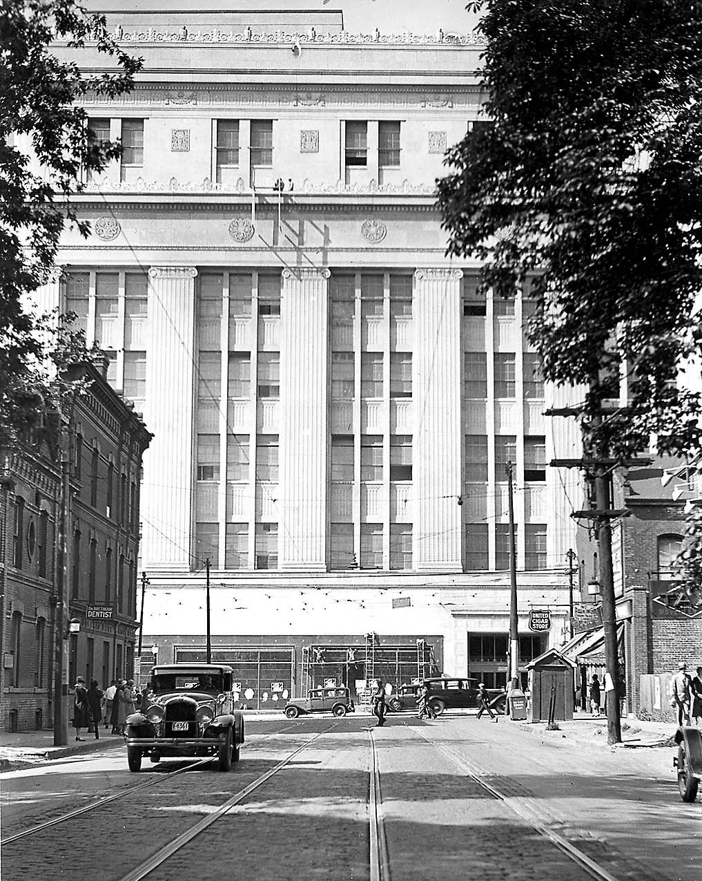
 Until June 1931, Carlton Street ended at Yonge Street, as pictured here
Carlton Street
Carlton Street
Location: Yonge Street – Riverdale Park
(continues west as College Street)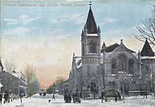 Looking east at Carlton and Sherbourne Streets circa 1910
Carlton Street was named by Ann Wood, wife of both Andrew Ryan McGill and then John Strachan, after her brother, Guy Carleton Wood, who was in turn named after Guy Carleton; it is unknown when the "e" was dropped from the spelling.[23] In 1930, as part of a depression relief program, Carlton Street was realigned east of Yonge Street in order to meet with College Street. Prior to that, it met Yonge Street south of the present intersection by several dozen metres. The completed intersection was opened in early June 1931.[24]
Carlton Street is home to Maple Leaf Gardens. It extends from Yonge Street east to Parliament Street as a major thoroughfare. Carleton continues east of Parliament as a residential street, ending at the edge of Riverdale Park.[3]
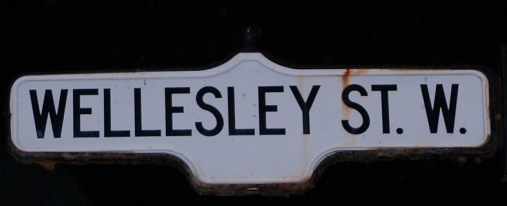
Wellesley Street
Wellesley Street
Location: Queen's Park Crescent – Wellesley Park Wellesley Street is named after Arthur Wellesley, 1st Duke of Wellington, who is best known for his victory over Napoleon at the Battle of Waterloo in 1815, and for a short but unpopular tenure as Prime Minister of Britain between 1828 and 1830.[25]
Wellesley Street begins at the entrance to the University of Toronto at Queen's Park Crescent. The road passes immediately north of the Ontario Legislative Building (Queen's Park)
Bloor Street
Main article: Bloor Street
Bloor Street
Location: Etobicoke Creek – Prince Edward Viaduct
(continues east of viaduct as Danforth Avenue)Bloor Street was named by 1855 after Joseph Bloore.[note 1][26] Originally surveyed as the first concession road north of the baseline (now Queen Street), it was known by many names, including the Tollgate Road (as the first tollgate On Yonge north of Lot Street was constructed there in 1820),[27] then St. Paul's Road (after the nearby church, constructed 1842), and possibly Sydenham Road (after Lord Sydenham, Governor General 1839-1841).[note 2][28][29][30][31] Although Bloore had an "e" at the end of his surname, Bloor Street was never spelled with it, as evidenced on numerous maps produced before his death.[32]
Danforth Avenue
Main article: Danforth Avenue
Danforth Avenue
Location: Prince Edward Viaduct – Kingston Road
(continues west of viaduct as Bloor Street East)Length: 9.1 km[33] (5.7 mi) Danforth Avenue, known as the Don and Danforth Road until 1871, takes its name from pioneer road builder Asa Danforth, who built the Governors Road and Danforth Road by the end of the 18th century, under the direction of surveryor general Augustus Jones. Danforth Avenue, however, was constructed in 1851 by The Don and Danforth Plank Road Company, connecting the Don Mills Road (now Broadview Avenue) with the Danforth Road.[34] The road was extended east to Kingston Road (formerly Highway 2) in 1935, which included the construction of the present interchange.
Annette Street
Annette Street Location: Jane Street – Keele Street
(continues east as Dupont Street)Wife of developer Columbus Greene
Dupont Street
Dundas Street
Location: Keele Street – Avenue Road
(continues west as Annette Street)Length: 5.2 km[35] (3.2 mi) Dupont Street is named for George Dupont Wells, son of Colonel Joseph Wells. George was one of the first students of Upper Canada College, and several other streets are named after him. These include Wells and Wells Hill[36] Dupont begins at Keele Street as a continuation of Annette Street. It runs parallel to and south of the CPR Midtown tracks east to Avenue Road.[3]
Davenport Road
Davenport Road
Location: Old Weston Road – Yonge Street
(continues east as Church Street
west as Old Weston Road)Length: 6.4 km[37] (4.0 mi) Davenport Road takes its name from the Davenport House, the first estate atop the Lake Iroquois shoreline and home of Colonel Joseph Wells, father of George Dupont Wells. The estate stood northeast of the modern Bathurst Street and Davenport Road intersection. Wells purchased the property from Adjutant John McGill in 1821 and rebuilt the house that occupied it. McGill built the original house in 1797 and supposedly named it after Major Davenport, who was stationed at Fort York at that time.[38]
Burnhamthorpe Road
Burnhamthorpe Road Location: Etobicoke Creek – Dundas Street West
(continues southeast as Cordova Avenue
west into Mississauga)After a village in Mississaga.
O'Connor Drive
O'Connor Drive Location: Broadview Avenue – Victoria Park Avenue
(continues east as Eglinton Square
south as Broadview Avenue)O'Connor Drive takes its name from Senator Frank Patrick O'Connor, who owned Maryvale farm in Scarborough Township. In 1913, Frank opened the Laura Secord Candy Shop on Yonge Street, which has since become a national franchise.[39] O'Connor Drive begins at the northern terminus of Broadview Avenue and progresses east to Woodbine Avenue, where it turns to the northeast and continues to Eglinton Avenue.[3] The first several kilometres were originally part of the Don Mills Road until the 1922.
Rathburn Road
Rathburn Road Location: Etobicoke Creek – Islington Avenue
(does not cross Etobicoke Creek)St. Clair Avenue
Main article: St. Clair Avenue
St. Clair Avenue
Location: Scarlett Road – Kingston Road
(interupted by Don Valley)St. Clair Avenue, once the Third Concession, crosses through a majority of the city. The road is separated into two sections by the Don Valley. The western segment begins east of the Humber River at Scarlett Road, where it is angled and does not follow the concession line as a result of road realignments for the construction of the Canadian Pacific railway crossing in 1912.[40] It proceeds east to near Mount Pleasant Road, but stops short of the Don valley. On the opposite side, it begins near O'Connor and continues along the same alignment to Kingston Road.[3]
Davisville Avenue
Davisville Avenue
Location: Yonge Street – Bayview Avenue
(continues west as Chaplin Crescent)Length: 1.9 km[3] (1.2 mi) Davisville Avenue is named after John Davis, who opened Davis Pottery at Yonge and Davisville in 1845. Davis Pottery became nationally renowned; John used the newfound fortune to build schools and churches, and became the first postmaster of the growing village.
Davisville Avenue was built in the early 20th century as one of several roads connecting Yonge Street with the planned town of Leaside. It begins as a continuation of Chaplin Crescent at Yonge Street and proceeds east 2 km (1.2 mi) to Bayview Avenue.[3]
Millwood Road
Millwood Road
Location: Yonge Street – Leaside Bridge
(continues south of viaduct
as Pape Avenue and Donlands Avenue)Rogers Road
Rogers Road Location: Weston Road – Oakwood Avenue Rogers Road is named for Stephen Rogers, who built one of the first houses in the Oakwood area in 1876 at the present corners of Rogers Road and Oakwood Avenue. It was constructed in the 1920s to serve Prospect Cemetery. The road crosses between Weston Road (incorporating a former section of Old Weston Road) and Oakwood Avenue.
Eglinton Avenue
Main article: Eglinton Avenue
Eglinton Avenue
Location: Etobicoke Creek – Kingston Road
(continues west into Mississauga)Eglinton Avenue takes its name from the village that was established at its intersection with Yonge Street. There are several possible origins of the name, all of which lead back to the Earl of Eglinton. Several Scottish veterans of the War of 1812 settled in the area, possibly naming it after their Earl of Eglinton, Hugh Montgomerie. Hugh's successor, Archibald William Montgomerie, was famous for a lavish tournament held at his Eglinton Castle in 1839. For two years prior to the formation of Metropolitan Toronto, the section of Eglinton Avenue through Scarborough was known as Highway 109.
Eglinton Avenue holds the distinction as the only road in Toronto to cross all six former municipalities. It begins at the Toronto–Mississauga boundary and travels east through Richview, Weston, North Toronto, Leaside, the Golden Mile, Brimley and Scarborough Village before ending at Kingston Road. The majority of Eglinton Avenue is abbuted by commercial strip plazas, auto dealerships, and dense apartment blocks, though almost every zoning condition presents itself along the road.[3] The route is heavily congested, which will be addressed by the Eglinton–Scarborough Crosstown line.
Blythwood Road
Blythwood Road Location: Yonge Street – Bayview Avenue Length: 1.8 km[41] (1.1 mi) Blythwood is a minor collector road, which connects Yonge Street with Bayview Avenue and the Sunnybrook Health Sciences Centre.[3]
Glencairn Avenue
Glencairn Avenue Location: Caledonia Road – Yonge Street Lawrence Avenue
Main article: Lawrence Avenue
Lawrence Avenue
Location: Royal York Road – Rouge Hills Drive
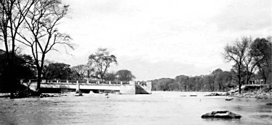
(continues west as The Westway) The Lawrence Avenue bridge over the Humber River was washed out by Hurricane Hazel; part of it remained attached to the shore, while the rest was swept away by the river.
Lawrence Avenue recognizes the Lawrence family, who immigrated from Yorkshire in 1829 and bought property on the east side of Yonge Street north of the Fourth Concession Road. Peter Lawrence, who served as Justice of the Peace for the village of Eglinton beginning in 1836, purchased the farm. Jacob Lawrence established a mill at Bayview Avenue in 1845. The property was sold in 1907 to Wilfred Dinnick, who developed a garden suburb that he named Lawrence Park in honour of the family.[42] The road remained a sod road until the 1920s before being developed as part of the development.[43]
Lawrence Avenue begins in the west at Royal York Road. West of there, the road continues as The Westway, a windy collector road that ends at Martin Grove Road constructed post-World War II to serve the growing Willowridge-Martingrove-Richview to the south and the Kingsview Village-The Westway to the north. In the east, the road ends near the Rouge River, east of Port Union.
Lawrence Avenue East is interrupted at Bayview Avenue, by the west branch of the Don River. A detour north on Bayview leads to Post Road, and a connection back to Lawrence Avenue on the east side of the valley. This detour runs through The Bridle Path, one of Toronto's most affluent neighbourhoods. East of Leslie Street, Lawrence becomes an arterial road, passing through Don Mills. In the East Don valley is the Lawrence Avenue exit of the Don Valley Parkway. From there, Lawrence continues as a six-lane road through most of Scarborough, with many strip malls flanking its sides. The segment east of Morningside Avenue is primarily residential. The road ends at Rouge Hills Drive at the entrance to Rouge Park near the mouth of the Rouge River.[3]
Dixon Road
Dixon Road Location: Highway 427 – east of Royal York Road
(continues south as Scarlett Road
northwest as Airport Road)Dixon Road, named after the Dixon family. George and Thomas Dixon constructed sawmills on their properties abbuting the road in 1818 and 1823, respectively.[44] Dixon begins at Highway 427 and travels eastward toward the former borough of York, becoming Scarlett Road. Dixon Road continues west of Highway 427 as Peel Regional Road 7, or Airport Road, continuing to the town of Wasaga Beach on the shores of Georgian Bay.[3] The stretch between Highway 427 and Martin Grove Road is often referred to as the "Airport Strip", due to the abundance of major hotel chains serving the airport, including Westin, Marriott, Holiday Inn, Hilton, DoubleTree, Crowne Plaza, and Sheraton.
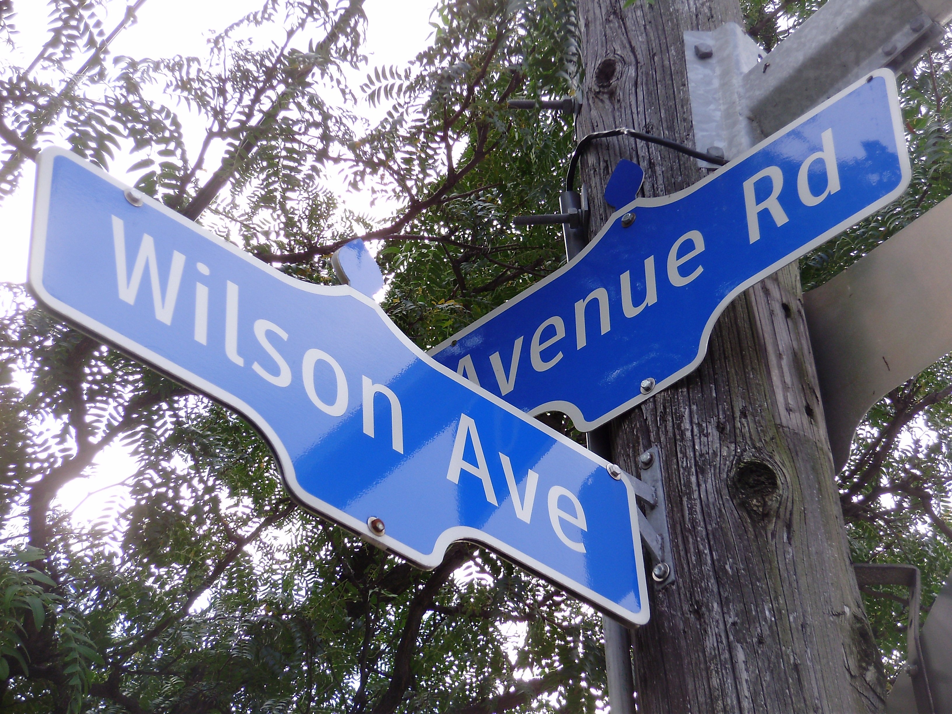
Wilson Avenue
Wilson Avenue
Location: Weston Road – Yonge Street
(continues east as York Mills Road
west as Albion Road)York Mills Road
York Mills Road
Location: Yonge Street – Victoria Park Avenue
(continues west as Wilson Avenue)York Mills Road meets Yonge Street, the road to York, in Hoggs Hollow. Between 1804 and 1926, many mills flourished in this valley, lending to both the name of the road and neighbourhood.[45] York Mills is an eastward continuation of Wilson Avenue; this continuity did not exist until the opening of the Yonge Subway extension in 1976. It is primarily residential in nature, except near Yonge Street and between Leslie Street and Don Mills Road, which are mostly commercial. The road ends at Victoria Park Avenue; a connection to Ellesmere Road is provided via Parkwoods Village Drive.[3]
Ellesmere Road
Ellesmere Road Location: Victoria Park Avenue – Kingston Road
(continues west as Parkwoods Village Drive)Ellesmere Road is named after the village that once occupied its intersection with Kennedy Road, which was itself named after the birthplace of the original settlers in Shropshire, England.[46] The road travels through Scarborough, where it was laid as the first concession road (Lawrence Avenue being the baseline in the survey of Scarborough). The surrounding land alternates between single-unit homes and commercial strips throughout its length.[3]
Highway 401
Main article: Highway 401King's Highway 401 Location: Renforth Road – Rouge River
(continues east and west across southern Ontario)King's Highway 401, colloquially referred to as the four-oh-one, opened between December 1947 and August 1956, and was known as the Toronto Bypass at that time. Although it has since been enveloped by suburban development, it still serves as the primary east–west through route in Toronto and the surrounding region. East of the Don Valley Parkway, it is also known as the Highway of Heroes, in reference to the funeral processions travelling between CFB Trenton and the Ontario Coroners Office. Highway 401 crosses the entirety of Toronto and physically divides the city in half.
Sheppard Avenue
Main article: Sheppard Avenue
Sheppard Avenue
Location: Weston Road – Kingston Road
(continues south as Port Union Road)Sheppard Avenue, originally the Lansing Sideroad (after the village it encountered at Yonge Street), is named after one of two families that lived adjacent to its intersection with Yonge Street. Tom Shepherd (or Sheppard) opened the Golden Lion Hotel on the southwest corner of the intersection in 1824 and sold it to his son, Charles, in 1856. On the opposing corner, an unrelated pioneer settler named Joseph Shepard built a log cabin in 1802. Joseph and various members of kin played pivotal roles in the establishment of York.[47]
Sheppard Avenue begins at Weston Road, and travels east across North York and Scarborough to Meadowvale Road. Shortly thereafter, it turns southeast. At Kingston Road (formerly Highway 2), it becomes Port Union Road. Twyn Rivers Road continues along the alignment into Pickering; at Altona Road it becomes Sheppard Avenue once again.
Finch Avenue
Main article: Finch Avenue
Finch Avenue
Location: Highway 427 – Morningside Avenue
(a small section continues east of Beare Road to Pickering) The intersection of Bayview and Finch was opened October 1960, eliminating a jog in both roads over Newtonbrook Creek
Finch Avenue is named after John Finch, who purchased the Bird-in-the-Hand inn in 1847.[48] It is residential for most of its length, although portions in North York and Scarborough are heavily industrialized. In the east, within Malvern, Finch Avenue becomes Morningside Avenue. However, Old Finch Avenue continues along the same right-of-way passing north of the Toronto Zoo and ending and Meadowvale Road. Approximately 800 m (0.50 mi) to the east, another section of Finch Avenue begins and passes into Pickering.
Cummer Avenue
Cummer Avenue Location: Yonge Street – Leslie Street
(continues east as McNicoll Avenue
west as Drewry Avenue)Cummer Avenue is named after Jacob Kummer, a German settler who emigrated to Upper Canada in 1797 and built a mill on the Don River in 1819. The road to this mill became associated with the anglicized variation of the family name.[49][50] The road travels east from Yonge as a continuation of Drewry Avenue. At its crossing of the Don River, Cummer curves north, retuns to the east and ends at Leslie Street. It continues east as McNicoll Avenue.
Steeles Avenue
Main article: Steeles Avenue
Steeles Avenue
Location: Albion Road – Scarborough–Pickering Townline
(continues east as Regional Road 4 (Taunton Road))
 Steeles Avenue, near its intersection with Warden Avenue
Steeles Avenue is a major arterial road in the north end of the city. It is the only road (aside from Highway 401) to pass, uninterrupted, west to east through the entire city; it also continues west to Milton and east into Pickering as Taunton Road.[3] The Steele family resided at Yonge and Steeles beginning in 1856, when Thomas purchased an inn and named it the Steele's Hotel. Thomas' son, John C. Steele, is known for inventing the Steeles Improved Road Machine, an early grader. It serves as the boundary line between Toronto and York Region to the north.[51]
Steeles Avenue was listed by the Canadian Automobile Association (CAA) as the "worst road in October" for 2006, and as the fifth worst road in 2007. In October 2008, it was again crowned the worst road in Ontario.[52] Reasons include potholes and general quality of the surface. Soon after the results of CAA's survey were made public, some parts of the road between Dufferin Street and Bayview Avenue were resurfaced. The results of the 2009 survey listed Steeles as Ontario's worst road, for the second year in a row.
However in 2010, Steeles Avenue was resurfaced from Yonge Street to Markham Road, with the funds coming from the federal infrastructure stimulus program, and the CAA named it the "Best Road in Ontario".[53]
References
- Notes
- ^ The vast majority of publications spell Joseph's surname Bloore, as the name is incribed on his grave and interment record. Henry Scadding (1873) spells it Bloor
- ^ Sydenham Road is noted by Henry Scadding (1873). However, street maps show that this was more likely an early name for Cumberland Street in Yorkville.
- Sources
- ^ Google, Inc. Google Maps – Queen's Quay route (Map). Cartography by Google, Inc. http://maps.google.ca/maps?ll=43.640113,-79.38077&spn=0.028262,0.076647&t=k&z=14. Retrieved January 24, 2010.
- ^ Master Plan
- ^ a b c d e f g h i j k l m n o p q r City of Toronto (2008). TO maps (Map). http://map.toronto.ca/imapit/iMapIt.jsp?app=TOMaps. Retrieved January 20, 2011.
- ^ City of Toronto Bylaw 9884 (1924)
- ^ City of Toronto Bylaw ?.
- ^ Google, Inc. Google Maps – Front Street length and route (Map). Cartography by Google, Inc. http://maps.google.ca/maps?ll=43.647566,-79.380941&spn=0.02801,0.076561&t=k&z=14. Retrieved February 2, 2011.
- ^ City of Toronto Bylaw 764 (1876)
- ^ City of Toronto Bylaw 813-1998
- ^ Laycock & Myrvold 1991, p. 59.
- ^ Wise & Gould 2000, p. 127.
- ^ City of Toronto Bylaw 84 (1844)
- ^ City of Toronto Bylaw 1526 (1884)
- ^ City of Toronto Bylaw 10675 (1926)
- ^ Municipality of Metropolitan Toronto Bylaw 2430 (1965)
- ^ Wise & Gould 2000, p. 174.
- ^ Wise & Gould 2000, pp. 170–171.
- ^ Filey 2004, pp. 159–160.
- ^ Bow, James (May 11, 2009). "Route 501 - The Queen Streetcar". Transit Toronto. http://torontoist.com/2010/07/ask_torontoist_the_afterlife_is_a_highway.php. Retrieved February 2, 2011.
- ^ Toronto Map Company (1916). Map of Greater Toronto and Suburbs (Map). Section A–G15.
- ^ Filey 2004, pp. 159–161.
- ^ Filey 2004, pp. 184–186.
- ^ Wise & Gould 2000, p. 216.
- ^ Wise & Gould 2000, p. 53.
- ^ Filey 2004, pp. 136–139.
- ^ Wise & Gould 2000, p. 221.
- ^ Historical Atlas of Toronto, page 63. Derek Hayes, Douglas & McIntyre. Isbn 978-1-55365-290-8
- ^ Ritchie 1992, p. 43.
- ^ Scadding 1873, p. 405.
- ^ Filey 1992, pp. 68–69.
- ^ Filey 2004, pp. 119–122.
- ^ Wise & Gould 2000, p. 40.
- ^ Hayes, Derek. Historical Atlas of Toronto
- ^ Google, Inc. Google Maps – Danforth Avenue length and route (Map). Cartography by Google, Inc. http://maps.google.ca/maps?ll=43.690218,-79.299831&spn=0.055981,0.153122&t=k&z=13. Retrieved February 2, 2011.
- ^ History of the Danforth
- ^ Google, Inc. Google Maps – Dupont Street length and route (Map). Cartography by Google, Inc. http://maps.google.ca/maps?ll=43.672031,-79.427633&spn=0.027999,0.076561&t=k&z=14. Retrieved February 2, 2011.
- ^ Wise & Gould 2000, p. 72.
- ^ Google, Inc. Google Maps – Davenport Road length and route (Map). Cartography by Google, Inc. http://maps.google.ca/maps?ll=43.673459,-79.427204&spn=0.055996,0.15295&t=k&z=13. Retrieved February 2, 2011.
- ^ Wise & Gould 2000, pp. 71–72.
- ^ Michailidis, John (June 2006). "East York Street Names". East York Historical Society. http://www.eastyork.org/eyhs/streetnames.pdf. Retrieved January 19, 2011.
- ^ Scarlett Road / CP Rail Bridge Class Environmental Assessment : Environmental Study Report
- ^ Google, Inc. Google Maps – Blythwood Avenue length and route (Map). Cartography by Google, Inc. http://maps.google.ca/maps?ll=43.718326,-79.389439&spn=0.013989,0.038238&t=k&z=15. Retrieved February 2, 2011.
- ^ Wise & Gould 2000, p. 132.
- ^ Hopkins, Jeanne (July 1994). "Lawrence Avenue". North Toronto Post (Post City Magazines): p. 2.
- ^ Etobicoke Street Names File
- ^ "York Mills". Maple Tree. 1999. http://www.torontoneighbourhoods.net/regions/northyork/122.html. Retrieved January 15, 2010.
- ^ Filey 1994, pp. 71–72.
- ^ Wise & Gould 2000, pp. 192–193.
- ^ Wise & Gould 2000, pp. 90–91.
- ^ Hopkins, Jeanne (December 1991). "Kummers Fled Europe — and the United States". The Bayview Post (Post City Magazines): p. 27.
- ^ Wise & Gould 2000, pp. 67–68.
- ^ Wise & Gould 2000, pp. 200–201.
- ^ "Ontario's Worst Roads Final Results". Canadian Automobile Association. October 4, 2007. http://www.worstroads.ca/rankings/. Retrieved October 6, 2007.
- ^ Rush, Curtis (October 28, 2010). "Federal infrastructure money resurfaced Steeles Ave. from Yonge St., to Markham Rd., which is now the Best Road in Ontario". The Star (Toronto). http://www.thestar.com/news/article/882278--ontario-s-worst-road-no-longer-belongs-to-toronto?bn=1. Retrieved October 28, 2010.
- Bibliography
- Filey, Mike (1992). Toronto Sketches: The Way We Were. Dundurn Press.
- Filey, Mike (1994). Toronto Sketches 3: The Way We Were. Dundurn Press. ISBN 1-55002-227-X.
- Filey, Mike (2004). Toronto Sketches 8: The Way We Were. Dundurn Press. ISBN 1-55002-527-9. http://books.google.ca/books?id=0dPEnyoio_gC&printsec=frontcover. Retrieved January 30, 2010.
- Laycock, Margaret; Myrvold, Barbara (1991). Parkdale in Pictures. Toronto Public Library Board. ISBN 0-920601-12-X.
- Ritchie, Don (1992). North Toronto. Boston Mills Press. ISBN 1-55046-011-0.
- Scadding, Henry (1873). Toronto of Old. Adam, Stevenson & Co. http://books.google.ca/books?id=tpovAAAAYAAJ&pg=PP1. Retrieved January 10, 2010.
- Wise, Leonard; Gould, Allan (2000). Toronto Street Names. Firefly Books. ISBN 1-55209-386-7.
Major roads in Toronto North-south Bathurst · Bayview · Birchmount · Brimley · Browns Line · Dufferin · Islington · Jane · Keele · Kennedy · Kipling · Leslie · Markham · Martin Grove · McCowan · Morningside · Royal York · Victoria Park · Warden · Weston · Woodbine · YongeOther streetsAvenue/University · Bay · Black Creek · De Grassi · Jameson · Jarvis · John · Lansdowne · Mount Pleasant · Ossington · Palmerston · Parliament · Roncesvalles · Spadina · VaughanEast-west Concession roadsBloor/Danforth · Eglinton · Finch · Lawrence · Sheppard · St. Clair · Steeles · The Queensway/Queen West/Queen East · York MillsOther streetsCollege/Carlton · Dundas · Eastern · Front · Gerrard · King · Kingston · Lake Shore · Queen's Quay · RaymoreExpressways and highwaysCategories:- Streets in Toronto
- Toronto-related lists
- Lists of roads in Ontario


Wikimedia Foundation. 2010.