- List of Ontario Colonization Roads
-
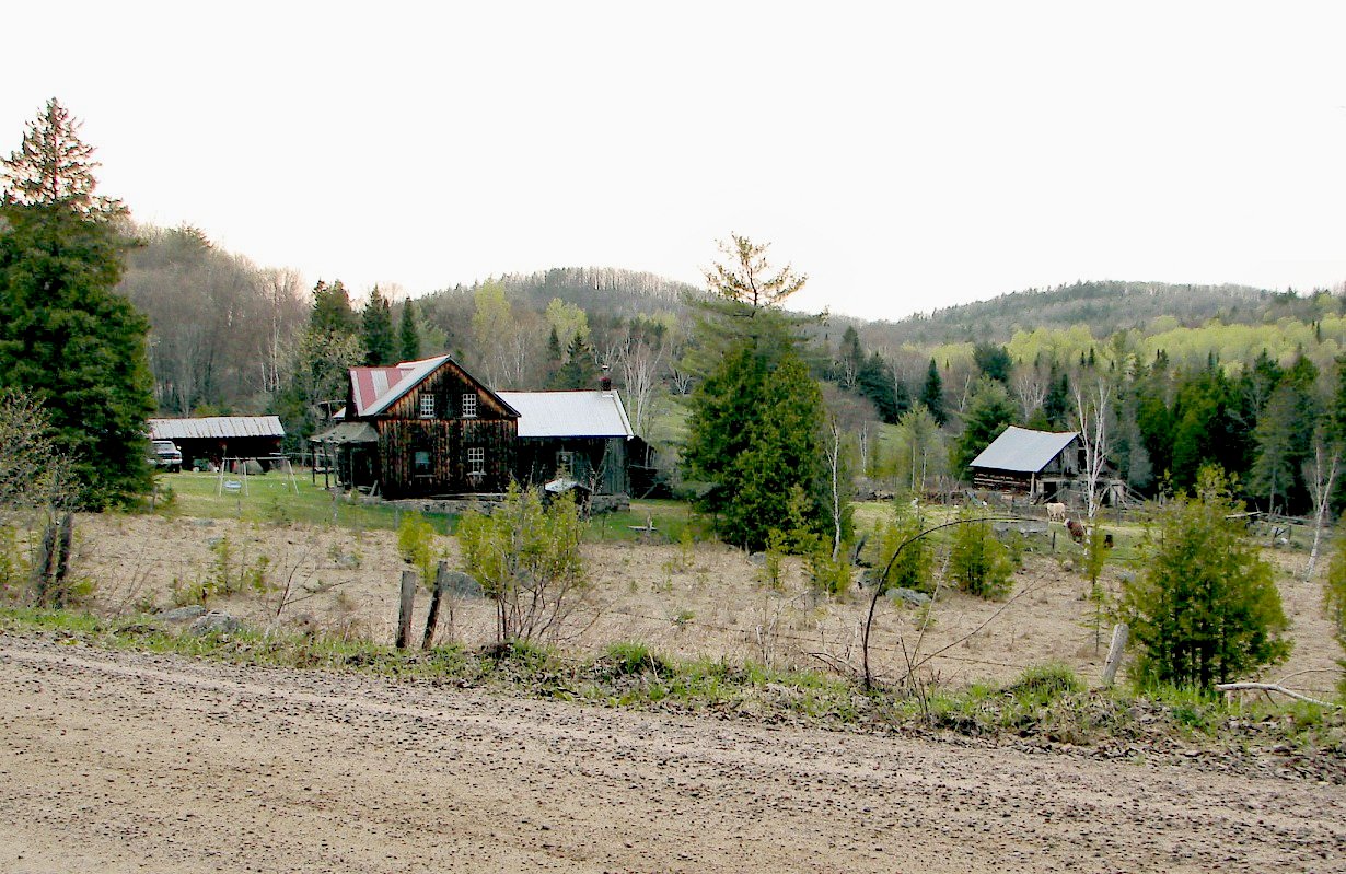
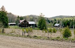 Old farm along the Opeongo Line.
The Colonization Roads were roads created during the 1840s and 1850s to open up or provide access to areas in Central and Eastern Ontario for settlement and agricultural development. The colonization roads were used by settlers, much like modern-day highways, to lead them towards areas for settlement.
History
During the early-1800s, the government of Upper Canada, a majority of which is now Ontario, appropriated settlers to various lots which had been surveyed along the lake shores of Lake Erie and Lake Ontario. The townships established along these fronts contained generally fertile land composed of glacial till and clay-rich loam. As these townships filled up, business opportunities presented themselves for investors to purchase native lands and open them to settlement. The Canada Company was the most successful of these ventures, and attracted settlers to vast areas of land in Western Ontario by building routes such as the Huron Road and the Toronto–Sydenham Road during the 1830s and 1840s.[1] As these areas too filled, the government came under pressure to open up the unforgiving terrain of the Canadian Shield to settlement, and sought to establish a network of east–west and north–south roads between the Ottawa Valley and Georgian Bay. This area was known as the Ottawa–Huron Tract.[2]
In 1847, an exploration survey was carried out by Robert Bell[disambiguation needed
 ] to lay out the lines that would become the Opeongo Road, Hastings Road and Addington Road. The Public Lands Act, passed in 1853, permitted the granting of land to settlers who were at least 18. Those settlers who cleared at least 12 acres (49,000 m2) within four years, built a house within a year and resided on the grant for at least five years would receive the title to that land. The government subsequently built over 1,600 kilometres (1,000 mi) of roads over the following 20 years to provide access to these grants.[3]
However, the promises of fertile land in this new northern tract of wilderness proved false. Beneath thin layers of sparsely spread soil was solid granite. Where this granite descended deeper, valleys formed and filled with muskeg. Despite an early influx of settlers, the vast majority of grants were abandoned by the turn of the century; only 40% remained. During the first half of the 1900s, many of these colonization roads were incorporated into the growing provincial highway network. Some sections were improved to modern highway standards, while others were subsequently bypassed or abandoned. The roads that were not incorporated as highways either became local roads or were consumed by nature.[4]
Though many other roads in the province can be considered "colonization roads", such as the Provincial Road (Highway 2), the Talbot Trail (Highway 3), the Garafraxa Road (Highway 6) and the Penetanguishene Road (Highway 93), they were either constructed for military purposes, or by private investment.
Description
The terrain these roads pass through is interlaced with many hills, lakes, forests, swamps and bedrock outcroppings. The location of many of these roads is in the Canadian Shield, among the most rugged terrain in all of Ontario. The soil is generally thin and unsuitable for the agricultural development that these roads were built to spur.
Most of the colonization roads are not provincially maintained highways. Instead they follow county roads, and local town/township roads. A few have even been converted into hiking trails and bike trails.
List of Colonization Roads
Below is a list of all the colonization roads.
 The Addington Road was surveyed as far north as the Opeongo Line in Brudenell
Addington Road
The Addington Road Location: Clareview–Brudenell Length: 113 km (70 mi) Formed: 1855–1865 The Addington Colonization Road was one of the initial routes surveyed in 1847. The contract to construct the road was awarded to A. B. Perry, who completed more than half of the length from the Clare River to the Opeongo Line by 1856.[5] In the south it began in the village of Clareview and travelled north to the Opeongo Line, where the village of Brudenell was established. From north of Clareview to the community of Ferguson Corners (southwest of Denbigh), Highway 41 follows the old road, though in many places bypasses have been constructed and the old road named Addington Road followed by a number from one to eight. North of Ferguson Corners, the old road has been consumed by the forest, though short spurs are evident west of Denbigh and north and south of Quadeville.
 The Bobcaygeon Road near the old Peterson Road, west of Carnarvon
Bobcaygeon Road
The Bobcaygeon Road Location: Bobcaygeon–Dorset Length: 89 km (55 mi) Formed: 1856–1863 The Bobcaygeon Colonization Road opened up the northern half of Peterborough and Victoria counties and much of Haliburton County. The road begins in the village of Bobcaygeon and travels north through Minden, ending north of the old Peterson Road (Highway 118). The old road was surveyed as far north as the Oxtongue river, but never improved beyond that. It now forms the boundary between Minden and Algonquin Highlands and further north the boundary between Muskoka and Haliburton. The former Highway 649 and Highway 121 were eventually assigned along the majority of the southern half of this road. From Minden north to Highway 118 the road is a paved township road. Between Ox Narrows and Dorset, Highway 35 generally follows the original survey line.
Buckhorn Road
The Buckhorn Road Location: Buckhorn–Gooderham Length: 48 km (30 mi) Formed: 1855–1865 Burleigh Falls Road
Cameron Road
The Cameron Road Location: Rosedale–Minden Formed: 1850s The Cameron Road travelled north from Rosedale to Minden and is now the route of Highway 35.
Frontenac Road
Great North Road
The Great North Road Location: Parry Sound – Commanda Length: 97 km (60 mi) Formed: 1867–1871 The Great North Road connected the Parry Sound Road in Parry Sound with the Nipissing Road in Commanda. Today, Highway 124 largely follows the old road.[6]
Hastings Road
The Hastings Road Location: Madoc – Whitney Length: 113 km (70 mi) Formed: 1854–1858 The Hastings Road was surveyed and built to the northern boundary of Hastings county, north of the hamlet of Lake St. Peter. It was continued north into the District of Nipissing under the name of "the north road" and at one time could be driven to an intersection with the current Highway 60 between Whitney and Madawaska. At one time it intersected with the Snow, Monck and Peterson roads.
Lavant Road
The Lavant Road Location: Snow Road – Lanark Road Mississippi Road
The Mississippi Road Location: Plevna–Bancroft Length: 98 km (61 mi) Formed: 1856–1866 The Mississippi Road began at a junction with Frontenac Road and Snow Road in the village of Plevna and travelled northwest, bisecting the Addington Road near Denbigh. It ended at the Hastings Road in Bancroft, where the Monck Road continued west. Today, Brule Lake Road and Buckshot Lake Road (Lennox and Addington County Road 30) follow a majority of the southwest portion of the road. Between Denbigh and Bancroft, Highway 28 travels adjacent to the old road, which has generally been consumed by the forest.
Monck Road
The Monck Road Location: Atherley–Bancroft Length: 172 km (107 mi) Formed: 1866–1873 The Monck Road was surveyed from 1864 to 1865, construction began the next year and completed seven years later in 1873. It was named in honour of Charles Stanley Monck, who was Governor General of Canada at that time. An Ontario Historical Plaque was erected by the province to commemorate the role of the Monck Road in Ontario's heritage.[7]
Muskoka Road
The Muskoka Road Location: Severn Bridge – North Bay Length: 203 km (126 mi) Formed: 1858–1875 The Muskoka Road, most of which now forms Highway 11, was constructed in the late 1850s and early 1860s, quickly becoming the primary trunk road to Lake Nipissing. A series of towns eventually would flourish along its length, but the first of these was Bracebridge. East of Muskoka Falls, Thomas J. McMurray established a 400 acres (1,600,000 m2) townsite in the spring of 1861 at the intersection of the Muskoka Road and Peterson Road.[8]
Construction on the Muskoka Road began in 1858. At the time of Bracebridge's founding, the road did not extend beyond the Muskoka River.[8] It was opened as far as Sundridge by 1875. Today Highway 11 follows a majority of the route, but bypasses it in several locations, notably between Bracebridge and Huntsville.
Nipissing Road
The Nipissing Road Location: Rosseau–Nipissing Length: 111 km (69 mi) Formed: 1864–1875 | Nipissing Road, Nipissing Road North, Old Nipissing Road, Rye Road | Highway 510 | Highway 518 near Seguin Falls (ghost town). Technically, it extends south as the Nipissing Trail down to Highway 141 near Rosseau | Highway 522 in Commanda | Rosseau
Ottawa and Opeongo Road
The Ottawa and Opeongo Road Location: Opeongo Lake – Renfrew Length: 106 km (66 mi) Formed: 1854–1865 The Ottawa and Opeongo Road was one of the initial colonization roads surveyed by William Bell in 1847. It was constructed westward from Renfrew beginning in 1854, reaching as far as the Hastings Road in Whitney by 1865; thereafter the survey line continued to Opeongo Lake. Today, Highway 60 follows the old road between Algonquin Park and east of Barry's Bay. At that point, the road branches out to the southeast, following portions of Renfrew County Road 66, 512 and 64. Approximately 5 kilometres (3.1 mi) west of Dacre, it encounters Highway 41. From there to Renfrew, Highway 132 follows the old road.[10]
Parry Sound
The Parry Sound Road Location: Parry Sound – Falkenburg Station Length: 72 km (45 mi) Formed: 1862–1865 | Horseshoe Lake Road, Highway 141, Raymond Road, Manitoba Street | Highway 400/Highway 69, Highway 141, Muskoka District Road 35, Muskoka District Road 4 | Parry Sound | Bracebridge | Parry Sound
Horseshoe Lake
Rosseau
BracebridgePembroke and Mattawan Road
The Pembroke and Mattawan Road Location: Pembroke–Mattawa Length: 158 km (98 mi) Formed: 1856–1866 Peterson Road
The Peterson Road Location: Bracebridge – Barry's Bay Length: 164 km (102 mi) Formed: 1858–1863 The Peterson Road began in Bracebridge and travelled east to Maynooth, where it met the Hastings Road. From Maynooth, its snaked its way northeast to Barry's Bay on the Opeongo Line. Today, the section from Bracebridge to Maynooth has mostly been consumed by the forest, though Highway 118 follows adjacent to the old road as far as Haliburton. A small section remains as a local township road, east of Carnarvon, named Tulip Road. Between Haliburton and Kennaway, on the shores of Elephant Lake, the old road is untraceable. East of Kenneway, the road is locally maintained but accessible. Between Maynooth and Barry's Bay, former Highway 62 follows the old road.
Snow Road
The Snow Road Location: Maberly–Plevna The Snow Road is a short minor branch of the colonization road network that connected the northern end of agricultural settlement in Maberly with the southeastern end of the Mississippi Road in Plevna. The Lavant Road branches off to the east at approximately the midpoint of the road. Today, County Road 36 follows the Snow Road through Lanark County, while the former Highway 509 follows the portion lying within Frontenac County.
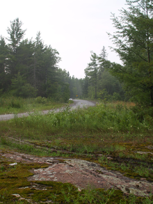 North of the Head River, Kawartha Lakes 35 enters the Canadian Shield
Victoria Road
The Victoria Road Location: Glenarm–Vancoughnet Victoria Road is one of several colonization roads in southern Ontario built in 1850s to promote settlement in what was then the frontier of Ontario. The road continued north of its current terminus in Uphill into what is now the Queen Elizabeth II Wildlands Provincial Park. It then followed the Black River north-east to the Peterson Road in Vankoughnet; this part of the road fell into disuse in the late 1800s. Between 1956 and 1998, the portion of The Victoria Road between Highway 46 (Highway 48 after 1975) and Highway 503 was designated as Secondary Highway 505. On January 1, 1998, the entire road south of Uphill was designated as Victoria County Road 35. Victoria County was restructured as the city Kawartha Lakes on January 1, 2001, which renamed the road as Kawartha Lakes Road 35.
References
- Footnotes
- ^ Shragge 1984, pp. 31, 40.
- ^ Shragge 1984, p. 17.
- ^ Shragge 1984, pp. 17–19.
- ^ Shragge 1984, p. 21.
- ^ Country Road Maps - Mazinaw Country
- ^ Shragge 1984, p. 20.
- ^ Ontario Plaque - Monck Road
- ^ a b Parry Sound: Gateway to Northern Ontario. p. 47
- ^ Ontario Plaque
- ^ Shragge 1984, pp. 18, 20.
- Bibliography
- Shragge, John; Bagnato, Sharon (1984). From Footpaths to Freeways. Ontario Ministry of Transportation and Communications, Historical Committee. ISBN 0-7743-9388-2.
Tertiary and 7000-series Highways of Ontario Tertiary Highways 
7000-series Highways Other See also: County roads in Ontario · Ontario numbered highways · Expressways and 400-series highways · King's Highways · Secondary highways · Tertiary and 7000-series highways · List of Ontario provincial highways · List of former provincial highways in Ontario · Highways in Ontario · List of Ontario expressways · Trans-Canada Highway · Connecting Link · Emergency Detour RouteCategories:- Colonization roads of Ontario
- Lists of roads in Ontario


Wikimedia Foundation. 2010.