- List of secondary highways in Parry Sound District
-
This is a list of secondary highways in Parry Sound District, many of which provide access to isolated settlements and recreational properties within the Parry Sound District of Ontario.
Contents
Highway 510
Main article: Ontario Highway 510
Highway 510
Route information Maintained by the Ministry of Transportation of Ontario Length: 2.8 km[1] (1.7 mi) Major junctions South end:  Highway 520 in Magnetawan
North end:  Highway 124 – Parry Sound, Sundridge
Districts: Parry Sound Highway system Ontario provincial highways
400-series • Former←  Hwy 505
Hwy 516  →
→Secondary Highway 510, commonly referred to as Highway 510, is a provincially maintained highway in the Canadian province of Ontario. The highway is 2.8 kilometres (1.7 mi) in length, connecting Highway 520 in Magnetawan with Highway 124.
Highway 518
Main article: Ontario Highway 518
Highway 518
Route information Maintained by the Ministry of Transportation of Ontario Length: 72.7 km[1] (45.2 mi) Existed: 1956[2] – present Major junctions West end:  Highway 400 – Parry Sound
East end: Kearney Location Districts: Parry Sound Major cities: Orrville, Bear Lake, Sprucedale, Emsdale Highway system Ontario provincial highways
400-series • Former← Hwy 516Hwy 519  →
→Secondary Highway 518, commonly referred to as Highway 518, is a provincially maintained secondary highway in the Canadian province of Ontario. Highway 518 spans 72.7 kilometres (45.2 mi) between Parry Sound and Kearney. It serves as one of the many links between Highway 400 and Highway 11. The highway was assumed in 1956, and has remained generally unchanged since, aside from being truncated slightly at both ends.
Highway 520
Main article: Ontario Highway 520
Highway 520
Route information Maintained by the Ministry of Transportation of Ontario Length: 68 km[1] (42 mi) Major junctions West end: Ardbeg CN station Highway 124
 Highway 510 – Magnetawan
East end:  Highway 11 – Burk's Falls
Districts: Parry Sound Highway system Ontario provincial highways
400-series • Former← Hwy 519Hwy 522  →
→Secondary Highway 520, commonly referred to as Highway 520, is a provincially maintained highway in the Canadian province of Ontario. The highway is 68 kilometres (42 mi) in length, connecting several small communities in Parry Sound District with Highway 124 and Highway 11.
The highway links several remote First Nation hamlets to the major highway routes of the region. However, the only places of noteworthy size are the village of Magnetawan and the town of Burk's Falls. It is concurrent with Highway 124 for 15.4 kilometres (9.6 mi).
Highway 522
Main article: Ontario Highway 522
Highway 522
Route information Maintained by the Ministry of Transportation of Ontario Length: 109.6 km[1] (68.1 mi) Major junctions West end:  Highway 69 – Cranberry
East end: Highway 11 – PowassanDistricts: Parry Sound Highway system Ontario provincial highways
400-series • Former←  Hwy 520
Hwy 522B  →
→Secondary Highway 522, commonly referred to as Highway 522, is a provincially maintained highway in the Canadian province of Ontario. The highway is 109.6 kilometres (68.1 mi) in length, connecting Highway 69 near Cranberry with Highway 11 in Powassan. Highway 522 serves as the only link between these two routes south of Highway 17 and north of Highway 124. It is often used to access Grundy Lake Provincial Park, a popular camping area for northbound travellers.
Highway 522B
Main article: Ontario Highway 522B
Highway 522B
Route information Maintained by the Ministry of Transportation of Ontario Length: 1.9 km[1] (1.2 mi) Existed: October 2002[3] – present Major junctions South end:  Highway 522 Highway 11 – North Bay
North end: Hemlock Road
(continues north as McCarthy Street)Districts: Parry Sound Highway system Ontario provincial highways
400-series • Former← Hwy 522Hwy 523  →
→Secondary Highway 522B, commonly referred to as Highway 522B, is a provincially maintained highway in the Canadian province of Ontario. The highway is 1.9 kilometres (1.2 mi) in length, connecting Highway 522 within Trout Creek with Highway 11 to the north. The highway was created in late 2002 when the Trout Creek Bypass of Highway 11 opened; Highway 522B forms a portion of the former routing.
Highway 524
Main article: Ontario Highway 524
Highway 524
Route information Maintained by the Ministry of Transportation of Ontario Length: 4.6 km[1] (2.9 mi) Existed: 1956[2] – present Major junctions South end: Highway 522 at Farley's Corners.North end:  Highway 534 near Restoule
Districts: Parry Sound Highway system Ontario provincial highways
400-series • Former← Hwy 523Hwy 525  →
→Secondary Highway 524, commonly referred to as Highway 524, is a provincially maintained highway in the Canadian province of Ontario. The highway is 4.6 kilometres (2.9 mi) in length, connecting Highway 520 at Farley's Corners with Highway 534, which leads to Restoule.
Highway 526
Main article: Ontario Highway 526
Highway 526
Route information Maintained by the Ministry of Transportation of Ontario Length: 3.9 km[1] (2.4 mi) Existed: 1956 – present Major junctions West end: Britt post office East end: Highway 69Location Districts: Parry Sound Villages: Britt Highway system Ontario provincial highways
400-series • Former← Hwy 525Hwy 527  →
→Secondary Highway 526, commonly referred to as Highway 526, is a provincially maintained secondary highway in the Canadian province of Ontario. It is a short and lightly travelled route that connects Highway 69 with the community of Britt.
Highway 529
Main article: Ontario Highway 529
Highway 529
Route information Maintained by the Ministry of Transportation of Ontario Length: 25.8 km[1] (16.0 mi) Major junctions South end: Highway 69 near Pointe au BarilNorth end: Highway 69 at Magnetawan RiverLocation Districts: Parry Sound Major cities: Manbert, Naiscoot, Naiscoutaing Highway system Ontario provincial highways
400-series • Former←  Hwy 528
Hwy 529A  →
→Secondary Highway 529, commonly referred to as Highway 529, is a secondary highway in the Canadian province of Ontario. Located within Parry Sound District, the highway follows a 25.8-kilometre (16.0 mi) route, from its southern terminus at Highway 69 near Pointe au Baril to its northern terminus at Highway 69's crossing of the Magnetawan River near Byng Inlet.
Highway 529A
Main article: Ontario Highway 529A
Highway 529A
Route information Maintained by the Ministry of Transportation of Ontario Length: 4.5 km[1] (2.8 mi) Existed: 1961 – present Major junctions West end: Bayfield Lodge East end:  Highway 529 at Manbert
Location Districts: Parry SoundParry Sound Villages: Bayfield Inlet, Manbert Highway system Ontario provincial highways
400-series • Former←  Hwy 529
Hwy 531  →
→Secondary Highway 529A, commonly referred to as Highway 529A, is a provincially maintained secondary highway in the Canadian province of Ontario. Located within Parry Sound District, the highway is a short spur of Highway 529, extending from Manbert to Bayfield Inlet.
Highway 559
Highway 559
Route information Length: 19.6 km[1] (12.2 mi) Major junctions Southwest end: Killbear Provincial Park Northeast end: Highway 400 at NobelLocation Districts: Parry Sound Major cities: Carling Highway system Ontario provincial highways
400-series • Former←  Hwy 558
Hwy 560  →
→Secondary Highway 559, commonly referred to as Highway 559, is a secondary highway in the Canadian province of Ontario, located within the township of Carling in Parry Sound District. The highway, 19.6 kilometres (12.2 mi) long, extends from an interchange (Exit 247) with Highway 400 north of Nobel to the boundary of Killbear Provincial Park on the shore of Georgian Bay.
The highway also serves as an access road to most of the communities in Carling Township, as well as the new northern terminus of Highway 400 as of October 27, 2010.[4]
Highway 592
Highway 612
Highway 612
Route information Maintained by the Ministry of Transportation of Ontario Length: 4.4 km[1] (2.7 mi) Major junctions South end: Parry Sound/Muskoka boundary North end: Highway 69 at Gordon BayLocation Divisions: Parry Sound Major cities: Seguin Highway system 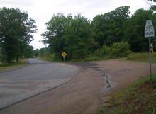 Highway 612 at Highway 69
Secondary Highway 612, commonly referred to as Highway 612, is a secondary highway in the Canadian province of Ontario. Located in the Parry Sound District, the highway extends for 4.4 kilometres (2.7 mi) from a junction with Highway 69 outside of Gordon Bay to the boundary of Parry Sound District with the regional municipality of Muskoka near a junction with Healey Lake Road.
At the boundary, the roadway continues southward as Muskoka Road 11 through MacTier. Prior to 1997, this county road was also part of Highway 612.
Highway 632
Highway 632
Route information Maintained by the Ministry of Transportation of Ontario Length: 11 km (7 mi) Major junctions South end: Parry Sound/Muskoka boundary North end:  Highway 141 in Rosseau
Location Districts: Parry Sound Major cities: Seguin Highway system Ontario provincial highways
400-series • Former←  Hwy 631
Hwy 633  →
→Highway 632 is a secondary highway in the Canadian province of Ontario. Located in the Parry Sound District, the highway extends for 11 kilometres (6.8 mi) from a junction with Highway 141 in Rosseau to the boundary of Parry Sound District with the regional municipality of Muskoka.
At the boundary, the roadway continues southward as Muskoka Road 7 through the communities of Minett, Gregory and Port Sandfield. Prior to 1997, this county road was also part of Highway 632.
Highway 644

Secondary Highway 644 commonly referred to as Highway 644, is a secondary highway in the Canadian province of Ontario. It is a very minor and extremely short route, and holds the distinction of being Ontario's shortest posted highway at only 800 metres (1/2 mile) in length.
It is located in Pointe au Baril in Parry Sound District and simply acts as an access road to the community from Highway 69.
Highway 645
Highway 645
Route information Length: 4.0 km[1] (2.5 mi) Major junctions West end: Byng Inlet East end: Highway 529Districts: Parry Sound Highway system Ontario provincial highways
400-series • Former←  Hwy 644
Hwy 646  →
→Secondary Highway 645, commonly referred to as Highway 645, is a secondary highway in the Canadian province of Ontario. Located within Parry Sound District, the highway extends for 4.0 kilometres (2.5 mi) from Highway 529 to the community of Byng Inlet.
Highway 654
Main article: Ontario Highway 654
Highway 654
Route information Maintained by the Ministry of Transportation of Ontario Length: 23.1 km[1] (14.4 mi) Existed: April 1, 1964[5] – present Major junctions South end: Highway 534 near Nipissing, Ontario Highway 94
East end: Highway 11 at CallanderDistricts: Timiskaming Highway system Ontario provincial highways
400-series • Former←  Hwy 653
Hwy 655  →
→Secondary Highway 654, commonly referred to as Highway 650, is a secondary highway in the Canadian province of Ontario. The highway is 23.1 kilometres (14.4 mi) in length, connecting Highway–534 south of Nipissing with Highway 11 in Callander. The route was designated in 1964, and has remained unchanged since then. It is sparsely travelled, but paved throughout its length.
References
- ^ a b c d e f g h i j k l m Ministry of Transportation of Ontario (2007). "Annual Average Daily Traffic (AADT) counts". http://www.raqsb.mto.gov.on.ca/techpubs/TrafficVolumes.nsf/tvweb?OpenForm&Seq=5. Retrieved July 7, 2011.
- ^ a b "Ontario Secondary Roads Now Designated 500, 600". 112. The Globe and Mail. February 4, 1956. p. 4. "Two new Ontario road numbers appear on the province's 1956 official road map which will be ready for distribution next week. The new numbers are the 500 and 600 series and designate hundreds of miles of secondary roads which are wholly maintained by the Highways Department. More than 100 secondary roads will have their own numbers and signs this year. All of these secondary roads were taken into the province's main highways system because they form important connecting links with the King's Highways"
- ^ http://www.mto.gov.on.ca/english/traveller/highway11/status.shtml
- ^ Ginn, Cameron (October 27, 2010). "$177-million section of highway now open". Cottage Country Now (Metroland Media Group). http://www.cottagecountrynow.ca/community/parrysound/article/893665. Retrieved October 28, 2010.
- ^ A.A.D.T. Traffic Volumes 1955–1969 And Traffic Collision Data 1967–1969. Ontario Department of Highways. 1970. p. 145.
Secondary highways of Ontario Secondary Highways 502 · 510 · 516 · 518 · 519 · 520 · 522 · 522B · 523 · 524 · 525 · 526 · 527 · 528 · 528A · 529 · 529A · 531 · 532 · 533 · 534 · 535 · 537 · 538 · 539 · 539A · 540 · 540A · 540B · 542 · 542A · 546 · 547 · 548 · 550 · 551 · 552 · 553 · 554 · 556 · 557 · 558 · 559 · 560 · 560A · 562 · 563 · 564 · 565 · 566 · 567 · 568 · 569 · 570 · 571 · 572 · 573 · 574 · 575 · 577 · 579 · 580 · 581 · 582 · 583 · 584 · 585 · 586 · 587 · 588 · 589 · 590 · 591 · 592 · 593 · 594 · 595 · 596 · 597 · 599 · 600 · 601 · 602 · 603 · 604 · 605 · 607 · 607A · 608 · 609 · 611 · 612 · 613 · 614 · 615 · 617 · 618 · 619 · 621 · 622 · 623 · 624 · 625 · 626 · 627 · 628 · 630 · 631 · 632 · 633 · 634 · 636 · 637 · 638 · 639 · 640 · 641 · 642 · 643 · 644 · 645 · 646 · 647 · 650 · 651 · 652 · 654 · 655 · 656 · 657 · 658 · 661 · 663 · 664 · 665 · 667 · 668 · 670 · 671 · 672 · 673
By district Algoma · Cochrane · Kenora · Manitoulin · Nipissing · Parry Sound · Sudbury · Thunder Bay · TimiskamingSee also County roads · Former highways · Historic Colonization Roads · List of Ontario provincial highways · Ministry of Transportation · Northern Ontario Resource Trail · Numbered highways in Canada · Tourist Routes · Trans-Canada HighwayCounty roads in Ontario · Ontario numbered highways · Expressways and 400-series highways · King's Highways · Secondary highways · Tertiary and 7000-series highways · List of Ontario provincial highways · List of former provincial highways in Ontario · Highways in Ontario · List of Ontario expressways · Trans-Canada Highway · Connecting Link · Emergency Detour Route Categories:- Ontario secondary highways
- Roads in Parry Sound District, Ontario


Wikimedia Foundation. 2010.