- Ontario Highway 522
-
Highway 522
Route information Maintained by the Ministry of Transportation of Ontario Length: 109.6 km[1] (68.1 mi) Major junctions West end:  Highway 69 – Cranberry
East end:  Highway 11 – Powassan
Districts: Parry Sound District Highway system Ontario provincial highways
400-series • Former←  Hwy 520
Hwy 522B  →
→Secondary Highway 522, commonly referred to as Highway 522, is a provincially maintained highway in the Canadian province of Ontario. The highway is 109.6 kilometres (68.1 mi) in length, connecting Highway 69 near Cranberry with Highway 11 in Powassan. Highway 522 serves as the only link between these two routes south of Highway 17 and north of Highway 124. It is often used to access Grundy Lake Provincial Park, a popular camping area for northbound travellers.
History
 Highway 522 in Trout Creek. At the stop sign, drivers can continue on the highway by turning right, or can turn left onto Highway 522B; both end at Highway 11.
In 2004, Highway 11 was re-routed along a recently completed freeway bypass around the community of Trout Creek. Highway 522 was then extended by 3 km along Hemlock Road (the former alignment of Highway 11), terminating at Highway 11's Exit 301 (interchange with Highway 522 and McFadden Lane). The remainder of Highway 11's alignment in Trout Creek was retained in the provincial system as the designation of Highway 522B, the province's newest numbered highway designation.
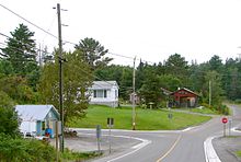 Highway 522 in Loring
Major intersections
The following table lists the major junctions along Highway 522. The entirety of the highway is located within Parry Sound District.[2]
Location[2] km[1] Destinations Notes Cranberry 0.0 Highway 69Powassan 109.6 Highway 111.000 mi = 1.609 km; 1.000 km = 0.621 mi References
- ^ a b Ministry of Transportation of Ontario (2007). "Annual Average Daily Traffic (AADT) counts". Government of Ontario. http://www.raqsb.mto.gov.on.ca/techpubs/TrafficVolumes.nsf/tvweb?OpenForm&Seq=5. Retrieved March 13, 2011.
- ^ a b Peter Heiler (2010). Ontario Back Road Atlas (Map). Cartography by MapArt. p. 106, section G4–H5. ISBN 978-1-55198-226-7.
Secondary highways of Ontario Secondary Highways 502 · 510 · 516 · 518 · 519 · 520 · 522 · 522B · 523 · 524 · 525 · 526 · 527 · 528 · 528A · 529 · 529A · 531 · 532 · 533 · 534 · 535 · 537 · 538 · 539 · 539A · 540 · 540A · 540B · 542 · 542A · 546 · 547 · 548 · 550 · 551 · 552 · 553 · 554 · 556 · 557 · 558 · 559 · 560 · 560A · 562 · 563 · 564 · 565 · 566 · 567 · 568 · 569 · 570 · 571 · 572 · 573 · 574 · 575 · 577 · 579 · 580 · 581 · 582 · 583 · 584 · 585 · 586 · 587 · 588 · 589 · 590 · 591 · 592 · 593 · 594 · 595 · 596 · 597 · 599 · 600 · 601 · 602 · 603 · 604 · 605 · 607 · 607A · 608 · 609 · 611 · 612 · 613 · 614 · 615 · 617 · 618 · 619 · 621 · 622 · 623 · 624 · 625 · 626 · 627 · 628 · 630 · 631 · 632 · 633 · 634 · 636 · 637 · 638 · 639 · 640 · 641 · 642 · 643 · 644 · 645 · 646 · 647 · 650 · 651 · 652 · 654 · 655 · 656 · 657 · 658 · 661 · 663 · 664 · 665 · 667 · 668 · 670 · 671 · 672 · 673
By district Algoma · Cochrane · Kenora · Manitoulin · Nipissing · Parry Sound · Sudbury · Thunder Bay · TimiskamingSee also County roads · Former highways · Historic Colonization Roads · List of Ontario provincial highways · Ministry of Transportation · Northern Ontario Resource Trail · Numbered highways in Canada · Tourist Routes · Trans-Canada HighwayCounty roads in Ontario · Ontario numbered highways · Expressways and 400-series highways · King's Highways · Secondary highways · Tertiary and 7000-series highways · List of Ontario provincial highways · List of former provincial highways in Ontario · Highways in Ontario · List of Ontario expressways · Trans-Canada Highway · Connecting Link · Emergency Detour RouteCategories:- Ontario secondary highways
- Roads in Parry Sound District, Ontario


Wikimedia Foundation. 2010.