- Ontario Highway 533
-
Highway 533
Route information Length: 53.4 km[3] (33.2 mi) Existed: 1956[1][2] – present Major junctions South end:  Highway 17 in Mattawa
North end:  Highway 63 near Eldee
Location Divisions: Nipissing District Towns: Mattawa Highway system Ontario provincial highways
400-series • Former←  Hwy 532
Hwy 534  →
→Secondary Highway 533, commonly referred to as Highway 533, is a provincially maintained secondary highway in the Canadian province of Ontario. The route begins in the town of Mattawa, at Highway 17, and travels north to Highway 63.
Contents
Route description
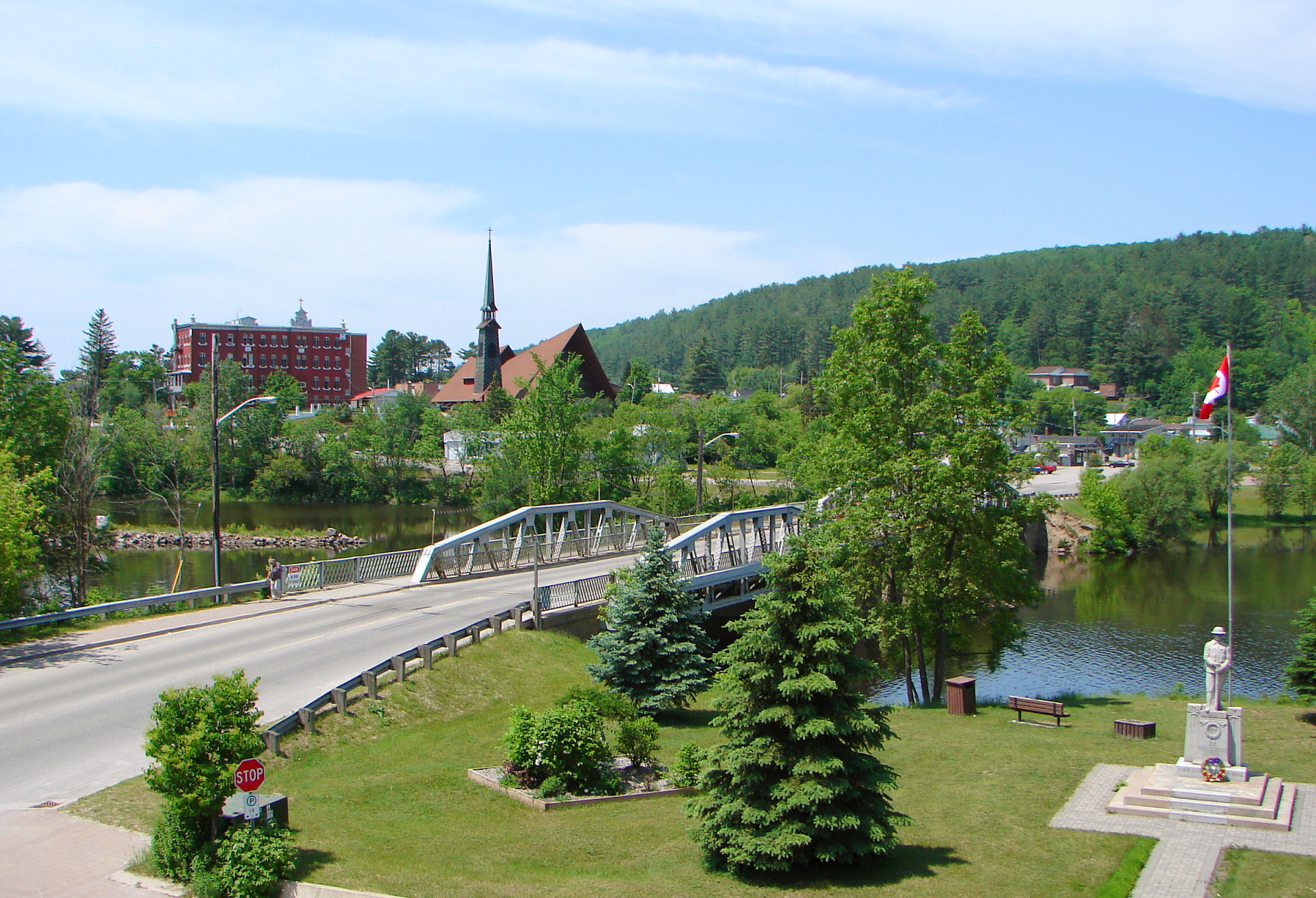
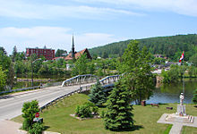 Highway 533 through Mattawa
At Mattawa, Highway 533 meets Highway 17 at a three-way junction in the town's downtown area, adjacent to the shore of the Ottawa River.[4]
The route provides access to Alexander Lake Forest Provincial Park.
History
The current route of Highway 533 was first assumed by the Department of Highways in early 1956, along with several dozen other secondary highways. It was likely maintained as a development road prior to that.[2] When it was assumed, the route was approximately 15 kilometres (9.3 mi) in length, terminating at its present intersection with Forest Acres Road. It was paved as far north as the Antoine Creek crossing.[1]
By 1958 the route was extended north to Highway 63.[5] In 1962, work began on paving the gravel sections of the highway.[6] Construction was completed by 1973.[7] The route has remained unchanged since then.[8]
Future
In September 2010, the Ministry of Transportation of Ontario announced upgrades to the intersection at Highway 17, including the construction of the first roundabout on a provincial highway.[9]
Major intersections
The following table lists the major junctions along Highway 533. The entirety of the route is located within Nipissing District.[8]
Location km[3] Destinations Notes Mattawa 0.0 Highway 17 – North Bay, OttawaUnorganized Nipissing District 4.8 Highway 656 (La Cave Road) Access to Holden Generating Station 53.4 Highway 63 – North Bay, Quebec1.000 mi = 1.609 km; 1.000 km = 0.621 mi References
- ^ a b Ontario Department of Highways (1956). Ontario Road Map (Map). Cartography by C.P. Robins. Section N35.
- ^ a b "Ontario Secondary Roads Now Designated 500, 600". 112. The Globe and Mail. February 4, 1956. p. 4. "Two new Ontario road numbers appear on the province's 1956 official road map which will be ready for distribution next week. The new numbers are the 500 and 600 series and designate hundreds of miles of secondary roads which are wholly maintained by the Highways Department. More than 100 secondary roads will have their own numbers and signs this year. All of these secondary roads were taken into the province's main highways system because they form important connecting links with the King's Highways"
- ^ a b Ministry of Transportation of Ontario (2007). "Annual Average Daily Traffic (AADT) counts". http://www.raqsb.mto.gov.on.ca/techpubs/TrafficVolumes.nsf/tvweb?OpenForm&Seq=5. Retrieved April 30, 2011.
- ^ Mattawa junction of Highways 17/533 on Google Maps.
- ^ Ontario Department of Highways (1958). Ontario Road Map (Map). Cartography by C.P. Robins. Section M34–N35.
- ^ Annual Report. Department of Highways. March 31, 1961. p. 136. http://books.google.com/books?ct=result&id=ngAjAQAAIAAJ&q=533#search_anchor. Retrieved April 30.
- ^ Ministry of Transportation and Communications (1973). Ontario Road Map (Map). Cartography by Photogrammetry Office. Section B–C24.
- ^ a b Peter Heiler (2010). Ontario Back Road Atlas (Map). Cartography by MapArt. p. 96, 105, section D–E37, K18–19. ISBN 978-1-55198-226-7.
- ^ "Improving Highway 17 Near Mattawa". Government of Ontario, September 1, 2010.
Secondary highways of Ontario Secondary Highways 502 · 510 · 516 · 518 · 519 · 520 · 522 · 522B · 523 · 524 · 525 · 526 · 527 · 528 · 528A · 529 · 529A · 531 · 532 · 533 · 534 · 535 · 537 · 538 · 539 · 539A · 540 · 540A · 540B · 542 · 542A · 546 · 547 · 548 · 550 · 551 · 552 · 553 · 554 · 556 · 557 · 558 · 559 · 560 · 560A · 562 · 563 · 564 · 565 · 566 · 567 · 568 · 569 · 570 · 571 · 572 · 573 · 574 · 575 · 577 · 579 · 580 · 581 · 582 · 583 · 584 · 585 · 586 · 587 · 588 · 589 · 590 · 591 · 592 · 593 · 594 · 595 · 596 · 597 · 599 · 600 · 601 · 602 · 603 · 604 · 605 · 607 · 607A · 608 · 609 · 611 · 612 · 613 · 614 · 615 · 617 · 618 · 619 · 621 · 622 · 623 · 624 · 625 · 626 · 627 · 628 · 630 · 631 · 632 · 633 · 634 · 636 · 637 · 638 · 639 · 640 · 641 · 642 · 643 · 644 · 645 · 646 · 647 · 650 · 651 · 652 · 654 · 655 · 656 · 657 · 658 · 661 · 663 · 664 · 665 · 667 · 668 · 670 · 671 · 672 · 673
By district Algoma · Cochrane · Kenora · Manitoulin · Nipissing · Parry Sound · Sudbury · Thunder Bay · TimiskamingSee also County roads · Former highways · Historic Colonization Roads · List of Ontario provincial highways · Ministry of Transportation · Northern Ontario Resource Trail · Numbered highways in Canada · Tourist Routes · Trans-Canada HighwayCounty roads in Ontario · Ontario numbered highways · Expressways and 400-series highways · King's Highways · Secondary highways · Tertiary and 7000-series highways · List of Ontario provincial highways · List of former provincial highways in Ontario · Highways in Ontario · List of Ontario expressways · Trans-Canada Highway · Connecting Link · Emergency Detour Route Categories:- Ontario secondary highways
- Roads in Nipissing District, Ontario


Wikimedia Foundation. 2010.