- Ontario Highway 651
-
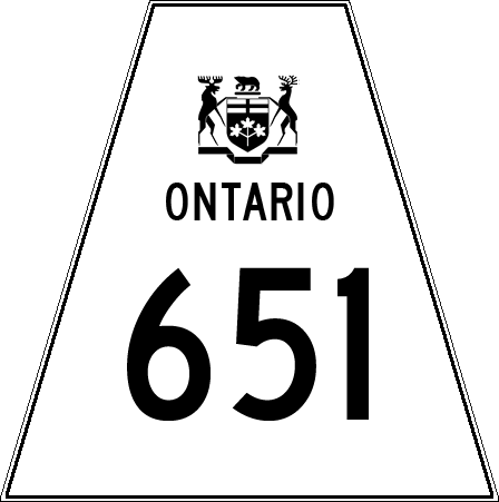
Highway 651
Route information Maintained by the Ministry of Transportation of Ontario Length: 52.9 km[2] (32.9 mi) History: Established July 1, 1967
Extended April 30, 1969[1]Major junctions South end:  Highway 101
North end: CPR crossing in Missanabie Districts: Algoma Highway system Ontario provincial highways
400-series • Former←  Hwy 650
Hwy 652  →
→Secondary Highway 651, commonly referred to as Highway 651, is a provincially maintained highway in the Canadian province of Ontario. The highway is 52.9 kilometres (32.9 mi) in length, connecting Highway 101 east of Wawa with the remote community of Missanabie.
Highway 651 was established on Centennial anniversary of Confederation, but did not connect to any other roads originally; access to the route was provided from Missanabie. While this situation has since been remedied, the route nevertheless remains extremely isolated.
History
Highway 651 was assumed by the Department of Highways (DOH) on the day of Canada's Centennial, July 1, 1967. At that point in time, Highway 101 had not yet been completed between Wawa and Chapleau, and so the route was connected to the rest of the province solely by rail. The isolated highway provided access between the community of Missanabie and the flag stop at Dalton, to the south. It was approximately half of the current length of the route.[1]
Presumably, Highway 651 was assumed by the DOH to provide better access to the remote region between Wawa and Chapleau, aiding in the construction of Highway 101.[citation needed] That highway, as well as a southward extension of Highway 651 to intersect it, opened to traffic on April 30, 1969.[1] The route has remained unchanged since that time.[3]
Major intersections
The following table lists the major junctions along Highway 651. The entirety of the highway is located within Algoma District.[3]
Location[3] km[2] Destinations Notes Unorganized Algoma District 0.0 Highway 101 – Timmins, Wawa, Chapleau27.9 Dalton Road – Dalton Missanabie 52.9 Renable Road Missanabie CPR flag stop 1.000 mi = 1.609 km; 1.000 km = 0.621 mi References
- ^ a b c A.A.D.T. Traffic Volumes 1955–1969 And Traffic Collision Data 1967–1969 (Report). Department of Highways. 1970. p. 145.
- ^ a b Ministry of Transportation of Ontario (2007). "Annual Average Daily Traffic (AADT) counts". Government of Ontario. http://www.raqsb.mto.gov.on.ca/techpubs/TrafficVolumes.nsf/tvweb?OpenForm&Seq=5. Retrieved March 13, 2011.
- ^ a b c Peter Heiler (2010). Ontario Back Road Atlas (Map). Cartography by MapArt. p. 104, section H–J13. ISBN 978-1-55198-226-7.
Secondary highways of Ontario Secondary Highways 502 · 510 · 516 · 518 · 519 · 520 · 522 · 522B · 523 · 524 · 525 · 526 · 527 · 528 · 528A · 529 · 529A · 531 · 532 · 533 · 534 · 535 · 537 · 538 · 539 · 539A · 540 · 540A · 540B · 542 · 542A · 546 · 547 · 548 · 550 · 551 · 552 · 553 · 554 · 556 · 557 · 558 · 559 · 560 · 560A · 562 · 563 · 564 · 565 · 566 · 567 · 568 · 569 · 570 · 571 · 572 · 573 · 574 · 575 · 577 · 579 · 580 · 581 · 582 · 583 · 584 · 585 · 586 · 587 · 588 · 589 · 590 · 591 · 592 · 593 · 594 · 595 · 596 · 597 · 599 · 600 · 601 · 602 · 603 · 604 · 605 · 607 · 607A · 608 · 609 · 611 · 612 · 613 · 614 · 615 · 617 · 618 · 619 · 621 · 622 · 623 · 624 · 625 · 626 · 627 · 628 · 630 · 631 · 632 · 633 · 634 · 636 · 637 · 638 · 639 · 640 · 641 · 642 · 643 · 644 · 645 · 646 · 647 · 650 · 651 · 652 · 654 · 655 · 656 · 657 · 658 · 661 · 663 · 664 · 665 · 667 · 668 · 670 · 671 · 672 · 673
By district Algoma · Cochrane · Kenora · Manitoulin · Nipissing · Parry Sound · Sudbury · Thunder Bay · TimiskamingSee also County roads · Former highways · Historic Colonization Roads · List of Ontario provincial highways · Ministry of Transportation · Northern Ontario Resource Trail · Numbered highways in Canada · Tourist Routes · Trans-Canada HighwayCounty roads in Ontario · Ontario numbered highways · Expressways and 400-series highways · King's Highways · Secondary highways · Tertiary and 7000-series highways · List of Ontario provincial highways · List of former provincial highways in Ontario · Highways in Ontario · List of Ontario expressways · Trans-Canada Highway · Connecting Link · Emergency Detour RouteCategories:- Ontario secondary highways
- Roads in Algoma District, Ontario

Wikimedia Foundation. 2010.