- List of secondary highways in Cochrane District
-
This is a list of secondary highways in Cochrane District, most of which serve as logging roads, mine and dam access roads, or provide access to isolated and sparsely populated areas in the Cochrane District of northeastern Ontario.
Contents
Highway 572
Highway 572
Route information Length: 16.6 km[1] (10.3 mi) Major junctions South end: Highway 11 in Ramore, Ontario North end: Highway 101 east of Matheson, Ontario Highway system Secondary Highway 572, commonly referred to as Highway 572, is a secondary highway in the Canadian province of Ontario which acts as a convenient short-cut for drivers travelling from Highway 11/Trans Canada Highway-northbound to Highway 101-eastbound, and vice-versa. By taking this road, one saves 14 kilometres (8.7 mi) from their trip.
Highway 574

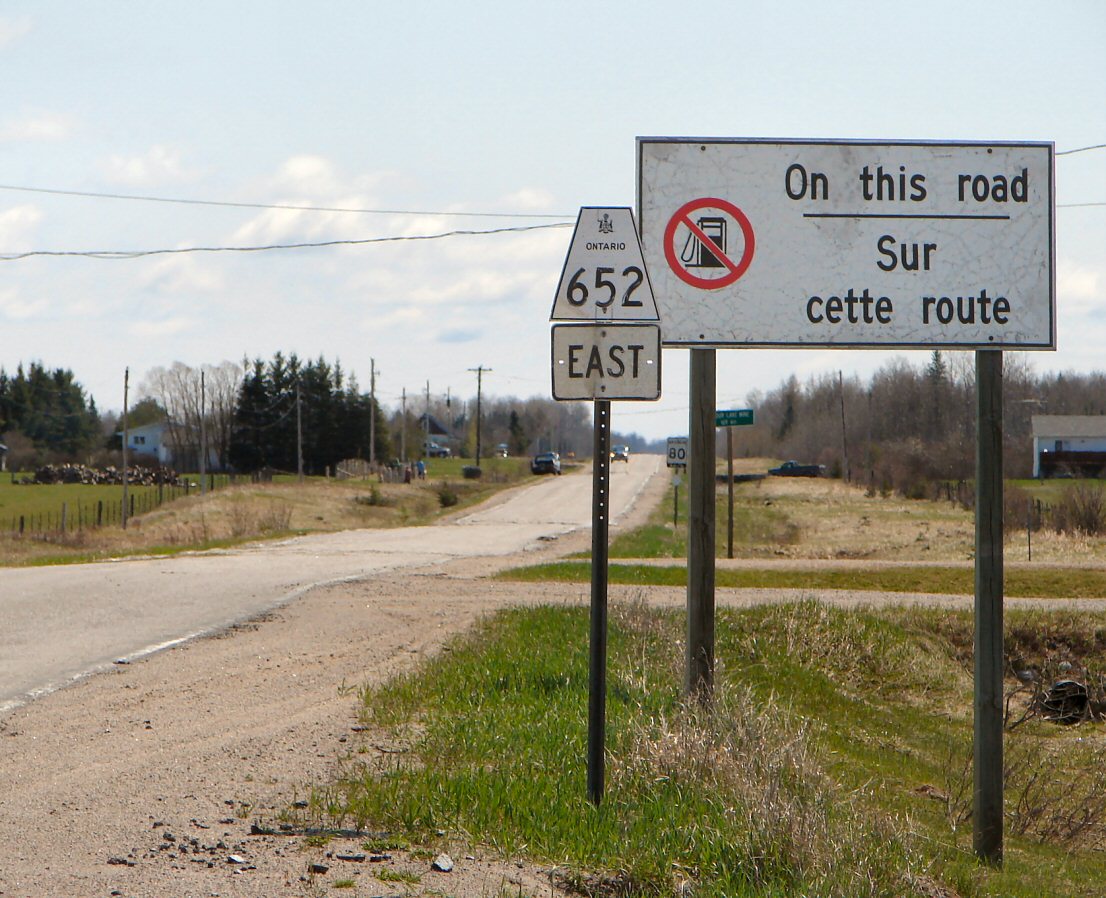
Secondary Highway 574, commonly referred to as Highway 574, is a short connecting road from Brower at the intersection of Highway 652, to the town of Norembega, all in Unorganized Cochrane North Part Territory, Ontario, Canada.
Highway 577

Secondary Highway 577, commonly referred to as Highway 577, is a secondary highway in Northern Ontario connecting Iroquois Falls, Ontario to Highway 11/Trans Canada Highway, and to Highway 101. This provides a very direct route for Timmins-Iroquois Falls traffic.
The road is 11 kilometres (6.8 mi) in length, but before the large 1998 highway downloading spree by the province, the road continued an additional 14 kilometres (8.7 mi) into Iroquois Falls, terminating at an intersection with Highway 67 (which was concurrent with Highway 578, another downloaded highway).
Highway 578

Highway 578 was a short spur road in Iroquois Falls that was transferred to that municipality on January 1, 1998. The road served to connect Iroquois Falls to Highway 11, the Trans Canada Highway, much like its sibling road, Highway 577 does. The road travelled along Victoria Road in Iroquois Falls, before terminating at Anson Drive.
Highway 579

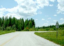
Secondary Highway 579, commonly referred to as Highway 579 is a secondary highway that travels north from the intersection of Highway 11/Trans Canada Highway and Highway 652, north through the town of Clute to the Abitibi River, where an automobile ferry allows drivers and pedestrians to cross to the town of Gardiner (its northern terminus). The road is 35 kilometres (22 mi) in length.[1]
Highway 581
Highway 583
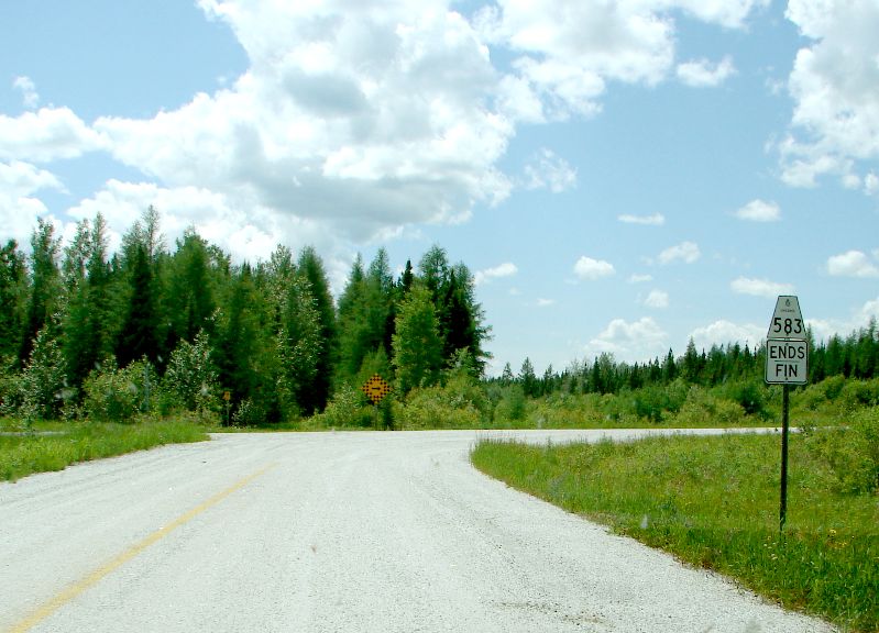
Highway 583
Route information Length: 49.2 km[1] (30.6 mi) Major junctions South end: Mead  Highway 11 at Hearst
North end: Lac-Sainte-Thérèse Location Counties: Cochrane District Highway system Secondary Highway 583, commonly referred to as Highway 583, is a secondary highway in the Canadian province of Ontario. Located within Cochrane District, the highway extends from the community of Mead approximately 65 kilometres (40 mi) north to Lac-Sainte-Thérèse. En route, it passes through the communities of Coppell and Jogues, and intersects with Highway 11 in Hearst.
While the highway's designation ends at Mead, the roadway continues as a lower-grade rural road, which extends for 102 kilometres to meet Highway 631 at Hornepayne. A network of rural wilderness roads extending eastward from Jogues also connects the highway to Dubreuilville and portions of Missinaibi Provincial Park.
 Southern terminus of highway 583 in Mead.
Highway 626

Secondary Highway 626, commonly referred to as Highway 626, was a former alignment of Highway 11 in Northern Ontario. The secondary highway started in Porquis Junction at Highway 67, and headed south, roughly a kilometre away from the main road, paralleling it for the entire length.
It travelled through the towns of Monteith, Val Gagné and Matheson, where it ended at Highway 101. The road used to continue south all the way to Highway 66 near Kirkland Lake, Ontario, but some of the pavement was removed, leaving only short dead-end streets off other roads. Highway 572 currently uses a tiny portion of Highway 626's former routing.
The road was transferred to local municipalities by the early 1990s. Another unrelated Highway 626 existed in Algoma District for 5 years. This Highway 626 ran from Highway 17 south to the town of Marathon. The road leading to Marathon was designated Highway 626 after the first Highway 626 was deleted. The highway was downloaded in 1998 and is known today as Peninsula Road.
Highway 634
Main article: Ontario Highway 634
Highway 634
Route information Length: 80.3 km[1] (49.9 mi) History: Opened July 21, 1966[2]
(as Highway 807)
renumbered in 1977
(as Highway 634)Major junctions North end: Abitibi Canyon Generating Station at Abitibi Canyon, Ontario South end: Highway 11 in Smooth Rock Falls, Ontario Location Counties: Cochrane District, Ontario Major cities: Smooth Rock Falls, Fraserdale Highway system Secondary Highway 634, commonly referred to as Highway 634, is a remote highway that travels through Northern Ontario from its southern terminus at Highway 11 in Smooth Rock Falls, Ontario to the Abitibi Canyon Generating Station at the community of Abitibi Canyon, Ontario.
It is the second highway in Ontario to be named Highway 634 (with the original Highway 634 being near Sudbury). Its original designation was Highway 807, but was renumbered in 1977, shortly after a route renumbering. The road was re-aligned around the eastern part of Smooth Rock Falls in the mid-1990s.
Although the 2003 Ontario Official Road Map shows the road as completely paved for its entire length, the northernmost 15 kilometres (9.3 mi) are gravel-surfaced. There are no gas stations on this road, aside from in Smooth Rock Falls.
Highway 636
Highway 636
Route information Length: 4.8 km[1] (3.0 mi) Major junctions South end: Highway 11 near CochraneNorth end: Clute Concession Road 6 Highway system Ontario provincial highways
400-series • Former←  Hwy 634
Hwy 637  →
→Secondary Highway 636, commonly referred to as Highway 636, is a secondary highway in the Canadian province of Ontario. Located in the Cochrane District, the highway connects the community of Frederick to Highway 11 just outside of Cochrane.
Highway 652
Highway 652
Route information Maintained by Ministry of Transportation of Ontario Length: 153.2 km[1] (95.2 mi) Existed: July 6, 1964 – present Major junctions North end: Kattawagami River bridge South end: Highway 11 in Cochrane Location Counties: Cochrane District Major cities: Cochrane Highway system Secondary Highway 652, commonly referred to as Highway 652, is a long and extremely desolate secondary highway in far Northeastern Ontario. It is one of the most isolated highways in North America, stretching over 150 km (93 mi) from Cochrane into boreal forest to an abandoned mine at Detour Lake.
Most of the highway is now paved, but some gravel sections remain near the northern terminus. There are no settlements of any kind along the route except for the southern terminus of Cochrane. No services are available along the route.
- Southern terminus: Highway 11 intersection in Cochrane
- Northern terminus: Entrance to the now-abandoned Detour Lake Mine (becomes a private road)
 There is no fuel available along Hwy 652.
Highway 655
Main article: Ontario Highway 655
Highway 655
Kidd Creek (Texas Gulf) Highway Route information Length: 75.1 km[1] (46.7 mi) Existed: (Original length) 1965 (Current length) 1979 – present Major junctions South end:  Highway 101 at Timmins
North end:  Highway 11 near Driftwood
Location Major cities: Timmins Highway system Secondary Highway 655, commonly referred to as Highway 655, is a secondary highway in the Cochrane District in Northern Ontario. The highway is about 75 kilometres (47 mi) long. It is heavily used by trucks as a critical access road to Timmins. The highway is one of the widest (by lane width), best-maintained secondary highways in the north (more comparable to a Kings Highway), and has the distinction of being Ontario's only secondary highway that features a 90 km/h (55 mph) speed limit, due to its importance and high design standards.
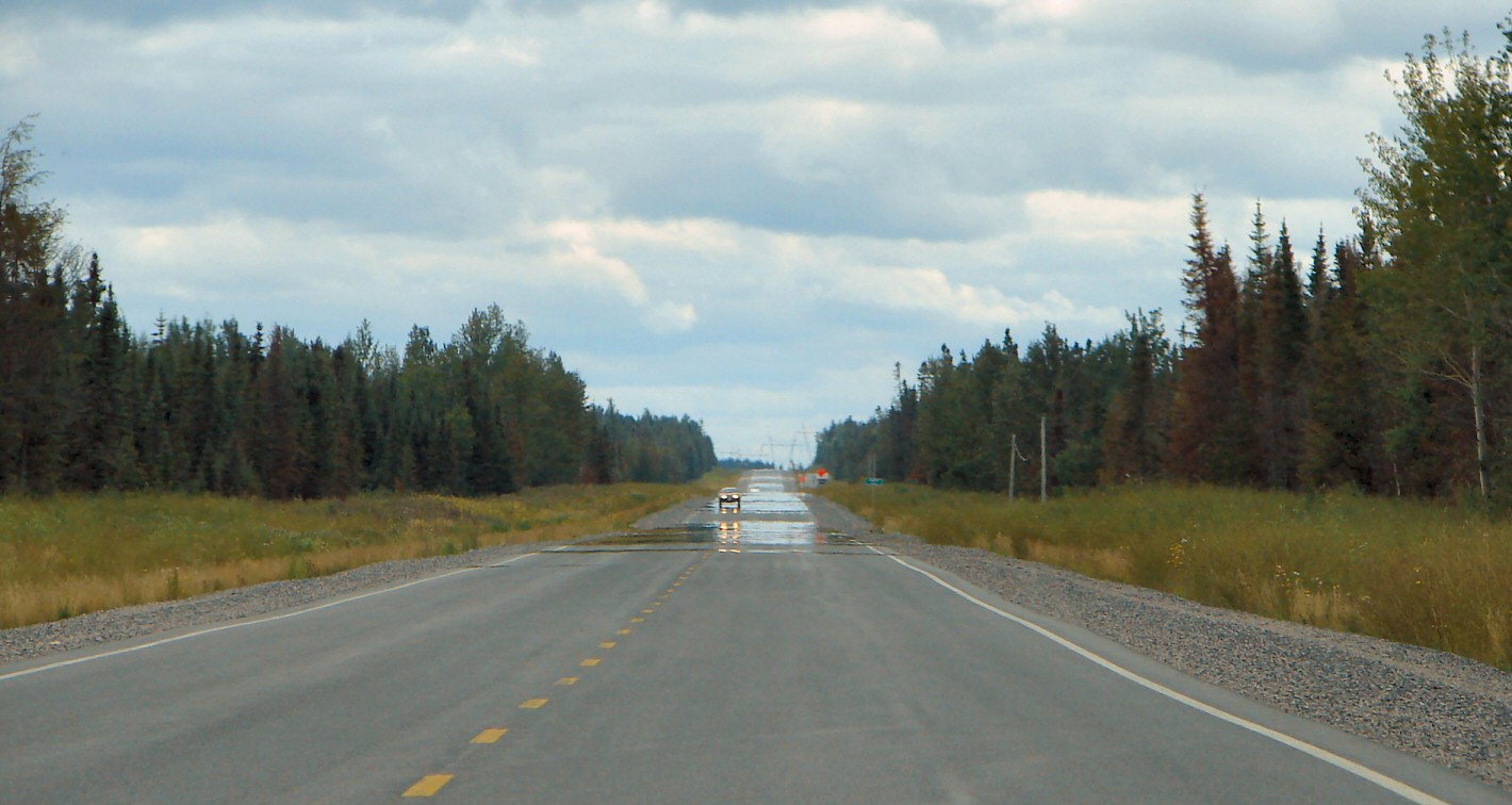
 Highway 655 is straight and flat.
Highway 663
Secondary Highway 663, commonly referred to as Highway 663, is a short secondary highway in the Canadian province of Ontario, which links Highway 11 to the community of Calstock in the Cochrane District.
While the highway designation ends in Calstock, the roadway continues for several more kilometres through and past the Constance Lake First Nation.
Highway 668
References
- ^ a b c d e f g Ministry of Transportation of Ontario (2007). "Annual Average Daily Traffic (AADT) counts". http://www.raqsb.mto.gov.on.ca/techpubs/TrafficVolumes.nsf/tvweb?OpenForm&Seq=5. Retrieved July 7, 2011.
- ^ "Ontario Hydro Shells Out $15,000 for 36-Hour Official Opening Party". The Globe and Mail (Toronto) 123 (36,385): p. 1. July 23, 1966. "After a cocktail party and elaborate luncheon in the Hydro cafeteria near the Little Long station, they crowded together on the gravel surface of the new Highway 807 to watch Highways Minister Charles MacNaughton cut a red, white and blue ribbon."
External links
Secondary highways of Ontario Secondary Highways 502 · 510 · 516 · 518 · 519 · 520 · 522 · 522B · 523 · 524 · 525 · 526 · 527 · 528 · 528A · 529 · 529A · 531 · 532 · 533 · 534 · 535 · 537 · 538 · 539 · 539A · 540 · 540A · 540B · 542 · 542A · 546 · 547 · 548 · 550 · 551 · 552 · 553 · 554 · 556 · 557 · 558 · 559 · 560 · 560A · 562 · 563 · 564 · 565 · 566 · 567 · 568 · 569 · 570 · 571 · 572 · 573 · 574 · 575 · 577 · 579 · 580 · 581 · 582 · 583 · 584 · 585 · 586 · 587 · 588 · 589 · 590 · 591 · 592 · 593 · 594 · 595 · 596 · 597 · 599 · 600 · 601 · 602 · 603 · 604 · 605 · 607 · 607A · 608 · 609 · 611 · 612 · 613 · 614 · 615 · 617 · 618 · 619 · 621 · 622 · 623 · 624 · 625 · 626 · 627 · 628 · 630 · 631 · 632 · 633 · 634 · 636 · 637 · 638 · 639 · 640 · 641 · 642 · 643 · 644 · 645 · 646 · 647 · 650 · 651 · 652 · 654 · 655 · 656 · 657 · 658 · 661 · 663 · 664 · 665 · 667 · 668 · 670 · 671 · 672 · 673
By district Algoma · Cochrane · Kenora · Manitoulin · Nipissing · Parry Sound · Sudbury · Thunder Bay · TimiskamingSee also County roads · Former highways · Historic Colonization Roads · List of Ontario provincial highways · Ministry of Transportation · Northern Ontario Resource Trail · Numbered highways in Canada · Tourist Routes · Trans-Canada HighwayCounty roads in Ontario · Ontario numbered highways · Expressways and 400-series highways · King's Highways · Secondary highways · Tertiary and 7000-series highways · List of Ontario provincial highways · List of former provincial highways in Ontario · Highways in Ontario · List of Ontario expressways · Trans-Canada Highway · Connecting Link · Emergency Detour RouteCategories:- Ontario secondary highways
- Roads in Cochrane District, Ontario


Wikimedia Foundation. 2010.