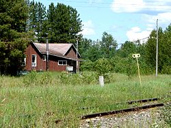
- Mead, Ontario
-
Coordinates: 49°28′12″N 83°51′43″W / 49.469909°N 83.861818°W
Mead is a siding along the Algoma Central Railway in the Canadian province of Ontario, located in the unincorporated geographic township of Lowther in Cochrane District. Along with a few isolated farms, the only other building at Mead is a former forestry company, which is at the southern terminus of Highway 583. From 1973 to 1984, American lumber company, Newaygo Timber operated a mill here.
Mead is counted as part of Cochrane, Unorganized, North Part in Canadian census data.
Categories:- Communities in Cochrane District, Ontario
- Northern Ontario geography stubs
Wikimedia Foundation. 2010.

