- Nipissing, Ontario
-
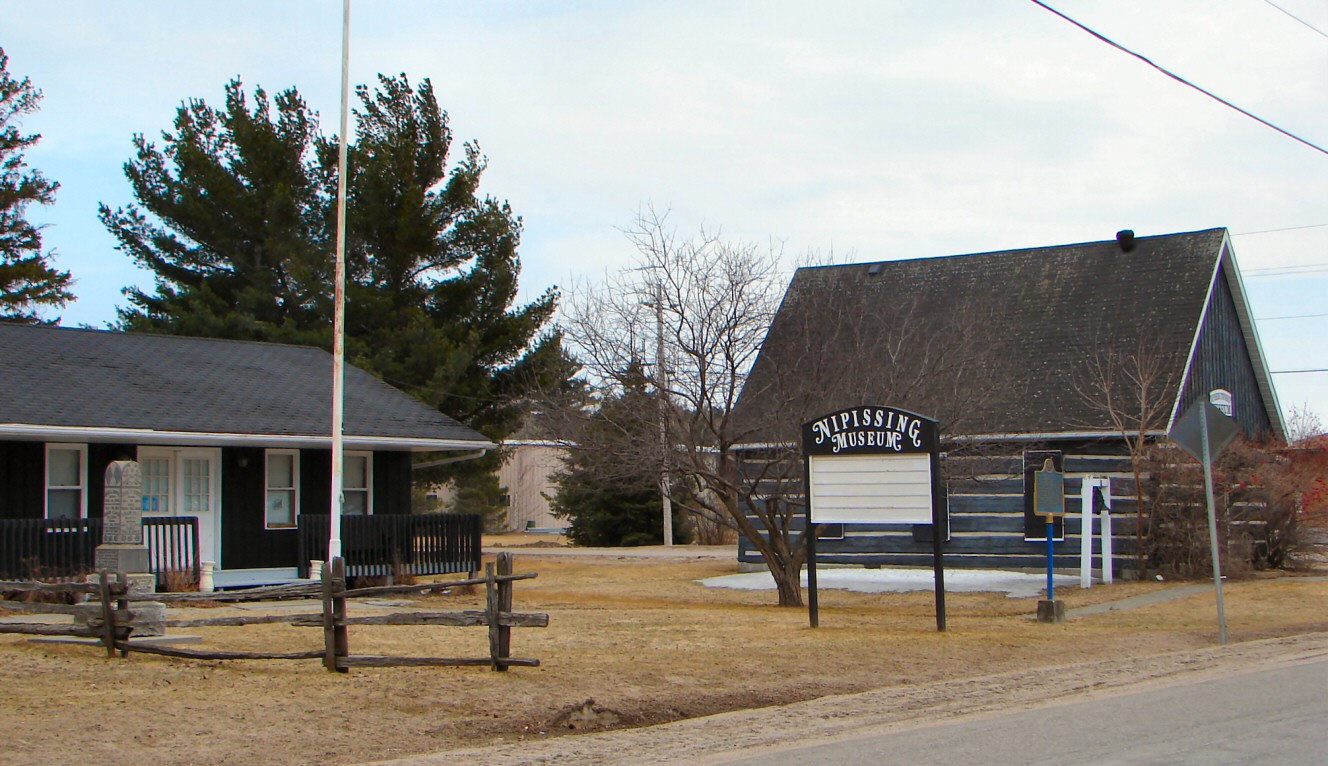
Nipissing Nipissing Township Museum
Motto: Life the Way it Should Be. Country  Canada
Province  Ontario
District Parry Sound Settled 1862 Incorporated 1888 Government – Type Township – Mayor Pat Haufe – Federal riding Nipissing—Timiskaming – Prov. riding Nipissing Area[1] – Land 387.40 km2 (149.6 sq mi) Population (2006)[1] – Total 1,644 – Density 4.2/km2 (10.9/sq mi) Time zone EST (UTC-5) – Summer (DST) EDT (UTC-4) Postal Code P0H Area code(s) 705 Website nipissingtownship.com Nipissing is a township in central Ontario, Canada, on Lake Nipissing in Parry Sound District. Nipissing was surveyed between 1874 and 1881, and was incorporated in 1888. Among the first settlers in the area were the Chapman and Beatty families. Nipissing village annexed Gurd Township in 1970. The township also contains a community named Nipissing, which is located on the South River near Chapman's Landing, on the South Bay of Lake Nipissing.
The township includes the communities of Alsace, Christian Valley, Commanda, Hotham, Nipissing and Wade's Landing.
Contents
History
The founder of Nipissing, James Chapman arrived by canoe from Pembroke in 1862. He was looking for land suitable for settlement. To lay claim to the property, he made brush piles, and was granted free land by the Ontario Government. Around 1869 James Chapman and his wife, Phoebe Edwards, built their first house and barn at the top of the chutes. The family farmed and he carried the mail by canoe, dog team and later horse on a route stretching 200 miles (320 km) between the villages of Magnetawan and Mattawa.
The Chapman Valley and Chapman Township near Magnetawan are named after the family. James and Phoebe are among the pioneers buried in the Nipissing village cemetery. More details about the pioneer families can be found in the Nipissing Township Museum. An Ontario Historical Plaque was erected at the Nipissing Township Museum by the province to commemorate the Rosseau-Nipissing Road's role in Ontario's heritage.[2]
Originally supplies were brought into Nipissing from Pembroke by canoe over the Champlain Trail and up the South River. Nipissing village became the main route for shipping supplies. The township and the life of the village as a key port began to fade.
The Chapman family donated the land to the municipal government, and the landing became a municipal boat launch, public dock and swimming hole for village children.
Around 1875 a colonization road was completed which connected tiny Nipissing village to Rosseau (near Huntsville) in the south and this created road travel and another route for shipment of supplies. Furthermore, in 1886 a railway connected Gravenhurst to Callander, cutting out Nipissing village from its main route and the life of the village as a key port began to fade. Today the landing is the municipal boat launch, public dock and favourite swimming hole for village children.
The Chapman family still has many connections to the local area.
Demographics
According to the Canada 2001 Census:
- Population: 1,553
- % Change (1996-2001): 1.9
- Dwellings: 1,071
- Area (km²): 387.40
- Density (persons per km²): 4.0
References
External links

Lake Nipissing Unorganized Centre Parry Sound District 
Callander
Powassan Nipissing

Machar Unorganized North East Parry Sound District Towns Kearney • Parry Sound • Powassan
Townships The Archipelago • Armour • Callander • Carling • Joly • Machar • Magnetawan • McDougall • McKellar • McMurrich/Monteith • Nipissing • Perry • Ryerson • Seguin • Strong • WhitestoneVillages Burk's Falls • South River • SundridgeFirst Nations Local services boards Unorganized areas Centre Part • North East PartSee also: Communities in Parry Sound District • Census divisions of OntarioCategories:- Municipalities in Parry Sound District, Ontario
- Township municipalities in Ontario
Wikimedia Foundation. 2010.