- The Archipelago
-
The Archipelago — Township — 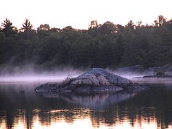

 The Archipelago
Coordinates: 45°35′N 80°23′W / 45.583°N 80.383°WCoordinates: 45°35′N 80°23′W / 45.583°N 80.383°W Country  Canada
Province  Ontario
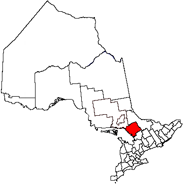
District Parry Sound Settled Incorporated 1980 Government – Type Township – Reeve Peter Ketchum – Federal riding Parry Sound—Muskoka – Prov. riding Parry Sound—Muskoka Area[1] – Land 602.30 km2 (232.5 sq mi) Population (2006)[1] – Total 576 – Density 1.0/km2 (2.6/sq mi) Time zone EST (UTC-5) – Summer (DST) EDT (UTC-4) Postal Code Area code(s) 705 Website www.thearchipelago.on.ca The Archipelago is a township in central Ontario, Canada, along the Georgian Bay in the District of Parry Sound.
The municipality consists of two non-contiguous parts, separated by Carling Township and the Parry Sound. The northern part includes the village of Pointe au Baril on the mainland and most of the geographic townships of Shawanaga and Harrison. This covers the islands and shoreline of Georgian Bay from the Twin Sisters (at the northern boundary of Carling Township) north to Charles Inlet and the Naiscoot River, a few miles south of Britt. The southern part consists of the geographic townships of Cowper and Conger that includes the islands and shoreline of Georgian Bay southwest of Parry Sound, from Twelve Mile Bay (at the Muskoka District boundary) to Parry Island and up the South Channel almost to the Town of Parry Sound. Almost a third of the population of the southern part lives on the islands in the Sans Souci and Copperhead area, centred around Frying Pan Island.[2]
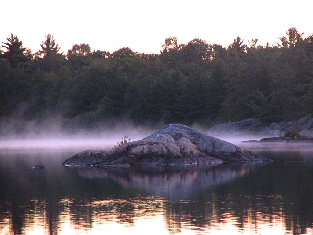
The township is characterized by numerous islands (hence its name) and bays that attract large amounts of vacationers and boaters in the summer. Much of its area is undeveloped and crown-owned land: in the north, 96 percent of the mainland and 50 percent of the islands remain in the public domain, and in the south, 83 percent of the mainland and 70 percent of the islands, a large part of it protected in the Massasauga Provincial Park.[2]
Contents
Communities
- Bayfield Inlet
- Blackstone Lake
- Copperhead
- Five Mile Bay
- Georgian Inlet
- Manbert
- Manitou Dock
- Naiscoot
- Nares Inlet
- Niweme
- Ojibway Island
- Pointe au Baril
- Pointe au Baril Station
- Sans Souci
- Seven Mile Narrows
- Skerryvore
- Woods Bay
History
On January 1, 1980, the townships of Georgian Bay South Archipelago and Georgian Bay North Archipelago were formed out of unincorporated geographic townships from the Parry Sound District, primarily in order to provide proper planning in the islands and waterways of the area. These two townships were intended to be set up as one municipality but the Ontario Legislature created two townships, with a provision for their later amalgamation, if requested by the elected Councils. Soon after the formation of the townships, both councils passed identical by-laws calling for the amalgamation of the two municipalities. Therefore, the Township of the Archipelago was formed on April 1, 1980, when the townships of Georgian Bay South Archipelago and Georgian Bay North Archipelago merged.[2]
Demographics
According to the 2006 Statistics Canada Census:[1]
- Population: 576
- % Change (2001–2006):+14.1
- % Change (1996–2001): -9.0
- Area (km²): 602.30
- Density (persons per km²): 1.0
- Private dwellings occupied by usual residents: 254 (total dwellings: 3312)
- Mother tongue:
- English as first language: 90.4 %
- French as first language: 0 %
- English and French as first language: 0 %
- Other as first language: 8.6 %
Population trend:[3]
- Population in 2006: 576
- Population in 2001: 505
- Population in 1996: 555
- Population in 1991: 720
References
- ^ a b c Statistics Canada 2006 Census – The Archipelago community profile
- ^ a b c "History of the Archipelago". Township of The Archipelago. http://www.thearchipelago.on.ca/index.php?option=com_content&view=article&id=23&Itemid=16. Retrieved 2010-07-26.
- ^ Statistics Canada: 1996, 2001, 2006 census
- "Topographic Map sheets 31E4, 31E5, 41H1, 41H8, 41H9, 41H10". Atlas of Canada. Natural Resources Canada. 2006-02-06. http://atlas.nrcan.gc.ca/site/english/maps/topo/map/. Retrieved 2009-06-13.
- "The Archipelago". 2006 Community Profiles. Statistics Canada. 2009-03-10. http://www12.statcan.ca/census-recensement/2006/dp-pd/prof/92-591/details/Page.cfm?Lang=E&Geo1=CSD&Code1=3549005&Geo2=PR&Code2=35&Data=Count&SearchText=The%20Archipelago&SearchType=Begins&SearchPR=35&B1=All&Custom=. Retrieved 2009-06-13.
External links
- North part

Naiscoutaing 17A, Unorg. Centre Parry Sound Georgian Bay 
Whitestone  The Archipelago

Carling, Shawanaga 17, Unorg. Centre Parry Sound (exclave) - South part
Parry Island FN Georgian Bay Seguin The Archipelago Georgian Bay Twp. Towns Kearney • Parry Sound • Powassan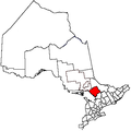
Townships The Archipelago • Armour • Callander • Carling • Joly • Machar • Magnetawan • McDougall • McKellar • McMurrich/Monteith • Nipissing • Perry • Ryerson • Seguin • Strong • WhitestoneVillages Burk's Falls • South River • SundridgeFirst Nations Local services boards Unorganized areas Centre Part • North East PartSee also: Communities in Parry Sound District • Census divisions of OntarioCategories:- Township municipalities in Ontario
- Municipalities in Parry Sound District, Ontario
- Ontario geography stubs

Wikimedia Foundation. 2010.