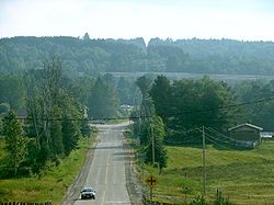
- Perry, Ontario
-
Perry — Township — Elmsdale Coordinates: 45°30′N 79°17′W / 45.5°N 79.283°WCoordinates: 45°30′N 79°17′W / 45.5°N 79.283°W Country  Canada
Province  Ontario
District Parry Sound Settled 1873 Incorporated 1888 Government – Type Township – Mayor Bill Core – Federal riding Parry Sound—Muskoka – Prov. riding Parry Sound—Muskoka Area[1] – Land 186.63 km2 (72.1 sq mi) Population (2006)[1] – Total 2,010 – Density 10.8/km2 (28/sq mi) Time zone EST (UTC-5) – Summer (DST) EDT (UTC-4) Postal Code P0A 1J0 Area code(s) 705 Website www.townshipofperry.ca Perry is a township in the Canadian province of Ontario, located in the Parry Sound District.
The township had a population of 2,252 in the 2001 Canadian census.
Contents
Communities
- Clear Lake
- Emsdale
- Novar
- Scotia
- Swindon
- Walls
Demographics
Population trend:[2]
- Population in 2006: 2010 (2001 to 2006 population change: -10.7 %)
- Population in 2001: 2252
- Population in 1996: 2215
- Population in 1991: 2049
Private dwellings occupied by usual residents: 846 (total dwellings: 1489)
Mother tongue:[1]
- English as first language: 91.8 %
- French as first language: 1.0 %
- English and French as first language: 0.5 %
- Other as first language: 6.7 %
References
External links
- Emsdale Ontario Almaguin Highlands Regional Portal
- Novar Ontario Almaguin Highlands Regional Portal

Ryerson Armour 
McMurrich/Monteith 
Kearney  Perry
Perry 

Huntsville Lake of Bays Towns Kearney • Parry Sound • Powassan
Townships The Archipelago • Armour • Callander • Carling • Joly • Machar • Magnetawan • McDougall • McKellar • McMurrich/Monteith • Nipissing • Perry • Ryerson • Seguin • Strong • WhitestoneVillages Burk's Falls • South River • SundridgeFirst Nations Local services boards Unorganized areas Centre Part • North East PartSee also: Communities in Parry Sound District • Census divisions of OntarioCategories:- Township municipalities in Ontario
- Municipalities in Parry Sound District, Ontario
- Ontario geography stubs
Wikimedia Foundation. 2010.


