- List of numbered roads in Peel Region
-
This page lists all of the numbered regional roads in Peel Region, Ontario.[1]
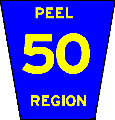
Number Names Western/Southern Terminus Eastern/Northern Terminus Major Communities Comments 1 Mississauga Road, Erin Mills Parkway Interchange with Queen Elizabeth Way (Exit 126) RR 11 Mississauga, Erin Mills, Streetsville, Huttonville, Brampton, Cheltenham One of the main roads into Mississauga. Its overpass and Interchange with Highway 401 was reconstructed in 2002 to accommodate the westward extension of the express-collector lanes. At the intersection with Turner Valley Road, the Peel Regional Road 1 designation is rerouted on the higher capacity Erin Mills Parkway, bypassing Mississauga Road which continues southward as a minor arterial. 2 Finch Avenue Interchange with Highway 427 (boundary between Peel Region and the City of Toronto) RR 15 Malton, Mississauga, Brampton 3 Britannia Road Interchange with Highway 407 (Exit 28), (boundary with Halton Regional Municipality), continues as Halton RR 6) Hurontario Street (formerly Highway 10) Mississauga 4 Dixie Road Lakeshore Road (formerly Highway 2) RR 12 Mississauga, Brampton, Bramalea Passes by Toronto Pearson International Airport to the west 5 Derry Road Interchange with Highway 407 (Exit 31), (boundary with Halton RM), continues as Halton RR 7 Highway 427 (boundary with the City of Toronto) Mississauga, Malton Passes by Toronto Pearson International Airport to the north. 6 Embleton Road, Queen Street RR 19 (Winston Churchill Road) Approximately 45 metres east of Haggart Avenue Huttonville, Brampton Has a small diversion/concurrency with RR 1 7 Airport Road Interchange with Highway 427 Highway 9 (boundary with Dufferin County, continues as Dufferin CR 18) Mississauga, Malton, Bramalea, Sandhill, Mono Road, Caledon East, Mono Mills Travels from Toronto Pearson International Airport up through the Caledon Highlands to Highway 9 8 The Gore Road Peel RR 50/York RR 24 Highway 9 Clairville, Sunset Corners, Ebenezer, Wildfield, Macville Named after the former township of Toronto Gore. Spurs off Highway 50 just north of Steeles Avenue and travels up to Highway 9 9 King Street Peel RR 19/Halton RR 25 Caledon-King Townline (boundary with York Regional Municipality, continues as York RR 11) Terra Cotta, Victoria, Sandhill, Bolton 10 Bovaird Drive East Interchange with RR 107 and Highway 410 RR 7 Bramalea, Brampton 11 Bush Street, Forks of the Credit Road Intersection with Wellington CR 25/Peel RR 19 (boundary with Wellington County, continues as Wellington CR 52) Highway 10 Sligo, Forks of the Credit Near the Forks of the Credit Provincial Park 12 Olde Baseline Road Intersection with Wellington CR 25/Peel RR 19 (boundary with Wellington County) RR 7 Inglewood, Mono Road 14 Mayfield Road Intersection with Wellington CR 25/Peel RR 19 (boundary with Halton RM), continues as Halton RR 23 Intersection with Peel RR 50/York RR 24 Snelgrove, Brampton, Mayfield, Wildfield, Tormore Acts as the boundary between Brampton and Caledon except for a small portion within Snelgrove. 15 Steeles Avenue Intersection with Peel RR 19 and Halton RR 8 (boundary with Halton RM, continues as Halton RR 8) RR 50 (boundary with the City of Toronto) Mississauga, Brampton, Malton, Clairville 16 Kennedy Road RR 15 RR 107 Brampton 17 Cawthra Road Lakeshore Road (formerly Highway 2) Interchange with Highway 403 and Eastgate Parkway (Exit 121) Mississauga 18 Mavis Road RR 15 Highway 407 Brampton, Mississauga 19 Winston Churchill Boulevard, Adamson Street, King Street Lakeshore Road in Oakville Intersection with Wellington CR 42 (boundary with Wellington County, continues as Peel RR 19/Wellington CR 25) Terra Cotta, Norval, Georgetown, Oakville Very busy road, named after Sir Winston Churchill, former British Prime Minister during the Second World War. Acts as the boundary between Peel Region and Halton Region. Discontinuous from Steeles Avenue to Dundas Street, as the Region line moves west and the road is fully in Peel Region (Mississauga). 20 Queensway Mavis Road Etobicoke Creek (boundary with the City of Toronto) Mississauga, Cooksville 22 Old Church Road RR 7 RR 50 Caledon East, Albion, Cedar Mills 23 Caledon-East Garafraxa Townline Dufferin RR 23 (B-Line) RR 136 Caledon, Orangeville 24 Charleston Sideroad Peel RR 19/Wellington CR 25 (boundary with Wellington County, continues as Wellington CR 124) RR 7 Cataract, Coulterville, Caledon Formerly Highway 51 from April 13, 1938 until 1962, when Highway 24 was extended along this road to Highway 10. Old Highway 24 alignment became Highway 136. Highway 51 was fully paved in 1947. It bears no relation to the second incarnation of Highway 51, near Rondeau Provincial Park. 50 Peel Regional Road 50, Queen Street Overpass of Highway 427 (boundary with the City of Toronto) Highway 9 (Boundary with Simcoe County, continues as Simcoe CR 50) Clairville, Sunset Corners, Brampton, Bolton, Cedar Mills, Palgrave Formerly Highway 50. South of Bolton, it forms the border between Peel Region and York Region, and therefore the road is sometimes referred to as York Regional Road 24. 107 Bovaird Drive, Queen Street East Peel RR 19 (continues into Halton RM as Highway 7) RR 50 (boundary with York RM (continues as York RR 7) Norval, Mount Pleasant, Brampton, Bramalea Formerly Highway 7. 136 Main Street, Queen Street, Porterfield Road RR 24 Orangeville Town Limits, continues as Townline Cataract, Coulterville, Alton, Orangeville Original Highway 24 alignment from April 13, 1938 to 1962. Highway 136 from 1962 to April 1, 1997. Fully paved by 1966, first from Cataract to Alton in 1964, then from Alton to Orangeville. References
- ^ "Map of Peel Regional Roads". Peel Region. December 2007. http://www.peelregion.ca/pw/roads/road-map/pdf/peelroad-map3.pdf. Retrieved 2011-09-01.[dead link]
See also
- List of York Regional Roads
- List of county roads in Simcoe County, Ontario
- List of county roads in Dufferin County, Ontario
Regional Roads in Peel Region, Ontario North-South routes 
East-West routes Highways and expressways Numbered roads in Ontario County roads Brant · Bruce · Dufferin · Elgin · Essex · Frontenac · Grey · Haliburton · Hastings · Huron · Lambton · Lanark · Leeds and Grenville · Lennox and Addington · Middlesex · Norfolk · Northumberland · Oxford · Perth · Peterborough · Prescott and Russell · Prince Edward · Renfrew · Simcoe · Stormont, Dundas and Glengarry · WellingtonRegional roads Municipal roads See also County roads in Ontario · Ontario numbered highways · Expressways and 400-series highways · King's Highways · Secondary highways · Tertiary and 7000-series highways · List of Ontario provincial highways · List of former provincial highways in Ontario · Highways in Ontario · List of Ontario expressways · Trans-Canada Highway · Connecting Link · Emergency Detour RouteCategories:- Peel Regional Roads
- Lists of roads in Ontario
Wikimedia Foundation. 2010.